close
-
Layers w
- Weather Layers
- Pro
- Pro
- Pro
- Pro
- Pro
- Pro
- More Layers
- Pro
- Pro
- Pro
- Pro
-
Upgrade to

3D
Trail Conditions
- Unknown
- Snow Groomed
- Snow Packed
- Snow Covered
- Snow Cover Partial
- Freeze/thaw Cycle
- Icy
- Prevalent Mud
- Wet
- Variable
- Ideal
- Dry
- Very Dry
Trail Flow (Ridden Direction)
Trailforks scans users ridelogs to determine the most popular direction each trail is ridden. A good flowing trail network will have most trails flowing in a single direction according to their intension.
The colour categories are based on what percentage of riders are riding a trail in its intended direction.
The colour categories are based on what percentage of riders are riding a trail in its intended direction.
- > 96%
- > 90%
- > 80%
- > 70%
- > 50%
- < 50%
- bi-directional trail
- no data
Trail Last Ridden
Trailforks scans ridelogs to determine the last time a trail was ridden.
- < 2 days
- < 1 week
- < 2 weeks
- < 1 month
- < 6 months
- > 6 months
Trail Ridden Direction
The intended direction a trail should be ridden.
- Downhill Only
- Downhill Primary
- Both Directions
- Uphill Primary
- Uphill Only
- One Direction
Contribute Details
Colors indicate trail is missing specified detail.
- Description
- Photos
- Description & Photos
- Videos
Trail Popularity ?
Trailforks scans ridelogs to determine which trails are ridden the most in the last 9 months.
Trails are compared with nearby trails in the same city region with a possible 25 colour shades.
Think of this as a heatmap, more rides = more kinetic energy = warmer colors.
- most popular
- popular
- less popular
- not popular
ATV/ORV/OHV Filter
Max Vehicle Width
inches
US Cell Coverage
Legend

Radar Time
Activity Recordings
Trailforks uses anonymized public activity data.
?
Activity Recordings
Trailforks uses anonymized public activity data.
?
Personal Heatmap
▶
Activity Types
all
/
none
▶
Options
2
Date range
month
–
Winter Trails
Warning
A routing network for winter maps does not exist. Selecting trails using the winter trails layer has been disabled.
Missing Trails
Most Popular
Least Popular
Trails are colored based on popularity. The more popular a trail is, the more red. Less popular trails trend towards green.
Jump Magnitude Heatmap
Heatmap of where riders jump on trails. Zoom in to see individual jumps, click circles to view jump details.
BC Backroad Status
![map legend]()
Service Road Atlas is a free to use, community-driven service for viewing and creating reports on the numerous back-country service roads around B.C. and Alberta.

Slope Aspect
Direction the slope faces
Trails Deemphasized
Trails are shown in grey.
Only show trails with no bike usage.
Suggested Layers
Based on selected activity type
Save the current map location and zoom level as your default home location whenever this page is loaded.
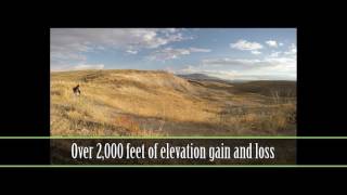
SaveSalmon Idaho offers a long bike riding season from March to November. Venture out for riding in the foothills in the spring and late fall months. Summer offers extensive high country riding with vast miles of spectacular scenic trails to explore.
Links
Activities Click to view
- Mountain Bike
390 trails
- E-Bike
99 trails
- Gravel Bike
1 trails
- Adaptive Bike
1 trails
- Winter Fat Bike
1 trails
- Horse
124 trails
- Hike
435 trails
- Trail Running
431 trails
- Dirtbike/Moto
69 trails
- ATV/ORV/OHV
66 trails
- Snowmobile
31 trails
- Snowshoe
58 trails
- Backcountry Ski
59 trails
- Nordic Ski
7 trails
Region Details
- 117
- 1
- 17
- 122
- 92
- 20
- 20
Region Status
Caution as of 2 daysStats
- Avg Trail Rating
- Trails (view details)
- 422
- Trails Mountain Bike
- 410
- Trails E-Bike
- 99
- Trails Gravel Bike
- 1
- Trails Adaptive Bike
- 1
- Trails Winter Fat Bike
- 1
- Trails Horse
- 124
- Trails Hike
- 435
- Trails Trail Running
- 431
- Trails Dirtbike/Moto
- 69
- Trails ATV/ORV/OHV
- 66
- Trails Snowmobile
- 31
- Trails Snowshoe
- 58
- Trails Backcountry Ski
- 59
- Trails Nordic Ski
- 7
- Total Distance
- 858 miles
- Total Descent
- 191,201 ft
- Total Vertical
- 6,558 ft
- Highest Trailhead
- 9,966 ft
- Reports
- 2,354
- Photos
- 756
- Ridden Counter
- 5,611
Sub Regions
-
Barracks Lane - Mulkey Creek
- 18
- 9
- 1
-
Discovery Hill
- 1
- 8
- 24
- 4
- 9
-
Iron Creek/Hat Creek
- 1
- 13
- 19
- 2
- 1
-
Lemhi Badlands
- 2
- 20
- 3
- 1
- 4
-
Stormy Peak
- 4
- 5
- 2
-
Twelvemile
- 2
- 15
- 16
- 2
- 1
-
Williams Creek
- 2
- 23
- 30
- 10
- 5
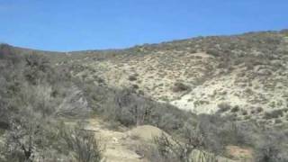
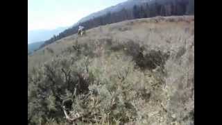
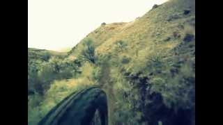
Popular Salmon Mountain Biking Trails
• 100 ★ 3.5 • 3 miles • 372 ft • 492 •
Singletrack from the Disco Hill Trailhead to the main trail junction with and the beginning of at Trail Marker #3. This is where most rides at Disco Hill begin. The trail is well traveled and relatively gentle for the first mile, then...
• 100 ★ 4.4 • 2 miles • 0 ft • 172 •
This trail follows a broad ridge for a fun cross country descent into with a few moments of great flowy fun, or a stout climb from the bottom of to the cow trough at the top. For those that want to avoid the short, steep section in the...
• 100 ★ 4.4 • 1 mile • 198 ft • 166 •
Nice singletrack climb and descent over a broad ridge providing a fun alternative to access the inner trails of Disco Hill. Great fun in both directions. New section of singletrack built April 2023 to eliminate the 300-foot section of...
• 100 ★ 4.0 • 1,765 ft • 57 ft • 154 •
This is an important and well-used connector trail between the and , allowing for some classic "Lower Disco" loop routes. Expect mostly gentle terrain with a couple crossings of small drainages.
• 95 ★ 3.0 • 4,682 ft • 125 ft • 147 •
Ridden in either direction, this trail drops into and climbs out of , a drainage that features a good sized stock pond that often has water in the springtime. This trail has a couple spots that are slightly more technical than many of...
• 100 ★ 3.0 • 2 miles • 336 ft • 123 •
This upper section of the features some nice varied terrain and generally smooth cross country riding with just a couple of steeper hills, accessing a hub junction of several trails at the cow trough at the top. From there, ride down to...
• 100 ★ 3.0 • 3,921 ft • 30 ft • 117 •
Good singletrack connecting the to BLM121 near the Motocross Park. The trail follows a gentle draw to the north and runs along a cobbly bench to the south.
• 100 ★ 3.0 • 4,629 ft • 80 ft • 115 •
The is a short singletrack that is part of the " ". This loop is marked with colorful headphones. For Mountain Bikers, the adds a couple of short options for coming or going on the first section of the Trail. This is also a popular...
Salmon Mountain Bike Routes
CDT - Sheep Creek Featured
13 miles • 1,405 ft • 6 • Point to Point •
The Continental Divide Trail to is a classic Idaho back-country ride. Great single-track mixed w/ scenery...
Yellow Peak Loop Featured
22 miles • 3,371 ft • 4 • Loop •
This remote and scenic loop around Yellow Peak, for advanced riders only, follows Big Timber and s....
Rippey Loop Featured
★ 3.0 • 11 miles • 1,576 ft • 13 •
The Barracks Trail System is about 8 miles Southeast of Salmon, Id. Barracks Trails begin to open up in...
Disco Hill Loops Featured
23 miles • 2,733 ft • 32 •
loops colored to match the arrows on the trail markers posted along the trails and on the trailhead map.
12 miles • 2,002 ft • 5 • Point to Point •
Twelvemile to Lime Creek is a classic Idaho ride, not for the faint of heart emotionally or physically....
3 miles • 2 ft • 4 • Shuttled •
is a great trail for several shuttle laps. It takes about 15-20 minutes/lap to drop 2000' in almost 3...
Photos of Salmon Mountain Bike
Videos of Salmon Mountain Bike

trail: Powderhouse Gulch (Upper)
850 |
Oct 18, 2017 , Salmon
705 |
Jan 23, 2017

trail: Rippey Canyon
934 |
Nov 20, 2014 , Salmon
trail: Owl Canyon
1031 |
Oct 3, 2014 , Salmon

trail: Discovery Hill
1185 |
Oct 3, 2014 , Salmon

trail: Powderhouse Gulch
971 |
Oct 3, 2014 , Salmon
trail: Twelvemile Meadow (South)
810 |
Oct 3, 2014 , Salmon
trail: Rippey Canyon
827 |
Oct 3, 2014 , Salmon
Current Trail Warnings
| status | trail | date | condition | user | info |
|---|---|---|---|---|---|
| Double R (Upper) | Jun 2, 2026 @ 9:50pm (America/Boise) Jun 2, 2026 | Ideal | wildbillmac simba | Clearing in progress. Cleared all... | |
| South Fork Williams Phoneline | May 31, 2026 @ 6:52pm (America/Boise) May 31, 2026 | Dry | sidehiller1 TRAILFORKS | About 20 trees down mostly in the upper... | |
| Thunder Mountain | May 23, 2026 @ 6:11pm (America/Boise) May 23, 2026 | Variable | sidehiller1 TRAILFORKS | Hike Cleared a couple ton of sticks and rocks... |
Recent Trail Reports
| status | trail | date | condition | info | user |
|---|---|---|---|---|---|
| Powderhouse Gulch | Jun 18, 2026 @ 9:58am (America/Boise) 2 days | Dry | wildbillmac simba | ||
| Zen-Fu | Jun 17, 2026 @ 10:22pm (America/Boise) 3 days | Dry | wildbillmac simba | ||
| Solitude | Jun 17, 2026 @ 9:56pm (America/Boise) 3 days | Dry | wildbillmac simba | ||
| Solitude (Lower) | Jun 12, 2026 @ 10:27pm (America/Boise) Jun 12, 2026 | Ideal | wildbillmac simba | ||
| Powderhouse Gulch (Upper) | Jun 8, 2026 @ 3:53pm (America/Boise) Jun 8, 2026 | Dry | wildbillmac simba | ||
| Crevice | Jun 4, 2026 @ 8:06pm (America/Boise) Jun 4, 2026 | Dry | sidehiller1 TRAILFORKS | ||
| Double R (Lower Lower) | May 31, 2026 @ 9:31pm (America/Boise) May 31, 2026 | Ideal | wildbillmac simba | ||
| Double R (Lower) | May 31, 2026 @ 9:25pm (America/Boise) May 31, 2026 | Ideal | wildbillmac simba | ||
| Twelvemile Meadow (North) | May 25, 2026 @ 11:14pm (America/Boise) May 25, 2026 | Dry | wildbillmac simba | ||
| Meadow Connector | May 25, 2026 @ 11:07pm (America/Boise) May 25, 2026 | Variable | wildbillmac simba |
Activity Feed
| username | action | type | title | date |
|---|---|---|---|---|
| wildbillmac | update | trail | activity #97260213 and 6 more | Jun 18, 2026 @ 10:09am 2 days |
| wildbillmac | add | report | activity #97255951 | Jun 18, 2026 @ 9:00am 2 days |
| wildbillmac | add | report | activity #97231145 and 1 more | Jun 17, 2026 @ 9:18pm 3 days |
| ccmski | wishlist | route | activity #97212867 | Jun 17, 2026 @ 3:30pm 3 days |
| toddhack8675309 | ridden | trail | activity #97108302 | Jun 16, 2026 @ 7:22am Jun 16, 2026 |
Recent Comments
| username | type | title | comment | date |
|---|---|---|---|---|
| report | Tell Kyle, Trailforks can’t write up a... | Jul 25, 2025 @ 9:54am Jul 25, 2025 | ||
| report | Still a good time though compared to the couch! | Aug 22, 2024 @ 5:45pm Aug 22, 2024 | ||
| trail | Not a black in my humble opinion. Less chunky... | Aug 22, 2024 @ 1:52pm Aug 22, 2024 | ||
| trail | I'd actually rate this a black compared to... | Aug 22, 2024 @ 1:52pm Aug 22, 2024 | ||
| report | Meant to say freshly cut pile up | Jun 25, 2024 @ 3:15pm Jun 25, 2024 |
Local Badges
-

Completionist0 awarded -

10 Expert Trails2 awarded -

Top 10 Trails1 awarded -

Completionist0 awarded -

Completionist2 awarded -
Completionist0 awarded
Activity Type Stats
| activitytype | trails | distance | descent | descent distance | total vertical | rating | global rank | state rank | photos | reports | routes | ridelogs |
|---|---|---|---|---|---|---|---|---|---|---|---|---|
| Mountain Bike | 390 | 724 miles | 165,033 ft | 347 miles | 6,450 ft | #172 | #66 | 674 | 2,321 | 18 | 4,242 | |
| E-Bike | 99 | 267 miles | 35,318 ft | 102 miles | 5,292 ft | #463 | #712 | 1,759 | 23 | |||
| Gravel Bike | 1 | #523 | #1,080 | 3 | 3 | |||||||
| Adaptive Bike | 1 | #467 | #1,799 | 1 | ||||||||
| Winter Fat Bike | 1 | #280 | #1,064 | 29 | 42 | |||||||
| Horse | 124 | 309 miles | 63,842 ft | 159 miles | 5,925 ft | #66 | #347 | 3 | 1,719 | 1 | ||
| Hike | 435 | 846 miles | 188,825 ft | 404 miles | 6,558 ft | #63 | #44 | 67 | 2,326 | 737 | ||
| Trail Running | 431 | 836 miles | 185,108 ft | 399 miles | 6,555 ft | #57 | #35 | 3 | 2,323 | 230 | ||
| Dirtbike/Moto | 69 | 151 miles | 21,788 ft | 65 miles | 5,174 ft | #162 | #99 | 1,486 | 22 | |||
| ATV/ORV/OHV | 66 | 145 miles | 18,268 ft | 62 miles | 5,171 ft | #72 | #44 | 1,454 | 3 | |||
| Snowmobile | 31 | 83 miles | 12,851 ft | 45 miles | 4,003 ft | #64 | #40 | 14 | 3 | |||
| Snowshoe | 58 | 70 miles | 15,417 ft | 42 miles | 4,091 ft | #319 | #82 | 155 | 3 | |||
| Backcountry Ski | 59 | 71 miles | 16,030 ft | 43 miles | 4,091 ft | #147 | #28 | 20 | 164 | 67 | ||
| Nordic Ski | 7 | 36 miles | 6,552 ft | 20 miles | 3,307 ft | #579 | #190 | 47 | 164 |
Frequently Asked Questions About Salmon
▼
What are the best places to ride in Salmon?
Salmon has 8 areas to explore for mountain biking. The top rated areas are:
▼
What are the highest rated mountain biking trails in Salmon?
The highest rated mountain biking trails in Salmon are:
- Thunder Mountain (4.4/5)
- Henry Creek (Upper) (4.3/5)
- Lower Williams/Perreau (DH) (4.3/5)
- Powderhouse Gulch (Upper) (4.3/5)
- Powderhouse Gulch (Lower) (4.2/5)
▼
What is the best time of the year to ride in Salmon?
Based on ride log data, the most popular months to ride in Salmon are:
- May (137 activities)
- July (125 activities)
- June (111 activities)
▼
Where can I park to ride in Salmon?
There are 27 parking locations listed in Salmon. The most popular parking spots are:
- Discovery Hill Trailhead
- Owl Canyon Trailhead
- RC Flyer Trailhead
- Podcast Overlook Trailhead
- Williams Creek Picnic Area
Activities
Trails
- By canadaka
 Trailforks & contributors
 - Admins: simba, sidehiller1, WRTC
- #4961 - 26,278 views
- salmon activity log | embed map of Salmon mountain bike trails | salmon mountain biking points of interest polygons
Downloading of trail gps tracks in kml & gpx formats is enabled for Salmon.
You must login to download files.