close
-
Layers w
- Weather Layers
- Pro
- Pro
- Pro
- Pro
- Pro
- Pro
- More Layers
- Pro
- Pro
- Pro
- Pro
-
Upgrade to

3D
Trail Conditions
- Unknown
- Snow Groomed
- Snow Packed
- Snow Covered
- Snow Cover Partial
- Freeze/thaw Cycle
- Icy
- Prevalent Mud
- Wet
- Variable
- Ideal
- Dry
- Very Dry
Trail Flow (Ridden Direction)
Trailforks scans users ridelogs to determine the most popular direction each trail is ridden. A good flowing trail network will have most trails flowing in a single direction according to their intension.
The colour categories are based on what percentage of riders are riding a trail in its intended direction.
The colour categories are based on what percentage of riders are riding a trail in its intended direction.
- > 96%
- > 90%
- > 80%
- > 70%
- > 50%
- < 50%
- bi-directional trail
- no data
Trail Last Ridden
Trailforks scans ridelogs to determine the last time a trail was ridden.
- < 2 days
- < 1 week
- < 2 weeks
- < 1 month
- < 6 months
- > 6 months
Trail Ridden Direction
The intended direction a trail should be ridden.
- Downhill Only
- Downhill Primary
- Both Directions
- Uphill Primary
- Uphill Only
- One Direction
Contribute Details
Colors indicate trail is missing specified detail.
- Description
- Photos
- Description & Photos
- Videos
Trail Popularity ?
Trailforks scans ridelogs to determine which trails are ridden the most in the last 9 months.
Trails are compared with nearby trails in the same city region with a possible 25 colour shades.
Think of this as a heatmap, more rides = more kinetic energy = warmer colors.
- most popular
- popular
- less popular
- not popular
ATV/ORV/OHV Filter
Max Vehicle Width
inches
US Cell Coverage
Legend

Radar Time
Activity Recordings
Trailforks uses anonymized public activity data.
?
Activity Recordings
Trailforks uses anonymized public activity data.
?
Personal Heatmap
▶
Activity Types
all
/
none
▶
Options
2
Date range
month
–
Winter Trails
Warning
A routing network for winter maps does not exist. Selecting trails using the winter trails layer has been disabled.
Missing Trails
Most Popular
Least Popular
Trails are colored based on popularity. The more popular a trail is, the more red. Less popular trails trend towards green.
Jump Magnitude Heatmap
Heatmap of where riders jump on trails. Zoom in to see individual jumps, click circles to view jump details.
BC Backroad Status
![map legend]()
Service Road Atlas is a free to use, community-driven service for viewing and creating reports on the numerous back-country service roads around B.C. and Alberta.

Slope Aspect
Direction the slope faces
Trails Deemphasized
Trails are shown in grey.
Only show trails with no bike usage.
Suggested Layers
Based on selected activity type
Save the current map location and zoom level as your default home location whenever this page is loaded.
Save
No description for Salmon Arm has been added yet!
Login or register to submit one.
Activities Click to view
- Mountain Bike
365 trails
- E-Bike
301 trails
- Gravel Bike
1 trails
- Adaptive Bike
0 trails
- Winter Fat Bike
0 trails
- Horse
115 trails
- Hike
374 trails
- Trail Running
372 trails
- Dirtbike/Moto
56 trails
- Observed Trials
2 trails
- ATV/ORV/OHV
64 trails
- Snowmobile
3 trails
- Snowshoe
93 trails
- Downhill Ski
2 trails
- Backcountry Ski
47 trails
- Nordic Ski
121 trails
Region Details
- 109
- 20
- 115
- 98
- 13
Region Status
Open as of 14 hoursStats
- Avg Trail Rating
- Trails (view details)
- 409
- Trails Mountain Bike
- 366
- Trails E-Bike
- 301
- Trails Gravel Bike
- 1
- Trails Horse
- 115
- Trails Hike
- 374
- Trails Trail Running
- 372
- Trails Dirtbike/Moto
- 56
- Trails Observed Trials
- 2
- Trails ATV/ORV/OHV
- 64
- Trails Snowmobile
- 3
- Trails Snowshoe
- 93
- Trails Downhill Ski
- 2
- Trails Backcountry Ski
- 47
- Trails Nordic Ski
- 121
- Total Distance
- 212 miles
- Total Descent
- 41,420 ft
- Total Vertical
- 4,005 ft
- Highest Trailhead
- 5,149 ft
- Reports
- 4,198
- Photos
- 788
- Ridden Counter
- 79,217
Articles
Video: An Ode To Fall with Jo Peters in Kelowna, BC
Sep 30, 2020 from pinkbike.com
Nothing quite like fall riding.
Sub Regions
-
Coyote Park
- 8
- 5
-
Larch Hills Nordic Trails
- 6
- 5
- 2
-
Larch Hills Traverse
- 8
-
Little Mountain Park
- 17
- 3
-
Mt Ida
- 2
-
Park Hill
- 29
- 5
-
Pileated Woods
-
Rubberhead Trail System
- 20
- 5
-
Salmon Arm Greenways
- 20
- 25
- 25
-
Shuswap Memorial Cemetery Trails
- 8
- 2
-
South Canoe
- 20
- 31
- 4
-
Top of the World Provincial Park
Popular Salmon Arm Mountain Biking Trails
• 100 ★ 4.3 • 2,185 ft • 0 ft • 1,814 •
fun, fast swoopy, constructed downhill.
• 100 ★ 4.5 • 1,755 ft • 0 ft • 1,770 •
Highly rated popular blue difficulty singletrack. This mountain bike primary trail and has a moderate overall physical rating. It features berm. On average it takes 2 minutes to complete this trail.
• 100 ★ 3.5 • 804 ft • 16 ft • 1,715 •
Popular green difficulty singletrack. This multi-use trail can be used one direction and has a easy overall physical rating with a 16 ft green climb. On average it takes minutes to complete this trail.
• 100 ★ 4.0 • 2,182 ft • 209 ft • 1,696 •
This is a constructed uphill trail to access most of our riding trails with out using the adjacent FSR. Grades have been softened to less than 10 percent. Can be ridden by fat tire bikes in the snow season. Multi use - snowshoers,...
• 100 ★ 3.3 • 709 ft • 11 ft • 1,683 •
Popular green difficulty singletrack. This multi-use trail can be used uphill only and has a easy overall physical rating with a 11 ft green climb. On average it takes minutes to complete this trail.
• 100 ★ 3.8 • 1,004 ft • 0 ft • 1,662 •
Popular green difficulty singletrack. This mountain bike primary trail can be used downhill only and has a easy overall physical rating. On average it takes 1 minutes to complete this trail.
• 100 ★ 4.1 • 1,355 ft • 43 ft • 1,581 •
Troll Trail's primary feature, Troll Bridge, is an approximately 30 m long gently winding bridge (see photos) about 30 cm above a seasonal water spot that is often very soft. This bridge is guarded by strategically placed trolls under...
Flying Nun Parking Connector Permanently Closed
• 95 ★ 4.3 • 509 ft • 0 ft • 1,361 •
Popular blue difficulty closed singletrack. This mountain bike primary trail can be used downhill only and has a moderate overall physical rating with a 0 ft blue climb. It features berm. On average it takes 2 minutes to complete this trail.
Salmon Arm Mountain Bike Routes
★ 5.0 • 18 miles • 2,075 ft • 2 • Point to Point •
Still pretty much the same ride as the long, but misses the first 10km of FSR Climb up from south canoe,...
★ 5.0 • 7 miles • 749 ft • 1 •
A great way to see BC's logging effects from recent to 40+ years since replanted. The loop is a mixture of...
★ 5.0 • 21 miles • 4,036 ft • 4 • Point to Point •
Upper Rubberhead to Larch Hills Traverse.
★ 4.0 • 7 miles • 902 ft • 14 • Loop •
Uphill mostly on , followed by a number of long abandoned, grassed over roads. These trails are maintained...
★ 3.0 • 7 miles • 1,234 ft • 16 • Loop •
A clockwise loop through the South Canoe Trails which takes in most the trails which have been build in...
★ 1.3 • 10 miles • 2,210 ft • 19 • Loop •
This is a a figure 8 lap which has some technical climbing as well and some fast south canoe down hill...
Photos of Salmon Arm Mountain Bike
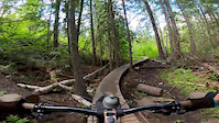
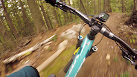
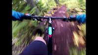
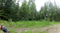
Videos of Salmon Arm Mountain Bike
trail: Upper Meatgrinder
2:34 |
2929 |
Nov 21, 2021

trail: The Flying Nun (lower)
7:05 |
223 |
Sep 16, 2020

trail: Troll Trail
0:29 |
153 |
Sep 16, 2020
trail: Mo Buddha
10:07 |
153 |
Jun 22, 2020
trail: Sansom
0:44 |
125 |
Jan 8, 2020
trail: Ravine (7km)
4:39 |
243 |
Sep 21, 2018
trail: Mo Buddha
4:26 |
120 |
Sep 18, 2018
trail: Coffee Time
0:15 |
568 |
Jun 28, 2018
Recent Trail Reports
| status | trail | date | condition | info | user |
|---|---|---|---|---|---|
| Double D | Jun 18, 2026 @ 5:35pm (America/Vancouver) 14 hours | Unknown | a-zircon | ||
| Outer Loop | Jun 17, 2026 @ 11:33am (America/Vancouver) 2 days | Dry | hanbanane | ||
| KC (Kattie and Collin Memorial Trail) | Jun 6, 2026 @ 7:43pm (America/Vancouver) Jun 6, 2026 | Ideal | v6M4EF | ||
| Lower Meat Grinder | Jun 4, 2026 @ 8:28pm (America/Vancouver) Jun 4, 2026 | Unknown | RustyRake | ||
| Mourning Wood | May 24, 2026 @ 1:06pm (America/Vancouver) May 24, 2026 | Dry | graymanc | ||
| Freefallin | May 23, 2026 @ 8:14am (America/Vancouver) May 23, 2026 | Ideal | hanbanane | ||
| LHT (Ida View) | May 21, 2026 @ 5:58pm (America/Vancouver) May 21, 2026 | Unknown | a-zircon | ||
| Muffin Top | May 21, 2026 @ 10:11am (America/Vancouver) May 21, 2026 | Ideal | hanbanane | ||
| Ravine | May 21, 2026 @ 10:09am (America/Vancouver) May 21, 2026 | Ideal | hanbanane | ||
| Ravine (9km) | May 21, 2026 @ 10:09am (America/Vancouver) May 21, 2026 | Ideal | hanbanane |
Activity Feed
| username | action | type | title | date |
|---|---|---|---|---|
| yakar | wishlist | route | activity #97292525 | Jun 18, 2026 @ 7:49pm 12 hours |
| a-zircon | add | report | activity #97285907 | Jun 18, 2026 @ 5:35pm 14 hours |
| MGV8 | comment | report | activity #97265180 | Jun 18, 2026 @ 11:23am 21 hours |
| hanbanane | comment | report | activity #97262179 | Jun 18, 2026 @ 10:39am 21 hours |
| DanlaJe5R | wishlist | region | activity #97210454 | Jun 17, 2026 @ 2:45pm 2 days |
Recent Comments
| username | type | title | comment | date |
|---|---|---|---|---|
| report | Just need to be given a mission LOL. | Jun 18, 2026 @ 11:23am 21 hours | ||
| report | Wow that was quick, thanks for saving me the trip! | Jun 18, 2026 @ 10:39am 21 hours | ||
| report | Got my butt in gear. Fixed | Jun 17, 2026 @ 2:57pm 2 days | ||
| report | Been meaning to fix that. Just never have a... | Jun 17, 2026 @ 12:46pm 2 days | ||
| report | Yes. Need to get it on the map. Lots of riders... | Jun 14, 2026 @ 12:44pm Jun 14, 2026 |
Local Badges
-

SCC Dirt Lovers Week 31 awarded -

Epic Ride 50k548 awarded -

Big Ride 30k1,233 awarded -

Top 10 Trails27 awarded -

Completionist0 awarded -
Completionist0 awarded
Upcoming Local Events
Local Trail Supporters
![]()
![]()
- Shuswap Dirt Riders
![]()
![]()
- Larch Hills Nordic Society
![]()
- Shuswap Outdoors
- NorthStar Rails to Trails
- Chris Fowler
Local Trail Supporters
![]()
![]()
- Shuswap Dirt Riders
![]()
![]()
- Larch Hills Nordic Society
![]()
- Shuswap Outdoors
- NorthStar Rails to Trails
- Chris Fowler
Activity Type Stats
| activitytype | trails | distance | descent | descent distance | total vertical | rating | global rank | state rank | photos | reports | routes | ridelogs |
|---|---|---|---|---|---|---|---|---|---|---|---|---|
| Mountain Bike | 365 | 182 miles | 36,847 ft | 88 miles | 4,006 ft | #191 | #24 | 716 | 4,180 | 38 | 29,115 | |
| E-Bike | 301 | 168 miles | 32,526 ft | 81 miles | 3,796 ft | #310 | #30 | 39 | 3,973 | 12 | 1,202 | |
| Gravel Bike | 1 | #351 | #95 | 1 | 15 | 4 | 42 | |||||
| Horse | 115 | 82 miles | 9,895 ft | 35 miles | 3,136 ft | #101 | #9 | 2 | 1,291 | 2 | 157 | |
| Hike | 374 | 193 miles | 37,054 ft | 90 miles | 4,006 ft | #464 | #29 | 32 | 3,909 | 4 | 1,735 | |
| Trail Running | 372 | 192 miles | 36,604 ft | 90 miles | 4,006 ft | #388 | #26 | 1 | 3,903 | 8 | 3,935 | |
| Dirtbike/Moto | 56 | 59 miles | 9,147 ft | 29 miles | 3,507 ft | #257 | #32 | 1,125 | 5 | 125 | ||
| Observed Trials | 2 | 3,524 ft | 26 ft | 253 ft | 420 ft | #181 | #17 | 280 | 2 | |||
| ATV/ORV/OHV | 64 | 64 miles | 9,219 ft | 30 miles | 3,507 ft | #152 | #19 | 1,201 | 29 | |||
| Snowmobile | 3 | 3 miles | 10 ft | 220 ft | 1,434 ft | #172 | #10 | 229 | 3 | |||
| Snowshoe | 93 | 49 miles | 10,256 ft | 20 miles | 4,003 ft | #264 | #25 | 2 | 841 | 315 | ||
| Downhill Ski | 2 | 220 ft | #562 | #23 | 13 | 1,117 | ||||||
| Backcountry Ski | 47 | 26 miles | 2,359 ft | 9 miles | 2,792 ft | #338 | #20 | 238 | 1 | 185 | ||
| Nordic Ski | 121 | 90 miles | 11,699 ft | 42 miles | 3,136 ft | #121 | #15 | 381 | 1 | 3,804 |
Frequently Asked Questions About Salmon Arm
▼
What are the best places to ride in Salmon Arm?
Salmon Arm has 15 areas to explore for mountain biking. The top rated areas are:
▼
What are the highest rated mountain biking trails in Salmon Arm?
The highest rated mountain biking trails in Salmon Arm are:
- Northstar Rails to Trails (4.5/5)
- Lower Schizo (4.4/5)
- Ravine (6.5km) (4.4/5)
- Ravine (4.4/5)
- The Flying Nun (lower) (4.3/5)
▼
What is the best time of the year to ride in Salmon Arm?
Based on ride log data, the most popular months to ride in Salmon Arm are:
- July (736 activities)
- May (548 activities)
- August (537 activities)
▼
Where can I park to ride in Salmon Arm?
There are 25 parking locations listed in Salmon Arm. The most popular parking spots are:
- Parking
- NorthStar Rails to Trail Cranbrook Trailhead
- 10th Ave Parking
- Disk Golf Course
- Field Of Dreams Parking
Activities
- Salmon Arm Mountain Biking Trails
- Salmon Arm E-Biking Trails
- Salmon Arm Horseback Trails
- Salmon Arm Hiking Trails
- Salmon Arm Trail Running Trails
- Salmon Arm Dirtbiking Trails
- Salmon Arm ATVing/Offroading Trails
- Salmon Arm Snowshoeing Trails
- Salmon Arm Backcountry Skiing Trails
- Salmon Arm Nordic Skiing Trails
Trails
- By smoke
 Simpcw & contributors
 - Admins: canadianenduro, STAB, SCC
- #6165 - 42,433 views
- salmon arm activity log | embed map of Salmon Arm mountain bike trails | salmon arm mountain biking points of interest polygons
Downloading of trail gps tracks in kml & gpx formats is enabled for Salmon Arm.
You must login to download files.