close
-
Layers w
- Weather Layers
- Pro
- Pro
- Pro
- Pro
- Pro
- Pro
- More Layers
- Pro
- Pro
- Pro
- Pro
-
Upgrade to

3D
Trail Conditions
- Unknown
- Snow Groomed
- Snow Packed
- Snow Covered
- Snow Cover Partial
- Freeze/thaw Cycle
- Icy
- Prevalent Mud
- Wet
- Variable
- Ideal
- Dry
- Very Dry
Trail Flow (Ridden Direction)
Trailforks scans users ridelogs to determine the most popular direction each trail is ridden. A good flowing trail network will have most trails flowing in a single direction according to their intension.
The colour categories are based on what percentage of riders are riding a trail in its intended direction.
The colour categories are based on what percentage of riders are riding a trail in its intended direction.
- > 96%
- > 90%
- > 80%
- > 70%
- > 50%
- < 50%
- bi-directional trail
- no data
Trail Last Ridden
Trailforks scans ridelogs to determine the last time a trail was ridden.
- < 2 days
- < 1 week
- < 2 weeks
- < 1 month
- < 6 months
- > 6 months
Trail Ridden Direction
The intended direction a trail should be ridden.
- Downhill Only
- Downhill Primary
- Both Directions
- Uphill Primary
- Uphill Only
- One Direction
Contribute Details
Colors indicate trail is missing specified detail.
- Description
- Photos
- Description & Photos
- Videos
Trail Popularity ?
Trailforks scans ridelogs to determine which trails are ridden the most in the last 9 months.
Trails are compared with nearby trails in the same city region with a possible 25 colour shades.
Think of this as a heatmap, more rides = more kinetic energy = warmer colors.
- most popular
- popular
- less popular
- not popular
ATV/ORV/OHV Filter
Max Vehicle Width
inches
US Cell Coverage
Legend

Radar Time
Activity Recordings
Trailforks uses anonymized public activity data.
?
Activity Recordings
Trailforks uses anonymized public activity data.
?
Personal Heatmap
▶
Activity Types
all
/
none
▶
Options
2
Date range
month
–
Winter Trails
Warning
A routing network for winter maps does not exist. Selecting trails using the winter trails layer has been disabled.
Missing Trails
Most Popular
Least Popular
Trails are colored based on popularity. The more popular a trail is, the more red. Less popular trails trend towards green.
Jump Magnitude Heatmap
Heatmap of where riders jump on trails. Zoom in to see individual jumps, click circles to view jump details.
BC Backroad Status
![map legend]()
Service Road Atlas is a free to use, community-driven service for viewing and creating reports on the numerous back-country service roads around B.C. and Alberta.

Slope Aspect
Direction the slope faces
Trails Deemphasized
Trails are shown in grey.
Only show trails with no bike usage.
Suggested Layers
Based on selected activity type
Save the current map location and zoom level as your default home location whenever this page is loaded.
Save
No description for San Dimas has been added yet!
Login or register to submit one.
Activities Click to view
- Mountain Bike
35 trails
- E-Bike
9 trails
- Gravel Bike
0 trails
- Adaptive Bike
0 trails
- Winter Fat Bike
0 trails
- Hike
35 trails
- Trail Running
35 trails
Region Details
- 2
- 9
- 20
- 1
- 1
Region Status
Caution as of May 17, 2026Stats
- Avg Trail Rating
- Trails (view details)
- 33
- Trails Mountain Bike
- 35
- Trails E-Bike
- 9
- Trails Horse
- 2
- Trails Hike
- 35
- Trails Trail Running
- 35
- Total Distance
- 19 miles
- Total Descent
- 3,850 ft
- Total Vertical
- 2,953 ft
- Highest Trailhead
- 3,528 ft
- Reports
- 286
- Photos
- 98
- Ridden Counter
- 11,097
Sub Regions
-
Frank G. Bonelli Park
- 2
- 9
- 20
- 1
Popular San Dimas Mountain Biking Trails
• 95 ★ 3.4 • 2 miles • 300 ft • 466 •
Popular green difficulty singletrack. This mountain bike primary trail can be used both directions and has a easy overall physical rating with a 300 ft green climb. On average it takes 16 minutes to complete this trail.
• 80 ★ 3.5 • 2,771 ft • 127 ft • 373 •
Ride around the stables and back up to the top of the hill. Get ready for a bumpy ride down the .
• 75 ★ 4.2 • 3,101 ft • 9 ft • 359 •
Highly rated popular blue difficulty singletrack. This mountain bike primary trail can be used downhill primary. It features rock garden. On average it takes 3 minutes to complete this trail.
• 95 ★ 3.8 • 1,147 ft • 21 ft • 349 •
Popular blue difficulty singletrack. This mountain bike primary trail can be used both directions. On average it takes 1 minutes to complete this trail.
• 75 ★ 4.4 • 938 ft • 17 ft • 279 •
Fun twisty downhill singletrack through a shady stand of trees.
• 55 ★ 3.8 • 3,240 ft • 119 ft • 266 •
Super wide trail climbs you up for a good view of the lake and is part of the Bonelli Loop Route
San Dimas Mountain Bike Routes
15 miles • 1,653 ft • 11 • Loop •
This route is originally intended for adaptive riders, but anyone can do it. It avoids certain obstacles...
10 miles • 1,422 ft • 7 • Loop •
The 10 mile Nurburgring of the West Coast, taking you round the whole outside perimiter of the Bonelli...
★ 3.0 • 10 miles • 1,463 ft • 8 •
Fun and easy tour of Bonelli Park, enjoyable for all levels
★ 3.0 • 10 miles • 1,371 ft • 18 • Loop •
The 10 mile Nurburgring of the West Coast, taking you round the whole outside perimiter of the Bonelli...
★ 4.0 • 11 miles • 1,525 ft • 0 • Loop • Race •
Cat 2/3 course for Goldstate series round 4 at Bonelli Park. The course is fairly technical and includes...
Photos of San Dimas Mountain Bike
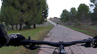
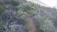
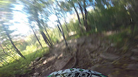
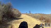
Videos of San Dimas Mountain Bike
trail: Fisherman's Lake Trail
3:46 |
118 |
Aug 5, 2019

trail: 57
0:55 |
65 |
Jan 31, 2017

trail: 57
0:55 |
401 |
Jan 31, 2017
trail: Rocky Trail
0:27 |
221 |
Mar 14, 2016
trail: Rocky Trail
3:39 |
538 |
Sep 29, 2014
trail: Rocky Trail
9:14 |
215 |
Dec 26, 2013

trail: Rocky Trail
14:59 |
177 |
Nov 21, 2024 , San Dimas
trail: Corkscrew
14:59 |
147 |
Nov 21, 2024 , San Dimas
Recent Trail Reports
| status | trail | date | condition | info | user |
|---|---|---|---|---|---|
| Cactus Line | May 17, 2026 @ 12:12pm (America/Los_Angeles) May 17, 2026 | Dry | rizzant | ||
| Corkscrew | May 2, 2026 @ 1:33pm (America/Los_Angeles) May 2, 2026 | Dry | BlindJoeDeath | ||
| Kikos Trail | May 2, 2026 @ 1:24pm (America/Los_Angeles) May 2, 2026 | Very Dry | BlindJoeDeath | ||
| Vietnam | May 2, 2026 @ 1:21pm (America/Los_Angeles) May 2, 2026 | Ideal | BlindJoeDeath | ||
| Enter The Dragon | May 2, 2026 @ 1:20pm (America/Los_Angeles) May 2, 2026 | Dry | BlindJoeDeath | ||
| East Shore Paved Path | Apr 29, 2026 @ 6:43pm (America/Los_Angeles) Apr 29, 2026 | Ideal | rizzant | ||
| Fisherman | Apr 29, 2026 @ 6:43pm (America/Los_Angeles) Apr 29, 2026 | Variable | rizzant | ||
| Puddingstone Connector | Apr 29, 2026 @ 6:43pm (America/Los_Angeles) Apr 29, 2026 | Variable | rizzant | ||
| North Shore | Apr 29, 2026 @ 6:43pm (America/Los_Angeles) Apr 29, 2026 | Variable | rizzant | ||
| McKinley Access Path | Apr 29, 2026 @ 6:43pm (America/Los_Angeles) Apr 29, 2026 | Very Dry | rizzant |
Activity Feed
| username | action | type | title | date |
|---|---|---|---|---|
| catalinamixer | wishlist | trail | activity #96494557 | Jun 7, 2026 @ 1:43pm Jun 7, 2026 |
| FedericoIZRNEL | ridden | route | activity #95405725 | May 24, 2026 @ 7:03am May 24, 2026 |
| Bran01 | wishlist | route | activity #95291831 | May 22, 2026 @ 11:29pm May 22, 2026 |
| rizzant | add | report | activity #94973806 | May 18, 2026 @ 7:11am May 18, 2026 |
| weeyompp | wishlist | trail | activity #94619407 | May 13, 2026 @ 5:04am May 13, 2026 |
Recent Comments
| username | type | title | comment | date |
|---|---|---|---|---|
| trail | Pretty steep, wasn’t expecting it | Apr 24, 2026 @ 4:45pm Apr 24, 2026 | ||
| trail | trail is blocked off now remove plz | Sep 10, 2025 @ 9:20am Sep 10, 2025 | ||
| trail | Trail really isn’t that fun. No obstacles... | Sep 5, 2025 @ 3:34pm Sep 5, 2025 | ||
| trail | Definitely steeper of the trails and very... | Jul 22, 2025 @ 5:10am Jul 22, 2025 | ||
| trail | A bit dry and loose. I think it is more PURPLE... | Jun 21, 2025 @ 2:19pm Jun 21, 2025 |
Local Badges
-

10 Green Trails187 awarded -

10 Blue Trails186 awarded -

Epic Ride Climb 2k12 awarded -

Climbing 10k Badge63 awarded -

Climbing 100k Badge3 awarded -

Epic Ride Descent 2k12 awarded
Activity Type Stats
| activitytype | trails | distance | descent | descent distance | total vertical | rating | global rank | state rank | photos | reports | routes | ridelogs |
|---|---|---|---|---|---|---|---|---|---|---|---|---|
| Mountain Bike | 35 | 19 miles | 3,848 ft | 9 miles | 2,953 ft | #2,350 | #840 | 114 | 286 | 6 | 13,787 | |
| E-Bike | 9 | 2,910 ft | 213 ft | 1,490 ft | 167 ft | #5,325 | #1,651 | 234 | 1 | 1,492 | ||
| Horse | 2 | 2,910 ft | 213 ft | 1,490 ft | 167 ft | 31 | ||||||
| Hike | 35 | 19 miles | 3,848 ft | 9 miles | 2,953 ft | #1,802 | #786 | 1 | 286 | 250 | ||
| Trail Running | 35 | 19 miles | 3,848 ft | 9 miles | 2,953 ft | #6,615 | #2,155 | 2 | 286 | 275 |
Frequently Asked Questions About San Dimas
▼
What are the best places to ride in San Dimas?
San Dimas has 1 areas to explore for mountain biking. The top rated areas are:
▼
What are the highest rated mountain biking trails in San Dimas?
The highest rated mountain biking trails in San Dimas are:
- Singletrack Thru the Trees (4.1/5)
- Rocky Trail (4.1/5)
- Lower Vargus (4/5)
- Corkscrew (3.9/5)
- Fisherman (3.9/5)
▼
What is the best time of the year to ride in San Dimas?
Based on ride log data, the most popular months to ride in San Dimas are:
- July (76 activities)
- May (62 activities)
- October (62 activities)
▼
Where can I park to ride in San Dimas?
There are 7 parking locations listed in San Dimas. The most popular parking spots are: View all parking and trailhead locations on the map to plan your visit.
Activities
Trails
Points of Interest
- By derkderkall
 & contributors
 - Admins: CORBA
- #14667 - 5,078 views
- san dimas activity log | embed map of San Dimas mountain bike trails | san dimas mountain biking points of interest
Downloading of trail gps tracks in kml & gpx formats is enabled for San Dimas.
You must login to download files.