close
-
Layers w
- Weather Layers
- Pro
- Pro
- Pro
- Pro
- Pro
- Pro
- More Layers
- Pro
- Pro
- Pro
- Pro
-
Upgrade to

3D
Trail Conditions
- Unknown
- Snow Groomed
- Snow Packed
- Snow Covered
- Snow Cover Partial
- Freeze/thaw Cycle
- Icy
- Prevalent Mud
- Wet
- Variable
- Ideal
- Dry
- Very Dry
Trail Flow (Ridden Direction)
Trailforks scans users ridelogs to determine the most popular direction each trail is ridden. A good flowing trail network will have most trails flowing in a single direction according to their intension.
The colour categories are based on what percentage of riders are riding a trail in its intended direction.
The colour categories are based on what percentage of riders are riding a trail in its intended direction.
- > 96%
- > 90%
- > 80%
- > 70%
- > 50%
- < 50%
- bi-directional trail
- no data
Trail Last Ridden
Trailforks scans ridelogs to determine the last time a trail was ridden.
- < 2 days
- < 1 week
- < 2 weeks
- < 1 month
- < 6 months
- > 6 months
Trail Ridden Direction
The intended direction a trail should be ridden.
- Downhill Only
- Downhill Primary
- Both Directions
- Uphill Primary
- Uphill Only
- One Direction
Contribute Details
Colors indicate trail is missing specified detail.
- Description
- Photos
- Description & Photos
- Videos
Trail Popularity ?
Trailforks scans ridelogs to determine which trails are ridden the most in the last 9 months.
Trails are compared with nearby trails in the same city region with a possible 25 colour shades.
Think of this as a heatmap, more rides = more kinetic energy = warmer colors.
- most popular
- popular
- less popular
- not popular
ATV/ORV/OHV Filter
Max Vehicle Width
inches
US Cell Coverage
Legend

Radar Time
Activity Recordings
Trailforks uses anonymized public activity data.
?
Activity Recordings
Trailforks uses anonymized public activity data.
?
Personal Heatmap
▶
Activity Types
all
/
none
▶
Options
2
Date range
month
–
Winter Trails
Warning
A routing network for winter maps does not exist. Selecting trails using the winter trails layer has been disabled.
Missing Trails
Most Popular
Least Popular
Trails are colored based on popularity. The more popular a trail is, the more red. Less popular trails trend towards green.
Jump Magnitude Heatmap
Heatmap of where riders jump on trails. Zoom in to see individual jumps, click circles to view jump details.
BC Backroad Status
![map legend]()
Service Road Atlas is a free to use, community-driven service for viewing and creating reports on the numerous back-country service roads around B.C. and Alberta.

Slope Aspect
Direction the slope faces
Trails Deemphasized
Trails are shown in grey.
Only show trails with no bike usage.
Suggested Layers
Based on selected activity type
Save the current map location and zoom level as your default home location whenever this page is loaded.
Save
No description for Sandviken has been added yet!
Login or register to submit one.
This region uses the Uk/Euro style trail grading system.
Activities Click to view
- Mountain Bike
372 trails
- E-Bike
17 trails
- Gravel Bike
0 trails
- Adaptive Bike
0 trails
- Winter Fat Bike
0 trails
- Hike
346 trails
- Trail Running
342 trails
- Backcountry Ski
9 trails
- Nordic Ski
61 trails
Region Details
- 96
- 128
- 107
- 38
- 1
Region Status
Open as of 3 daysStats
- Avg Trail Rating
- Trails (view details)
- 375
- Trails Mountain Bike
- 372
- Trails E-Bike
- 17
- Trails Horse
- 3
- Trails Hike
- 346
- Trails Trail Running
- 342
- Trails Downhill Ski
- 1
- Trails Backcountry Ski
- 9
- Trails Nordic Ski
- 61
- Total Distance
- 186 miles
- Total Descent
- 12,345 ft
- Total Vertical
- 813 ft
- Highest Trailhead
- 1,000 ft
- Reports
- 1,368
- Photos
- 142
- Ridden Counter
- 44,016
Sub Regions
-
Årsunda
- 4
-
Åshammar
-
Centrala Sandviken
- 15
- 5
- 2
-
Gästrike Hammarby
- 3
- 5
-
Högbo MTB Arena
- 58
- 34
- 24
-
Järbo
- 3
- 22
- 2
-
Kungsberget
- 4
- 8
- 5
- 1
-
Österfärnebo
- 3
- 6
- 3
-
Stensätra
- 4
- 7
-
Storvik
- 14
- 15
- 1
Popular Sandviken Mountain Biking Trails
• 100 ★ 3.7 • 3,668 ft • 9 ft • 817 •
Popular green difficulty family friendly singletrack. This mountain bike primary trail can be used one direction. Trail visibility is always easy to follow. On average it takes 4 minutes to complete this trail.
• 100 ★ 5.0 • 843 ft • 0 ft • 742 •
Popular green difficulty singletrack. This mountain bike primary trail can be used one direction. On average it takes 1 minutes to complete this trail.
• 100 ★ 5.0 • 1,667 ft • 8 ft • 702 •
Popular green difficulty family friendly singletrack. This mountain bike primary trail can be used one direction and has a easy overall physical rating with a 8 ft green climb. Trail visibility is always easy to follow. On average it takes 1 minutes to complete this trail.
• 100 ★ 5.0 • 3,615 ft • 2 ft • 698 •
Popular green difficulty family friendly singletrack. This mountain bike primary trail can be used both directions and has a easy overall physical rating with a 2 ft green climb. Trail visibility is always easy to follow. On average it takes 4 minutes to complete this trail.
• 100 ★ 4.0 • 1,286 ft • 5 ft • 690 •
Popular green difficulty family friendly singletrack. This mountain bike primary trail can be used one direction. Trail visibility is always easy to follow. On average it takes 1 minutes to complete this trail.
Sandviken Mountain Bike Routes
★ 5.0 • 6 miles • 116 ft • 9 •
En snäll bana som har ett jämt och lättåkt underlag och svag kupering. Banan har både...
★ 4.0 • 3 miles • 64 ft • 12 • Loop •
En 4,6 km lång bana med få backar men med flera stigar där dina färdigheter utmanas, omväxlande med...
★ 5.0 • 2 miles • 43 ft • 5 • Loop •
Högbo MTB: Blå bana till största delen byggd med många svängar som flyter fram i terrängen och ger...
3 miles • 50 ft • 7 • Loop •
HögboMTB: En riktigt rolig instegsbana och även rolig för den som vill känna fartkänslan i de...
5 miles • 691 ft • 5 • Point to Point •
Lenåsleden kopplar ihop Fäbodleden som går mellan Högbo och Kungsberg med Mårtens Klack varifrån man...
9 miles • 158 ft • 24 • Loop •
En riktigt omväxlande bana med nästan bara ”singletrack” av skiftande svårighet. En stor del av...
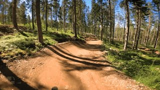
Photos of Sandviken Mountain Bike
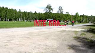
Videos of Sandviken Mountain Bike

trail: Far&Son-Stigen 2
0:44 |
13 |
Aug 21, 2021
trail: Far&Son-Stigen 1
0:59 |
9 |
Aug 21, 2021
trail: Skuggan Nedre
0:18 |
64 |
Jul 31, 2024 , Sandviken

trail: Skuggan Övre
0:18 |
77 |
Jul 31, 2024 , Sandviken
trail: Slash
0:27 |
123 |
Jul 31, 2024 , Sandviken
youtuber
![MTB Full Run: Velodromen in Kungsberget, Sweden]()
trail: Velodromen
4:19 |
92 |
Jul 4, 2024 , Sandviken
trail: Högbo MTB 9 Genväg
0:13 |
215 |
Mar 30, 2022 , Sandviken
Current Trail Warnings
| status | trail | date | condition | user | info |
|---|---|---|---|---|---|
| Isakasvägen | Jun 19, 2026 @ 7:46am (Europe/Stockholm) 3 days | Ideal | torbjorn1 |
Recent Trail Reports
| status | trail | date | condition | info | user |
|---|---|---|---|---|---|
| Lexehällvägen | Jun 17, 2026 @ 7:58am (Europe/Stockholm) Jun 16, 2026 | Ideal | torbjorn1 | ||
| Sandviken Canal | Jun 12, 2026 @ 8:26am (Europe/Stockholm) Jun 11, 2026 | Ideal | torbjorn1 | ||
| Högboleden Jädraån | Jun 12, 2026 @ 8:26am (Europe/Stockholm) Jun 11, 2026 | Ideal | torbjorn1 | ||
| Högboleden Kvarnströmmen | Jun 12, 2026 @ 8:26am (Europe/Stockholm) Jun 11, 2026 | Ideal | torbjorn1 | ||
| Högboleden Ol-Mats | Jun 12, 2026 @ 8:26am (Europe/Stockholm) Jun 11, 2026 | Dry | torbjorn1 | ||
| Svibacka | Jun 12, 2026 @ 8:26am (Europe/Stockholm) Jun 11, 2026 | Ideal | torbjorn1 | ||
| Torgtarmen | May 24, 2026 @ 8:10am (Europe/Stockholm) May 23, 2026 | Ideal | torbjorn1 | ||
| Jädraån Östra | May 21, 2026 @ 10:14am (Europe/Stockholm) May 21, 2026 | Ideal | torbjorn1 | ||
| Sprintbana | May 16, 2026 @ 6:21am (Pacific/Midway) May 16, 2026 | Ideal | atakua | ||
| Pumptrackbana | May 16, 2026 @ 6:21am (Pacific/Midway) May 16, 2026 | Ideal | atakua |
Activity Feed
| username | action | type | title | date |
|---|---|---|---|---|
| OrjanX | comment | report | activity #97301474 | Jun 19, 2026 @ 12:45am 3 days |
| torbjorn1 | add | report | activity #97301159 | Jun 19, 2026 @ 12:34am 3 days |
| torbjorn1 | add | report | activity #97168259 | Jun 17, 2026 @ 1:08am Jun 17, 2026 |
| torbjorn1 | add | report | activity #96789770 and 4 more | Jun 12, 2026 @ 1:25am Jun 12, 2026 |
| Atomenmtb | wishlist | route | activity #96368150 and 1 more | Jun 6, 2026 @ 7:25am Jun 6, 2026 |
Recent Comments
| username | type | title | comment | date |
|---|---|---|---|---|
| report | Varning för vadå? Skriv gärna en kommentar. | Jun 19, 2026 @ 12:45am 3 days | ||
| report | Varför orange om den är ideal? | Mar 9, 2025 @ 12:06pm Mar 9, 2025 | ||
| trail | This trail is abusive. It takes all your... | Jun 20, 2024 @ 7:46am Jun 20, 2024 | ||
| report | Trädet är uppsågat och flyttat | Jul 25, 2023 @ 5:31am Jul 25, 2023 | ||
| trail | Jag vet inte vad majoriteten av användare... | Apr 19, 2021 @ 2:21am Apr 19, 2021 |
Local Badges
-

Completionist0 awarded -

Top 10 Trails16 awarded -
Completionist3 awarded -
Completionist0 awarded -
Completionist0 awarded -
Completionist0 awarded
Bike & Skill Parks
| name | type | city | rating |
|---|---|---|---|
| Högbo MTB Arena Skillpark | skill park | Sandviken |
Activity Type Stats
| activitytype | trails | distance | descent | descent distance | total vertical | rating | global rank | state rank | photos | reports | routes | ridelogs |
|---|---|---|---|---|---|---|---|---|---|---|---|---|
| Mountain Bike | 372 | 177 miles | 11,995 ft | 60 miles | 801 ft | #329 | #28 | 142 | 1,359 | 38 | 10,427 | |
| E-Bike | 17 | 7 miles | 3,858 ft | 5 miles | 764 ft | #3,905 | #92 | 1,272 | 2 | 421 | ||
| Horse | 3 | 1 mile | 16 ft | 1,427 ft | 20 ft | 182 | ||||||
| Hike | 346 | 172 miles | 8,399 ft | 57 miles | 814 ft | #804 | #51 | 1,359 | 9 | 133 | ||
| Trail Running | 342 | 170 miles | 8,307 ft | 56 miles | 814 ft | #590 | #53 | 1,359 | 9 | 680 | ||
| Downhill Ski | 1 | 3,927 ft | 95 ft | 2,395 ft | 98 ft | 10 | 1,068 | |||||
| Backcountry Ski | 9 | 4 miles | 121 ft | 1 mile | 194 ft | #321 | #25 | 10 | 41 | |||
| Nordic Ski | 61 | 44 miles | 1,795 ft | 14 miles | 302 ft | #260 | #31 | 12 | 1,381 |
Frequently Asked Questions About Sandviken
▼
What are the best places to ride in Sandviken?
Sandviken has 10 areas to explore for mountain biking. The top rated areas are:
▼
What are the highest rated mountain biking trails in Sandviken?
The highest rated mountain biking trails in Sandviken are:
- Sprintbana (4.4/5)
- Najsingen (4.3/5)
- Nya Maja (4.2/5)
- A New Start Of 20 (4.1/5)
- Kungsleden Övre (4.1/5)
▼
What is the best time of the year to ride in Sandviken?
Based on ride log data, the most popular months to ride in Sandviken are:
- July (175 activities)
- August (94 activities)
- June (90 activities)
▼
Where can I park to ride in Sandviken?
There are 3 parking locations listed in Sandviken. The most popular parking spots are: View all parking and trailhead locations on the map to plan your visit.
Activities
Trails
- By brenthillier
 NSMBA TRAILFORKS & contributors
 - Admins: ollesvenskonthetrail, JALLE, OrjanX, martinlindstr, nordis
- #13594 - 3,807 views
- sandviken activity log | embed map of Sandviken mountain bike trails | sandviken mountain biking points of interest polygons
Downloading of trail gps tracks in kml & gpx formats is enabled for Sandviken.
You must login to download files.