close
-
Layers w
- Weather Layers
- Pro
- Pro
- Pro
- Pro
- Pro
- Pro
- More Layers
- Pro
- Pro
- Pro
- Pro
-
Upgrade to

3D
Trail Conditions
- Unknown
- Snow Groomed
- Snow Packed
- Snow Covered
- Snow Cover Partial
- Freeze/thaw Cycle
- Icy
- Prevalent Mud
- Wet
- Variable
- Ideal
- Dry
- Very Dry
Trail Flow (Ridden Direction)
Trailforks scans users ridelogs to determine the most popular direction each trail is ridden. A good flowing trail network will have most trails flowing in a single direction according to their intension.
The colour categories are based on what percentage of riders are riding a trail in its intended direction.
The colour categories are based on what percentage of riders are riding a trail in its intended direction.
- > 96%
- > 90%
- > 80%
- > 70%
- > 50%
- < 50%
- bi-directional trail
- no data
Trail Last Ridden
Trailforks scans ridelogs to determine the last time a trail was ridden.
- < 2 days
- < 1 week
- < 2 weeks
- < 1 month
- < 6 months
- > 6 months
Trail Ridden Direction
The intended direction a trail should be ridden.
- Downhill Only
- Downhill Primary
- Both Directions
- Uphill Primary
- Uphill Only
- One Direction
Contribute Details
Colors indicate trail is missing specified detail.
- Description
- Photos
- Description & Photos
- Videos
Trail Popularity ?
Trailforks scans ridelogs to determine which trails are ridden the most in the last 9 months.
Trails are compared with nearby trails in the same city region with a possible 25 colour shades.
Think of this as a heatmap, more rides = more kinetic energy = warmer colors.
- most popular
- popular
- less popular
- not popular
ATV/ORV/OHV Filter
Max Vehicle Width
inches
US Cell Coverage
Legend

Radar Time
Activity Recordings
Trailforks uses anonymized public activity data.
?
Activity Recordings
Trailforks uses anonymized public activity data.
?
Personal Heatmap
▶
Activity Types
all
/
none
▶
Options
2
Date range
month
–
Winter Trails
Warning
A routing network for winter maps does not exist. Selecting trails using the winter trails layer has been disabled.
Missing Trails
Most Popular
Least Popular
Trails are colored based on popularity. The more popular a trail is, the more red. Less popular trails trend towards green.
Jump Magnitude Heatmap
Heatmap of where riders jump on trails. Zoom in to see individual jumps, click circles to view jump details.
BC Backroad Status
![map legend]()
Service Road Atlas is a free to use, community-driven service for viewing and creating reports on the numerous back-country service roads around B.C. and Alberta.

Slope Aspect
Direction the slope faces
Trails Deemphasized
Trails are shown in grey.
Only show trails with no bike usage.
Suggested Layers
Based on selected activity type
Save the current map location and zoom level as your default home location whenever this page is loaded.
Save
No description for Sandy has been added yet!
Login or register to submit one.
Activities Click to view
- Mountain Bike
26 trails
- Gravel Bike
0 trails
- Adaptive Bike
0 trails
- Hike
15 trails
- Trail Running
27 trails
Region Details
- 4
- 9
- 6
- 5
- 3
Region Status
Open as of 11 hoursStats
- Avg Trail Rating
- Trails (view details)
- 35
- Trails Mountain Bike
- 27
- Trails E-Bike
- 1
- Trails Horse
- 2
- Trails Hike
- 15
- Trails Trail Running
- 27
- Total Distance
- 36 miles
- Total Descent Distance
- 21 miles
- Total Descent
- 8,848 ft
- Total Vertical
- 4,011 ft
- Highest Trailhead
- 4,384 ft
- Reports
- 2,056
- Photos
- 396
- Ridden Counter
- 38,522
Articles

Oregon's 5 Most Popular Trail Networks According to Trailforks Data
Oct 19, 2021 from pinkbike.com
Oregon is one of the most revered parts of the country amongst the mountain bike community, with riding opportunities that reflect the diverse...
Sub Regions
-
Sandy Ridge
- 6
- 6
- 5
- 3
-
Sandy River Park
- 3
Popular Sandy Mountain Biking Trails
• 100 ★ 4.7 • 2 miles • 3 ft • 3,672 •
Although it shares a name with , Lower H&S is a very different trail. Very much a modern flow trail with tons of berms to keep you at whatever speed you desire. A few small side hits and a couple small tables are thrown in for good...
• 95 ★ 4.4 • 3,760 ft • 50 ft • 2,710 •
is one of the newest trails at Sandy Ridge. It connects to and features an abundance of flow with endless berms and rollers the whole way through. can be included in a bigger ride with or a session route with .
• 90 ★ 4.6 • 1 mile • 0 ft • 2,679 •
is one of the shorter downhills at Sandy Ridge. It packs in a lot of excitement in a short amount of time. The route begins at the end of and an intersection with . Drop in off a shallow rock slab and then whip through a few tight...
• 90 ★ 3.9 • 3,291 ft • 112 ft • 2,566 •
is a great way to get familiar with the technical features and gravity elements found throughout the Sandy Ridge system. Climbing initially from the upper trailhead, then transitions into rocky drops and rollers. The trail can be...
• 80 ★ 4.6 • 2 miles • 102 ft • 2,348 •
Classic NW singletrack with a more natural feel than anything else at Sandy. Nearly everything is negotiable by an intermediate rider, but at speed the trail comes alive. Trail has many medium-sized rocks on direct lines that need to be...
• 100 ★ 3.5 • 689 ft • 11 ft • 2,108 •
Small series of rollers to get you from the parking lot to Homestead Rd for the climb up.
• 80 ★ 4.0 • 1 mile • 233 ft • 1,804 •
starts from a climb up . The first part of the trail is a pedal up through large sweeping berms. The grade is steady but not lung busting. Be sure to stop and enjoy the views from green rock down across the valley. The descent on is...
• 90 ★ 4.6 • 1,877 ft • 0 ft • 1,802 •
This is an easier jump trail with some mellow jumps early on and then some bugs get ones toward the end. No gaps or big commits until the very last jump as you are getting closer to the end of LM. This last jump can be ridden around
Sandy Mountain Bike Routes
★ 5.0 • 9 miles • 1,761 ft • 5 • Loop •
Those whoops and hollers in the woods at Sandy Ridge aren’t Bigfoot but your fellow riders expressing...
★ 5.0 • 5 miles • 874 ft • 13 •
LOC MTB Medium route for August 10th, 2019 Team ride. Up Homestead to , Down , across Homestead to , Down...
3 miles • 650 ft • 2 • Loop •
evo Trailgate Sandy Ridge Chiller Route 2025
5 miles • 918 ft • 4 • Loop •
evo Trailgate Sandy Ridge Women's & Intermediate Group Ride Route 2025
13 miles • 2,458 ft • 7 • Loop •
evo Trailgate Sandy Ridge eBike Route 2025
9 miles • 1,658 ft • 7 • Loop •
evo Trailgate Sandy Ridge Thriller Route 2025
Photos of Sandy Mountain Bike
Videos of Sandy Mountain Bike
trail: Flow Motion
0:12 |
68 |
Jul 3, 2024
trail: Little Monkey
0:13 |
136 |
Oct 15, 2023
trail: TNT
2:45 |
132 |
Sep 18, 2023
trail: Quid Pro Flow
0:08 |
86 |
May 6, 2023

trail: Little Monkey
0:32 |
213 |
Jul 30, 2022

trail: Little Monkey
0:07 |
190 |
Jul 30, 2022

trail: Little Monkey
2:13 |
109 |
Aug 16, 2021
trail: Little Monkey
0:08 |
268 |
Dec 11, 2020
Recent Trail Reports
Activity Feed
| username | action | type | title | date |
|---|---|---|---|---|
| TimYvjwzu | ridden | trail | activity #98441964 | Jul 4, 2026 @ 12:02pm 13 hours |
| z06X3k | wishlist | region | activity #98289509 | Jul 2, 2026 @ 1:00pm 2 days |
| chuck-brown | wishlist | route | activity #98238706 and 1 more | Jul 1, 2026 @ 6:01pm Jul 1, 2026 |
| vwatony | wishlist | route | activity #98180438 | Jun 30, 2026 @ 10:51pm Jun 30, 2026 |
| AdrianRkSyFA | wishlist | route | activity #98179027 | Jun 30, 2026 @ 9:56pm Jun 30, 2026 |
Recent Comments
| username | type | title | comment | date |
|---|---|---|---|---|
| trail | I found this more manageable on a Hardtail... | Jun 26, 2026 @ 9:07pm Jun 26, 2026 | ||
| trail | Middle of June and best trail on the hill is... | Jun 16, 2026 @ 2:46pm Jun 16, 2026 | ||
| trail | Absolute blast! Kudos to the builders! I love... | Apr 29, 2026 @ 10:51am Apr 29, 2026 | ||
| trail | I popped two DH tubes on this trail, both... | Oct 13, 2025 @ 10:23pm Oct 13, 2025 | ||
| report | Do you think it would be dry enough to ride on... | Oct 13, 2025 @ 6:45pm Oct 13, 2025 |
Local Badges
-

Epic Ride Climb 2k42 awarded -

Climbing 10k Badge210 awarded -

Climbing 100k Badge3 awarded -

Epic Ride Descent 2k57 awarded -

Descent 10k Badge214 awarded -

Descent 100k Badge4 awarded
Bike & Skill Parks
| name | type | city | rating |
|---|---|---|---|
| Mountain View MX Park | skill park | Sandy |
Activity Type Stats
| activitytype | trails | distance | descent | descent distance | total vertical | rating | global rank | state rank | photos | reports | routes | ridelogs |
|---|---|---|---|---|---|---|---|---|---|---|---|---|
| Mountain Bike | 26 | 20 miles | 4,895 ft | 12 miles | 2,231 ft | #781 | #304 | 396 | 2,074 | 16 | 26,811 | |
| E-Bike | 1 | 1,429 | 1 | 2,479 | ||||||||
| Horse | 2 | 14 miles | 3,727 ft | 9 miles | 2,769 ft | 276 | 1 | |||||
| Hike | 15 | 18 miles | 4,426 ft | 11 miles | 4,012 ft | #6,434 | #2,256 | 1,632 | 306 | |||
| Trail Running | 27 | 31 miles | 6,824 ft | 17 miles | 4,012 ft | #4,843 | #1,504 | 1,910 | 77 |
Frequently Asked Questions About Sandy
▼
What are the best places to ride in Sandy?
Sandy has 3 areas to explore for mountain biking. The top rated areas are:
▼
What are the highest rated mountain biking trails in Sandy?
The highest rated mountain biking trails in Sandy are:
- Lower Hide and Seek (4.6/5)
- Upper Hide and Seek (4.5/5)
- Two Turntables and a Microwave (4.5/5)
- Johnny Royale (4.4/5)
- Little Monkey (4.4/5)
▼
What is the best time of the year to ride in Sandy?
Based on ride log data, the most popular months to ride in Sandy are:
- July (623 activities)
- August (464 activities)
- June (331 activities)
▼
Where can I park to ride in Sandy?
There are 3 parking locations listed in Sandy. The most popular parking spots are: View all parking and trailhead locations on the map to plan your visit.
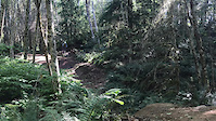
Trails
- By brenthillier
 NSMBA TRAILFORKS & contributors
 - Admins: NWTA
- #4779 - 12,367 views
- sandy activity log | embed map of Sandy mountain bike trails | sandy mountain biking points of interest
Downloading of trail gps tracks in kml & gpx formats is enabled for Sandy.
You must login to download files.