close
-
Layers w
- Weather Layers
- Pro
- Pro
- Pro
- Pro
- Pro
- Pro
- More Layers
- Pro
- Pro
- Pro
- Pro
-
Upgrade to

3D
Trail Conditions
- Unknown
- Snow Groomed
- Snow Packed
- Snow Covered
- Snow Cover Partial
- Freeze/thaw Cycle
- Icy
- Prevalent Mud
- Wet
- Variable
- Ideal
- Dry
- Very Dry
Trail Flow (Ridden Direction)
Trailforks scans users ridelogs to determine the most popular direction each trail is ridden. A good flowing trail network will have most trails flowing in a single direction according to their intension.
The colour categories are based on what percentage of riders are riding a trail in its intended direction.
The colour categories are based on what percentage of riders are riding a trail in its intended direction.
- > 96%
- > 90%
- > 80%
- > 70%
- > 50%
- < 50%
- bi-directional trail
- no data
Trail Last Ridden
Trailforks scans ridelogs to determine the last time a trail was ridden.
- < 2 days
- < 1 week
- < 2 weeks
- < 1 month
- < 6 months
- > 6 months
Trail Ridden Direction
The intended direction a trail should be ridden.
- Downhill Only
- Downhill Primary
- Both Directions
- Uphill Primary
- Uphill Only
- One Direction
Contribute Details
Colors indicate trail is missing specified detail.
- Description
- Photos
- Description & Photos
- Videos
Trail Popularity ?
Trailforks scans ridelogs to determine which trails are ridden the most in the last 9 months.
Trails are compared with nearby trails in the same city region with a possible 25 colour shades.
Think of this as a heatmap, more rides = more kinetic energy = warmer colors.
- most popular
- popular
- less popular
- not popular
ATV/ORV/OHV Filter
Max Vehicle Width
inches
US Cell Coverage
Legend

Radar Time
Activity Recordings
Trailforks uses anonymized public activity data.
?
Activity Recordings
Trailforks uses anonymized public activity data.
?
Personal Heatmap
▶
Activity Types
all
/
none
▶
Options
2
Date range
month
–
Winter Trails
Warning
A routing network for winter maps does not exist. Selecting trails using the winter trails layer has been disabled.
Missing Trails
Most Popular
Least Popular
Trails are colored based on popularity. The more popular a trail is, the more red. Less popular trails trend towards green.
Jump Magnitude Heatmap
Heatmap of where riders jump on trails. Zoom in to see individual jumps, click circles to view jump details.
BC Backroad Status
![map legend]()
Service Road Atlas is a free to use, community-driven service for viewing and creating reports on the numerous back-country service roads around B.C. and Alberta.

Slope Aspect
Direction the slope faces
Trails Deemphasized
Trails are shown in grey.
Only show trails with no bike usage.
Suggested Layers
Based on selected activity type
Save the current map location and zoom level as your default home location whenever this page is loaded.
Save
No description for Sanford has been added yet!
Login or register to submit one.
Activities Click to view
- Mountain Bike
31 trails
- E-Bike
19 trails
- Adaptive Bike
0 trails
- Winter Fat Bike
0 trails
- Hike
17 trails
- Trail Running
17 trails
Region Details
- 4
- 10
- 6
- 7
- 3
Region Status
Open as of May 1, 2025Stats
- Avg Trail Rating
- Trails (view details)
- 34
- Trails Mountain Bike
- 31
- Trails E-Bike
- 19
- Trails Hike
- 17
- Trails Trail Running
- 17
- Total Distance
- 15 miles
- Total Descent Distance
- 7 miles
- Total Descent
- 2,483 ft
- Total Vertical
- 146 ft
- Highest Trailhead
- 409 ft
- Reports
- 234
- Photos
- 50
- Ridden Counter
- 10,889
Sub Regions
-
San-Lee Park
- 11
- 6
- 7
- 3
Popular Sanford Mountain Biking Trails
• 95 ★ 5.0 • 679 ft • 21 ft • 549 •
Popular black diamond difficulty singletrack. This mountain bike primary trail can be used both directions. It features berm, drop, rock face and rock garden. Trail visibility is always easy to follow. On average it takes 1 minutes to complete this trail.
• 55 ★ 4.7 • 7 miles • 913 ft • 535 •
One of the best Mountain Bike Parks in the greater Triangle. There are miles of technical single track here, with rock gardens, and switch backs that make riding here fun and challenging at the same time. There are also some awesome...
• 90 ★ 5.0 • 1,955 ft • 7 ft • 523 •
Popular green difficulty singletrack. This mountain bike primary trail can be used downhill only. Trail visibility is always easy to follow. On average it takes 2 minutes to complete this trail.
• 100 ★ 5.0 • 1,749 ft • 0 ft • 518 •
is a moderate - first in flight type trail - all jumps are roll able and are easy to clear - provides good learning curve for introduction to JUMPS and flow
• 100 ★ 5.0 • 1,358 ft • 107 ft • 508 •
San Lee Gravity Park return trail - one direction - climb only
• 60 ★ 5.0 • 200 ft • 3 ft • 458 •
This is a bypass trail for to San Lee Gravity Park
• 50 ★ 5.0 • 522 ft • 0 ft • 452 •
Moderately popular green difficulty singletrack. This mountain bike primary trail can be used one direction and has a easy overall physical rating with a 0 ft green climb. It features jump. Trail visibility is always easy to follow. On average it takes minutes to complete this trail.
Sanford Mountain Bike Routes
• 14 miles • 1,623 ft • 34 •
• 15 miles • 1,659 ft • 48 •
• 13 miles • 1,323 ft • 33 •
• 11 miles • 1,527 ft • 24 •
• 7 miles • 855 ft • 25 •
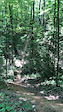
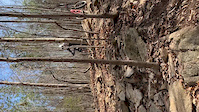
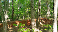
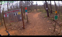
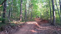
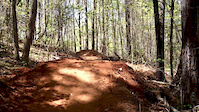
Photos of Sanford Mountain Bike
Videos of Sanford Mountain Bike
trail: San Lee Full Tour
0:12 |
363 |
Jul 8, 2019
trail: San Lee Full Tour
0:10 |
696 |
Mar 29, 2019

trail: San Lee Full Tour
0:45 |
187 |
Aug 16, 2018

trail: San Lee Full Tour
0:10 |
285 |
Aug 16, 2018
trail: San Lee Full Tour
0:07 |
354 |
Apr 26, 2016
trail: San Lee Full Tour
0:19 |
414 |
Mar 12, 2016
trail: San Lee Full Tour
0:16 |
123 |
May 4, 2015
trail: San Lee Full Tour
0:02 |
154 |
Apr 11, 2015
Recent Trail Reports
| status | trail | date | condition | info | user |
|---|---|---|---|---|---|
| Fist Full of Crystals | May 1, 2025 @ 3:17pm May 1, 2025 | Dry | spillcoleman | ||
| Mega-Low-Donn | May 1, 2025 @ 3:17pm May 1, 2025 | Dry | spillcoleman | ||
| Ouiji | May 1, 2025 @ 3:10pm May 1, 2025 | Dry | spillcoleman | ||
| Wizardry | May 1, 2025 @ 3:08pm May 1, 2025 | Dry | spillcoleman | ||
| San Lee Full Tour | Oct 25, 2024 @ 6:09pm Oct 25, 2024 | Dry | cgmorais | ||
| Upper MTB Parking | Oct 4, 2024 @ 7:31am Oct 4, 2024 | Ideal | WillieJacobsz Trailforks | ||
| Sling-Shot - Pump Track | Oct 4, 2024 @ 7:31am Oct 4, 2024 | Ideal | WillieJacobsz Trailforks | ||
| Sling-Shot - Jump Line | Oct 4, 2024 @ 7:31am Oct 4, 2024 | Ideal | WillieJacobsz Trailforks | ||
| San Lee Single Track Access from lower parking | Oct 4, 2024 @ 7:31am Oct 4, 2024 | Ideal | WillieJacobsz Trailforks | ||
| San Lee Gravity Park Access from lower parking | Oct 4, 2024 @ 7:31am Oct 4, 2024 | Ideal | WillieJacobsz Trailforks |
Activity Feed
| username | action | type | title | date |
|---|---|---|---|---|
| VGCpQh | wishlist | region | activity #96863363 | Jun 13, 2026 @ 4:49am Jun 13, 2026 |
| jbar107 | wishlist | trail | activity #96679324 and 1 more | Jun 10, 2026 @ 9:44am Jun 10, 2026 |
| VGCpQh | wishlist | region | activity #96611921 | Jun 9, 2026 @ 9:41am Jun 9, 2026 |
| CorbinPADUXT | wishlist | region | activity #96595697 | Jun 9, 2026 @ 4:17am Jun 9, 2026 |
| VGCpQh | wishlist | trail | activity #96518306 | Jun 7, 2026 @ 8:23pm Jun 7, 2026 |
Recent Comments
| username | type | title | comment | date |
|---|---|---|---|---|
| trail | Is probably the best trail within the... | Aug 9, 2025 @ 6:51am Aug 9, 2025 | ||
| report | Thank you | Jun 2, 2025 @ 4:55pm Jun 2, 2025 | ||
| trail | fun ups and downs, not for faint of heart | May 18, 2025 @ 4:30pm May 18, 2025 | ||
| trail | Great park. Is there anything else close to... | May 18, 2025 @ 4:28pm May 18, 2025 | ||
| trail | super techy and toughest part of loop if you... | May 18, 2025 @ 4:26pm May 18, 2025 |
Local Badges
-

Completionist5 awarded -

Epic Mountain Bike Climb 2k0 awarded -

Climbing 10k Badge13 awarded -

Mountain Biking 100k Badge0 awarded -

Epic Ride Descent 2k0 awarded -

Descent 10k Badge13 awarded
Bike & Skill Parks
| name | type | city | rating |
|---|---|---|---|
| San Lee Gravity Bike Park | skill park | Sanford |
Activity Type Stats
| activitytype | trails | distance | descent | descent distance | total vertical | rating | global rank | state rank | photos | reports | routes | ridelogs |
|---|---|---|---|---|---|---|---|---|---|---|---|---|
| Mountain Bike | 31 | 13 miles | 2,195 ft | 6 miles | 148 ft | #1,696 | #631 | 42 | 234 | 1 | 7,135 | |
| E-Bike | 19 | 12 miles | 1,906 ft | 5 miles | 144 ft | #5,380 | #1,671 | 173 | 1 | 220 | ||
| Hike | 17 | 5 miles | 709 ft | 2 miles | 144 ft | #11,321 | #4,044 | 9 | 216 | 59 | ||
| Trail Running | 17 | 5 miles | 709 ft | 2 miles | 144 ft | #11,745 | #4,093 | 216 | 22 |
Frequently Asked Questions About Sanford
▼
What are the best places to ride in Sanford?
Sanford has 1 areas to explore for mountain biking. The top rated areas are:
▼
What are the highest rated mountain biking trails in Sanford?
The highest rated mountain biking trails in Sanford are:
- San Lee Full Tour (4.4/5)
- Freefall (4.2/5)
- Ouiji (4.2/5)
- Rockness First Section to Creek (4.1/5)
- Otteban Gravity Park Reride (4.1/5)
▼
What is the best time of the year to ride in Sanford?
Based on ride log data, the most popular months to ride in Sanford are:
- October (47 activities)
- June (44 activities)
- March (42 activities)
▼
Where can I park to ride in Sanford?
There are 4 parking locations listed in Sanford. The most popular parking spots are: View all parking and trailhead locations on the map to plan your visit.
Activities
Trails
Points of Interest
- By brenthillier
 NSMBA TRAILFORKS & contributors
 - Admins: BTDC, FritzNeal
- #3775 - 4,633 views
- sanford activity log | embed map of Sanford mountain bike trails | sanford mountain biking points of interest
Downloading of trail gps tracks in kml & gpx formats is enabled for Sanford.
You must login to download files.