close
-
Layers w
- Weather Layers
- Pro
- Pro
- Pro
- Pro
- Pro
- Pro
- More Layers
- Pro
- Pro
- Pro
- Pro
-
Upgrade to

3D
Trail Conditions
- Unknown
- Snow Groomed
- Snow Packed
- Snow Covered
- Snow Cover Partial
- Freeze/thaw Cycle
- Icy
- Prevalent Mud
- Wet
- Variable
- Ideal
- Dry
- Very Dry
Trail Flow (Ridden Direction)
Trailforks scans users ridelogs to determine the most popular direction each trail is ridden. A good flowing trail network will have most trails flowing in a single direction according to their intension.
The colour categories are based on what percentage of riders are riding a trail in its intended direction.
The colour categories are based on what percentage of riders are riding a trail in its intended direction.
- > 96%
- > 90%
- > 80%
- > 70%
- > 50%
- < 50%
- bi-directional trail
- no data
Trail Last Ridden
Trailforks scans ridelogs to determine the last time a trail was ridden.
- < 2 days
- < 1 week
- < 2 weeks
- < 1 month
- < 6 months
- > 6 months
Trail Ridden Direction
The intended direction a trail should be ridden.
- Downhill Only
- Downhill Primary
- Both Directions
- Uphill Primary
- Uphill Only
- One Direction
Contribute Details
Colors indicate trail is missing specified detail.
- Description
- Photos
- Description & Photos
- Videos
Trail Popularity ?
Trailforks scans ridelogs to determine which trails are ridden the most in the last 9 months.
Trails are compared with nearby trails in the same city region with a possible 25 colour shades.
Think of this as a heatmap, more rides = more kinetic energy = warmer colors.
- most popular
- popular
- less popular
- not popular
ATV/ORV/OHV Filter
Max Vehicle Width
inches
US Cell Coverage
Legend

Radar Time
Activity Recordings
Trailforks uses anonymized public activity data.
?
Activity Recordings
Trailforks uses anonymized public activity data.
?
Personal Heatmap
▶
Activity Types
all
/
none
▶
Options
2
Date range
month
–
Winter Trails
Warning
A routing network for winter maps does not exist. Selecting trails using the winter trails layer has been disabled.
Missing Trails
Most Popular
Least Popular
Trails are colored based on popularity. The more popular a trail is, the more red. Less popular trails trend towards green.
Jump Magnitude Heatmap
Heatmap of where riders jump on trails. Zoom in to see individual jumps, click circles to view jump details.
BC Backroad Status
![map legend]()
Service Road Atlas is a free to use, community-driven service for viewing and creating reports on the numerous back-country service roads around B.C. and Alberta.

Slope Aspect
Direction the slope faces
Trails Deemphasized
Trails are shown in grey.
Only show trails with no bike usage.
Suggested Layers
Based on selected activity type
Save the current map location and zoom level as your default home location whenever this page is loaded.
SavePopular Trail Networks
view all areas »
No description for Santiago has been added yet!
Login or register to submit one.
Activities Click to view
- Mountain Bike
240 trails
- E-Bike
75 trails
- Gravel Bike
0 trails
- Adaptive Bike
0 trails
- Winter Fat Bike
0 trails
- Horse
5 trails
- Hike
220 trails
- Trail Running
255 trails
- Dirtbike/Moto
4 trails
Region Details
- 25
- 4
- 37
- 99
- 47
- 14
- 2
Region Status
Open as of May 30, 2026Stats
- Avg Trail Rating
- Trails (view details)
- 235
- Trails Mountain Bike
- 240
- Trails E-Bike
- 75
- Trails Horse
- 5
- Trails Hike
- 252
- Trails Trail Running
- 255
- Trails Dirtbike/Moto
- 4
- Total Distance
- 316 miles
- Total Descent
- 148,935 ft
- Total Vertical
- 10,480 ft
- Highest Trailhead
- 11,834 ft
- Reports
- 2,696
- Photos
- 828
- Ridden Counter
- 31,938
Sub Regions
-
Bike Parque Farellones
- 1
- 1
-
Bikepark RKF EL Durazno
- 8
- 19
- 7
- 1
-
Camino el Trebal
- 1
-
Cerro 26 Bike Park
- 3
- 1
-
Cerro Calán
-
Cerro el Roble
- 3
- 1
- 1
-
El Cardo
- 1
- 2
-
Farellones
- 3
- 1
-
La Parva Bikepark
- 1
- 1
- 1
-
Lagunillas
- 1
- 1
-
Las Varas
- 5
- 14
- 5
- 2
-
Manquehue
- 5
- 8
- 6
- 1
-
Panul La Florida
- 1
- 8
- 1
-
Parque Chamisero Outlife
- 4
- 2
- 2
-
Parque La Vacada
- 1
- 2
- 3
-
Parque Mahuida
- 1
- 1
-
Quebrada de la Plata
- 2
- 3
-
Quebrada de Macul
- 1
-
Renca Bike Park
- 1
- 3
-
San Cristobal
- 4
- 5
- 26
- 9
- 2
-
Santuario de la Naturaleza Yerba Loca
Popular Santiago Mountain Biking Trails
• 100 ★ 4.4 • 3,034 ft • 3 ft • 501 •
Highly rated popular blue difficulty dirt/gravel road. This mountain bike primary trail can be used downhill only and has a moderate overall physical rating. It features jump, gap jump and pump track. On average it takes 3 minutes to complete this trail.
• 100 ★ 0.0 • 1,678 ft • 59 ft • 456 •
Sendero principalmente de trekking. Permite pequeño atajo si se desea acceder al sector oriente del cerro.
• 95 ★ 4.9 • 2 miles • 49 ft • 443 •
Highly rated popular blue difficulty singletrack. This mountain bike primary trail can be used downhill only and has a moderate overall physical rating with a 49 ft green climb. It features berm and jump. On average it takes 7 minutes to complete this trail.
• 100 ★ 0.0 • 841 ft • 69 ft • 421 •
Popular green difficulty singletrack. This mountain bike primary trail can be used uphill primary and has a moderate overall physical rating with a 69 ft green climb. On average it takes 1 minutes to complete this trail.
• 100 ★ 3.0 • 2,394 ft • 61 ft • 394 •
Short trail, soft at the begining with a rockgarden at the end
• 95 ★ 3.0 • 2,035 ft • 5 ft • 387 •
Popular blue difficulty singletrack. This mountain bike primary trail can be used downhill primary. On average it takes 8 minutes to complete this trail.
• 90 ★ 4.6 • 1 mile • 98 ft • 383 •
Popular blue difficulty singletrack. This mountain bike primary trail can be used downhill primary. On average it takes 5 minutes to complete this trail.
• 95 ★ 4.3 • 2 miles • 17 ft • 382 •
fun trail, lot´s of rocks and drops, "anti-grip", very technical.
Santiago Mountain Bike Routes
★ 5.0 • 15 miles • 3,620 ft • 3 • Point to Point •
Excelente travesia que cruza los cordones montañosos desde curva 1 de farellones hasta el durazno.
9 miles • 1,941 ft • 6 • Loop •
Good crosscountry mt. bike route for those who want more technical riding and less berms and flow. Good...
11 miles • 2,515 ft • 3 •
Bonita ruta al sur de cerro Manquehue poco tecnico. En la bajada desde el portezuelo hay opcion entre la...
6 miles • 642 ft • 4 •
Bonita ruta al sur de cerro Manquehue poco tecnico. En la bajada desde el portezuelo hay opcion entre la...
2 miles • 147 ft • 3 •
circuito de la vuelta de partida copa lippi trek 2018
Photos of Santiago Mountain Bike
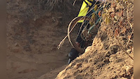
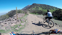
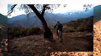
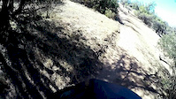
Videos of Santiago Mountain Bike
trail: Han Solo
0:17 |
6 |
Oct 28, 2025

trail: Tanketa Trail FREERIDE-DH
4:14 |
39 |
Nov 14, 2021

trail: Aguila
0:39 |
99 |
Aug 20, 2021

trail: Mordor
2:32 |
5952 |
Dec 23, 2020
trail: Aguila
0:42 |
151 |
Nov 19, 2020
trail: Pinkfloyd full
0:31 |
247 |
Sep 14, 2020
trail: Curva 16 a 1
2:45 |
109 |
Jul 23, 2020
trail: Lomo Vetado
0:26 |
49 |
Jul 17, 2020
Recent Trail Reports
| status | trail | date | condition | info | user |
|---|---|---|---|---|---|
| Parcero | May 30, 2026 @ 11:13am (America/Santiago) May 30, 2026 | Ideal | nicogalvez | ||
| Lomo Vetado | May 30, 2026 @ 11:13am (America/Santiago) May 30, 2026 | Ideal | nicogalvez | ||
| Antenazo | Mar 28, 2026 @ 1:22pm (America/Santiago) Mar 28, 2026 | Unknown | Hubert1TtrS | ||
| Mampato | Mar 7, 2026 @ 6:35am (America/Santiago) Mar 7, 2026 | Ideal | jotacruz | ||
| Lagunillas hacia San Jose | Jan 14, 2026 @ 1:09pm (America/Santiago) Jan 14, 2026 | Very Dry | FabioPersiani | ||
| Gaseoducto | Jan 8, 2026 @ 5:30pm (America/Santiago) Jan 8, 2026 | Very Dry | FabioPersiani | ||
| Vagabundo 2.0 | Jan 3, 2026 @ 10:39am (America/Santiago) Jan 3, 2026 | Dry | nicogalvez | ||
| Endurito (parte baja) | Jan 3, 2026 @ 10:39am (America/Santiago) Jan 3, 2026 | Dry | nicogalvez | ||
| Endurito | Jan 3, 2026 @ 10:39am (America/Santiago) Jan 3, 2026 | Dry | nicogalvez | ||
| Dennissita | Jan 3, 2026 @ 10:39am (America/Santiago) Jan 3, 2026 | Very Dry | nicogalvez |
Activity Feed
| username | action | type | title | date |
|---|---|---|---|---|
| nicogalvez | add | report | activity #96164917 and 1 more | Jun 3, 2026 @ 10:21am Jun 3, 2026 |
| JonathanQzX5hi | comment | trail | activity #94705448 and 1 more | May 14, 2026 @ 12:16pm May 14, 2026 |
| JonathanQzX5hi | vote | trail | activity #94652565 | May 13, 2026 @ 3:31pm May 13, 2026 |
| JonathanQzX5hi | comment | trail | activity #94651956 | May 13, 2026 @ 3:19pm May 13, 2026 |
| JonathanQzX5hi | checkin | trail | activity #94651803 | May 13, 2026 @ 3:16pm May 13, 2026 |
Recent Comments
| username | type | title | comment | date |
|---|---|---|---|---|
| trail | The sign says no bicycles are allowed on this... | May 14, 2026 @ 12:17pm May 14, 2026 | ||
| trail | The sign says no bicycles are allowed | May 14, 2026 @ 12:16pm May 14, 2026 | ||
| trail | The bottom third of this trail is overgrown... | May 13, 2026 @ 3:19pm May 13, 2026 | ||
| trail | Really nice trail. More of a blue than a... | Jan 25, 2026 @ 3:50pm Jan 25, 2026 | ||
| trail | It's a long climb! Longer and steeper than... | Jan 25, 2026 @ 3:48pm Jan 25, 2026 |
Local Badges
-

Completionist0 awarded -

Big Ride 30k10,804 awarded -

Epic Ride 50k3,419 awarded -

10 Expert Trails85 awarded -

Top 10 Trails11 awarded -
Completionist0 awarded
Bike & Skill Parks
| name | type | city | rating |
|---|---|---|---|
| Bikepark RKF EL Durazno | bike park | Santiago | |
| La Parva Bikepark | bike park | Santiago | |
| Bike Parque Farellones | bike park | Santiago |
Local Trail Supporters
- Outlife
Activity Type Stats
| activitytype | trails | distance | descent | descent distance | total vertical | rating | global rank | state rank | photos | reports | routes | ridelogs |
|---|---|---|---|---|---|---|---|---|---|---|---|---|
| Mountain Bike | 240 | 316 miles | 148,934 ft | 197 miles | 10,479 ft | #98 | #1 | 809 | 2,691 | 31 | 112,150 | |
| E-Bike | 75 | 81 miles | 34,892 ft | 53 miles | 5,213 ft | #142 | #2 | 2,444 | 15 | 16,150 | ||
| Horse | 5 | 11 miles | 7,090 ft | 8 miles | 7,461 ft | #291 | #2 | 531 | 1 | 1 | ||
| Hike | 220 | 209 miles | 95,548 ft | 125 miles | 10,479 ft | #103 | #4 | 15 | 2,556 | 4 | 3,254 | |
| Trail Running | 255 | 214 miles | 96,834 ft | 127 miles | 10,479 ft | #110 | #4 | 1 | 2,557 | 4 | 2,077 | |
| Dirtbike/Moto | 4 | 3 miles | 2,907 ft | 3 miles | 2,051 ft | #291 | #1 | 532 | 2 |
Frequently Asked Questions About Santiago
▼
What are the best places to ride in Santiago?
Santiago has 21 areas to explore for mountain biking. The top rated areas are:
▼
What are the highest rated mountain biking trails in Santiago?
The highest rated mountain biking trails in Santiago are:
- calibre 12 (4.6/5)
- 4 1/2 (4.5/5)
- Lomo Vetado (4.5/5)
- MTB La Cruz (4.4/5)
- Star Wars (4.4/5)
▼
What is the best time of the year to ride in Santiago?
Based on ride log data, the most popular months to ride in Santiago are:
- July (330 activities)
- October (178 activities)
- September (177 activities)
▼
Where can I park to ride in Santiago?
There are 17 parking locations listed in Santiago. The most popular parking spots are:
- Access to Bike Park El Durazno
- Parque Metropolitano de Santiago
- Jardin Japones de la Amistad
- Parking
- Parking Area
Activities
Trails
Points of Interest
- Mirador Aguila Mora Viewpoint
- Cerro Pochoco Summit
- Cerro Manquehuito Summit
- Punto de Información Ambiental Information
- Oficina de Informacion Information
- Mirador de la Roca Viewpoint
- Mirador Natural Atlas Cumbres Viewpoint
- [falls] Cascada San Juan Other
- Mirador Jmanaya Viewpoint
- Rinconanda de El Salto Viewpoint
- Cerro San Juan (20,128 ft)
- Cerro Marmolejo (20,079 ft)
- Cerro Negro (19,829 ft)
- By brenthillier
 NSMBA TRAILFORKS & contributors
 - Admins: MB
- #3524 - 23,394 views
- santiago activity log | embed map of Santiago mountain bike trails | santiago mountain biking points of interest
Downloading of trail gps tracks in kml & gpx formats is enabled for Santiago.
You must login to download files.