close
-
Layers w
- Weather Layers
- Pro
- Pro
- Pro
- Pro
- Pro
- Pro
- More Layers
- Pro
- Pro
- Pro
- Pro
-
Upgrade to

3D
Trail Conditions
- Unknown
- Snow Groomed
- Snow Packed
- Snow Covered
- Snow Cover Partial
- Freeze/thaw Cycle
- Icy
- Prevalent Mud
- Wet
- Variable
- Ideal
- Dry
- Very Dry
Trail Flow (Ridden Direction)
Trailforks scans users ridelogs to determine the most popular direction each trail is ridden. A good flowing trail network will have most trails flowing in a single direction according to their intension.
The colour categories are based on what percentage of riders are riding a trail in its intended direction.
The colour categories are based on what percentage of riders are riding a trail in its intended direction.
- > 96%
- > 90%
- > 80%
- > 70%
- > 50%
- < 50%
- bi-directional trail
- no data
Trail Last Ridden
Trailforks scans ridelogs to determine the last time a trail was ridden.
- < 2 days
- < 1 week
- < 2 weeks
- < 1 month
- < 6 months
- > 6 months
Trail Ridden Direction
The intended direction a trail should be ridden.
- Downhill Only
- Downhill Primary
- Both Directions
- Uphill Primary
- Uphill Only
- One Direction
Contribute Details
Colors indicate trail is missing specified detail.
- Description
- Photos
- Description & Photos
- Videos
Trail Popularity ?
Trailforks scans ridelogs to determine which trails are ridden the most in the last 9 months.
Trails are compared with nearby trails in the same city region with a possible 25 colour shades.
Think of this as a heatmap, more rides = more kinetic energy = warmer colors.
- most popular
- popular
- less popular
- not popular
ATV/ORV/OHV Filter
Max Vehicle Width
inches
US Cell Coverage
Legend

Radar Time
Activity Recordings
Trailforks uses anonymized public activity data.
?
Activity Recordings
Trailforks uses anonymized public activity data.
?
Personal Heatmap
▶
Activity Types
all
/
none
▶
Options
2
Date range
month
–
Winter Trails
Warning
A routing network for winter maps does not exist. Selecting trails using the winter trails layer has been disabled.
Missing Trails
Most Popular
Least Popular
Trails are colored based on popularity. The more popular a trail is, the more red. Less popular trails trend towards green.
Jump Magnitude Heatmap
Heatmap of where riders jump on trails. Zoom in to see individual jumps, click circles to view jump details.
BC Backroad Status
![map legend]()
Service Road Atlas is a free to use, community-driven service for viewing and creating reports on the numerous back-country service roads around B.C. and Alberta.

Slope Aspect
Direction the slope faces
Trails Deemphasized
Trails are shown in grey.
Only show trails with no bike usage.
Suggested Layers
Based on selected activity type
Save the current map location and zoom level as your default home location whenever this page is loaded.
Save
No description for Saratoga has been added yet!
Login or register to submit one.
Activities Click to view
- Mountain Bike
50 trails
- E-Bike
9 trails
- Gravel Bike
1 trails
- Adaptive Bike
0 trails
- Horse
12 trails
- Hike
73 trails
- Trail Running
74 trails
Region Details
- 9
- 14
- 19
Region Status
Open as of Jun 13, 2026Stats
- Avg Trail Rating
- Trails (view details)
- 57
- Trails Mountain Bike
- 50
- Trails E-Bike
- 9
- Trails Gravel Bike
- 1
- Trails Horse
- 12
- Trails Hike
- 74
- Trails Trail Running
- 74
- Total Distance
- 62 miles
- Total Descent
- 10,398 ft
- Total Vertical
- 2,669 ft
- Highest Trailhead
- 3,087 ft
- Reports
- 838
- Photos
- 339
- Ridden Counter
- 17,158
Sub Regions
-
Fremont Older Open Space Preserve
- 13
-
Sanborn County Park
- 6
-
Saratoga Gap Open Space Preserve
- 11
Popular Saratoga Mountain Biking Trails
• 100 ★ 4.6 • 3 miles • 1,067 ft • 1,439 •
From Black Road to the reservoir this is a dirt road, but from the reservoir up to this is one of the premiere maintained singletrack rides in the Bay Area. Purpose built by Santa Clara County as a bicycle connector trail - also used by...
• 90 ★ 0.0 • 1,174 ft • 38 ft • 964 •
Popular blue difficulty singletrack. This mountain bike primary trail. On average it takes 1 minutes to complete this trail.
• 85 ★ 3.5 • 2 miles • 250 ft • 928 •
Singletrack paralleling . Regraded in Nov 2016, completely eliminating all technical difficulty.
• 85 ★ 5.0 • 1,198 ft • 47 ft • 865 •
Singletrack with views. East end was sterilized by MidPen in summer 2016 to remove the fun.
• 75 ★ 3.4 • 1 mile • 232 ft • 740 •
Popular blue difficulty singletrack. This mountain bike primary trail. On average it takes 10 minutes to complete this trail.
• 95 ★ 4.0 • 1,752 ft • 0 ft • 667 •
A sketchy drop-in that leads to some fun singletrack and minor features. It can get freaky in spots, so ride with care!
• 70 ★ 3.8 • 2 miles • 331 ft • 630 •
Popular blue difficulty singletrack. This mountain bike primary trail can be used both directions and has a easy overall physical rating with a 331 ft green climb. Trail visibility is always easy to follow. On average it takes 17 minutes to complete this trail.
Saratoga Mountain Bike Routes
★ 4.5 • 15 miles • 2,879 ft • 13 • Loop •
A big climbing ride. Best features are the flowy parts of Bella Vista and White Oaks. The indian creek...
★ 3.7 • 10 miles • 1,782 ft • 31 • Loop •
Russian Ridge and Coal Creek Loop. About 10 miles of riding with a little bit of everything, including...
★ 2.0 • 5 miles • 1,109 ft • 4 •
Climb to Coyote Ridge, down Toyon and 7 Springs, back to Prospect Rd parking
★ 1.0 • 8 miles • 1,847 ft • 5 • Loop •
Start at the parking area on Skyline, down Grizzly Flat to Table Mountain and Charcoal and then back up...
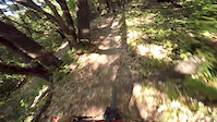
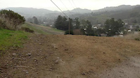
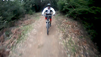
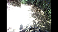
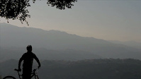
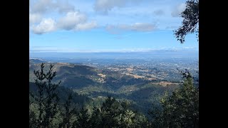
Photos of Saratoga Mountain Bike
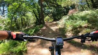
Videos of Saratoga Mountain Bike
trail: Table Mountain Fire Road
0:38 |
156 |
Jul 26, 2017
trail: Fireroad
0:07 |
99 |
Jan 31, 2016

trail: Saratoga Gap Trail
2:01 |
564 |
Jan 10, 2016
trail: John Nicholas
5:16 |
768 |
Feb 21, 2015
trail: Grizzly Flat
0:02 |
12 |
Jul 6, 2013
trail: Fireroad
2:06 |
621 |
Dec 18, 2011
trail: John Nicholas
7:53 |
247 |
Jan 7, 2025 , Saratoga
trail: John Nicholas
14:36 |
641 |
May 20, 2023 , Saratoga
Recent Trail Reports
| status | trail | date | condition | info | user |
|---|---|---|---|---|---|
| Regnart Trail | Jun 13, 2026 @ 12:44pm (America/Los_Angeles) Jun 13, 2026 | Very Dry | carenaw92 | ||
| John Nicholas | Jun 7, 2026 @ 2:29pm (America/Los_Angeles) Jun 7, 2026 | Ideal | apexarbitrage | ||
| Saratoga Gap Trail | Apr 17, 2026 @ 5:35pm (America/Los_Angeles) Apr 17, 2026 | Ideal | James2550 | ||
| Lake Ranch Singletrack | Apr 1, 2026 @ 5:47pm (America/Los_Angeles) Apr 1, 2026 | Ideal | aceccato | ||
| Nicholas Connector | Apr 1, 2026 @ 5:47pm (America/Los_Angeles) Apr 1, 2026 | Ideal | aceccato | ||
| John Nicholas Trail | Apr 1, 2026 @ 5:47pm (America/Los_Angeles) Apr 1, 2026 | Wet | aceccato | ||
| Cora Older Trail | Jan 17, 2026 @ 9:26am (America/Los_Angeles) Jan 17, 2026 | Ideal | RahulPaXu3F | ||
| Grizzly Flat | Jan 9, 2026 @ 10:19am (America/Los_Angeles) Jan 9, 2026 | Ideal | chowdog SCMTS Reporter | ||
| Hickory Oaks Trail | Nov 15, 2025 @ 10:53am (America/Los_Angeles) Nov 15, 2025 | Ideal | aceccato | ||
| Turtle Rock | Nov 15, 2025 @ 10:53am (America/Los_Angeles) Nov 15, 2025 | Ideal | aceccato |
Activity Feed
| username | action | type | title | date |
|---|---|---|---|---|
| mjmiao | wishlist | route | activity #97248479 | Jun 18, 2026 @ 6:45am 14 hours |
| lKox | ridden | trail | activity #97163012 | Jun 16, 2026 @ 10:15pm 2 days |
| carenaw92 | add | report | activity #96916856 | Jun 13, 2026 @ 2:29pm Jun 13, 2026 |
| carenaw92 | wishlist | trail | activity #96647670 | Jun 9, 2026 @ 7:10pm Jun 9, 2026 |
| Alpha8MwqOa | ridden | trail | activity #96647642 | Jun 9, 2026 @ 7:09pm Jun 9, 2026 |
Recent Comments
| username | type | title | comment | date |
|---|---|---|---|---|
| trail | If you ride an adaptive mountain bike, I... | Apr 4, 2026 @ 6:11pm Apr 4, 2026 | ||
| trail | Great trail to take downhill from Skyline.... | Jul 20, 2025 @ 3:18pm Jul 20, 2025 | ||
| trail | This trail is closed to bikes according to the... | Jul 18, 2025 @ 7:34am Jul 18, 2025 | ||
| trail | Trail is still in great condition. | May 7, 2025 @ 11:51pm May 7, 2025 | ||
| trail | Pretty good leg burner, lots of elevation in a... | May 7, 2025 @ 11:48pm May 7, 2025 |
Local Badges
-

10 Blue Trails463 awarded -

Epic Ride Climb 2k521 awarded -

Climbing 10k Badge211 awarded -

Climbing 100k Badge10 awarded -

Epic Ride Descent 2k534 awarded -

Descent 10k Badge218 awarded
Activity Type Stats
| activitytype | trails | distance | descent | descent distance | total vertical | rating | global rank | state rank | photos | reports | routes | ridelogs |
|---|---|---|---|---|---|---|---|---|---|---|---|---|
| Mountain Bike | 50 | 43 miles | 7,323 ft | 17 miles | 2,648 ft | #1,481 | #561 | 332 | 835 | 6 | 21,412 | |
| E-Bike | 9 | 3 miles | 220 ft | 4,862 ft | 1,453 ft | #6,014 | #1,840 | 3 | 663 | 1,732 | ||
| Gravel Bike | 1 | #631 | #1,155 | 9 | 52 | |||||||
| Horse | 12 | 8 miles | 1,201 ft | 3 miles | 2,369 ft | #2,360 | #1,304 | 125 | 1 | |||
| Hike | 73 | 62 miles | 10,397 ft | 24 miles | 2,671 ft | #3,220 | #1,132 | 4 | 838 | 2 | 1,426 | |
| Trail Running | 74 | 62 miles | 10,397 ft | 24 miles | 2,671 ft | #3,209 | #941 | 838 | 1 | 276 |
Frequently Asked Questions About Saratoga
▼
What are the best places to ride in Saratoga?
Saratoga has 4 areas to explore for mountain biking. The top rated areas are:
▼
What are the highest rated mountain biking trails in Saratoga?
The highest rated mountain biking trails in Saratoga are:
- John Nicholas (4.5/5)
- Table Mountain (4.2/5)
- Turtle Rock (4.1/5)
- Nob Hill (4.1/5)
- Hayfield Trail (4/5)
▼
What is the best time of the year to ride in Saratoga?
Based on ride log data, the most popular months to ride in Saratoga are:
- July (272 activities)
- August (159 activities)
- October (143 activities)
▼
Where can I park to ride in Saratoga?
There are 14 parking locations listed in Saratoga. The most popular parking spots are: View all parking and trailhead locations on the map to plan your visit.
Activities
Trails
- By yeash28 & contributors
- Admins: SVMTB
- #5335 - 6,627 views
- saratoga activity log | embed map of Saratoga mountain bike trails | saratoga mountain biking points of interest polygons
Downloading of trail gps tracks in kml & gpx formats is enabled for Saratoga.
You must login to download files.