close
-
Layers w
- Weather Layers
- Pro
- Pro
- Pro
- Pro
- Pro
- Pro
- More Layers
- Pro
- Pro
- Pro
- Pro
-
Upgrade to

3D
Trail Conditions
- Unknown
- Snow Groomed
- Snow Packed
- Snow Covered
- Snow Cover Partial
- Freeze/thaw Cycle
- Icy
- Prevalent Mud
- Wet
- Variable
- Ideal
- Dry
- Very Dry
Trail Flow (Ridden Direction)
Trailforks scans users ridelogs to determine the most popular direction each trail is ridden. A good flowing trail network will have most trails flowing in a single direction according to their intension.
The colour categories are based on what percentage of riders are riding a trail in its intended direction.
The colour categories are based on what percentage of riders are riding a trail in its intended direction.
- > 96%
- > 90%
- > 80%
- > 70%
- > 50%
- < 50%
- bi-directional trail
- no data
Trail Last Ridden
Trailforks scans ridelogs to determine the last time a trail was ridden.
- < 2 days
- < 1 week
- < 2 weeks
- < 1 month
- < 6 months
- > 6 months
Trail Ridden Direction
The intended direction a trail should be ridden.
- Downhill Only
- Downhill Primary
- Both Directions
- Uphill Primary
- Uphill Only
- One Direction
Contribute Details
Colors indicate trail is missing specified detail.
- Description
- Photos
- Description & Photos
- Videos
Trail Popularity ?
Trailforks scans ridelogs to determine which trails are ridden the most in the last 9 months.
Trails are compared with nearby trails in the same city region with a possible 25 colour shades.
Think of this as a heatmap, more rides = more kinetic energy = warmer colors.
- most popular
- popular
- less popular
- not popular
ATV/ORV/OHV Filter
Max Vehicle Width
inches
US Cell Coverage
Legend

Radar Time
Activity Recordings
Trailforks uses anonymized public activity data.
?
Activity Recordings
Trailforks uses anonymized public activity data.
?
Personal Heatmap
▶
Activity Types
all
/
none
▶
Options
2
Date range
month
–
Winter Trails
Warning
A routing network for winter maps does not exist. Selecting trails using the winter trails layer has been disabled.
Missing Trails
Most Popular
Least Popular
Trails are colored based on popularity. The more popular a trail is, the more red. Less popular trails trend towards green.
Jump Magnitude Heatmap
Heatmap of where riders jump on trails. Zoom in to see individual jumps, click circles to view jump details.
BC Backroad Status
![map legend]()
Service Road Atlas is a free to use, community-driven service for viewing and creating reports on the numerous back-country service roads around B.C. and Alberta.

Slope Aspect
Direction the slope faces
Trails Deemphasized
Trails are shown in grey.
Only show trails with no bike usage.
Suggested Layers
Based on selected activity type
Save the current map location and zoom level as your default home location whenever this page is loaded.
Save
No description for Sarrancolin has been added yet!
Login or register to submit one.
This region uses the Uk/Euro style trail grading system.
Activities Click to view
- Mountain Bike
40 trails
- E-Bike
24 trails
- Gravel Bike
1 trails
- Adaptive Bike
0 trails
- Hike
30 trails
- Trail Running
30 trails
Region Details
- 5
- 1
- 8
- 9
- 3
Region Status
Open as of May 1, 2026Stats
- Avg Trail Rating
- Trails (view details)
- 29
- Trails Mountain Bike
- 40
- Trails E-Bike
- 24
- Trails Gravel Bike
- 1
- Trails Hike
- 30
- Trails Trail Running
- 30
- Total Distance
- 30 miles
- Total Descent
- 14,002 ft
- Total Vertical
- 5,310 ft
- Highest Trailhead
- 5,692 ft
- Reports
- 87
- Photos
- 14
- Ridden Counter
- 616
Sub Regions
-
vtt Aure
- 1
- 4
- 5
- 2
Popular Sarrancolin Mountain Biking Trails
• 100 ★ 4.8 • 2,388 ft • 0 ft • 48 •
Popular red difficulty singletrack. This mountain bike primary trail can be used downhill only. On average it takes 3 minutes to complete this trail.
• 80 ★ 4.4 • 4,432 ft • 0 ft • 34 • • hike
Highly rated popular red difficulty singletrack. This hike primary trail. On average it takes 4 minutes to complete this trail.
• 60 ★ 4.0 • 3 miles • 42 ft • 31 • • hike
Moderately popular blue difficulty singletrack. This hike primary trail. On average it takes 14 minutes to complete this trail.
• 75 ★ 5.0 • 2 miles • 5 ft • 28 •
Popular black difficulty singletrack. This mountain bike primary trail can be used downhill only.
• 60 ★ 4.8 • 1 mile • 2 ft • 26 •
Moderately popular blue difficulty singletrack. This multi-use trail can be used downhill primary and has a moderate overall physical rating. Trail visibility is always easy to follow. On average it takes 27 minutes to complete this trail.
• 30 ★ 4.0 • 4,203 ft • 0 ft • 19 • • hike
Less popular blue difficulty singletrack. This hike primary trail. On average it takes 6 minutes to complete this trail.
• 55 ★ 1.0 • 4,452 ft • 0 ft • 15 • • hike
Moderately popular blue difficulty singletrack. This hike primary trail. On average it takes 4 minutes to complete this trail.
• 45 ★ 3.0 • 1,991 ft • 0 ft • 14 • • hike
Moderately popular red difficulty singletrack. This hike primary trail. Trail visibility is always easy to follow. On average it takes 2 minutes to complete this trail.
Photos of Sarrancolin Mountain Bike
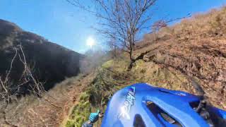
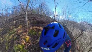
Videos of Sarrancolin Mountain Bike
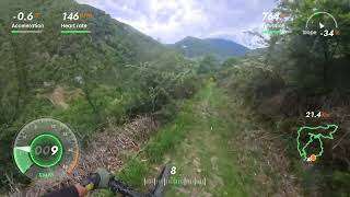
trail: Les Tourteres
0:45 |
11 |
May 4, 2026 , Sarrancolin
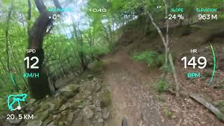
trail: Le Relais
4:01 |
13 |
May 4, 2026 , Sarrancolin

trail: Daveline
16:38 |
94 |
Jul 24, 2025 , Sarrancolin
trail: Les Tourteres
0:40 |
61 |
Feb 25, 2025 , Sarrancolin
trail: Le Coq
5:00 |
91 |
Feb 25, 2025 , Sarrancolin
trail: Zona véro Haute
3:01 |
33 |
Feb 25, 2025 , Sarrancolin
Recent Trail Reports
| status | trail | date | condition | info | user |
|---|---|---|---|---|---|
| Cacamous | May 1, 2026 @ 10:49pm (Europe/Paris) May 1, 2026 | Wet | sergiwaikiki | ||
| Daveline | May 1, 2026 @ 10:33pm (Europe/Paris) May 1, 2026 | Ideal | sergiwaikiki | ||
| Jumet | May 1, 2026 @ 4:31pm (Europe/Paris) May 1, 2026 | Variable | sergiwaikiki | ||
| Hard and Ghost | Sep 27, 2025 @ 3:45pm (Europe/Paris) Sep 27, 2025 | Dry | AJ31 | ||
| Burgatoire | Sep 27, 2025 @ 3:39pm (Europe/Paris) Sep 27, 2025 | Dry | AJ31 | ||
| Sonères Downhill | Sep 19, 2025 @ 10:41am (Europe/Andorra) Sep 19, 2025 | Very Dry | Roussimof | ||
| Montée Relais | Sep 19, 2025 @ 10:41am (Europe/Andorra) Sep 19, 2025 | Dry | Roussimof | ||
| Le Coq | Apr 30, 2025 @ 11:29am Apr 30, 2025 | Dry | Roussimof | ||
| Liaison Col De Sonères Les Carriéres | Dec 1, 2024 @ 12:43pm Dec 1, 2024 | Unknown | NicoWatteau | ||
| Le Relais | Sep 1, 2024 @ 1:49pm Sep 1, 2024 | Wet | Dan3958 |
Activity Feed
| username | action | type | title | date |
|---|---|---|---|---|
| provencemb | add | trail | activity #96005961 | Jun 1, 2026 @ 3:05am Jun 1, 2026 |
| freerider48 | update | trail | activity #96000242 and 2 more | May 31, 2026 @ 10:52pm May 31, 2026 |
| Stebrex | comment | trail | activity #95582581 | May 26, 2026 @ 12:18pm May 26, 2026 |
| Stebrex | ridden | trail | activity #95582421 | May 26, 2026 @ 12:15pm May 26, 2026 |
| WillieJacobsz | update | region | activity #94212253 | May 7, 2026 @ 6:08am May 7, 2026 |
Recent Comments
| username | type | title | comment | date |
|---|---|---|---|---|
| trail | In the beginning it’s not easy to follow as... | May 26, 2026 @ 12:18pm May 26, 2026 | ||
| trail | Au sommet, on peut se décourager, mais la... | May 1, 2026 @ 1:46pm May 1, 2026 | ||
| report | Top! | Sep 27, 2025 @ 6:47am Sep 27, 2025 | ||
| report | A la suite de la descente Burgatoire. En... | Sep 27, 2025 @ 6:44am Sep 27, 2025 | ||
| trail | Superbe itinéraire avec quelques passages... | Dec 1, 2024 @ 12:52pm Dec 1, 2024 |
Local Badges
-

Epic Mountain Bike Climb 2k42 awarded -

Climbing 10k Badge3 awarded -

Mountain Biking 100k Badge0 awarded -

Epic Ride Descent 2k42 awarded -

Descent 10k Badge3 awarded -

Descent 100k Badge0 awarded
Activity Type Stats
| activitytype | trails | distance | descent | descent distance | total vertical | rating | global rank | state rank | photos | reports | routes | ridelogs |
|---|---|---|---|---|---|---|---|---|---|---|---|---|
| Mountain Bike | 40 | 30 miles | 14,003 ft | 16 miles | 5,312 ft | #4,781 | #166 | 12 | 87 | 356 | ||
| E-Bike | 24 | 15 miles | 4,869 ft | 7 miles | 5,312 ft | #4,553 | #276 | 2 | 71 | 94 | ||
| Gravel Bike | 1 | #307 | #66 | 1 | ||||||||
| Hike | 30 | 23 miles | 10,945 ft | 12 miles | 5,312 ft | #5,965 | #203 | 74 | 32 | |||
| Trail Running | 30 | 23 miles | 10,945 ft | 12 miles | 5,312 ft | #5,780 | #211 | 74 | 8 |
Frequently Asked Questions About Sarrancolin
▼
What are the best places to ride in Sarrancolin?
Sarrancolin has 1 areas to explore for mountain biking. The top rated areas are:
▼
What are the highest rated mountain biking trails in Sarrancolin?
The highest rated mountain biking trails in Sarrancolin are:
- Jumet (4.4/5)
- Le Coq (4.3/5)
- Daveline (4.2/5)
- Burgatoire (4.2/5)
- Sonères Downhill (4/5)
▼
What is the best time of the year to ride in Sarrancolin?
Based on ride log data, the most popular months to ride in Sarrancolin are:
- August (4 activities)
- September (3 activities)
- October (1 activities)
▼
Where can I park to ride in Sarrancolin?
Check the Sarrancolin trail map for trailhead and parking information. Community members regularly update access and parking details for trails in the area.
Activities
Trails
Points of Interest
- By Fred65410 & contributors
- Admins: MTB65, JackyStyleTom, lcoadik
- #22150 - 1,477 views
- sarrancolin activity log | embed map of Sarrancolin mountain bike trails |
Downloading of trail gps tracks in kml & gpx formats is enabled for Sarrancolin.
You must login to download files.