close
-
Layers w
- Weather Layers
- Pro
- Pro
- Pro
- Pro
- Pro
- Pro
- More Layers
- Pro
- Pro
- Pro
- Pro
-
Upgrade to

3D
Trail Conditions
- Unknown
- Snow Groomed
- Snow Packed
- Snow Covered
- Snow Cover Partial
- Freeze/thaw Cycle
- Icy
- Prevalent Mud
- Wet
- Variable
- Ideal
- Dry
- Very Dry
Trail Flow (Ridden Direction)
Trailforks scans users ridelogs to determine the most popular direction each trail is ridden. A good flowing trail network will have most trails flowing in a single direction according to their intension.
The colour categories are based on what percentage of riders are riding a trail in its intended direction.
The colour categories are based on what percentage of riders are riding a trail in its intended direction.
- > 96%
- > 90%
- > 80%
- > 70%
- > 50%
- < 50%
- bi-directional trail
- no data
Trail Last Ridden
Trailforks scans ridelogs to determine the last time a trail was ridden.
- < 2 days
- < 1 week
- < 2 weeks
- < 1 month
- < 6 months
- > 6 months
Trail Ridden Direction
The intended direction a trail should be ridden.
- Downhill Only
- Downhill Primary
- Both Directions
- Uphill Primary
- Uphill Only
- One Direction
Contribute Details
Colors indicate trail is missing specified detail.
- Description
- Photos
- Description & Photos
- Videos
Trail Popularity ?
Trailforks scans ridelogs to determine which trails are ridden the most in the last 9 months.
Trails are compared with nearby trails in the same city region with a possible 25 colour shades.
Think of this as a heatmap, more rides = more kinetic energy = warmer colors.
- most popular
- popular
- less popular
- not popular
ATV/ORV/OHV Filter
Max Vehicle Width
inches
US Cell Coverage
Legend

Radar Time
Activity Recordings
Trailforks uses anonymized public activity data.
?
Activity Recordings
Trailforks uses anonymized public activity data.
?
Personal Heatmap
▶
Activity Types
all
/
none
▶
Options
2
Date range
month
–
Winter Trails
Warning
A routing network for winter maps does not exist. Selecting trails using the winter trails layer has been disabled.
Missing Trails
Most Popular
Least Popular
Trails are colored based on popularity. The more popular a trail is, the more red. Less popular trails trend towards green.
Jump Magnitude Heatmap
Heatmap of where riders jump on trails. Zoom in to see individual jumps, click circles to view jump details.
BC Backroad Status
![map legend]()
Service Road Atlas is a free to use, community-driven service for viewing and creating reports on the numerous back-country service roads around B.C. and Alberta.

Slope Aspect
Direction the slope faces
Trails Deemphasized
Trails are shown in grey.
Only show trails with no bike usage.
Suggested Layers
Based on selected activity type
Save the current map location and zoom level as your default home location whenever this page is loaded.
SavePopular Trail Networks
view all areas »
No description for Saskatchewan has been added yet!
Login or register to submit one.
Region Details
- 59
- 110
- 265
- 240
- 54
- 6
Stats
- Avg Trail Rating
- Trails (view details)
- 917
- Trails Mountain Bike
- 734
- Trails E-Bike
- 354
- Trails Gravel Bike
- 3
- Trails Winter Fat Bike
- 1
- Trails Horse
- 108
- Trails Hike
- 791
- Trails Trail Running
- 763
- Trails Dirtbike/Moto
- 20
- Trails Observed Trials
- 13
- Trails ATV/ORV/OHV
- 23
- Trails Snowmobile
- 13
- Trails Snowshoe
- 337
- Trails Downhill Ski
- 40
- Trails Backcountry Ski
- 105
- Trails Nordic Ski
- 236
- Total Distance
- 804 miles
- Total Descent
- 49,541 ft
- Total Vertical
- 3,500 ft
- Highest Trailhead
- 4,481 ft
- Reports
- 7,104
- Photos
- 1,234
- Ridden Counter
- 52,110
Articles
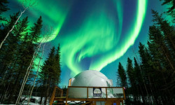
Where to Find the Darkest Skies in North America for Aurora Hunting and Stargazing
Aug 1, 2024 from outsideonline.com
You’ll be counting stars and catching the Northern Lights at these one-of-a-kind dark-sky retreats
Sub Regions
- Battlefords Provincial Park (0)
- Grasslands National Park (17)
- Lakeland (16)
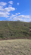
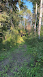
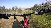
Popular Saskatchewan Mountain Biking Trails
• 100 ★ 4.5 • 2,313 ft • 172 ft • 409 •
Super mellow flow trail great for beginners but it's still fun for advanced riders. The trail has several rollers and bermed corners. The rollers can use as booters if you aren't ripping too fast. Getting air on them while going fast...
• 100 ★ 4.0 • 2,005 ft • 16 ft • 284 •
A nice easy trail, with a good view of the weir from the north end.
• 100 ★ 4.2 • 2,070 ft • 0 ft • 382 •
This is an amazing run to continually repeat and challenge yourself on. is a tight, twisty trail with several challenges. While mainly a downhill trail travel is in both directions and the trail is a challenging technical climb, but...
• 100 ★ 0.0 • 4,843 ft • 24 ft • 227 •
Meewasin Trail from University Bridge to Railway Bridge (west side)
• 95 ★ 4.7 • 1,660 ft • 160 ft • 335 •
Highly rated popular blue difficulty singletrack. This mountain bike primary trail can be used uphill primary and has a hard overall physical rating with a 160 ft black diamond climb. Trail visibility is always easy to follow. On average it takes 4 minutes to complete this trail.
Saskatchewan Mountain Bike Routes
Green Pole Loop Featured
★ 5.0 • 1 mile • 101 ft • 1 •
Follow the green poles for some winter fatbiking and snowshoeing. These trails are groomed regularly.
Red Pole Loop Featured
★ 5.0 • 1 mile • 143 ft • 3 •
Follow the red poles. This route is groomed in the winter for fatbiking.
Maverick/Boat Launch Winter Loop Featured
★ 5.0 • 3 miles • 346 ft • 3 • Out & Back •
Super fun winter route that is groomed and connects Maple Vale to the the trailhead.
★ 5.0 • 12 miles • 294 ft • 5 • Out & Back •
In 1936, a few hundred people trekked through the Prince Albert wilderness to meet conservationist...
★ 4.0 • 4 miles • 382 ft • 6 • Loop •
This is Stage 15 - Tour du Buffalo Pound
3 miles • 338 ft • 8 •
This is the longest of the routes, with the course stretching all the way to the of Escalator and down.
Photos of Saskatchewan Mountain Bike
Videos of Saskatchewan Mountain Bike
featured
![Turkey Vulture is open!]()
trail: Turkey Vulture
0:23 |
264 |
Sep 17, 2021
0:30 |
3 |
Aug 25, 2025
trail: Upside Down
0:44 |
56 |
Aug 22, 2024
trail: Chasing Cows
2:27 |
60 |
Oct 10, 2022
trail: Mus Knuckle
0:36 |
146 |
Jul 5, 2022
trail: Grip-It 'n Rip-It
0:14 |
62 |
Jul 4, 2022

trail: Turkey Vulture
0:35 |
246 |
May 19, 2022
trail: Turkey Vulture
0:12 |
185 |
Apr 6, 2022
Activity Feed
| username | action | type | title | date |
|---|---|---|---|---|
| jamesfehr | add | trail | activity #97529332 | Jun 21, 2026 @ 4:20pm 2 hours |
| kondilemma | comment | report | activity #97453653 and 2 more | Jun 20, 2026 @ 8:52pm 22 hours |
| ta-da | add | report | activity #97436465 and 1 more | Jun 20, 2026 @ 3:10pm 1 day |
| kondilemma | add | report | activity #97434691 | Jun 20, 2026 @ 2:44pm 1 day |
| emwescott | wishlist | trail | activity #97401970 and 1 more | Jun 20, 2026 @ 9:03am 1 day |
Recent Comments
| username | type | title | comment | date |
|---|---|---|---|---|
| report | Leaner tree removed. All clear | Jun 20, 2026 @ 8:54pm 22 hours | ||
| report | Tree has been moved. All clear. Early season... | Jun 20, 2026 @ 8:53pm 22 hours | ||
| report | Trail cleared of downed tree. All clear | Jun 20, 2026 @ 8:52pm 22 hours | ||
| skillpark | Super sketchy to ride, not great for bikes,... | May 14, 2026 @ 9:59am May 14, 2026 | ||
| trail | Entrance furthest away from parkinglot under water | May 10, 2026 @ 5:43pm May 10, 2026 |
Local Badges
-

Saskatoon Trail Alliance April 202127 awarded -

Saskatoon Trail Alliance November 20218 awarded -

Saskatoon Trail Alliance January 202129 awarded -

Ride the Tech62 awarded -

Descent 100k Badge0 awarded -
Descent 100k Badge0 awarded
Bike & Skill Parks
| name | type | city | rating |
|---|---|---|---|
| Kensington Pump Track | skill park | Saskatoon | |
| Moose Jaw Police Association Bike Skills Park | skill park | Moose Jaw | |
| Estevan Skatepark | skill park | Estevan | |
| La Ronge Skills Park | skill park | La Ronge | |
| RRT Dirt Jumps | skill park | Langham |
Activity Type Stats
| activitytype | trails | distance | descent | descent distance | total vertical | rating | global rank | state rank | photos | reports | routes | ridelogs |
|---|---|---|---|---|---|---|---|---|---|---|---|---|
| Mountain Bike | 734 | 680 miles | 33,209 ft | 215 miles | 3,435 ft | #51 | 1,072 | 6,812 | 119 | 84,628 | ||
| E-Bike | 354 | 245 miles | 12,943 ft | 78 miles | 1,952 ft | #48 | 5 | 4,536 | 37 | 2,329 | ||
| Gravel Bike | 3 | #47 | 27 | 2 | 929 | |||||||
| Winter Fat Bike | 1 | #47 | 21 | 152 | 3 | 51 | ||||||
| Horse | 108 | 94 miles | 3,248 ft | 29 miles | 2,966 ft | #52 | 1,158 | 4 | ||||
| Hike | 791 | 740 miles | 40,955 ft | 236 miles | 3,501 ft | #53 | 70 | 6,605 | 16 | 3,471 | ||
| Trail Running | 763 | 726 miles | 39,859 ft | 231 miles | 3,435 ft | #52 | 12 | 6,586 | 28 | 8,211 | ||
| Dirtbike/Moto | 20 | 26 miles | 732 ft | 8 miles | 1,490 ft | #49 | 1,159 | 57 | ||||
| Observed Trials | 13 | 11 miles | 354 ft | 3 miles | 387 ft | #44 | 41 | 2 | ||||
| ATV/ORV/OHV | 23 | 40 miles | 1,014 ft | 14 miles | 1,490 ft | #44 | 1,157 | 79 | ||||
| Snowmobile | 13 | 40 miles | 1,033 ft | 13 miles | 1,490 ft | #29 | 208 | 103 | ||||
| Snowshoe | 337 | 308 miles | 10,814 ft | 92 miles | 1,785 ft | #30 | 1,082 | 9 | 724 | |||
| Downhill Ski | 40 | 11 miles | 6,165 ft | 10 miles | 945 ft | #40 | 170 | 178 | ||||
| Backcountry Ski | 105 | 33 miles | 968 ft | 8 miles | 938 ft | #36 | 185 | 142 | ||||
| Nordic Ski | 236 | 210 miles | 6,703 ft | 57 miles | 3,179 ft | #31 | 44 | 995 | 14 | 3,313 |
Activities
- Saskatchewan Mountain Biking Trails
- Saskatchewan E-Biking Trails
- Saskatchewan Horseback Trails
- Saskatchewan Hiking Trails
- Saskatchewan Trail Running Trails
- Saskatchewan Dirtbiking Trails
- Saskatchewan Observed Trials Trails
- Saskatchewan ATVing/Offroading Trails
- Saskatchewan Snowmobiling Trails
- Saskatchewan Snowshoeing Trails
- Saskatchewan Skiing Trails
- Saskatchewan Backcountry Skiing Trails
- Saskatchewan Nordic Skiing Trails
Trails
Points of Interest
- Mount Blackstrap Summit
- Road Gap TTF
- MnM Roller TTF
- South Campground Recreation Hall - Battlefords Provincial Park Lodge
- Drop Zone Bike Skills Other
- Bike & Ski Skills Area Other
- Bike & Ski Skills Area Other
- Haylee's Look Off Viewpoint
- Rock garden TTF
- Rock garden TTF
- Bald Butte (4,131 ft)
- Cypress Hills (3,848 ft)
- Cypress Hills (3,750 ft)
- By canadaka
 Trailforks & contributors
 - Admins: IMBA Canada, brenthillier, adaptivemike, maddy03, SaskParks, Bould170, tgullacher, Shishking
- #3168 - 43,525 views
- saskatchewan activity log | embed map of Saskatchewan mountain bike trails | saskatchewan mountain biking points of interest
Downloading of trail gps tracks in kml & gpx formats is enabled for Saskatchewan.
You must login to download files.