close
-
Layers w
- Weather Layers
- Pro
- Pro
- Pro
- Pro
- Pro
- Pro
- More Layers
- Pro
- Pro
- Pro
- Pro
-
Upgrade to

3D
Trail Conditions
- Unknown
- Snow Groomed
- Snow Packed
- Snow Covered
- Snow Cover Partial
- Freeze/thaw Cycle
- Icy
- Prevalent Mud
- Wet
- Variable
- Ideal
- Dry
- Very Dry
Trail Flow (Ridden Direction)
Trailforks scans users ridelogs to determine the most popular direction each trail is ridden. A good flowing trail network will have most trails flowing in a single direction according to their intension.
The colour categories are based on what percentage of riders are riding a trail in its intended direction.
The colour categories are based on what percentage of riders are riding a trail in its intended direction.
- > 96%
- > 90%
- > 80%
- > 70%
- > 50%
- < 50%
- bi-directional trail
- no data
Trail Last Ridden
Trailforks scans ridelogs to determine the last time a trail was ridden.
- < 2 days
- < 1 week
- < 2 weeks
- < 1 month
- < 6 months
- > 6 months
Trail Ridden Direction
The intended direction a trail should be ridden.
- Downhill Only
- Downhill Primary
- Both Directions
- Uphill Primary
- Uphill Only
- One Direction
Contribute Details
Colors indicate trail is missing specified detail.
- Description
- Photos
- Description & Photos
- Videos
Trail Popularity ?
Trailforks scans ridelogs to determine which trails are ridden the most in the last 9 months.
Trails are compared with nearby trails in the same city region with a possible 25 colour shades.
Think of this as a heatmap, more rides = more kinetic energy = warmer colors.
- most popular
- popular
- less popular
- not popular
ATV/ORV/OHV Filter
Max Vehicle Width
inches
US Cell Coverage
Legend

Radar Time
Activity Recordings
Trailforks uses anonymized public activity data.
?
Activity Recordings
Trailforks uses anonymized public activity data.
?
Personal Heatmap
▶
Activity Types
all
/
none
▶
Options
2
Date range
month
–
Winter Trails
Warning
A routing network for winter maps does not exist. Selecting trails using the winter trails layer has been disabled.
Missing Trails
Most Popular
Least Popular
Trails are colored based on popularity. The more popular a trail is, the more red. Less popular trails trend towards green.
Jump Magnitude Heatmap
Heatmap of where riders jump on trails. Zoom in to see individual jumps, click circles to view jump details.
BC Backroad Status
![map legend]()
Service Road Atlas is a free to use, community-driven service for viewing and creating reports on the numerous back-country service roads around B.C. and Alberta.

Slope Aspect
Direction the slope faces
Trails Deemphasized
Trails are shown in grey.
Only show trails with no bike usage.
Suggested Layers
Based on selected activity type
Save the current map location and zoom level as your default home location whenever this page is loaded.
Save
No description for Sassuolo has been added yet!
Login or register to submit one.
This region uses the Uk/Euro style trail grading system.
Activities Click to view
- Mountain Bike
38 trails
- E-Bike
36 trails
- Gravel Bike
0 trails
- Adaptive Bike
0 trails
- Winter Fat Bike
0 trails
- Hike
31 trails
- Trail Running
31 trails
Region Details
- 6
- 11
- 15
Region Status
Caution as of Jun 17, 2026Stats
- Avg Trail Rating
- Trails (view details)
- 38
- Trails Mountain Bike
- 38
- Trails E-Bike
- 36
- Trails Horse
- 4
- Trails Hike
- 31
- Trails Trail Running
- 31
- Total Distance
- 19 miles
- Total Descent
- 9,470 ft
- Total Vertical
- 2,063 ft
- Highest Trailhead
- 2,535 ft
- Reports
- 467
- Photos
- 36
- Ridden Counter
- 2,142
Sub Regions
-
Montegibbio
- 4
- 8
-
Porn Valley
- 5
Popular Sassuolo Mountain Biking Trails
• 100 ★ 4.5 • 1,470 ft • 10 ft • 84 •
Popular green difficulty singletrack. This mountain bike primary trail can be used both directions and has a easy overall physical rating with a 10 ft blue climb. Adaptive MTB rating: amtb green. Trail visibility is always easy to follow. On average it takes 2 minutes to complete this trail.
• 55 ★ 4.4 • 3 miles • 234 ft • 71 •
Moderately popular green difficulty mixed. This mountain bike primary trail can be used both directions and has a moderate overall physical rating with a 234 ft blue climb. On average it takes 15 minutes to complete this trail.
• 60 ★ 3.8 • 1,371 ft • 23 ft • 63 •
Trail sottobosco divertente ...tendenzialmente abbastanza tecnico
• 90 ★ 5.0 • 607 ft • 0 ft • 58 •
Popular blue difficulty singletrack. This mountain bike primary trail can be used downhill primary and has a easy overall physical rating with a 0 ft black diamond climb. Trail visibility is always easy to follow. On average it takes 2 minutes to complete this trail.
• 70 ★ 4.5 • 833 ft • 0 ft • 57 •
Popular blue difficulty singletrack. This mountain bike primary trail can be used downhill primary and has a moderate overall physical rating with a 0 ft black diamond climb. Trail visibility is always easy to follow. On average it takes 1 minutes to complete this trail.
• 80 ★ 4.0 • 971 ft • 0 ft • 50 •
Popular red difficulty singletrack. This mountain bike primary trail can be used downhill only. It features drop, jump and wallride. On average it takes 1 minutes to complete this trail.
Sassuolo Mountain Bike Routes
★ 4.0 • 6 miles • 1,355 ft • 0 • Loop •
giro interessante e di media/alta difficoltà nei single track della Porn Valley in zona Montegibbio,...
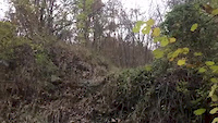
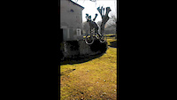
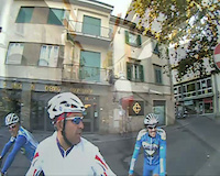
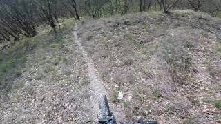
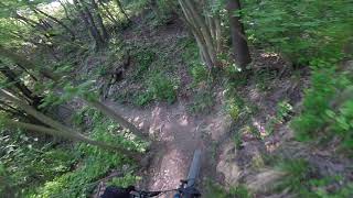
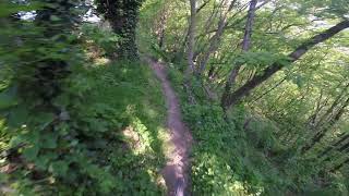
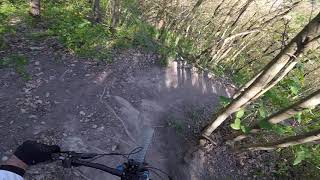
Photos of Sassuolo Mountain Bike
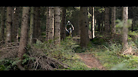
Videos of Sassuolo Mountain Bike
trail: Clito
0:15 |
647 |
Nov 16, 2016
trail: Easy Ride
0:32 |
140 |
Dec 14, 2013
trail: Golden
0:46 |
1098 |
Oct 12, 2012
trail: Castello
35:55 |
227 |
Oct 6, 2011
trail: Golden Low
0:10 |
737 |
Jun 1, 2021 , Sassuolo
trail: Squirtle
0:58 |
1096 |
Jun 1, 2021 , Sassuolo
trail: Golden
2:07 |
1271 |
Jun 1, 2021 , Sassuolo
trail: Squirtle
4:43 |
1365 |
Jun 1, 2021 , Sassuolo
Recent Trail Reports
| status | trail | date | condition | info | user |
|---|---|---|---|---|---|
| La Ghinella | Jun 17, 2026 @ 7:20pm (Europe/Rome) Jun 17, 2026 | Dry | EnricoGenerali | ||
| Bagole | Jun 17, 2026 @ 7:20pm (Europe/Rome) Jun 17, 2026 | Dry | EnricoGenerali | ||
| Collegamento Capriola | Jun 17, 2026 @ 7:20pm (Europe/Rome) Jun 17, 2026 | Dry | EnricoGenerali | ||
| Boschetto 1 | Jun 17, 2026 @ 7:20pm (Europe/Rome) Jun 17, 2026 | Dry | EnricoGenerali | ||
| Piffero | Jun 17, 2026 @ 7:20pm (Europe/Rome) Jun 17, 2026 | Dry | EnricoGenerali | ||
| Dildo | May 2, 2026 @ 3:01pm (Europe/Rome) May 2, 2026 | Dry | Bex72 | ||
| Refisting | Apr 27, 2026 @ 7:10pm (Europe/Rome) Apr 27, 2026 | Very Dry | KerloKerlo | ||
| Linea del Pollo | Mar 10, 2026 @ 7:16pm (Europe/Rome) Mar 10, 2026 | Variable | pibi73 | ||
| Pollo | Mar 10, 2026 @ 7:13pm (Europe/Rome) Mar 10, 2026 | Variable | pibi73 | ||
| Panoramica | Dec 1, 2025 @ 6:45pm (Europe/Rome) Dec 1, 2025 | Prevalent Mud | Bex72 |
Activity Feed
| username | action | type | title | date |
|---|---|---|---|---|
| EnricoGenerali | add | report | activity #97323618 and 4 more | Jun 19, 2026 @ 9:23am Jun 19, 2026 |
| Bex72 | add | report | activity #93851644 | May 2, 2026 @ 6:04am May 2, 2026 |
| KerloKerlo | add | report | activity #93525444 | Apr 27, 2026 @ 10:11am Apr 27, 2026 |
| GabGad | add | trail | activity #92772417 | Apr 17, 2026 @ 12:21am Apr 17, 2026 |
| RD84 | ridden | trail | activity #90711665 | Mar 16, 2026 @ 3:26pm Mar 16, 2026 |
Recent Comments
| username | type | title | comment | date |
|---|---|---|---|---|
| trail | Solchi e linee sporche... | Mar 10, 2026 @ 11:12am Mar 10, 2026 | ||
| trail | Tutto ok .. a parte le foglie... | Mar 10, 2026 @ 11:06am Mar 10, 2026 | ||
| trail | Totalmente distrutto nella parte finale con... | Mar 10, 2026 @ 11:01am Mar 10, 2026 | ||
| trail | Un po' invaso da erbacce il primo tratto,... | May 25, 2025 @ 12:20pm May 25, 2025 | ||
| report | Erba alta ieri. | Aug 2, 2023 @ 6:58am Aug 2, 2023 |
Local Badges
-

Epic Ride Climb 2k98 awarded -

Climbing 10k Badge58 awarded -

Climbing 100k Badge6 awarded -

Epic Ride Descent 2k96 awarded -

Descent 10k Badge58 awarded -

Descent 100k Badge6 awarded
Activity Type Stats
| activitytype | trails | distance | descent | descent distance | total vertical | rating | global rank | state rank | photos | reports | routes | ridelogs |
|---|---|---|---|---|---|---|---|---|---|---|---|---|
| Mountain Bike | 38 | 19 miles | 9,472 ft | 13 miles | 2,064 ft | #3,470 | #189 | 36 | 467 | 1 | 7,627 | |
| E-Bike | 36 | 17 miles | 8,704 ft | 12 miles | 922 ft | #4,109 | #386 | 463 | 849 | |||
| Horse | 4 | 2 miles | 1,037 ft | 2 miles | 778 ft | 51 | ||||||
| Hike | 31 | 17 miles | 8,215 ft | 12 miles | 2,064 ft | #7,234 | #401 | 442 | 395 | |||
| Trail Running | 31 | 17 miles | 8,215 ft | 12 miles | 2,064 ft | #6,547 | #367 | 442 | 314 |
Frequently Asked Questions About Sassuolo
▼
What are the best places to ride in Sassuolo?
Sassuolo has 2 areas to explore for mountain biking. The top rated areas are:
▼
What are the highest rated mountain biking trails in Sassuolo?
The highest rated mountain biking trails in Sassuolo are:
- Piffero (4.3/5)
- Refisting (4.3/5)
- Squirtle (4.2/5)
- Pollo (4.2/5)
- Collegamento Capriola (4.2/5)
▼
What is the best time of the year to ride in Sassuolo?
Based on ride log data, the most popular months to ride in Sassuolo are:
- April (20 activities)
- March (19 activities)
- May (15 activities)
▼
Where can I park to ride in Sassuolo?
There are 2 parking locations listed in Sassuolo. The most popular parking spots are:
- By Lucaballa
 & contributors
 - Admins: apply
- #16847 - 3,624 views
- sassuolo activity log | embed map of Sassuolo mountain bike trails | sassuolo mountain biking points of interest
Downloading of trail gps tracks in kml & gpx formats is enabled for Sassuolo.
You must login to download files.