close
-
Layers w
- Weather Layers
- Pro
- Pro
- Pro
- Pro
- Pro
- Pro
- More Layers
- Pro
- Pro
- Pro
- Pro
-
Upgrade to

3D
Trail Conditions
- Unknown
- Snow Groomed
- Snow Packed
- Snow Covered
- Snow Cover Partial
- Freeze/thaw Cycle
- Icy
- Prevalent Mud
- Wet
- Variable
- Ideal
- Dry
- Very Dry
Trail Flow (Ridden Direction)
Trailforks scans users ridelogs to determine the most popular direction each trail is ridden. A good flowing trail network will have most trails flowing in a single direction according to their intension.
The colour categories are based on what percentage of riders are riding a trail in its intended direction.
The colour categories are based on what percentage of riders are riding a trail in its intended direction.
- > 96%
- > 90%
- > 80%
- > 70%
- > 50%
- < 50%
- bi-directional trail
- no data
Trail Last Ridden
Trailforks scans ridelogs to determine the last time a trail was ridden.
- < 2 days
- < 1 week
- < 2 weeks
- < 1 month
- < 6 months
- > 6 months
Trail Ridden Direction
The intended direction a trail should be ridden.
- Downhill Only
- Downhill Primary
- Both Directions
- Uphill Primary
- Uphill Only
- One Direction
Contribute Details
Colors indicate trail is missing specified detail.
- Description
- Photos
- Description & Photos
- Videos
Trail Popularity ?
Trailforks scans ridelogs to determine which trails are ridden the most in the last 9 months.
Trails are compared with nearby trails in the same city region with a possible 25 colour shades.
Think of this as a heatmap, more rides = more kinetic energy = warmer colors.
- most popular
- popular
- less popular
- not popular
ATV/ORV/OHV Filter
Max Vehicle Width
inches
US Cell Coverage
Legend

Radar Time
Activity Recordings
Trailforks uses anonymized public activity data.
?
Activity Recordings
Trailforks uses anonymized public activity data.
?
Personal Heatmap
▶
Activity Types
all
/
none
▶
Options
2
Date range
month
–
Winter Trails
Warning
A routing network for winter maps does not exist. Selecting trails using the winter trails layer has been disabled.
Missing Trails
Most Popular
Least Popular
Trails are colored based on popularity. The more popular a trail is, the more red. Less popular trails trend towards green.
Jump Magnitude Heatmap
Heatmap of where riders jump on trails. Zoom in to see individual jumps, click circles to view jump details.
BC Backroad Status
![map legend]()
Service Road Atlas is a free to use, community-driven service for viewing and creating reports on the numerous back-country service roads around B.C. and Alberta.

Slope Aspect
Direction the slope faces
Trails Deemphasized
Trails are shown in grey.
Only show trails with no bike usage.
Suggested Layers
Based on selected activity type
Save the current map location and zoom level as your default home location whenever this page is loaded.
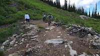
SaveThe Little Sandcreek Basin multi use recreation trail system has been developed with cooperation between the landowners; Schweitzer and the City of Sandpoint, the local bike club Pend Oreille Pedalers and the Selkirk Recreation District.
Up to dozen trail sections make up the system and they make for a great day outing for all levels and abilities of mountain bikers, hikers and runners.
Courtesy and etiquette remark: Downhill mountain bikers, 1. Go slow when approaching hikers, runners and other mountain bikers 2. Give right-of-way to those travelling uphill 3. Communicate to other riders and pedestrians how many are in your riding group.
Primary Trail Type: Cross-Country
Shuttleable: YES
AKA: Schweitzer Mountain
Land Status: Private Property
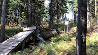
 google parking directions
 Activities Click to view
- Mountain Bike
56 trails
- E-Bike
39 trails
- Hike
37 trails
- Trail Running
34 trails
- Snowshoe
2 trails
- Downhill Ski
107 trails
- Nordic Ski
13 trails
Region Details
- 2
- 38
- 13
- 2
Region Status
Caution as of 22 hours- Day Ticket
- $50 USD
- Uplift Type
- Chair Lift
- Season start
- Jun 14
- Season end
- Sep 2
Stats
- Avg Trail Rating
- Trails (view details)
- 187
- Trails Mountain Bike
- 56
- Trails E-Bike
- 39
- Trails Gravel Bike
- 3
- Trails Hike
- 37
- Trails Trail Running
- 34
- Trails ATV/ORV/OHV
- 3
- Trails Snowshoe
- 2
- Trails Downhill Ski
- 107
- Trails Nordic Ski
- 13
- Total Distance
- 122 miles
- Total Descent
- 66,795 ft
- Total Vertical
- 3,580 ft
- Highest Trailhead
- 6,392 ft
- Reports
- 530
- Photos
- 115
- Ridden Counter
- 25,793
Popular Schweitzer Mountain Biking Trails
• 95 ★ 4.4 • 4,711 ft • 22 ft • 491 •
Perhaps the favorite trail of the Selkirk Recreation District. Endless loopy, bermed switchbacks. Climbs extremely well with only a few "chin on your stem sections".
• 70 ★ 3.5 • 4 miles • 13 ft • 406 •
is Schweitzer Mountains main blue top to bottom trail within their lift served trail system. is accessed from the top portion of trail and is 4 miles long. This trail is somewhat rocky at the top and works it's way down to better dirt...
• 80 ★ 4.5 • 2 miles • 0 ft • 377 •
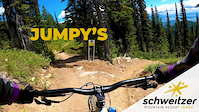
Pinch Flat is one of Schweitzer Mountain Resort's main trails off the summit with in their lift access trail system. is a technical trail but has plenty of flow as well. This trail can take you to Redemption, Moffit's Edge and as well...
• 100 ★ 3.4 • 3 miles • 0 ft • 374 •
Popular blue difficulty singletrack. This mountain bike primary trail can be used downhill only. It features berm. On average it takes 13 minutes to complete this trail.
• 90 ★ 4.7 • 5,223 ft • 13 ft • 366 •
Descending: After a steep drop in from the main road trail bobs, weaves and ws parallel to the main road. Climbing: Makes for a semi strenuous climb except the hike a bike section up to the main road. Great section for beginner riders....
• 30 ★ 3.9 • 3 miles • 128 ft • 366 •
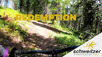
This route is the coup de grace of the Little Sand Creek Basin and Schweitzer Mountain Resort series of trails. This awesome alpine single track trail will reward you with beautiful views and huckleberries (mid July thru August). In...
• 100 ★ 0.0 • 2,799 ft • 0 ft • 319 •
Popular blue difficulty alpine singletrack. This mountain bike primary trail can be used downhill only. Trail visibility is always easy to follow. On average it takes 2 minutes to complete this trail.
Photos of Schweitzer Mountain Bike
Videos of Schweitzer Mountain Bike
trail: Shenanigans
0:15 |
|
Jul 16, 2023
trail: Upper Redemption
0:09 |
|
Sep 6, 2020
trail: Lower Redemption
4:23 |
875 |
Aug 10, 2020
trail: Jumpy's
0:58 |
150 |
Aug 10, 2020
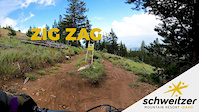
trail: Zig Zag
2:31 |
175 |
Aug 7, 2020
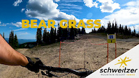
trail: Bear Grass
15:46 |
193 |
Jul 27, 2020
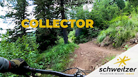
trail: Collector
2:13 |
82 |
Jul 23, 2020
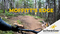
trail: Moffit's Edge
4:25 |
235 |
Jul 23, 2020
Current Trail Warnings
| status | trail | date | condition | user | info |
|---|---|---|---|---|---|
| Gnarnia | May 24, 2026 @ 10:30am (America/Los_Angeles) May 24, 2026 | Unknown | Ccgoehle | Too many downed trees. Trail not cleared yet. |
Recent Trail Reports
| status | trail | date | condition | info | user |
|---|---|---|---|---|---|
| Sidewinder | May 7, 2026 @ 11:27am (America/Creston) May 7, 2026 | Variable | eich3773 | ||
| Upper Basin Connector | May 3, 2026 @ 10:06am (America/Los_Angeles) May 3, 2026 | Dry | 7bBruce | ||
| View Ski Loop | Nov 16, 2025 @ 11:49am (America/Los_Angeles) Nov 16, 2025 | Ideal | 7bBruce | ||
| Upper Missing Lynx lower slab ridearound | Aug 30, 2025 @ 11:44am Aug 30, 2025 | Ideal | robbayuk | ||
| Upper Basin | Aug 30, 2025 @ 11:44am Aug 30, 2025 | Ideal | robbayuk | ||
| Corkscrew - Blizzard Rd Connector | Aug 18, 2025 @ 1:59pm Aug 18, 2025 | Variable | itsKmac | ||
| Sparky | Aug 18, 2025 @ 1:54pm Aug 18, 2025 | Variable | itsKmac | ||
| Sparky - Upper Basin Connector | Aug 15, 2025 @ 6:08am Aug 15, 2025 | Dry | arniewolff | ||
| Solar Ecstasy | Aug 15, 2025 @ 6:08am Aug 15, 2025 | Dry | arniewolff | ||
| Uleda Ridge | Aug 15, 2025 @ 6:08am Aug 15, 2025 | Dry | arniewolff |
Activity Feed
| username | action | type | title | date |
|---|---|---|---|---|
| Tssfo31 | add | report | activity #97420398 | Jun 20, 2026 @ 12:02pm 22 hours |
| Jarwins | ridden | trail | activity #96120558 and 1 more | Jun 2, 2026 @ 5:04pm Jun 2, 2026 |
| Ccgoehle | comment | trail | activity #95438885 | May 24, 2026 @ 1:01pm May 24, 2026 |
| Ccgoehle | add | report | activity #95424431 | May 24, 2026 @ 10:30am May 24, 2026 |
| Ccgoehle | vote | trail | activity #95424321 and 1 more | May 24, 2026 @ 10:29am May 24, 2026 |
Recent Comments
| username | type | title | comment | date |
|---|---|---|---|---|
| trail | This is a double track road (not trail) | May 24, 2026 @ 1:01pm May 24, 2026 | ||
| trail | Fun loamy trail that you can really get some... | Aug 23, 2025 @ 5:48pm Aug 23, 2025 | ||
| trail | Fantastic trail, flow, berms, bridges, jumps | Oct 9, 2024 @ 8:26pm Oct 9, 2024 | ||
| trail | Had a great time riding bear grass. if its... | Jul 23, 2024 @ 8:19am Jul 23, 2024 | ||
| trail | This is a great section of trail. Thanks for... | Jul 20, 2024 @ 10:00pm Jul 20, 2024 |
Nearby Areas
| name | distance | ||||
|---|---|---|---|---|---|
| Lower Basin Trails | 10 | 8 | 2 | 2.7 km | |
| Syringa Trail System | 2 | 10 | 6.9 km | ||
| Gold Hill | 2 | 15 | 3 | 10.2 km | |
| Panhandle Bike Ranch | 1 | 5 | 4 | 2 | 15.5 km |
| Mineral Point | 3 | 6 | 16.8 km |
Local Badges
-

Completionist0 awarded
Local Trail Supporters
- Selkirk Recreation District
![]()
- Schweitzer Mountain Resort
Activity Type Stats
| activitytype | trails | distance | descent | descent distance | total vertical | rating | global rank | state rank | photos | reports | routes | ridelogs |
|---|---|---|---|---|---|---|---|---|---|---|---|---|
| Mountain Bike | 56 | 53 miles | 15,223 ft | 33 miles | 2,730 ft | #1,723 | #585 | 115 | 516 | 5,445 | ||
| E-Bike | 39 | 38 miles | 10,338 ft | 22 miles | 2,198 ft | #2,926 | #911 | 299 | 293 | |||
| Gravel Bike | 3 | 6 miles | 505 ft | 2 miles | 820 ft | #1,233 | #662 | 15 | 2 | |||
| Hike | 37 | 33 miles | 4,610 ft | 13 miles | 2,205 ft | #4,912 | #1,780 | 323 | 2 | 430 | ||
| Trail Running | 34 | 30 miles | 4,472 ft | 12 miles | 2,198 ft | #4,851 | #1,428 | 313 | 175 | |||
| ATV/ORV/OHV | 3 | 3 miles | 62 ft | 1,043 ft | 3,281 ft | 23 | 3 | |||||
| Snowshoe | 2 | 1,362 ft | 20 ft | 525 ft | 66 ft | #604 | #248 | 2 | 57 | |||
| Downhill Ski | 107 | 49 miles | 50,187 ft | 45 miles | 2,398 ft | #80 | #42 | 2 | 3,930 | |||
| Nordic Ski | 13 | 12 miles | 814 ft | 4 miles | 902 ft | #504 | #152 | 2 | 194 |
Frequently Asked Questions About Schweitzer
▼
What are the highest rated mountain biking trails in Schweitzer?
The highest rated mountain biking trails in Schweitzer are:
- Shenanigans (4.3/5)
- Huckleberry Hill (4.2/5)
- Upper Basin (4.2/5)
- Solar Ecstasy (4.2/5)
- Pinch Flat (4.2/5)
▼
What is the best time of the year to ride in Schweitzer?
Based on ride log data, the most popular months to ride in Schweitzer are:
- July (230 activities)
- August (206 activities)
- September (102 activities)
▼
Where can I park to ride in Schweitzer?
There are 3 parking locations listed in Schweitzer. The most popular parking spots are: View all parking and trailhead locations on the map to plan your visit.
▼
What is the longest trail in Schweitzer?
The longest trail in Schweitzer is Overland at 4.3 miles. View all trails sorted by distance.
Activities
Trails
- By SelkirkPowder & contributors
- Admins: SBBP, Agbircher, MConger, POP
- #19214 - 19,595 views
- schweitzer activity log | embed map of Schweitzer mountain bike trails | schweitzer mountain biking points of interest
Downloading of trail gps tracks in kml & gpx formats is enabled for Schweitzer.
You must login to download files.