close
-
Layers w
- Weather Layers
- Pro
- Pro
- Pro
- Pro
- Pro
- Pro
- More Layers
- Pro
- Pro
- Pro
- Pro
-
Upgrade to

3D
Trail Conditions
- Unknown
- Snow Groomed
- Snow Packed
- Snow Covered
- Snow Cover Partial
- Freeze/thaw Cycle
- Icy
- Prevalent Mud
- Wet
- Variable
- Ideal
- Dry
- Very Dry
Trail Flow (Ridden Direction)
Trailforks scans users ridelogs to determine the most popular direction each trail is ridden. A good flowing trail network will have most trails flowing in a single direction according to their intension.
The colour categories are based on what percentage of riders are riding a trail in its intended direction.
The colour categories are based on what percentage of riders are riding a trail in its intended direction.
- > 96%
- > 90%
- > 80%
- > 70%
- > 50%
- < 50%
- bi-directional trail
- no data
Trail Last Ridden
Trailforks scans ridelogs to determine the last time a trail was ridden.
- < 2 days
- < 1 week
- < 2 weeks
- < 1 month
- < 6 months
- > 6 months
Trail Ridden Direction
The intended direction a trail should be ridden.
- Downhill Only
- Downhill Primary
- Both Directions
- Uphill Primary
- Uphill Only
- One Direction
Contribute Details
Colors indicate trail is missing specified detail.
- Description
- Photos
- Description & Photos
- Videos
Trail Popularity ?
Trailforks scans ridelogs to determine which trails are ridden the most in the last 9 months.
Trails are compared with nearby trails in the same city region with a possible 25 colour shades.
Think of this as a heatmap, more rides = more kinetic energy = warmer colors.
- most popular
- popular
- less popular
- not popular
ATV/ORV/OHV Filter
Max Vehicle Width
inches
US Cell Coverage
Legend

Radar Time
Activity Recordings
Trailforks uses anonymized public activity data.
?
Activity Recordings
Trailforks uses anonymized public activity data.
?
Personal Heatmap
▶
Activity Types
all
/
none
▶
Options
2
Date range
month
–
Winter Trails
Warning
A routing network for winter maps does not exist. Selecting trails using the winter trails layer has been disabled.
Missing Trails
Most Popular
Least Popular
Trails are colored based on popularity. The more popular a trail is, the more red. Less popular trails trend towards green.
Jump Magnitude Heatmap
Heatmap of where riders jump on trails. Zoom in to see individual jumps, click circles to view jump details.
BC Backroad Status
![map legend]()
Service Road Atlas is a free to use, community-driven service for viewing and creating reports on the numerous back-country service roads around B.C. and Alberta.

Slope Aspect
Direction the slope faces
Trails Deemphasized
Trails are shown in grey.
Only show trails with no bike usage.
Suggested Layers
Based on selected activity type
Save the current map location and zoom level as your default home location whenever this page is loaded.
Save
No description for Scott County has been added yet!
Login or register to submit one.
Activities Click to view
- Mountain Bike
41 trails
- E-Bike
9 trails
- Hike
40 trails
- Trail Running
40 trails
Stats
- Avg Trail Rating
- Trails (view details)
- 41
- Trails Mountain Bike
- 41
- Trails E-Bike
- 9
- Trails Gravel Bike
- 8
- Trails Adaptive Bike
- 5
- Trails Winter Fat Bike
- 6
- Trails Hike
- 40
- Trails Trail Running
- 40
- Total Distance
- 49 miles
- Total Descent
- 2,182 ft
- Total Vertical
- 233 ft
- Highest Trailhead
- 784 ft
- Reports
- 511
- Photos
- 176
- Ridden Counter
- 5,235
Sub Regions
- Bettendorf (3)
- Davenport (25)
- Credit Island Park (3)
- Sunderbruch Park (18)
- Eldridge (2)
- Park View (13)
- Scott County Park (13)
Popular Scott County Mountain Biking Trails
• 75 ★ 5.0 • 1,093 ft • 0 ft • 219 •
Popular blue difficulty singletrack. This multi-use trail can be used downhill only and has a easy overall physical rating with a 0 ft green climb. It features drop. On average it takes 1 minutes to complete this trail.
• 85 ★ 3.5 • 866 ft • 61 ft • 215 •
Popular blue difficulty singletrack. This multi-use trail can be used uphill only and has a moderate overall physical rating with a 61 ft blue climb. It features ladder bridge. On average it takes 1 minutes to complete this trail.
• 70 ★ 3.7 • 1,184 ft • 22 ft • 210 •
Popular double black diamond difficulty singletrack. This multi-use trail can be used downhill only. It features berm, drop, jump and gap jump. On average it takes 2 minutes to complete this trail.
• 70 ★ 0.0 • 1,450 ft • 28 ft • 198 •
Popular green difficulty singletrack. This multi-use trail can be used downhill primary. On average it takes 1 minutes to complete this trail.
• 80 ★ 4.0 • 4,094 ft • 65 ft • 198 •
Popular blue difficulty singletrack. This multi-use trail can be used both directions. On average it takes 4 minutes to complete this trail.
• 100 ★ 3.0 • 974 ft • 28 ft • 198 •
Popular black diamond difficulty singletrack. This multi-use trail can be used downhill only and has a moderate overall physical rating with a 28 ft blue climb. It features drop, log ride and skinny. On average it takes minutes to complete this trail.
• 65 ★ 3.7 • 2,398 ft • 48 ft • 194 •
Moderately popular blue difficulty singletrack. This multi-use trail can be used downhill only and has a moderate overall physical rating with a 48 ft blue climb. It features berm and bridge. On average it takes 4 minutes to complete this trail.
Scott County Mountain Bike Routes
5 miles • 479 ft • 13 •
My route cause I'm not big on the long black trail with the insane climb out
3 miles • 174 ft • 3 •
This starts in the parking lot and combines the 2 beginner trails to create larger beginner loop.
3 miles • 315 ft • 10 • Loop • Race •
2026 FORC-Side Thrill Ride Beginner Lap
6 miles • 557 ft • 15 • Loop • Race •
FORC-Side Thrill Ride Short & Long Course Loop
Photos of Scott County Mountain Bike
Videos of Scott County Mountain Bike

trail: Jump Line
0:52 |
571 |
Dec 14, 2014
trail: Palos
0:22 |
153 |
Dec 2, 2013
trail: Rock Cut
10:41 |
230 |
Aug 19, 2013
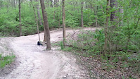
trail: ScoCoPa
11:04 |
26 |
Nov 18, 2025 , Park View
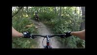
trail: Park View
19:33 |
31 |
Nov 18, 2025 , Park View
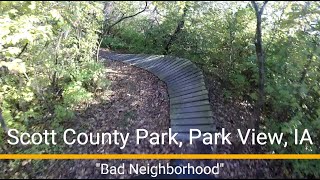
trail: Bad Neighborhood
2:01 |
34 |
Nov 17, 2025 , Park View
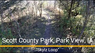
trail: Skylz Loop
5:05 |
39 |
Nov 17, 2025 , Park View
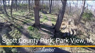
trail: Jumbo
5:11 |
35 |
Nov 17, 2025 , Park View
Recent Trail Reports
Activity Feed
| username | action | type | title | date |
|---|---|---|---|---|
| ChrisBan21 | update | trail | activity #97697993 | Jun 24, 2026 @ 8:00am 14 hours |
| ChrisBan21 | update | trail | activity #97686303 and 1 more | Jun 24, 2026 @ 4:01am 18 hours |
| ChrisBan21 | update | trail | activity #97614104 and 3 more | Jun 23, 2026 @ 2:49am 2 days |
| ChrisBan21 | update | trail | activity #97612561 and 1 more | Jun 23, 2026 @ 1:40am 2 days |
| ChrisBan21 | update | trail | activity #97485431 | Jun 21, 2026 @ 8:03am Jun 21, 2026 |
Recent Comments
| username | type | title | comment | date |
|---|---|---|---|---|
| report | Ignore meant LT | Nov 8, 2024 @ 2:33pm Nov 8, 2024 | ||
| report | Tree just cleared | Nov 8, 2024 @ 2:20pm Nov 8, 2024 | ||
| trail | This trail can be ridden both directions. The... | Aug 13, 2024 @ 5:39pm Aug 13, 2024 | ||
| report | Partially cleared. Caution after dirt berm... | Jun 8, 2024 @ 5:25am Jun 8, 2024 | ||
| report | Broke board on small ladder bridge | Mar 31, 2024 @ 1:39pm Mar 31, 2024 |
Local Badges
-

Descent 100k Badge0 awarded -

Climbing 10k Badge6 awarded -

Mountain Biking 100k Badge0 awarded -

Epic Ride Descent 2k0 awarded -

Descent 10k Badge6 awarded -

Epic Ride 50k207 awarded
Activity Type Stats
| activitytype | trails | distance | descent | descent distance | total vertical | rating | global rank | state rank | photos | reports | routes | ridelogs |
|---|---|---|---|---|---|---|---|---|---|---|---|---|
| Mountain Bike | 41 | 49 miles | 2,182 ft | 11 miles | 233 ft | 169 | 511 | 6 | 7,160 | |||
| E-Bike | 9 | 25 miles | 492 ft | 4 miles | 223 ft | 441 | 1 | 285 | ||||
| Gravel Bike | 8 | 23 miles | 394 ft | 4 miles | 230 ft | 4 | 107 | |||||
| Adaptive Bike | 5 | 11 miles | 154 ft | 1 mile | 180 ft | 16 | ||||||
| Winter Fat Bike | 6 | 18 miles | 108 ft | 2 miles | 233 ft | 5 | ||||||
| Hike | 40 | 45 miles | 2,178 ft | 10 miles | 233 ft | 7 | 507 | 188 | ||||
| Trail Running | 40 | 45 miles | 2,178 ft | 10 miles | 233 ft | 507 | 122 |
Frequently Asked Questions About Scott County
▼
What are the best places to ride in Scott County?
Scott County has 4 areas to explore for mountain biking. The top rated areas are:
▼
What are the highest rated mountain biking trails in Scott County?
The highest rated mountain biking trails in Scott County are:
- Jumbo (4.2/5)
- Tarmac (4.2/5)
- Area 51 Connector (4.2/5)
- Kickapoo Down (4.1/5)
- Pine Bowl (4.1/5)
▼
What is the best time of the year to ride in Scott County?
Based on ride log data, the most popular months to ride in Scott County are:
- July (42 activities)
- August (38 activities)
- May (23 activities)
▼
What is the longest trail in Scott County?
The longest trail in Scott County is Riverfront Trail at 5.8 miles. View all trails sorted by distance.
Activities
- By brenthillier
 NSMBA TRAILFORKS & contributors
 - Admins: IGS, Mxtyphoon, QC FORC
- #16977 - 4,365 views
- scott county activity log | embed map of Scott County mountain bike trails | scott county mountain biking points of interest
Downloading of trail gps tracks in kml & gpx formats is enabled for Scott County.
You must login to download files.