close
-
Layers w
- Weather Layers
- Pro
- Pro
- Pro
- Pro
- Pro
- Pro
- More Layers
- Pro
- Pro
- Pro
- Pro
-
Upgrade to

3D
Trail Conditions
- Unknown
- Snow Groomed
- Snow Packed
- Snow Covered
- Snow Cover Partial
- Freeze/thaw Cycle
- Icy
- Prevalent Mud
- Wet
- Variable
- Ideal
- Dry
- Very Dry
Trail Flow (Ridden Direction)
Trailforks scans users ridelogs to determine the most popular direction each trail is ridden. A good flowing trail network will have most trails flowing in a single direction according to their intension.
The colour categories are based on what percentage of riders are riding a trail in its intended direction.
The colour categories are based on what percentage of riders are riding a trail in its intended direction.
- > 96%
- > 90%
- > 80%
- > 70%
- > 50%
- < 50%
- bi-directional trail
- no data
Trail Last Ridden
Trailforks scans ridelogs to determine the last time a trail was ridden.
- < 2 days
- < 1 week
- < 2 weeks
- < 1 month
- < 6 months
- > 6 months
Trail Ridden Direction
The intended direction a trail should be ridden.
- Downhill Only
- Downhill Primary
- Both Directions
- Uphill Primary
- Uphill Only
- One Direction
Contribute Details
Colors indicate trail is missing specified detail.
- Description
- Photos
- Description & Photos
- Videos
Trail Popularity ?
Trailforks scans ridelogs to determine which trails are ridden the most in the last 9 months.
Trails are compared with nearby trails in the same city region with a possible 25 colour shades.
Think of this as a heatmap, more rides = more kinetic energy = warmer colors.
- most popular
- popular
- less popular
- not popular
ATV/ORV/OHV Filter
Max Vehicle Width
inches
US Cell Coverage
Legend

Radar Time
Activity Recordings
Trailforks uses anonymized public activity data.
?
Activity Recordings
Trailforks uses anonymized public activity data.
?
Personal Heatmap
▶
Activity Types
all
/
none
▶
Options
2
Date range
month
–
Winter Trails
Warning
A routing network for winter maps does not exist. Selecting trails using the winter trails layer has been disabled.
Missing Trails
Most Popular
Least Popular
Trails are colored based on popularity. The more popular a trail is, the more red. Less popular trails trend towards green.
Jump Magnitude Heatmap
Heatmap of where riders jump on trails. Zoom in to see individual jumps, click circles to view jump details.
BC Backroad Status
![map legend]()
Service Road Atlas is a free to use, community-driven service for viewing and creating reports on the numerous back-country service roads around B.C. and Alberta.

Slope Aspect
Direction the slope faces
Trails Deemphasized
Trails are shown in grey.
Only show trails with no bike usage.
Suggested Layers
Based on selected activity type
Save the current map location and zoom level as your default home location whenever this page is loaded.
Save
No description for Seatac has been added yet!
Login or register to submit one.
Activities Click to view
- Mountain Bike
102 trails
- E-Bike
29 trails
- Gravel Bike
0 trails
- Adaptive Bike
0 trails
- Hike
111 trails
- Trail Running
111 trails
Stats
- Avg Trail Rating
- Trails (view details)
- 112
- Trails Mountain Bike
- 102
- Trails E-Bike
- 29
- Trails Hike
- 111
- Trails Trail Running
- 111
- Total Distance
- 62 miles
- Total Descent
- 2,831 ft
- Total Vertical
- 420 ft
- Highest Trailhead
- 432 ft
- Reports
- 72
- Photos
- 56
- Ridden Counter
- 13,627
Sub Regions
-
North SeaTac Park
- 40
- 4
- 2
-
Seahurst Park
- 2
- 4
-
South Seatac
- 23
- 3
- 1
Popular Seatac Mountain Biking Trails
• 100 ★ 0.0 • 465 ft • 7 ft • 408 •
Popular green difficulty singletrack. This mountain bike primary trail can be used downhill primary. On average it takes minutes to complete this trail.
• 95 ★ 0.0 • 618 ft • 2 ft • 407 •
Popular green difficulty singletrack. This mountain bike primary trail can be used downhill primary. On average it takes minutes to complete this trail.
• 85 ★ 0.0 • 435 ft • 7 ft • 372 •
Popular green difficulty singletrack. This mountain bike primary trail can be used downhill primary. On average it takes minutes to complete this trail.
• 85 ★ 0.0 • 1,048 ft • 14 ft • 359 •
Popular green difficulty singletrack. This mountain bike primary trail can be used downhill primary. On average it takes 1 minutes to complete this trail.
• 95 ★ 0.0 • 475 ft • 14 ft • 351 •
Popular green difficulty singletrack. This multi-use trail can be used both directions. On average it takes minutes to complete this trail.
• 95 ★ 0.0 • 823 ft • 16 ft • 341 •
Popular green difficulty singletrack. This multi-use trail can be used both directions. On average it takes 1 minutes to complete this trail.
• 100 ★ 0.0 • 610 ft • 7 ft • 323 •
Popular green difficulty singletrack. This multi-use trail can be used both directions. On average it takes minutes to complete this trail.
• 90 ★ 0.0 • 515 ft • 12 ft • 316 •
Popular green difficulty singletrack. This multi-use trail can be used both directions. On average it takes minutes to complete this trail.
Seatac Mountain Bike Routes
Photos of Seatac Mountain Bike
Videos of Seatac Mountain Bike
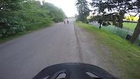
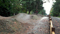
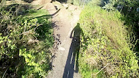
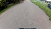
trail: Dirt Jumps
0:31 |
327 |
Jul 1, 2015

trail: Dirt Jumps
0:23 |
195 |
Feb 22, 2015
trail: Dirt Jumps
0:30 |
336 |
Oct 21, 2014
trail: Dirt Jumps
0:48 |
325 |
Apr 25, 2014
trail: Dirt Jumps
0:18 |
157 |
Apr 4, 2014

trail: Dirt Jumps
0:35 |
254 |
Oct 7, 2013
trail: Dirt Jumps
0:34 |
464 |
Mar 12, 2013

trail: Dirt Jumps
0:30 |
141 |
Feb 3, 2013
Recent Trail Reports
| status | trail | date | condition | info | user |
|---|---|---|---|---|---|
| Green River Trail (Duwamish) | Jun 20, 2026 @ 7:39am (America/Vancouver) 1 day | Dry | theprofessionaljerry | ||
| Green River Trail (Tukwila North) | Jun 20, 2026 @ 7:39am (America/Vancouver) 1 day | Dry | theprofessionaljerry | ||
| Dirt Jumps | Oct 8, 2025 @ 9:33am (America/Los_Angeles) Oct 8, 2025 | Dry | R4F7Ul | ||
| Des Moines Creek Trail | Sep 4, 2025 @ 10:16am Sep 4, 2025 | Ideal | sveronneau | ||
| Green River Trail | Mar 9, 2024 @ 3:03am Mar 9, 2024 | Ideal | puch532 | ||
| Access Road | Nov 6, 2023 @ 12:43pm Nov 6, 2023 | Wet | PeterMazur | ||
| Westside Trail | Jun 12, 2023 @ 9:01am Jun 12, 2023 | Dry | Tomdog56 | ||
| Loose Chain | May 9, 2023 @ 2:48pm May 9, 2023 | Unknown | jmlough | ||
| Turns and Berms | May 9, 2023 @ 2:48pm May 9, 2023 | Unknown | jmlough | ||
| Trail | Jun 24, 2022 @ 5:25pm Jun 24, 2022 | Unknown | mjc1970 |
Activity Feed
| username | action | type | title | date |
|---|---|---|---|---|
| theprofessionaljerry | add | report | activity #97483892 and 1 more | Jun 21, 2026 @ 7:44am 6 hours |
| Bagtak | wishlist | trail | activity #96583237 | Jun 8, 2026 @ 8:36pm Jun 8, 2026 |
| trailforks | add | video | activity #96084543 | Jun 2, 2026 @ 8:00am Jun 2, 2026 |
| onlyfrans | add | video | activity #95493809 | May 25, 2026 @ 9:00am May 25, 2026 |
| pelted | wishlist | trail | activity #95428395 | May 24, 2026 @ 11:11am May 24, 2026 |
Recent Comments
| username | type | title | comment | date |
|---|---|---|---|---|
| trail | New Des Moines creek trailhead and park is... | May 10, 2026 @ 5:41pm May 10, 2026 | ||
| trail | Ride this downhill, kind of the point of the... | May 17, 2023 @ 3:00pm May 17, 2023 | ||
| trail | This jump is MASSIVE no gap but still | Feb 4, 2023 @ 2:12pm Feb 4, 2023 | ||
| trail | Most exciting trail here! | Aug 22, 2022 @ 12:44pm Aug 22, 2022 | ||
| trail | Dry but uninspiring. | Feb 24, 2021 @ 3:26pm Feb 24, 2021 |
Local Badges
-

10 Green Trails266 awarded -

Epic Ride Climb 2k6 awarded -

Climbing 10k Badge40 awarded -

Climbing 100k Badge0 awarded -

Epic Ride Descent 2k7 awarded -

Descent 10k Badge42 awarded
Bike & Skill Parks
| name | type | city | rating |
|---|---|---|---|
| North SeaTac BMX | skill park | Seatac |
Activity Type Stats
| activitytype | trails | distance | descent | descent distance | total vertical | rating | global rank | state rank | photos | reports | routes | ridelogs |
|---|---|---|---|---|---|---|---|---|---|---|---|---|
| Mountain Bike | 102 | 60 miles | 2,530 ft | 14 miles | 420 ft | #943 | #371 | 56 | 72 | 1 | 11,390 | |
| E-Bike | 29 | 22 miles | 440 ft | 4 miles | 371 ft | #4,533 | #1,463 | 55 | 278 | |||
| Hike | 111 | 62 miles | 2,805 ft | 15 miles | 420 ft | #1,562 | #700 | 69 | 2 | 388 | ||
| Trail Running | 111 | 62 miles | 2,805 ft | 15 miles | 420 ft | #2,927 | #848 | 69 | 1 | 764 |
Frequently Asked Questions About Seatac
▼
What are the best places to ride in Seatac?
Seatac has 5 areas to explore for mountain biking. The top rated areas are:
▼
What are the highest rated mountain biking trails in Seatac?
The highest rated mountain biking trails in Seatac are:
- Turns and Berms (3.8/5)
- Space Mountain's Revenge (3.7/5)
- SST Ridgeline (3.7/5)
- Cracker Jack (3.7/5)
- Bulldozer (3.6/5)
▼
What is the best time of the year to ride in Seatac?
Based on ride log data, the most popular months to ride in Seatac are:
- July (53 activities)
- September (40 activities)
- June (39 activities)
▼
Where can I park to ride in Seatac?
There are 10 parking locations listed in Seatac. The most popular parking spots are: View all parking and trailhead locations on the map to plan your visit.
Activities
- By jmahler
 TRAILFORKS WMBC Amb & contributors
 - Admins: EMBA-C2S, EMBA-C2S
- #13188 - 3,609 views
- seatac activity log | embed map of Seatac mountain bike trails | seatac mountain biking points of interest
Downloading of trail gps tracks in kml & gpx formats is enabled for Seatac.
You must login to download files.