close
-
Layers w
- Weather Layers
- Pro
- Pro
- Pro
- Pro
- Pro
- Pro
- More Layers
- Pro
- Pro
- Pro
- Pro
-
Upgrade to

3D
Trail Conditions
- Unknown
- Snow Groomed
- Snow Packed
- Snow Covered
- Snow Cover Partial
- Freeze/thaw Cycle
- Icy
- Prevalent Mud
- Wet
- Variable
- Ideal
- Dry
- Very Dry
Trail Flow (Ridden Direction)
Trailforks scans users ridelogs to determine the most popular direction each trail is ridden. A good flowing trail network will have most trails flowing in a single direction according to their intension.
The colour categories are based on what percentage of riders are riding a trail in its intended direction.
The colour categories are based on what percentage of riders are riding a trail in its intended direction.
- > 96%
- > 90%
- > 80%
- > 70%
- > 50%
- < 50%
- bi-directional trail
- no data
Trail Last Ridden
Trailforks scans ridelogs to determine the last time a trail was ridden.
- < 2 days
- < 1 week
- < 2 weeks
- < 1 month
- < 6 months
- > 6 months
Trail Ridden Direction
The intended direction a trail should be ridden.
- Downhill Only
- Downhill Primary
- Both Directions
- Uphill Primary
- Uphill Only
- One Direction
Contribute Details
Colors indicate trail is missing specified detail.
- Description
- Photos
- Description & Photos
- Videos
Trail Popularity ?
Trailforks scans ridelogs to determine which trails are ridden the most in the last 9 months.
Trails are compared with nearby trails in the same city region with a possible 25 colour shades.
Think of this as a heatmap, more rides = more kinetic energy = warmer colors.
- most popular
- popular
- less popular
- not popular
ATV/ORV/OHV Filter
Max Vehicle Width
inches
US Cell Coverage
Legend

Radar Time
Activity Recordings
Trailforks uses anonymized public activity data.
?
Activity Recordings
Trailforks uses anonymized public activity data.
?
Personal Heatmap
▶
Activity Types
all
/
none
▶
Options
2
Date range
month
–
Winter Trails
Warning
A routing network for winter maps does not exist. Selecting trails using the winter trails layer has been disabled.
Missing Trails
Most Popular
Least Popular
Trails are colored based on popularity. The more popular a trail is, the more red. Less popular trails trend towards green.
Jump Magnitude Heatmap
Heatmap of where riders jump on trails. Zoom in to see individual jumps, click circles to view jump details.
BC Backroad Status
![map legend]()
Service Road Atlas is a free to use, community-driven service for viewing and creating reports on the numerous back-country service roads around B.C. and Alberta.

Slope Aspect
Direction the slope faces
Trails Deemphasized
Trails are shown in grey.
Only show trails with no bike usage.
Suggested Layers
Based on selected activity type
Save the current map location and zoom level as your default home location whenever this page is loaded.
SavePopular Trail Networks
view all areas »
No description for Seattle has been added yet!
Login or register to submit one.
Activities Click to view
- Mountain Bike
127 trails
- E-Bike
14 trails
- Adaptive Bike
3 trails
- Hike
181 trails
- Trail Running
180 trails
Region Details
- 28
- 13
- 50
- 16
- 5
- 1
Region Status
Open as of Jun 24, 2026Local Trail Association
Stats
- Avg Trail Rating
- Trails (view details)
- 193
- Trails Mountain Bike
- 128
- Trails E-Bike
- 14
- Trails Adaptive Bike
- 3
- Trails Hike
- 181
- Trails Trail Running
- 180
- Total Distance
- 103 miles
- Total Descent
- 7,446 ft
- Total Vertical
- 440 ft
- Highest Trailhead
- 445 ft
- Reports
- 341
- Photos
- 91
- Ridden Counter
- 31,784
Articles
The Best Hikes Near Seattle for Every Kind of Hiker
Jan 25, 2022 from backpacker.com
Looking for a great dayhike, weekend trip, or multiday expedition near Seattle? We've got you covered.
Sub Regions
-
Camp Long
-
Cheasty Trails & Bike Park
- 4
- 2
-
Discovery Park
-
I5-Colonnade
- 5
- 4
- 4
- 1
-
Interlaken Park
- 1
- 1
-
Lincoln Park
- 13
-
Ravenna Park
- 1
- 2
- 1
-
Richmond Beach Trails
-
Seward Park
- 6
- 5
-
Sunset Pump Park
- 2
- 1
-
Union Bay Natural Area
- 4
-
Washington Park Arboretum
- 1
-
West Crest Park
- 3
-
West Duwamish Greenbelt
- 13
- 5
- 1
Popular Seattle Mountain Biking Trails
• 90 ★ 0.0 • 2 miles • 13 ft • 270 •
Popular white difficulty paved path. This mountain bike primary trail can be used both directions. On average it takes 12 minutes to complete this trail.
• 75 ★ 0.0 • 1 mile • 15 ft • 270 •
Popular white difficulty paved path. This mountain bike primary trail can be used both directions. On average it takes 19 minutes to complete this trail.
• 85 ★ 0.0 • 551 ft • 0 ft • 253 •
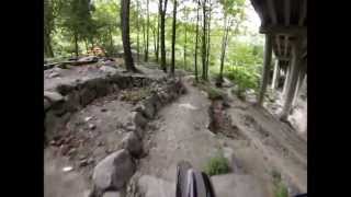
A fun line with a few jumps. Hard to make it up the far side of the first gully, so be prepared to hike your bike. Some cross traffic, so good to hoot and holler a bit on the roll in to make sure your presence is known.
• 90 ★ 0.0 • 2,116 ft • 23 ft • 250 •
Popular white difficulty paved path. This mountain bike primary trail can be used both directions. On average it takes 1 minutes to complete this trail.
• 95 ★ 4.0 • 741 ft • 0 ft • 222 •
Popular blue difficulty singletrack. This mountain bike primary trail. On average it takes 1 minutes to complete this trail.
• 80 ★ 0.0 • 4,625 ft • 30 ft • 217 •
Popular green difficulty dirt/gravel road. This multi-use trail can be used both directions. On average it takes 4 minutes to complete this trail.
• 95 ★ 0.0 • 938 ft • 47 ft • 210 •
Popular green difficulty singletrack. This mountain bike primary trail can be used both directions. On average it takes 2 minutes to complete this trail.
• 85 ★ 4.0 • 1,109 ft • 0 ft • 196 •
Popular green difficulty singletrack. This mountain bike primary trail can be used downhill only. On average it takes 1 minutes to complete this trail.
Seattle Mountain Bike Routes
2 miles • 14 ft • 0 • Loop •
Photos of Seattle Mountain Bike
Videos of Seattle Mountain Bike

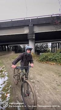
trail: Red Cedar
0:47 |
19 |
Dec 28, 2025
trail: K-Line
0:18 |
107 |
Dec 5, 2022
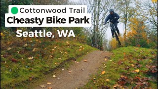
trail: Cottonwood
0:13 |
60 |
Dec 1, 2025 , Seattle

trail: Red Cedar
0:57 |
73 |
Dec 1, 2025 , Seattle

17:06 |
22 |
Dec 1, 2025
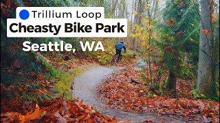
trail: Trillium Loop
2:13 |
144 |
Dec 1, 2025 , Seattle
trail: Limestone Loop
394 |
Mar 2, 2023 , Seattle

trail: Nick's Kicks
4:36 |
358 |
Dec 4, 2021 , Seattle
Current Trail Warnings
| status | trail | date | condition | user | info |
|---|---|---|---|---|---|
| LaFarge | Jun 24, 2026 @ 7:39am (America/Los_Angeles) Jun 24, 2026 | Variable | SpencerR8VMpi | almost impassable by bike due to heavy... | |
| West Duwamish Greenbelt Trail | Jun 24, 2026 @ 7:34am (America/Los_Angeles) Jun 24, 2026 | Prevalent Mud | SpencerR8VMpi | overgrown and has fallen trees making it... |
Recent Trail Reports
Activity Feed
| username | action | type | title | date |
|---|---|---|---|---|
| seanwynng | ridden | trail | activity #97960963 | Jun 27, 2026 @ 9:47pm 2 days |
| seanwynng | ridden | trail | activity #97960961 | Jun 27, 2026 @ 9:47pm 2 days |
| seanwynng | wishlist | trail | activity #97960955 | Jun 27, 2026 @ 9:47pm 2 days |
| VEBXIB | wishlist | trail | activity #97910272 | Jun 27, 2026 @ 9:13am 3 days |
| Bretly6oVvBq | wishlist | trail | activity #97874676 | Jun 26, 2026 @ 8:43pm Jun 26, 2026 |
Recent Comments
| username | type | title | comment | date |
|---|---|---|---|---|
| trail | We | Aug 28, 2025 @ 7:25am Aug 28, 2025 | ||
| trail | Trail has been fully revamped from the first... | Mar 5, 2025 @ 8:52pm Mar 5, 2025 | ||
| trail | Great local resource, needs more use! A bunch... | Nov 25, 2024 @ 12:32am Nov 25, 2024 | ||
| trail | Lots of blue tarps and tents on this trail... | May 5, 2024 @ 6:16pm May 5, 2024 | ||
| trail | A friend and I have been working on the trails... | Mar 22, 2024 @ 11:28am Mar 22, 2024 |
Local Badges
-

Epic Mountain Bike Climb 2k45 awarded -

Climbing 10k Badge272 awarded -

Mountain Biking 100k Badge10 awarded -

Epic Ride Descent 2k45 awarded -

Descent 10k Badge274 awarded -

Descent 100k Badge10 awarded
Bike & Skill Parks
| name | type | city | rating |
|---|---|---|---|
| I-5 Colonnade | skill park | Seattle | |
| Lower woodland dirt jump | skill park | Seattle |
Activity Type Stats
| activitytype | trails | distance | descent | descent distance | total vertical | rating | global rank | state rank | photos | reports | routes | ridelogs |
|---|---|---|---|---|---|---|---|---|---|---|---|---|
| Mountain Bike | 127 | 75 miles | 5,052 ft | 27 miles | 440 ft | #1,005 | #396 | 91 | 341 | 1 | 138,761 | |
| E-Bike | 14 | 26 miles | 463 ft | 8 miles | 305 ft | #2,642 | #1,042 | 284 | 7,048 | |||
| Adaptive Bike | 3 | #370 | #1,672 | |||||||||
| Hike | 181 | 101 miles | 7,159 ft | 36 miles | 440 ft | #1,095 | #503 | 2 | 303 | 10 | 3,938 | |
| Trail Running | 180 | 99 miles | 7,149 ft | 35 miles | 440 ft | #504 | #195 | 303 | 1 | 25,048 |
Frequently Asked Questions About Seattle
▼
What are the best places to ride in Seattle?
Seattle has 17 areas to explore for mountain biking. The top rated areas are:
▼
What are the highest rated mountain biking trails in Seattle?
The highest rated mountain biking trails in Seattle are:
- Trillium Loop (4.2/5)
- The Ogie (4.2/5)
- West Duwamish Greenbelt Trail (4.2/5)
- Dog Park Flow (4.2/5)
- West Duwamish Greenbelt Trail (4.1/5)
▼
What is the best time of the year to ride in Seattle?
Based on ride log data, the most popular months to ride in Seattle are:
- July (279 activities)
- August (245 activities)
- September (158 activities)
▼
Where can I park to ride in Seattle?
There are 25 parking locations listed in Seattle. The most popular parking spots are: View all parking and trailhead locations on the map to plan your visit.
Activities
Trails
- By anavot
 & contributors
 - Admins: EMBA-C2S, EMBA-C2S
- #9702 - 42,306 views
- seattle activity log | embed map of Seattle mountain bike trails | seattle mountain biking points of interest polygons
Downloading of trail gps tracks in kml & gpx formats is enabled for Seattle.
You must login to download files.