close
-
Layers w
- Weather Layers
- Pro
- Pro
- Pro
- Pro
- Pro
- Pro
- More Layers
- Pro
- Pro
- Pro
- Pro
-
Upgrade to

3D
Trail Conditions
- Unknown
- Snow Groomed
- Snow Packed
- Snow Covered
- Snow Cover Partial
- Freeze/thaw Cycle
- Icy
- Prevalent Mud
- Wet
- Variable
- Ideal
- Dry
- Very Dry
Trail Flow (Ridden Direction)
Trailforks scans users ridelogs to determine the most popular direction each trail is ridden. A good flowing trail network will have most trails flowing in a single direction according to their intension.
The colour categories are based on what percentage of riders are riding a trail in its intended direction.
The colour categories are based on what percentage of riders are riding a trail in its intended direction.
- > 96%
- > 90%
- > 80%
- > 70%
- > 50%
- < 50%
- bi-directional trail
- no data
Trail Last Ridden
Trailforks scans ridelogs to determine the last time a trail was ridden.
- < 2 days
- < 1 week
- < 2 weeks
- < 1 month
- < 6 months
- > 6 months
Trail Ridden Direction
The intended direction a trail should be ridden.
- Downhill Only
- Downhill Primary
- Both Directions
- Uphill Primary
- Uphill Only
- One Direction
Contribute Details
Colors indicate trail is missing specified detail.
- Description
- Photos
- Description & Photos
- Videos
Trail Popularity ?
Trailforks scans ridelogs to determine which trails are ridden the most in the last 9 months.
Trails are compared with nearby trails in the same city region with a possible 25 colour shades.
Think of this as a heatmap, more rides = more kinetic energy = warmer colors.
- most popular
- popular
- less popular
- not popular
ATV/ORV/OHV Filter
Max Vehicle Width
inches
US Cell Coverage
Legend

Radar Time
Activity Recordings
Trailforks uses anonymized public activity data.
?
Activity Recordings
Trailforks uses anonymized public activity data.
?
Personal Heatmap
▶
Activity Types
all
/
none
▶
Options
2
Date range
month
–
Winter Trails
Warning
A routing network for winter maps does not exist. Selecting trails using the winter trails layer has been disabled.
Missing Trails
Most Popular
Least Popular
Trails are colored based on popularity. The more popular a trail is, the more red. Less popular trails trend towards green.
Jump Magnitude Heatmap
Heatmap of where riders jump on trails. Zoom in to see individual jumps, click circles to view jump details.
BC Backroad Status
![map legend]()
Service Road Atlas is a free to use, community-driven service for viewing and creating reports on the numerous back-country service roads around B.C. and Alberta.

Slope Aspect
Direction the slope faces
Trails Deemphasized
Trails are shown in grey.
Only show trails with no bike usage.
Suggested Layers
Based on selected activity type
Save the current map location and zoom level as your default home location whenever this page is loaded.
Save
No description for Semmering has been added yet!
Login or register to submit one.
Links
This region uses the Uk/Euro style trail grading system.
Activities Click to view
- Mountain Bike
11 trails
- E-Bike
3 trails
- Gravel Bike
0 trails
- Adaptive Bike
0 trails
- Winter Fat Bike
0 trails
- Hike
7 trails
- Trail Running
7 trails
Region Details
- 2
- 1
- 6
- 2
Region Status
Open as of Apr 9, 2026Stats
- Avg Trail Rating
- Trails (view details)
- 14
- Trails Mountain Bike
- 11
- Trails E-Bike
- 3
- Trails Hike
- 7
- Trails Trail Running
- 7
- Trails Snowshoe
- 1
- Total Distance
- 16 miles
- Total Descent
- 8,449 ft
- Total Vertical
- 3,410 ft
- Highest Trailhead
- 4,975 ft
- Reports
- 112
- Photos
- 37
- Ridden Counter
- 3,810
Articles
Course Preview: Dominic Platt & Indy Deavoll Ride the iXS EDC #3 in Semmering, Austria
Jun 13, 2025 from pinkbike.com
Watch out for those loose marbles on the right-hander around the halfway mark.
Sub Regions
-
Bikepark Semmering
- 3
- 3
- 3
- 2
Popular Semmering Mountain Biking Trails
• 75 ★ 4.7 • 3,009 ft • 0 ft • 381 •
line with lots of berms. Jumps, drops, gaps and wallride are optional. Nice root section
• 55 ★ 4.7 • 4,242 ft • 0 ft • 368 •
Highly rated moderately popular red difficulty singletrack. This mountain bike primary trail can be used downhill primary. It features berm, drop, jump and rock garden. On average it takes 6 minutes to complete this trail.
• 85 ★ 4.6 • 1,650 ft • 0 ft • 363 •
Popular red difficulty machine groomed. This mountain bike primary trail can be used downhill only. It features berm and jump. On average it takes 1 minutes to complete this trail.
• 100 ★ 5.0 • 2,093 ft • 0 ft • 362 •
Highly rated popular black difficulty singletrack. This mountain bike primary trail can be used downhill primary and has a moderate overall physical rating. It features berm, drop and gap jump. On average it takes 2 minutes to complete this trail.
• 65 ★ 3.8 • 2,657 ft • 0 ft • 358 •
Moderately popular red difficulty machine groomed. This mountain bike primary trail can be used downhill primary and has a moderate overall physical rating. It features berm, drop, jump and wallride. On average it takes 3 minutes to complete this trail.
• 95 ★ 4.5 • 755 ft • 0 ft • 354 •
Popular red difficulty singletrack. This mountain bike primary trail can be used downhill primary. It features berm, bridge, gap jump, roller coaster, skinny and teeter totter. On average it takes minutes to complete this trail.
• 30 ★ 4.6 • 3,251 ft • 0 ft • 308 •
Less popular black difficulty singletrack. This mountain bike primary trail can be used downhill primary. It features drop, jump and rock garden. On average it takes 9 minutes to complete this trail.
• 45 ★ 4.4 • 1,811 ft • 0 ft • 253 •
, new line between slopestylepark and finish area.
Semmering Mountain Bike Routes
15 miles • 2,542 ft • 0 • Loop •
Loop starting from/ending at Semmering Kurort.
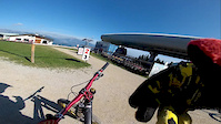
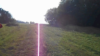
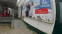
Photos of Semmering Mountain Bike
Videos of Semmering Mountain Bike

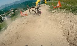
trail: Sweet & Sexy
0:14 |
|
Aug 21, 2020

trail: Fast & Tricky
6:21 |
107 |
Dec 28, 2016
trail: Banana Flip
6:18 |
577 |
Nov 8, 2015
trail: Banana Flip
0:24 |
59 |
Oct 4, 2015

trail: Airline
0:50 |
170 |
Sep 26, 2015
trail: Banana Flip
9:01 |
158 |
Oct 29, 2014

trail: Sweet & Sexy
5:33 |
463 |
Aug 19, 2014

trail: Banana Flip
4:35 |
179 |
May 26, 2014
Recent Trail Reports
| status | trail | date | condition | info | user |
|---|---|---|---|---|---|
| Upper Downhill | Aug 15, 2024 @ 10:07am Aug 15, 2024 | Dry | deviz | ||
| Lower Downhill | Aug 15, 2024 @ 10:07am Aug 15, 2024 | Dry | deviz | ||
| Panorama Jump Line | Aug 15, 2024 @ 10:07am Aug 15, 2024 | Dry | deviz | ||
| Fast & Tricky | Aug 15, 2024 @ 10:07am Aug 15, 2024 | Dry | deviz | ||
| Banana Flip | Aug 15, 2024 @ 10:07am Aug 15, 2024 | Dry | deviz | ||
| Sweet & Sexy | Aug 15, 2024 @ 10:07am Aug 15, 2024 | Dry | deviz | ||
| Airline | Aug 15, 2024 @ 10:07am Aug 15, 2024 | Dry | deviz | ||
| Lower Family | Aug 15, 2024 @ 10:07am Aug 15, 2024 | Dry | deviz | ||
| North Shore | Aug 15, 2024 @ 10:07am Aug 15, 2024 | Dry | deviz | ||
| Schlingel-Trail | Aug 15, 2024 @ 10:07am Aug 15, 2024 | Dry | deviz |
Activity Feed
| username | action | type | title | date |
|---|---|---|---|---|
| berniemoves | wishlist | region | activity #97026387 | Jun 15, 2026 @ 12:23am Jun 15, 2026 |
| iPhilGood23 | ridden | trail | activity #95424720 | May 24, 2026 @ 10:33am May 24, 2026 |
| gaborkurucz89 | wishlist | region | activity #94677549 | May 14, 2026 @ 3:24am May 14, 2026 |
| kubike | wishlist | region | activity #91776544 | Apr 2, 2026 @ 12:26pm Apr 2, 2026 |
| lines | add | event | activity #89007803 | Feb 16, 2026 @ 1:41am Feb 16, 2026 |
Local Badges
-

Epic Ride Climb 2k260 awarded -

Climbing 10k Badge30 awarded -

Climbing 100k Badge0 awarded -

Epic Ride Descent 2k260 awarded -

Descent 10k Badge51 awarded -

Descent 100k Badge0 awarded
Bike & Skill Parks
| name | type | city | rating |
|---|---|---|---|
| Bikepark Semmering | bike park | Semmering |
Activity Type Stats
| activitytype | trails | distance | descent | descent distance | total vertical | rating | global rank | state rank | photos | reports | routes | ridelogs |
|---|---|---|---|---|---|---|---|---|---|---|---|---|
| Mountain Bike | 11 | 6 miles | 4,419 ft | 5 miles | 1,070 ft | #1,924 | #14 | 31 | 112 | 1 | 1,973 | |
| E-Bike | 3 | 2 miles | 1,309 ft | 1 mile | 1,043 ft | #2,091 | #24 | 89 | 1 | 132 | ||
| Hike | 7 | 12 miles | 5,876 ft | 7 miles | 3,412 ft | #3,045 | #36 | 108 | 500 | |||
| Trail Running | 7 | 12 miles | 5,876 ft | 7 miles | 3,412 ft | #2,581 | #29 | 108 | 6 | |||
| Snowshoe | 1 | 2,654 ft | 348 ft | 2,031 ft | 302 ft | 4 |
Frequently Asked Questions About Semmering
▼
What are the best places to ride in Semmering?
Semmering has 1 areas to explore for mountain biking. The top rated areas are:
▼
What are the highest rated mountain biking trails in Semmering?
The highest rated mountain biking trails in Semmering are:
- Lower Downhill (4.5/5)
- Sweet & Sexy (4.4/5)
- Banana Flip (4.3/5)
- Airline (4.3/5)
- Upper Downhill (4.3/5)
▼
What is the best time of the year to ride in Semmering?
Based on ride log data, the most popular months to ride in Semmering are:
- August (42 activities)
- October (28 activities)
- July (22 activities)
▼
Where can I park to ride in Semmering?
Check the Semmering trail map for trailhead and parking information. Community members regularly update access and parking details for trails in the area.
Trails
- By brenthillier
 NSMBA TRAILFORKS & contributors
 - Admins: apply
- #15250 - 7,490 views
- semmering activity log | embed map of Semmering mountain bike trails | semmering mountain biking points of interest
Downloading of trail gps tracks in kml & gpx formats is enabled for Semmering.
You must login to download files.