close
-
Layers w
- Weather Layers
- Pro
- Pro
- Pro
- Pro
- Pro
- Pro
- More Layers
- Pro
- Pro
- Pro
- Pro
-
Upgrade to

3D
Trail Conditions
- Unknown
- Snow Groomed
- Snow Packed
- Snow Covered
- Snow Cover Partial
- Freeze/thaw Cycle
- Icy
- Prevalent Mud
- Wet
- Variable
- Ideal
- Dry
- Very Dry
Trail Flow (Ridden Direction)
Trailforks scans users ridelogs to determine the most popular direction each trail is ridden. A good flowing trail network will have most trails flowing in a single direction according to their intension.
The colour categories are based on what percentage of riders are riding a trail in its intended direction.
The colour categories are based on what percentage of riders are riding a trail in its intended direction.
- > 96%
- > 90%
- > 80%
- > 70%
- > 50%
- < 50%
- bi-directional trail
- no data
Trail Last Ridden
Trailforks scans ridelogs to determine the last time a trail was ridden.
- < 2 days
- < 1 week
- < 2 weeks
- < 1 month
- < 6 months
- > 6 months
Trail Ridden Direction
The intended direction a trail should be ridden.
- Downhill Only
- Downhill Primary
- Both Directions
- Uphill Primary
- Uphill Only
- One Direction
Contribute Details
Colors indicate trail is missing specified detail.
- Description
- Photos
- Description & Photos
- Videos
Trail Popularity ?
Trailforks scans ridelogs to determine which trails are ridden the most in the last 9 months.
Trails are compared with nearby trails in the same city region with a possible 25 colour shades.
Think of this as a heatmap, more rides = more kinetic energy = warmer colors.
- most popular
- popular
- less popular
- not popular
ATV/ORV/OHV Filter
Max Vehicle Width
inches
US Cell Coverage
Legend

Radar Time
Activity Recordings
Trailforks uses anonymized public activity data.
?
Activity Recordings
Trailforks uses anonymized public activity data.
?
Personal Heatmap
▶
Activity Types
all
/
none
▶
Options
2
Date range
month
–
Winter Trails
Warning
A routing network for winter maps does not exist. Selecting trails using the winter trails layer has been disabled.
Missing Trails
Most Popular
Least Popular
Trails are colored based on popularity. The more popular a trail is, the more red. Less popular trails trend towards green.
Jump Magnitude Heatmap
Heatmap of where riders jump on trails. Zoom in to see individual jumps, click circles to view jump details.
BC Backroad Status
![map legend]()
Service Road Atlas is a free to use, community-driven service for viewing and creating reports on the numerous back-country service roads around B.C. and Alberta.

Slope Aspect
Direction the slope faces
Trails Deemphasized
Trails are shown in grey.
Only show trails with no bike usage.
Suggested Layers
Based on selected activity type
Save the current map location and zoom level as your default home location whenever this page is loaded.
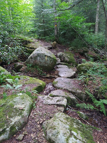
SaveSeneca State Forest has over 40 miles of trails and back roads open to bicycles. A hidden gem of Pocahontas County; Seneca State Forest has a little bit for everyone. Whether your into rugged terrain, gravel paths, or just staying on the road, this region has it all in one place. Seasonal camping options, a lake, cabins for rent, and a Fire tower available for overnight stays make Seneca State Forest a top notch destination.
Primary Trail Type: Cross-Country
Land Status: State Forest
Land Manager: WV State Parks
 google parking directions
Links
Region Supporters & Maintainers
![]()
Pocahontas TrailsMaintainer![]()
Snowshoe Highland Area Ride CenterMaintainer
Activities Click to view
- Mountain Bike
42 trails
- E-Bike
9 trails
- Hike
47 trails
- Trail Running
47 trails
- Snowshoe
9 trails
- Nordic Ski
9 trails
Region Details
- 17
- 5
- 7
Region Status
Caution as of Jun 15, 2025Stats
- Avg Trail Rating
- Trails (view details)
- 29
- Trails Mountain Bike
- 44
- Trails E-Bike
- 9
- Trails Hike
- 47
- Trails Trail Running
- 47
- Trails Snowshoe
- 9
- Trails Backcountry Ski
- 3
- Trails Nordic Ski
- 9
- Total Distance
- 22 miles
- Total Descent Distance
- 11 miles
- Total Descent
- 4,483 ft
- Total Vertical
- 1,105 ft
- Highest Trailhead
- 3,399 ft
- Reports
- 49
- Photos
- 73
- Ridden Counter
- 158
Articles
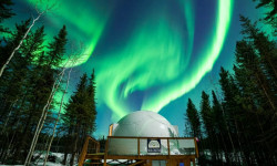
Where to Find the Darkest Skies in North America for Aurora Hunting and Stargazing
Aug 1, 2024 from outsideonline.com
You’ll be counting stars and catching the Northern Lights at these one-of-a-kind dark-sky retreats
Popular Seneca State Forest Mountain Biking Trails
• 90 ★ 5.0 • 2 miles • 620 ft • 24 •
This portion of the can be ridden both ways. Uphill is a slow burner; pick your pace and get to the top. Downhill is flowy singletrack fun for mostly every rider level. Shelter at the top makes for epic views.
• 85 ★ 5.0 • 5,253 ft • 10 ft • 11 •
offers a fast & flowy singletrack ride. There are a few small up-hill punches, but this trail is mostly all downhill. Keep on your toes for quick switchback turns!
• 85 ★ 5.0 • 2 miles • 13 ft • 11 •
This is the upper portion of the . There is a fun decent with a few technical sections; or you can try for the uphill climb. Both ways you will have a creek crossing in the middle.
• 5 ★ 5.0 • 3 miles • 475 ft • 9 •
This portion of the runs along Thorny Creek Mountain through Seneca State Forest. Riders will can enjoy unique views while ridge running; be prepared for a few steep climbs.
• 75 ★ 0.0 • 2,841 ft • 0 ft • 7 •
connects from to the . As a decent; this trail offers a fun ride down old grade. Riders can also use the trail as an up-hill pedal to get to . Be aware of a few roots, but nothing on this trail an intermediate rider couldn't handle.
• 80 ★ 4.0 • 1 mile • 248 ft • 5 •
offers some steep Blue Singletrack along with a few rootsy/rocky sections. This is a great trail for intermediate riders to test their skills on.
• 5 ★ 0.0 • 1,903 ft • 0 ft • 3 •
Short trail that stems off of . Check out the Shelter at the top of the trail. Gradual climb/decent.
• 5 ★ 4.0 • 4,436 ft • 3 ft • 3 •
is a 4,439 ft blue singletrack trail located in Seneca State Forest, West Virginia. This multi-use trail can be used both directions. Steep climb from leads to ; ride the opposite way to enjoy a quick and fun decent back to .
Seneca State Forest Mountain Bike Routes
★ 5.0 • 9 miles • 1,435 ft • 3 •
This is a local favorite accessed from Lot. It includes 2 of the best trails in the county.
19 miles • 3,421 ft • 7 •
Optimal Enduro Day route in Seneca State Forest provided there is a shuttle from 2 Mile Smile to .
• 2 miles • 11 ft • 1 •
• 11 miles • 2,106 ft • 4 •
• 28 miles • 1,838 ft • 0 •
Photos of Seneca State Forest Mountain Bike
Recent Trail Reports
| status | trail | date | condition | info | user |
|---|---|---|---|---|---|
| Thorny Creek Trail (North) | Jun 15, 2025 @ 5:37pm Jun 15, 2025 | Variable | taosmith365 RVMBA | ||
| Allegheny Trail (Thorny Creek Mountain) | Jun 15, 2025 @ 5:35pm Jun 15, 2025 | Wet | taosmith365 RVMBA | ||
| Hilltop Trail | Jun 5, 2025 @ 3:42pm Jun 5, 2025 | Dry | cjp730 Pocahontas | ||
| Thorny Creek Trail (South) | Mar 20, 2025 @ 6:50am Mar 20, 2025 | Dry | zenclements Pocahontas | ||
| Little Mtn. Trail | Mar 15, 2025 @ 10:26am Mar 15, 2025 | Ideal | zenclements Pocahontas | ||
| Black Oak | Mar 15, 2025 @ 10:25am Mar 15, 2025 | Ideal | zenclements Pocahontas | ||
| McCutcheon Trail | Jun 15, 2024 @ 7:07am Jun 15, 2024 | Dry | erwinberry | ||
| Rich Patch Loop Trail | Dec 13, 2023 @ 12:37pm Dec 13, 2023 | Variable | cjp730 Pocahontas |
National Scenic Trails & Official Routes
-
Allegheny Trail
- Mountain Bike
- E-Bike
- Hike
- Trail Running
Activity Feed
| username | action | type | title | date |
|---|---|---|---|---|
| LJ154320 | wishlist | region | activity #96718444 | Jun 10, 2026 @ 9:56pm Jun 10, 2026 |
| zenclements | vote | trail | activity #85262366 | Dec 9, 2025 @ 5:21am Dec 9, 2025 |
| zenclements | add | trail | activity #85262288 | Dec 9, 2025 @ 5:19am Dec 9, 2025 |
| GeezerEnduro | wishlist | region | activity #81899144 | Oct 7, 2025 @ 12:48pm Oct 7, 2025 |
| zenclements | vote | route | activity #81609258 | Oct 3, 2025 @ 9:02am Oct 3, 2025 |
Recent Comments
| username | type | title | comment | date |
|---|---|---|---|---|
| trail | This trail should be removed from the map. It... | Jul 24, 2025 @ 2:33pm Jul 24, 2025 | ||
| trail | Fun fast down hill, trail is manicured for... | Apr 22, 2025 @ 6:03pm Apr 22, 2025 | ||
| trail | Clear of trees. | Sep 26, 2024 @ 12:42pm Sep 26, 2024 | ||
| trail | As of 27 March '24 the trail is clear. Fun... | Mar 21, 2024 @ 7:31am Mar 21, 2024 |
Nearby Areas
| name | distance | ||||
|---|---|---|---|---|---|
| Marlin Mountain Area Trails | 1 | 1 | 6.5 km | ||
| Snowshoe Mountain Resort | 4 | 8.6 km | |||
| Snowshoe Backcountry | 14 | 22 | 11 | 8.7 km | |
| Snowshoe Bike Park | 3 | 16 | 21 | 7 | 8.8 km |
| Monday Lick | 6 | 1 | 10.4 km |
Local Badges
-

Completionist0 awarded
Activity Type Stats
| activitytype | trails | distance | descent | descent distance | total vertical | rating | global rank | state rank | photos | reports | routes | ridelogs |
|---|---|---|---|---|---|---|---|---|---|---|---|---|
| Mountain Bike | 42 | 22 miles | 4,482 ft | 11 miles | 1,106 ft | #5,055 | #1,824 | 110 | 49 | 2 | 221 | |
| E-Bike | 9 | 1 mile | 259 ft | 1 mile | 249 ft | #9,717 | #3,299 | 36 | 2 | 7 | ||
| Hike | 47 | 22 miles | 4,482 ft | 11 miles | 1,106 ft | #7,094 | #2,583 | 53 | 64 | |||
| Trail Running | 47 | 22 miles | 4,482 ft | 11 miles | 1,106 ft | #6,424 | #2,051 | 53 | 3 | |||
| Snowshoe | 9 | 1 mile | 259 ft | 1 mile | 249 ft | #2,351 | #1,331 | 2 | ||||
| Backcountry Ski | 3 | |||||||||||
| Nordic Ski | 9 | 1 mile | 259 ft | 1 mile | 249 ft | #2,323 | #1,250 | 2 |
Frequently Asked Questions About Seneca State Forest
▼
What are the highest rated mountain biking trails in Seneca State Forest?
The highest rated mountain biking trails in Seneca State Forest are:
- Allegheny Trail (Laurel Run-Loop Rd.) (4.2/5)
- Allegheny Trail (Buckskin Road - Thorny Creek Mountain Road) (4.1/5)
- Thorny Creek Trail (North) (4.1/5)
- Allegheny Trail (Thorny Creek Mountain) (4.1/5)
- Black Oak (0/5)
▼
What is the best time of the year to ride in Seneca State Forest?
Based on ride log data, the most popular months to ride in Seneca State Forest are:
- August (1 activities)
▼
Where can I park to ride in Seneca State Forest?
There are 16 parking locations listed in Seneca State Forest. The most popular parking spots are: View all parking and trailhead locations on the map to plan your visit.
▼
What is the longest trail in Seneca State Forest?
The longest trail in Seneca State Forest is Thorny Creek Trail (South) at 3.9 miles. View all trails sorted by distance.
Activities
Trails
- By swampboy62 & contributors
- Admins: Pocahontas, SHARC, UWV
- #6543 - 4,186 views
- seneca state forest activity log | embed map of Seneca State Forest mountain bike trails | seneca state forest mountain biking points of interest
Downloading of trail gps tracks in kml & gpx formats is enabled for Seneca State Forest.
You must login to download files.