close
-
Layers w
- Weather Layers
- Pro
- Pro
- Pro
- Pro
- Pro
- Pro
- More Layers
- Pro
- Pro
- Pro
- Pro
-
Upgrade to

3D
Trail Conditions
- Unknown
- Snow Groomed
- Snow Packed
- Snow Covered
- Snow Cover Partial
- Freeze/thaw Cycle
- Icy
- Prevalent Mud
- Wet
- Variable
- Ideal
- Dry
- Very Dry
Trail Flow (Ridden Direction)
Trailforks scans users ridelogs to determine the most popular direction each trail is ridden. A good flowing trail network will have most trails flowing in a single direction according to their intension.
The colour categories are based on what percentage of riders are riding a trail in its intended direction.
The colour categories are based on what percentage of riders are riding a trail in its intended direction.
- > 96%
- > 90%
- > 80%
- > 70%
- > 50%
- < 50%
- bi-directional trail
- no data
Trail Last Ridden
Trailforks scans ridelogs to determine the last time a trail was ridden.
- < 2 days
- < 1 week
- < 2 weeks
- < 1 month
- < 6 months
- > 6 months
Trail Ridden Direction
The intended direction a trail should be ridden.
- Downhill Only
- Downhill Primary
- Both Directions
- Uphill Primary
- Uphill Only
- One Direction
Contribute Details
Colors indicate trail is missing specified detail.
- Description
- Photos
- Description & Photos
- Videos
Trail Popularity ?
Trailforks scans ridelogs to determine which trails are ridden the most in the last 9 months.
Trails are compared with nearby trails in the same city region with a possible 25 colour shades.
Think of this as a heatmap, more rides = more kinetic energy = warmer colors.
- most popular
- popular
- less popular
- not popular
ATV/ORV/OHV Filter
Max Vehicle Width
inches
US Cell Coverage
Legend

Radar Time
Activity Recordings
Trailforks uses anonymized public activity data.
?
Activity Recordings
Trailforks uses anonymized public activity data.
?
Personal Heatmap
▶
Activity Types
all
/
none
▶
Options
2
Date range
month
–
Winter Trails
Warning
A routing network for winter maps does not exist. Selecting trails using the winter trails layer has been disabled.
Missing Trails
Most Popular
Least Popular
Trails are colored based on popularity. The more popular a trail is, the more red. Less popular trails trend towards green.
Jump Magnitude Heatmap
Heatmap of where riders jump on trails. Zoom in to see individual jumps, click circles to view jump details.
BC Backroad Status
![map legend]()
Service Road Atlas is a free to use, community-driven service for viewing and creating reports on the numerous back-country service roads around B.C. and Alberta.

Slope Aspect
Direction the slope faces
Trails Deemphasized
Trails are shown in grey.
Only show trails with no bike usage.
Suggested Layers
Based on selected activity type
Save the current map location and zoom level as your default home location whenever this page is loaded.
Save
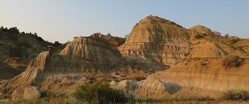
No description for Sentinel Butte has been added yet!
Login or register to submit one.
Activities Click to view
- Mountain Bike
5 trails
- Hike
5 trails
- Trail Running
5 trails
Region Details
- 5
Region Status
Caution as of Oct 13, 2025Local Trail Association
Stats
- Avg Trail Rating
- Trails (view details)
- 5
- Trails Mountain Bike
- 5
- Trails Hike
- 5
- Trails Trail Running
- 5
- Total Distance
- 19 miles
- Total Descent
- 1,893 ft
- Total Vertical
- 329 ft
- Highest Trailhead
- 2,646 ft
- Reports
- 72
- Photos
- 7
- Ridden Counter
- 694
Popular Sentinel Butte Mountain Biking Trails
• 100 ★ 4.3 • 6 miles • 384 ft • 259 •
Highly rated popular blue difficulty singletrack. This mountain bike primary trail can be used both directions. On average it takes 52 minutes to complete this trail.
• 80 ★ 4.0 • 11 miles • 957 ft • 207 •
The Buffalo Gap trail goes around the South Unit of Theodore Roosevelt National Park. This trail was developed as an uninterrupted single track mountain bike trail to Sully Creek Campground. The trail crosses Knutson creek with a...
• 60 ★ 1.7 • 1 mile • 119 ft • 121 •
Moderately popular blue difficulty singletrack. This mountain bike primary trail can be used both directions. On average it takes 10 minutes to complete this trail.
• 40 ★ 0.0 • 4,587 ft • 47 ft • 31 •
Moderately popular blue difficulty singletrack. This mountain bike primary trail can be used both directions. On average it takes 4 minutes to complete this trail.
• 20 ★ 0.0 • 2,099 ft • 79 ft • 29 •
Less popular blue difficulty singletrack. This mountain bike primary trail can be used both directions. On average it takes 2 minutes to complete this trail.
Photos of Sentinel Butte Mountain Bike
Recent Trail Reports
| status | trail | date | condition | info | user |
|---|---|---|---|---|---|
| Buffalo Gap | Jul 30, 2025 @ 12:03pm Jul 30, 2025 | Variable | Roadwarriorxo | ||
| Buffalo Gap - W. River Rd. to Campground | Aug 3, 2024 @ 4:59am Aug 3, 2024 | Dry | SNK922 | ||
| Buffalo Gap - Campground Access Trail | Sep 5, 2022 @ 5:04am Sep 5, 2022 | Dry | Bikingspyder | ||
| Buffalo Gap Campground Loop | Aug 15, 2021 @ 10:15am Aug 15, 2021 | Dry | Bikingspyder | ||
| Buffalo Gap Campground Loop | Aug 15, 2021 @ 10:15am Aug 15, 2021 | Dry | Bikingspyder |
National Scenic Trails & Official Routes
-
Maah Daah Hey Trail
- Mountain Bike
- Horse
- Hike
- Trail Running
- Snowshoe
Activity Feed
| username | action | type | title | date |
|---|---|---|---|---|
| RrZbvz | wishlist | trail | activity #97833218 | Jun 26, 2026 @ 7:33am 6 hours |
| djnodak | wishlist | trail | activity #96505427 | Jun 7, 2026 @ 4:11pm Jun 7, 2026 |
| Brian5BvIzl | ridden | trail | activity #88303343 | Feb 3, 2026 @ 6:40pm Feb 3, 2026 |
| Rbarnhardt | ridden | trail | activity #80012356 | Sep 9, 2025 @ 4:06pm Sep 9, 2025 |
| Rbarnhardt | ridden | trail | activity #79682197 | Sep 5, 2025 @ 7:19am Sep 5, 2025 |
Recent Comments
| username | type | title | comment | date |
|---|---|---|---|---|
| trail | Shouldn't the trail be rated lower if it's not... | Jun 19, 2025 @ 12:23am Jun 19, 2025 | ||
| trail | Scenic. Fun. Not technical. | Sep 24, 2022 @ 3:16pm Sep 24, 2022 |
Activity Type Stats
| activitytype | trails | distance | descent | descent distance | total vertical | rating | global rank | state rank | photos | reports | routes | ridelogs |
|---|---|---|---|---|---|---|---|---|---|---|---|---|
| Mountain Bike | 5 | 19 miles | 1,893 ft | 9 miles | 328 ft | #9,700 | #3,035 | 7 | 72 | 466 | ||
| Hike | 5 | 19 miles | 1,893 ft | 9 miles | 328 ft | #9,689 | #3,411 | 72 | 72 | |||
| Trail Running | 5 | 19 miles | 1,893 ft | 9 miles | 328 ft | #9,199 | #3,092 | 72 | 15 |
- By brenthillier
 NSMBA TRAILFORKS & contributors
 - Admins: apply
- #16496 - 2,360 views
- sentinel butte activity log | embed map of Sentinel Butte mountain bike trails | sentinel butte mountain biking points of interest
Downloading of trail gps tracks in kml & gpx formats is enabled for Sentinel Butte.
You must login to download files.