close
-
Layers w
- Weather Layers
- Pro
- Pro
- Pro
- Pro
- Pro
- Pro
- More Layers
- Pro
- Pro
- Pro
- Pro
-
Upgrade to

3D
Trail Conditions
- Unknown
- Snow Groomed
- Snow Packed
- Snow Covered
- Snow Cover Partial
- Freeze/thaw Cycle
- Icy
- Prevalent Mud
- Wet
- Variable
- Ideal
- Dry
- Very Dry
Trail Flow (Ridden Direction)
Trailforks scans users ridelogs to determine the most popular direction each trail is ridden. A good flowing trail network will have most trails flowing in a single direction according to their intension.
The colour categories are based on what percentage of riders are riding a trail in its intended direction.
The colour categories are based on what percentage of riders are riding a trail in its intended direction.
- > 96%
- > 90%
- > 80%
- > 70%
- > 50%
- < 50%
- bi-directional trail
- no data
Trail Last Ridden
Trailforks scans ridelogs to determine the last time a trail was ridden.
- < 2 days
- < 1 week
- < 2 weeks
- < 1 month
- < 6 months
- > 6 months
Trail Ridden Direction
The intended direction a trail should be ridden.
- Downhill Only
- Downhill Primary
- Both Directions
- Uphill Primary
- Uphill Only
- One Direction
Contribute Details
Colors indicate trail is missing specified detail.
- Description
- Photos
- Description & Photos
- Videos
Trail Popularity ?
Trailforks scans ridelogs to determine which trails are ridden the most in the last 9 months.
Trails are compared with nearby trails in the same city region with a possible 25 colour shades.
Think of this as a heatmap, more rides = more kinetic energy = warmer colors.
- most popular
- popular
- less popular
- not popular
ATV/ORV/OHV Filter
Max Vehicle Width
inches
US Cell Coverage
Legend

Radar Time
Activity Recordings
Trailforks uses anonymized public activity data.
?
Activity Recordings
Trailforks uses anonymized public activity data.
?
Personal Heatmap
▶
Activity Types
all
/
none
▶
Options
2
Date range
month
–
Winter Trails
Warning
A routing network for winter maps does not exist. Selecting trails using the winter trails layer has been disabled.
Missing Trails
Most Popular
Least Popular
Trails are colored based on popularity. The more popular a trail is, the more red. Less popular trails trend towards green.
Jump Magnitude Heatmap
Heatmap of where riders jump on trails. Zoom in to see individual jumps, click circles to view jump details.
BC Backroad Status
![map legend]()
Service Road Atlas is a free to use, community-driven service for viewing and creating reports on the numerous back-country service roads around B.C. and Alberta.

Slope Aspect
Direction the slope faces
Trails Deemphasized
Trails are shown in grey.
Only show trails with no bike usage.
Suggested Layers
Based on selected activity type
Save the current map location and zoom level as your default home location whenever this page is loaded.
Save
No description for Serbia has been added yet!
Login or register to submit one.
Region Details
- 67
- 2
- 35
- 29
- 1
- 1
Stats
- Avg Trail Rating
- Trails (view details)
- 164
- Trails Mountain Bike
- 165
- Trails E-Bike
- 144
- Trails Horse
- 10
- Trails Hike
- 55
- Trails Trail Running
- 54
- Trails Dirtbike/Moto
- 14
- Trails ATV/ORV/OHV
- 10
- Total Distance
- 222 miles
- Total Descent
- 51,792 ft
- Total Vertical
- 6,212 ft
- Highest Trailhead
- 6,440 ft
- Reports
- 1,333
- Photos
- 155
- Ridden Counter
- 1,336
Sub Regions
- Central Serbia (34)
- Belgrade Region (14)
- Belgrade (14)
- Bor Region (20)
- Bor (20)
- Belgrade Region (14)
- Northern Serbia (103)
- North Banat District (0)
- South Backa Region (106)
- Novi Sad (102)
- North Banat District (0)
- Southern Serbia (13)
- Nisava Region (10)
- Krusevac (5)
- Niš (8)
- Niska Banja (5)
- Raska Region (3)
- Kapaonik (3)
- Nisava Region (10)
- Western Region (2)
- Zlatibor Region (3)
- Zlatibor (3)
- Zlatibor Region (3)
- Western Serbia (10)
- Kolubarsky Region (6)
- Divcibare (6)
- Mačvanski Okrug (1)
- Loznica (1)
- Kolubarsky Region (6)
Popular Serbia Mountain Biking Trails
• 90 ★ 5.0 • 1 mile • 0 ft • 24 •
One of the most popular trills on Frushka, based on a single track, with many man-made counter slopes, wooden jumps, one huge road gap, very fast, while you can go slowly and go around all the complex elements.
• 95 ★ 5.0 • 2,349 ft • 0 ft • 20 •
One of the two main DH tracks in Košutnjak. The track is narrow with lots of challenging features. Mid track it contains a choice of 3 steep sections in varying difficulties. Two of them are off-camber.
• 65 ★ 4.0 • 2 miles • 98 ft • 18 •
Moderately popular green difficulty mixed. This mountain bike primary trail can be used both directions and has a easy overall physical rating with a 98 ft green climb. Trail visibility is always easy to follow. On average it takes 20 minutes to complete this trail.
• 60 ★ 3.5 • 3,166 ft • 15 ft • 18 •
Moderately popular red difficulty singletrack. This mountain bike primary trail and has a hard overall physical rating. It features a-frame, berm, drop, jump, gap jump and skinny. Trail visibility is always easy to follow. On average it takes 4 minutes to complete this trail.
• 90 ★ 5.0 • 3,625 ft • 9 ft • 16 •
Popular red difficulty singletrack. This mountain bike primary trail and has a moderate overall physical rating. It features drop, jump, gap jump, skinny and wallride. Trail visibility is always easy to follow. On average it takes 6 minutes to complete this trail.
• 100 ★ 5.0 • 1,552 ft • 3 ft • 16 •
Popular blue difficulty family friendly singletrack. This mountain bike primary trail and has a easy overall physical rating. It features berm, drop, jump, gap jump and skinny. Trail visibility is always easy to follow. On average it takes 1 minutes to complete this trail.
• 95 ★ 5.0 • 1 mile • 14 ft • 15 •
Popular green difficulty family friendly singletrack. This mountain bike primary trail and has a easy overall physical rating with a 14 ft green climb. It features jump, gap jump and skinny. Trail visibility is always easy to follow.
Serbia Mountain Bike Routes
20 miles • 3,656 ft • 2 •
Start na poljani ispod hotela Fruške terme. Vozi se kaldrmom do puta Vrdnik – Zmajevac. Prolazak kroz...
19 miles • 3,615 ft • 1 • Loop •
Start na poljani ispod hotela Fruške terme. Vozi se kaldrmom do puta Vrdnik - Zmajevac. Prolazak kroz...
32 miles • 5,831 ft • 3 •
Start na poljani ispod hotela Fruške terme. Vozi se kaldrmom do puta Vrdnik – Zmajevac. Prolazak kroz...
31 miles • 5,872 ft • 2 • Loop •
Start na poljani ispod hotela Fruške terme. Vozi se kaldrmom do puta Vrdnik - Zmajevac. Prolazak kroz...
4 miles • 999 ft • 0 • Loop •
Start na poljani ispod hotela Fruške terme. Prelazak preko puta i nastavak stazom koja vodi iza hotela na...
Photos of Serbia Mountain Bike
Videos of Serbia Mountain Bike
trail: Struga
0:23 |
49 |
Jul 2, 2023

trail: Bomber trail
0:16 |
17 |
Apr 21, 2026 , Novi Sad

trail: Vepar 2
3:25 |
12 |
Apr 21, 2026 , Novi Sad
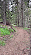
trail: Popovichko
2:33 |
17 |
Apr 21, 2026 , Novi Sad
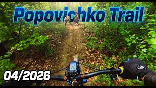
trail: Juliska DH
2:56 |
19 |
Apr 21, 2026 , Novi Sad
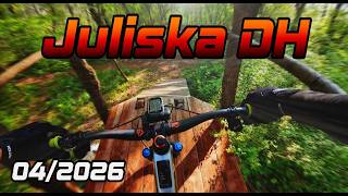
trail: Rupe
0:14 |
25 |
Apr 17, 2026 , Belgrade
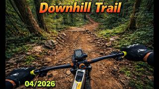
trail: Downhill
0:37 |
43 |
Apr 17, 2026 , Belgrade
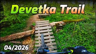
trail: Devetka
2:17 |
41 |
Apr 17, 2026 , Belgrade
Recent Comments
| username | type | title | comment | date |
|---|---|---|---|---|
| trail | По одышке на видео там 350... | Jun 12, 2026 @ 2:19pm Jun 12, 2026 | ||
| trail | Fun local trail. A loot of off camber. Some... | Sep 5, 2025 @ 2:00am Sep 5, 2025 | ||
| report | Ideal. Some roots. | Jun 8, 2025 @ 3:33am Jun 8, 2025 | ||
| trail | Not ridable right now, fallen trees on every step. | Feb 8, 2025 @ 4:22am Feb 8, 2025 | ||
| trail | Not ridable right now, fallen trees on every step. | Feb 8, 2025 @ 4:21am Feb 8, 2025 |
Bike & Skill Parks
| name | type | city | rating |
|---|---|---|---|
| Kopaonik Bike Park | bike park | Kapaonik | |
| Divcibare Bike Park | bike park | Divcibare |
Activity Type Stats
| activitytype | trails | distance | descent | descent distance | total vertical | rating | global rank | state rank | photos | reports | routes | ridelogs |
|---|---|---|---|---|---|---|---|---|---|---|---|---|
| Mountain Bike | 165 | 222 miles | 51,791 ft | 114 miles | 6,214 ft | #66 | 155 | 1,333 | 17 | 10,875 | ||
| E-Bike | 144 | 190 miles | 44,255 ft | 95 miles | 6,214 ft | #57 | 1,340 | 13 | 1,051 | |||
| Horse | 10 | 20 miles | 6,683 ft | 16 miles | 2,438 ft | #64 | 5 | |||||
| Hike | 55 | 115 miles | 23,038 ft | 59 miles | 3,602 ft | #82 | 1,326 | 2 | 641 | |||
| Trail Running | 54 | 114 miles | 23,261 ft | 59 miles | 3,602 ft | #77 | 1,326 | 7 | 510 | |||
| Dirtbike/Moto | 14 | 33 miles | 8,425 ft | 21 miles | 2,687 ft | #55 | 5 | 2 | ||||
| ATV/ORV/OHV | 10 | 32 miles | 7,789 ft | 20 miles | 2,687 ft | #45 | 5 | 7 |
Activities
Trails
Points of Interest
- By dragonaut12 & contributors
- Admins: SERBIA
- #4339 - 21,683 views
- serbia activity log | embed map of Serbia mountain bike trails | serbia mountain biking points of interest
Downloading of trail gps tracks in kml & gpx formats is enabled for Serbia.
You must login to download files.