close
-
Layers w
- Weather Layers
- Pro
- Pro
- Pro
- Pro
- Pro
- Pro
- More Layers
- Pro
- Pro
- Pro
- Pro
-
Upgrade to

3D
Trail Conditions
- Unknown
- Snow Groomed
- Snow Packed
- Snow Covered
- Snow Cover Partial
- Freeze/thaw Cycle
- Icy
- Prevalent Mud
- Wet
- Variable
- Ideal
- Dry
- Very Dry
Trail Flow (Ridden Direction)
Trailforks scans users ridelogs to determine the most popular direction each trail is ridden. A good flowing trail network will have most trails flowing in a single direction according to their intension.
The colour categories are based on what percentage of riders are riding a trail in its intended direction.
The colour categories are based on what percentage of riders are riding a trail in its intended direction.
- > 96%
- > 90%
- > 80%
- > 70%
- > 50%
- < 50%
- bi-directional trail
- no data
Trail Last Ridden
Trailforks scans ridelogs to determine the last time a trail was ridden.
- < 2 days
- < 1 week
- < 2 weeks
- < 1 month
- < 6 months
- > 6 months
Trail Ridden Direction
The intended direction a trail should be ridden.
- Downhill Only
- Downhill Primary
- Both Directions
- Uphill Primary
- Uphill Only
- One Direction
Contribute Details
Colors indicate trail is missing specified detail.
- Description
- Photos
- Description & Photos
- Videos
Trail Popularity ?
Trailforks scans ridelogs to determine which trails are ridden the most in the last 9 months.
Trails are compared with nearby trails in the same city region with a possible 25 colour shades.
Think of this as a heatmap, more rides = more kinetic energy = warmer colors.
- most popular
- popular
- less popular
- not popular
ATV/ORV/OHV Filter
Max Vehicle Width
inches
US Cell Coverage
Legend

Radar Time
Activity Recordings
Trailforks uses anonymized public activity data.
?
Activity Recordings
Trailforks uses anonymized public activity data.
?
Personal Heatmap
▶
Activity Types
all
/
none
▶
Options
2
Date range
month
–
Winter Trails
Warning
A routing network for winter maps does not exist. Selecting trails using the winter trails layer has been disabled.
Missing Trails
Most Popular
Least Popular
Trails are colored based on popularity. The more popular a trail is, the more red. Less popular trails trend towards green.
Jump Magnitude Heatmap
Heatmap of where riders jump on trails. Zoom in to see individual jumps, click circles to view jump details.
BC Backroad Status
![map legend]()
Service Road Atlas is a free to use, community-driven service for viewing and creating reports on the numerous back-country service roads around B.C. and Alberta.

Slope Aspect
Direction the slope faces
Trails Deemphasized
Trails are shown in grey.
Only show trails with no bike usage.
Suggested Layers
Based on selected activity type
Save the current map location and zoom level as your default home location whenever this page is loaded.
SaveLocalizada entre os municípios de Jundiaí, Cabreúva, Pirapora do Bom Jesus e Cajamar, a Serra do Japi estende-se por um total de 350 Km². Desse total uma área de 191,7 km² foi tombada pelo CONDEPHAAT (Conselho de Defesa do Patrimônio Histórico, Arqueológico e Turístico do Estado de São Paulo).
Primary Trail Type: All-Mountain & Downhill
eBikes Allowed:
Yes
Shuttleable: YES
AKA: Serra do Japi
Land Status: Community Forest
 google parking directions
 Access Info:
Type "Campo de Futebol Santa Clara" at Waze
Links
Activities Click to view
- Mountain Bike
21 trails
- E-Bike
20 trails
- Hike
12 trails
- Trail Running
12 trails
Region Details
- 1
- 2
- 12
- 6
Region Status
Open as of Jun 12, 2026Stats
- Avg Trail Rating
- Trails (view details)
- 21
- Trails Mountain Bike
- 21
- Trails E-Bike
- 20
- Trails Horse
- 3
- Trails Hike
- 12
- Trails Trail Running
- 12
- Trails Dirtbike/Moto
- 3
- Trails Observed Trials
- 1
- Total Distance
- 31 miles
- Total Descent
- 8,301 ft
- Total Vertical
- 1,814 ft
- Highest Trailhead
- 4,278 ft
- Reports
- 116
- Photos
- 15
- Ridden Counter
- 1,111
Popular Serra do Japi Mountain Biking Trails
• 85 ★ 4.9 • 3 miles • 93 ft • 144 •
Trail used in both directions: up to access other trails and down mostly by XC. Watch out for hikers/trail runners.
• 90 ★ 4.5 • 3,478 ft • 0 ft • 118 •
UGLY é uma trilha que sai da Taturana. Com drops altos. É uma trilha muito rápida e bem marcada.
• 95 ★ 5.0 • 2,218 ft • 94 ft • 72 •
Popular blue difficulty singletrack. This multi-use trail can be used both directions and has a moderate overall physical rating with a 94 ft blue climb. On average it takes 4 minutes to complete this trail.
• 50 ★ 5.0 • 1 mile • 88 ft • 40 •
Trilha começa na Taturana e segue abaixo, por horas conectado/utilizando o mesmo caminho de outras trilhas (assim ela é uma composição de partes únicas com outras trilhas)
• 70 ★ 5.0 • 1,352 ft • 0 ft • 34 •
Saindo da Taturana a Limbo é o inicio da Limo, na verdade é a mesma trilha, mas criaram com nomes diferentes, porém nessa entrada você pega apenas descidas na trilha.
• 65 ★ 5.0 • 456 ft • 0 ft • 33 •
Grau é a trilha que parte reto (a é a esquerda) na segunda entrada a direita (Depois da Piramba). Ela varia bastante de qualidade, no seco é bem difícil.
Serra do Japi Mountain Bike Routes
★ 5.0 • 12 miles • 2,988 ft • 5 • Point to Point •
Esse percurso é a junção de diversas trilhas e mescla bastante subidas e descidas técnicas. Segmento...
18 miles • 4,093 ft • 2 • Out & Back •
Rota clássica no Japi para um XC clássico, optando sempre por trilhas quando possível, subindo pelo...
★ 5.0 • 58 miles • 4,770 ft • 0 • Point to Point •
Etapa 1 2022 de 690km do DESC PFB (Pra Ficar Bruto) DESC: Desafio entre Serras e Colinas de MTB, Percursos...
★ 5.0 • 55 miles • 5,028 ft • 0 • Point to Point •
Etapa 2 2022 de 90km do DESC PFB (Pra Ficar Bruto) DESC: Desafio entre Serras e Colinas de MTB, Percursos...
★ 5.0 • 55 miles • 6,039 ft • 0 • Point to Point •
Etapa 5 2022 de 90km do DESC PFB (Pra Ficar Bruto) DESC: Desafio entre Serras e Colinas de MTB, Percursos...
★ 5.0 • 57 miles • 3,451 ft • 0 • Point to Point •
Etapa 3 2022 de 90km do DESC PFB (Pra Ficar Bruto) DESC: Desafio entre Serras e Colinas de MTB, Percursos...
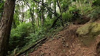
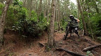
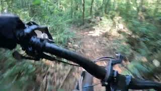
Photos of Serra do Japi Mountain Bike

Recent Trail Reports
| status | trail | date | condition | info | user |
|---|---|---|---|---|---|
| Mago | Jun 12, 2026 @ 10:40am (America/Sao_Paulo) Jun 12, 2026 | Ideal | edusallouti | ||
| Retorno Ex-critório | Jun 9, 2025 @ 4:13pm Jun 9, 2025 | Variable | lucasdefalco | ||
| Limo - Pinheirinho | Jun 9, 2025 @ 4:12pm Jun 9, 2025 | Wet | lucasdefalco | ||
| Taturana DH | Apr 21, 2025 @ 7:43am Apr 21, 2025 | Unknown | Alexsteinpt | ||
| Ugly | Feb 22, 2025 @ 8:12am Feb 22, 2025 | Ideal | Bighetti | ||
| Limbo | Aug 4, 2024 @ 4:19am Aug 4, 2024 | Ideal | Bighetti | ||
| Limo | Apr 20, 2024 @ 4:25am Apr 20, 2024 | Wet | GustavoMelo | ||
| Pe Grande | Feb 3, 2024 @ 1:22am Feb 3, 2024 | Wet | paulomach | ||
| Japi Antena - K2 | Jan 27, 2024 @ 1:19am Jan 27, 2024 | Variable | Bighetti | ||
| Jacare ate as antenas | May 6, 2023 @ 5:20am May 6, 2023 | Dry | Rochar1 |
Activity Feed
| username | action | type | title | date |
|---|---|---|---|---|
| alexsanderMd9pga | wishlist | route | activity #97542479 | Jun 21, 2026 @ 9:46pm Jun 21, 2026 |
| Tadeulopes82 | wishlist | route | activity #97438250 | Jun 20, 2026 @ 3:37pm Jun 20, 2026 |
| edusallouti | add | video | activity #96800405 | Jun 12, 2026 @ 6:50am Jun 12, 2026 |
| edusallouti | like | report | activity #96799977 | Jun 12, 2026 @ 6:43am Jun 12, 2026 |
| edusallouti | add | report | activity #96799971 | Jun 12, 2026 @ 6:43am Jun 12, 2026 |
Recent Comments
| username | type | title | comment | date |
|---|---|---|---|---|
| trail | Essa é melhor que black...é Shiny... | Jan 25, 2026 @ 2:23pm Jan 25, 2026 | ||
| trail | Trilha flow muito encaixada. Em tempos secos... | Aug 1, 2025 @ 4:16pm Aug 1, 2025 | ||
| trail | Recomendo este role, mas tem que pegar e... | Sep 18, 2022 @ 9:54am Sep 18, 2022 | ||
| trail | Esta trilha também é conhecida por... | Aug 10, 2022 @ 2:47pm Aug 10, 2022 | ||
| trail | Proibido entrada na fazenda. Caseiro armado... | Mar 20, 2022 @ 9:14am Mar 20, 2022 |
Nearby Areas
| name | distance | ||||
|---|---|---|---|---|---|
| X PARK Serra Azul | 12.2 km | ||||
| Interior Paulista | 23.4 km | ||||
| Cantareira | 1 | 4 | 1 | 23.5 km | |
| Nore Bike Park | 1 | 2 | 23.7 km | ||
| Arena iMTB Bike Park | 1 | 24 km |
Local Badges
-

Completionist0 awarded
Local Trail Supporters
- Thiago Velardi
- Feio
Activity Type Stats
| activitytype | trails | distance | descent | descent distance | total vertical | rating | global rank | state rank | photos | reports | routes | ridelogs |
|---|---|---|---|---|---|---|---|---|---|---|---|---|
| Mountain Bike | 21 | 31 miles | 8,301 ft | 14 miles | 1,814 ft | #1,306 | #11 | 15 | 115 | 11 | 3,119 | |
| E-Bike | 20 | 31 miles | 8,301 ft | 14 miles | 1,814 ft | #174 | #15 | 112 | 10 | 744 | ||
| Horse | 3 | 4 miles | 128 ft | 2,828 ft | 1,348 ft | 4 | ||||||
| Hike | 12 | 25 miles | 4,321 ft | 9 miles | 1,814 ft | #1,582 | #19 | 114 | 27 | |||
| Trail Running | 12 | 25 miles | 4,321 ft | 9 miles | 1,814 ft | #947 | #20 | 114 | 37 | |||
| Dirtbike/Moto | 3 | 4 miles | 108 ft | 2,966 ft | 1,348 ft | 3 | ||||||
| Observed Trials | 1 | 2 miles | 66 ft | 1,716 ft | 771 ft |
Frequently Asked Questions About Serra do Japi
▼
What are the highest rated mountain biking trails in Serra do Japi?
The highest rated mountain biking trails in Serra do Japi are:
- Taturana DH (4.4/5)
- Mago (4.2/5)
- Ugly (4.2/5)
- Pe Grande (4.2/5)
- Zika Trail (4.1/5)
▼
What is the best time of the year to ride in Serra do Japi?
Based on ride log data, the most popular months to ride in Serra do Japi are:
- May (6 activities)
- July (3 activities)
- October (3 activities)
▼
Where can I park to ride in Serra do Japi?
There are 2 parking locations listed in Serra do Japi. The most popular parking spots are:
▼
What is the longest trail in Serra do Japi?
The longest trail in Serra do Japi is Jacare ate as antenas at 15.6 km. View all trails sorted by distance.
Activities
- By marcosksaad & contributors
- Admins: chpw, Crer, NataGiacomozzi
- #20519 - 4,921 views
- serra do japi activity log | embed map of Serra do Japi mountain bike trails | serra do japi mountain biking points of interest
Downloading of trail gps tracks in kml & gpx formats is enabled for Serra do Japi.
You must login to download files.