close
-
Layers w
- Weather Layers
- Pro
- Pro
- Pro
- Pro
- Pro
- Pro
- More Layers
- Pro
- Pro
- Pro
- Pro
-
Upgrade to

3D
Trail Conditions
- Unknown
- Snow Groomed
- Snow Packed
- Snow Covered
- Snow Cover Partial
- Freeze/thaw Cycle
- Icy
- Prevalent Mud
- Wet
- Variable
- Ideal
- Dry
- Very Dry
Trail Flow (Ridden Direction)
Trailforks scans users ridelogs to determine the most popular direction each trail is ridden. A good flowing trail network will have most trails flowing in a single direction according to their intension.
The colour categories are based on what percentage of riders are riding a trail in its intended direction.
The colour categories are based on what percentage of riders are riding a trail in its intended direction.
- > 96%
- > 90%
- > 80%
- > 70%
- > 50%
- < 50%
- bi-directional trail
- no data
Trail Last Ridden
Trailforks scans ridelogs to determine the last time a trail was ridden.
- < 2 days
- < 1 week
- < 2 weeks
- < 1 month
- < 6 months
- > 6 months
Trail Ridden Direction
The intended direction a trail should be ridden.
- Downhill Only
- Downhill Primary
- Both Directions
- Uphill Primary
- Uphill Only
- One Direction
Contribute Details
Colors indicate trail is missing specified detail.
- Description
- Photos
- Description & Photos
- Videos
Trail Popularity ?
Trailforks scans ridelogs to determine which trails are ridden the most in the last 9 months.
Trails are compared with nearby trails in the same city region with a possible 25 colour shades.
Think of this as a heatmap, more rides = more kinetic energy = warmer colors.
- most popular
- popular
- less popular
- not popular
ATV/ORV/OHV Filter
Max Vehicle Width
inches
US Cell Coverage
Legend

Radar Time
Activity Recordings
Trailforks uses anonymized public activity data.
?
Activity Recordings
Trailforks uses anonymized public activity data.
?
Personal Heatmap
▶
Activity Types
all
/
none
▶
Options
2
Date range
month
–
Winter Trails
Warning
A routing network for winter maps does not exist. Selecting trails using the winter trails layer has been disabled.
Missing Trails
Most Popular
Least Popular
Trails are colored based on popularity. The more popular a trail is, the more red. Less popular trails trend towards green.
Jump Magnitude Heatmap
Heatmap of where riders jump on trails. Zoom in to see individual jumps, click circles to view jump details.
BC Backroad Status
![map legend]()
Service Road Atlas is a free to use, community-driven service for viewing and creating reports on the numerous back-country service roads around B.C. and Alberta.

Slope Aspect
Direction the slope faces
Trails Deemphasized
Trails are shown in grey.
Only show trails with no bike usage.
Suggested Layers
Based on selected activity type
Save the current map location and zoom level as your default home location whenever this page is loaded.
Save
No description for Sestola has been added yet!
Login or register to submit one.
This region uses the Uk/Euro style trail grading system.
Activities Click to view
- Mountain Bike
19 trails
- E-Bike
3 trails
- Adaptive Bike
0 trails
- Winter Fat Bike
0 trails
- Hike
5 trails
- Trail Running
5 trails
Region Details
- 1
- 2
- 5
Region Status
Open as of May 31, 2026Stats
- Avg Trail Rating
- Trails (view details)
- 14
- Trails Mountain Bike
- 19
- Trails E-Bike
- 3
- Trails Hike
- 5
- Trails Trail Running
- 5
- Total Distance
- 16 miles
- Total Descent
- 13,026 ft
- Total Vertical
- 2,416 ft
- Highest Trailhead
- 4,992 ft
- Reports
- 189
- Photos
- 51
- Ridden Counter
- 1,386
Popular Sestola Mountain Biking Trails
• 100 ★ 4.0 • 4,813 ft • 74 ft • 205 •
Highly rated popular blue difficulty singletrack. This mountain bike primary trail can be used downhill primary and has a easy overall physical rating. It features roller coaster. On average it takes 8 minutes to complete this trail.
• 80 ★ 3.7 • 2,661 ft • 0 ft • 174 •
Popular blue difficulty singletrack. This mountain bike primary trail can be used downhill only. It features berm. On average it takes 5 minutes to complete this trail.
• 95 ★ 4.7 • 3,540 ft • 0 ft • 173 •
Highly rated popular red difficulty singletrack. This mountain bike primary trail can be used downhill only. On average it takes 6 minutes to complete this trail.
• 85 ★ 4.2 • 4,344 ft • 11 ft • 164 •
Highly rated popular blue difficulty singletrack. This mountain bike primary trail can be used downhill only. It features berm, jump and skinny. On average it takes 7 minutes to complete this trail.
• 50 ★ 3.0 • 2,543 ft • 0 ft • 110 •
Moderately popular blue difficulty singletrack. This mountain bike primary trail can be used downhill only and has a moderate overall physical rating with a 0 ft blue climb. It features jump. Trail visibility is always easy to follow. On average it takes 3 minutes to complete this trail.
• 55 ★ 3.6 • 1 mile • 0 ft • 101 •
Moderately popular red difficulty singletrack. This mountain bike primary trail can be used downhill only. On average it takes 6 minutes to complete this trail.
• 40 ★ 4.0 • 2 miles • 39 ft • 68 •
Moderately popular black difficulty singletrack. This mountain bike primary trail can be used downhill primary and has a hard overall physical rating. On average it takes 22 minutes to complete this trail.
• 65 ★ 3.5 • 2 miles • 220 ft • 55 •
Bellissimo tracciato in cresta e nel bosco da Pian del Falco a passo Serre.
Sestola Mountain Bike Routes
25 miles • 8,209 ft • 5 • Loop •
Giro con partenza e ritorno a Sestola, discese enduro-freeride di Montecreto
19 miles • 4,015 ft • 0 • Loop •
Sestola , Roncoscaglia , Passo Del Lupo , Lago della Ninfa e Pian Del Falco.
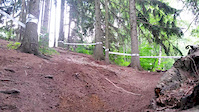
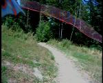
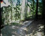
Photos of Sestola Mountain Bike
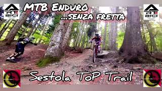
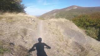
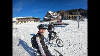
Videos of Sestola Mountain Bike
trail: DH
0:15 |
178 |
Jun 15, 2015
trail: Scaffa del Gatto
4:48 |
133 |
Jan 1, 2024 , Sestola
trail: Poggio Perduto DH
17:42 |
137 |
Oct 17, 2023 , Sestola
trail: Ardicello Short
7:16 |
159 |
Nov 29, 2020 , Sestola
trail: Falco Rosso
2:43 |
312 |
Oct 20, 2008
trail: Falco Rosso
2:37 |
171 |
Oct 20, 2008

trail: DH
0:06 |
123 |
Jun 24, 2008

trail: DH
0:09 |
115 |
Jun 24, 2008
Recent Trail Reports
| status | trail | date | condition | info | user |
|---|---|---|---|---|---|
| Easy Rider | May 31, 2026 @ 9:05am (Europe/San_Marino) May 31, 2026 | Ideal | Chiere | ||
| Balla coi lupi (Ex Blue Wave) | May 31, 2026 @ 9:05am (Europe/San_Marino) May 31, 2026 | Ideal | Chiere | ||
| Top gun (Ex Skinny Shark) | May 31, 2026 @ 9:05am (Europe/San_Marino) May 31, 2026 | Ideal | Chiere | ||
| Aquila Reale (Ex Brusina) | May 31, 2026 @ 9:05am (Europe/San_Marino) May 31, 2026 | Ideal | Chiere | ||
| Terminator (Ex Double black) | May 31, 2026 @ 9:05am (Europe/San_Marino) May 31, 2026 | Ideal | Chiere | ||
| DH | May 31, 2026 @ 9:05am (Europe/San_Marino) May 31, 2026 | Ideal | Chiere | ||
| Falco Rosso | May 31, 2026 @ 9:05am (Europe/San_Marino) May 31, 2026 | Ideal | Chiere | ||
| Scaffa del Gatto | Nov 17, 2025 @ 8:28am (Europe/Rome) Nov 16, 2025 | Variable | Africatwin78 | ||
| Ardicello XC | Aug 27, 2025 @ 9:01am Aug 27, 2025 | Ideal | alessandrozacheo | ||
| Poggio Perduto DH | Jun 2, 2025 @ 10:56am Jun 2, 2025 | Unknown | kio83 |
Activity Feed
| username | action | type | title | date |
|---|---|---|---|---|
| Jaki760 | wishlist | region | activity #96318566 | Jun 5, 2026 @ 1:37pm Jun 5, 2026 |
| Chiere | add | report | activity #95933990 and 6 more | May 31, 2026 @ 6:36am May 31, 2026 |
| Nessuries | wishlist | trail | activity #93200320 | Apr 23, 2026 @ 2:00am Apr 23, 2026 |
| Africatwin78 | add | report | activity #84287144 | Nov 16, 2025 @ 11:30pm Nov 16, 2025 |
| Muffa | add | report | activity #80843891 | Sep 21, 2025 @ 11:22am Sep 21, 2025 |
Recent Comments
| username | type | title | comment | date |
|---|---|---|---|---|
| trail | Fantastico Trail freeride. Single track... | Jun 2, 2025 @ 10:50am Jun 2, 2025 | ||
| trail | trail closed for MTB | Jun 4, 2022 @ 3:47am Jun 4, 2022 | ||
| trail | percorso il 30/10/21, abbondanti foglie e... | Nov 3, 2021 @ 8:18am Nov 3, 2021 | ||
| trail | A tratti molto bello, ha un bel potenziale se... | Aug 9, 2021 @ 3:01pm Aug 9, 2021 | ||
| trail | Non cosi Easy... merita il blu, pendenze non... | Aug 7, 2021 @ 7:13am Aug 7, 2021 |
Local Badges
-

Epic Mountain Bike Climb 2k130 awarded -

Climbing 10k Badge14 awarded -

Mountain Biking 100k Badge0 awarded -

Epic Ride Descent 2k130 awarded -

Descent 10k Badge17 awarded -

Descent 100k Badge0 awarded
Activity Type Stats
| activitytype | trails | distance | descent | descent distance | total vertical | rating | global rank | state rank | photos | reports | routes | ridelogs |
|---|---|---|---|---|---|---|---|---|---|---|---|---|
| Mountain Bike | 19 | 16 miles | 13,025 ft | 13 miles | 2,415 ft | #4,148 | #258 | 50 | 189 | 2 | 1,002 | |
| E-Bike | 3 | 6 miles | 3,707 ft | 5 miles | 2,415 ft | #6,505 | #677 | 1 | 128 | 1 | 137 | |
| Hike | 5 | 6 miles | 5,043 ft | 5 miles | 1,621 ft | #10,259 | #721 | 159 | 111 | |||
| Trail Running | 5 | 6 miles | 5,043 ft | 5 miles | 1,621 ft | #9,772 | #709 | 159 | 6 |
Frequently Asked Questions About Sestola
▼
What are the highest rated mountain biking trails in Sestola?
The highest rated mountain biking trails in Sestola are:
- DH (4.3/5)
- Trick Wood (4.3/5)
- Ardicello Short (4.1/5)
- Top gun (Ex Skinny Shark) (4.1/5)
- Falco Rosso (4/5)
▼
What is the best time of the year to ride in Sestola?
Based on ride log data, the most popular months to ride in Sestola are:
- August (56 activities)
- July (19 activities)
- June (14 activities)
▼
Where can I park to ride in Sestola?
Check the Sestola trail map for trailhead and parking information. Community members regularly update access and parking details for trails in the area.
▼
What is the longest trail in Sestola?
The longest trail in Sestola is Poggio Perduto DH at 3.9 miles. View all trails sorted by distance.
Trails
Points of Interest
- By anatas & contributors
- Admins: apply
- #14186 - 4,115 views
- sestola activity log | embed map of Sestola mountain bike trails |
Downloading of trail gps tracks in kml & gpx formats is enabled for Sestola.
You must login to download files.