close
-
Layers w
- Weather Layers
- Pro
- Pro
- Pro
- Pro
- Pro
- Pro
- More Layers
- Pro
- Pro
- Pro
- Pro
-
Upgrade to

3D
Trail Conditions
- Unknown
- Snow Groomed
- Snow Packed
- Snow Covered
- Snow Cover Partial
- Freeze/thaw Cycle
- Icy
- Prevalent Mud
- Wet
- Variable
- Ideal
- Dry
- Very Dry
Trail Flow (Ridden Direction)
Trailforks scans users ridelogs to determine the most popular direction each trail is ridden. A good flowing trail network will have most trails flowing in a single direction according to their intension.
The colour categories are based on what percentage of riders are riding a trail in its intended direction.
The colour categories are based on what percentage of riders are riding a trail in its intended direction.
- > 96%
- > 90%
- > 80%
- > 70%
- > 50%
- < 50%
- bi-directional trail
- no data
Trail Last Ridden
Trailforks scans ridelogs to determine the last time a trail was ridden.
- < 2 days
- < 1 week
- < 2 weeks
- < 1 month
- < 6 months
- > 6 months
Trail Ridden Direction
The intended direction a trail should be ridden.
- Downhill Only
- Downhill Primary
- Both Directions
- Uphill Primary
- Uphill Only
- One Direction
Contribute Details
Colors indicate trail is missing specified detail.
- Description
- Photos
- Description & Photos
- Videos
Trail Popularity ?
Trailforks scans ridelogs to determine which trails are ridden the most in the last 9 months.
Trails are compared with nearby trails in the same city region with a possible 25 colour shades.
Think of this as a heatmap, more rides = more kinetic energy = warmer colors.
- most popular
- popular
- less popular
- not popular
ATV/ORV/OHV Filter
Max Vehicle Width
inches
US Cell Coverage
Legend

Radar Time
Activity Recordings
Trailforks uses anonymized public activity data.
?
Activity Recordings
Trailforks uses anonymized public activity data.
?
Personal Heatmap
▶
Activity Types
all
/
none
▶
Options
2
Date range
month
–
Winter Trails
Warning
A routing network for winter maps does not exist. Selecting trails using the winter trails layer has been disabled.
Missing Trails
Most Popular
Least Popular
Trails are colored based on popularity. The more popular a trail is, the more red. Less popular trails trend towards green.
Jump Magnitude Heatmap
Heatmap of where riders jump on trails. Zoom in to see individual jumps, click circles to view jump details.
BC Backroad Status
![map legend]()
Service Road Atlas is a free to use, community-driven service for viewing and creating reports on the numerous back-country service roads around B.C. and Alberta.

Slope Aspect
Direction the slope faces
Trails Deemphasized
Trails are shown in grey.
Only show trails with no bike usage.
Suggested Layers
Based on selected activity type
Save the current map location and zoom level as your default home location whenever this page is loaded.
Save
No description for Setmurthy Woods has been added yet!
Login or register to submit one.
 google parking directions
google parking directionsThis region uses the Uk/Euro style trail grading system.
Activities Click to view
- Mountain Bike
47 trails
- E-Bike
38 trails
- Hike
20 trails
- Trail Running
29 trails
Region Details
- 15
- 2
- 4
- 6
- 13
- 5
Region Status
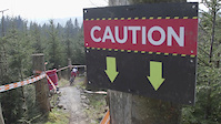
Caution as of Jun 6, 2026Stats
- Avg Trail Rating
- Trails (view details)
- 45
- Trails Mountain Bike
- 47
- Trails E-Bike
- 38
- Trails Horse
- 1
- Trails Hike
- 20
- Trails Trail Running
- 29
- Total Distance
- 10 miles
- Total Descent
- 3,601 ft
- Total Vertical
- 494 ft
- Highest Trailhead
- 832 ft
- Reports
- 222
- Photos
- 874
- Ridden Counter
- 3,488
Popular Setmurthy Woods Mountain Biking Trails
• 95 ★ 4.2 • 1,611 ft • 0 ft • 209 •
Highly rated popular black difficulty singletrack. This mountain bike primary trail can be used downhill primary and has a moderate overall physical rating. It features jump. On average it takes 4 minutes to complete this trail.
• 85 ★ 4.0 • 1,398 ft • 0 ft • 161 •
Popular black difficulty singletrack. This mountain bike primary trail can be used downhill only. It features berm, drop and gap jump. On average it takes 4 minutes to complete this trail.
• 90 ★ 4.5 • 1,818 ft • 0 ft • 139 •
Popular black difficulty singletrack. This mountain bike primary trail can be used downhill only. It features berm and drop. On average it takes 2 minutes to complete this trail.
• 80 ★ 3.5 • 1,280 ft • 0 ft • 136 •
Popular black difficulty singletrack. This mountain bike primary trail can be used one direction. On average it takes 2 minutes to complete this trail.
• 80 ★ 4.0 • 633 ft • 0 ft • 120 •
Popular black difficulty singletrack. This mountain bike primary trail can be used downhill primary. It features berm and jump. On average it takes minutes to complete this trail.
• 50 ★ 0.0 • 745 ft • 0 ft • 92 •
Moderately popular black difficulty singletrack. This mountain bike primary trail can be used downhill primary and has a moderate overall physical rating. It features berm, drop and jump. On average it takes 2 minutes to complete this trail.
• 65 ★ 5.0 • 423 ft • 0 ft • 90 •
Carrying on down the fence and get onto an amzing trail full of steep berms. Although it's not as fun as the 'fenceline' its a little harder!
Small jump line Permanently Closed
• 40 ★ 4.0 • 449 ft • 0 ft • 82 •
Moderately popular red difficulty closed singletrack. This mountain bike primary trail can be used both directions and has a easy overall physical rating with a 0 ft blue climb. It features berm, drop, jump and gap jump. Trail visibility is sometimes hard to follow. On average it takes 1 minutes to complete this trail.
Setmurthy Woods Mountain Bike Routes
★ 5.0 • 7 miles • 1,780 ft • 19 • Loop • Race •
A GPS track of mini enduro weekend! Including best trails up there: Mainline, Fenceline, Middle steep...
• 5 miles • 1,171 ft • 10 •
• 7 miles • 1,790 ft • 14 •
• 4 miles • 962 ft • 8 •
• 8 miles • 2,037 ft • 14 •
• 7 miles • 1,843 ft • 21 •
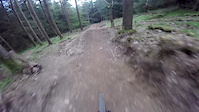
Photos of Setmurthy Woods Mountain Bike
Videos of Setmurthy Woods Mountain Bike
trail: Link
4:56 |
1203 |
Apr 9, 2019

trail: Link
0:06 |
103 |
Dec 20, 2018
trail: Setmurthy Jump Line #1
0:08 |
122 |
Sep 14, 2018

trail: Link
5:10 |
20 |
Aug 28, 2018
trail: Quary Trail
0:48 |
87 |
Mar 13, 2017
trail: Setmurthy Jump Line #1
0:05 |
288 |
Feb 5, 2017

trail: Forest trail
2:32 |
19 |
Sep 25, 2016
trail: Setmurthy Jump Line #1
0:34 |
709 |
May 7, 2016
Recent Trail Reports
| status | trail | date | condition | info | user |
|---|---|---|---|---|---|
| Cat in the Hat | Jun 1, 2026 @ 8:54pm (Europe/London) Jun 1, 2026 | Very Dry | timmyisasleep | ||
| Access Trail | Jun 1, 2026 @ 8:53pm (Europe/London) Jun 1, 2026 | Dry | timmyisasleep | ||
| pump it up lower | Apr 6, 2026 @ 8:48pm (Europe/London) Apr 6, 2026 | Unknown | bexrex | ||
| Link | Apr 6, 2026 @ 8:48pm (Europe/London) Apr 6, 2026 | Unknown | bexrex | ||
| Top Doubles | Apr 6, 2026 @ 8:47pm (Europe/London) Apr 6, 2026 | Variable | bexrex | ||
| Roadgap line | Apr 6, 2026 @ 8:46pm (Europe/London) Apr 6, 2026 | Unknown | bexrex | ||
| Main Push up track | Apr 6, 2026 @ 8:46pm (Europe/London) Apr 6, 2026 | Prevalent Mud | bexrex | ||
| Forest trail | Apr 6, 2026 @ 8:45pm (Europe/London) Apr 6, 2026 | Ideal | bexrex | ||
| Back of the Woods trail | Apr 6, 2026 @ 8:43pm (Europe/London) Apr 6, 2026 | Prevalent Mud | bexrex | ||
| Double Header | Apr 6, 2026 @ 8:42pm (Europe/London) Apr 6, 2026 | Unknown | bexrex |
Activity Feed
| username | action | type | title | date |
|---|---|---|---|---|
| timmyisasleep | add | report | activity #96035801 and 1 more | Jun 1, 2026 @ 12:53pm Jun 1, 2026 |
| timmyisasleep | comment | trail | activity #96035657 and 3 more | Jun 1, 2026 @ 12:50pm Jun 1, 2026 |
| finpek2011 | add | photo | activity #94140369 | May 6, 2026 @ 12:03am May 6, 2026 |
| bexrex | ridden | trail | activity #92071682 | Apr 6, 2026 @ 12:43pm Apr 6, 2026 |
| bexrex | add | report | activity #92071353 and 14 more | Apr 6, 2026 @ 12:37pm Apr 6, 2026 |
Recent Comments
| username | type | title | comment | date |
|---|---|---|---|---|
| trail | few trees down to the east of mainline. its... | Jun 1, 2026 @ 12:52pm Jun 1, 2026 | ||
| trail | more of a walkers path than anything you would... | Jun 1, 2026 @ 12:51pm Jun 1, 2026 | ||
| trail | closed due to lack of use | Jun 1, 2026 @ 12:50pm Jun 1, 2026 | ||
| trail | trail no longer exists | Jun 1, 2026 @ 12:50pm Jun 1, 2026 | ||
| trail | Trees down. No trail anymore | Sep 9, 2025 @ 6:43am Sep 9, 2025 |
Nearby Areas
| name | distance | ||||
|---|---|---|---|---|---|
| Whinlatter | 7 | 5.6 km | |||
| Ennerdale Valley | 10.6 km | ||||
| Dent | 3 | 5 | 14.1 km | ||
| Lake District National Park | 16.3 km | ||||
| Eskdale | 19.2 km |
Local Badges
-

Completionist0 awarded
Activity Type Stats
| activitytype | trails | distance | descent | descent distance | total vertical | rating | global rank | state rank | photos | reports | routes | ridelogs |
|---|---|---|---|---|---|---|---|---|---|---|---|---|
| Mountain Bike | 47 | 10 miles | 3,602 ft | 5 miles | 495 ft | #3,850 | #121 | 874 | 220 | 1 | 1,661 | |
| E-Bike | 38 | 8 miles | 2,605 ft | 4 miles | 495 ft | #4,195 | #179 | 180 | 1 | 117 | ||
| Horse | 1 | 1,024 ft | 52 ft | 991 ft | 52 ft | 6 | ||||||
| Hike | 20 | 7 miles | 791 ft | 2 miles | 492 ft | #8,592 | #219 | 150 | 85 | |||
| Trail Running | 29 | 8 miles | 1,368 ft | 3 miles | 492 ft | #7,030 | #176 | 168 | 123 |
Frequently Asked Questions About Setmurthy Woods
▼
What are the highest rated mountain biking trails in Setmurthy Woods?
The highest rated mountain biking trails in Setmurthy Woods are:
- steep turns(upper) (4.2/5)
- pump it up higher (4.1/5)
- Far fenceline (4.1/5)
- setters jumpline (4.1/5)
- Main Line (4.1/5)
▼
What is the best time of the year to ride in Setmurthy Woods?
Based on ride log data, the most popular months to ride in Setmurthy Woods are:
- October (3 activities)
- April (3 activities)
- March (3 activities)
▼
Where can I park to ride in Setmurthy Woods?
There are 4 parking locations listed in Setmurthy Woods. The most popular parking spots are: View all parking and trailhead locations on the map to plan your visit.
▼
What is the longest trail in Setmurthy Woods?
The longest trail in Setmurthy Woods is Back of the Woods trail at 765.0 m. View all trails sorted by distance.
Activities
Trails
Points of Interest
- By brenthillier
 NSMBA TRAILFORKS & contributors
 - Admins: apply
- #7965 - 17,102 views
- setmurthy woods activity log | embed map of Setmurthy Woods mountain bike trails | setmurthy woods mountain biking points of interest
Downloading of trail gps tracks in kml & gpx formats is enabled for Setmurthy Woods.
You must login to download files.