close
-
Layers w
- Weather Layers
- Pro
- Pro
- Pro
- Pro
- Pro
- Pro
- More Layers
- Pro
- Pro
- Pro
- Pro
-
Upgrade to

3D
Trail Conditions
- Unknown
- Snow Groomed
- Snow Packed
- Snow Covered
- Snow Cover Partial
- Freeze/thaw Cycle
- Icy
- Prevalent Mud
- Wet
- Variable
- Ideal
- Dry
- Very Dry
Trail Flow (Ridden Direction)
Trailforks scans users ridelogs to determine the most popular direction each trail is ridden. A good flowing trail network will have most trails flowing in a single direction according to their intension.
The colour categories are based on what percentage of riders are riding a trail in its intended direction.
The colour categories are based on what percentage of riders are riding a trail in its intended direction.
- > 96%
- > 90%
- > 80%
- > 70%
- > 50%
- < 50%
- bi-directional trail
- no data
Trail Last Ridden
Trailforks scans ridelogs to determine the last time a trail was ridden.
- < 2 days
- < 1 week
- < 2 weeks
- < 1 month
- < 6 months
- > 6 months
Trail Ridden Direction
The intended direction a trail should be ridden.
- Downhill Only
- Downhill Primary
- Both Directions
- Uphill Primary
- Uphill Only
- One Direction
Contribute Details
Colors indicate trail is missing specified detail.
- Description
- Photos
- Description & Photos
- Videos
Trail Popularity ?
Trailforks scans ridelogs to determine which trails are ridden the most in the last 9 months.
Trails are compared with nearby trails in the same city region with a possible 25 colour shades.
Think of this as a heatmap, more rides = more kinetic energy = warmer colors.
- most popular
- popular
- less popular
- not popular
ATV/ORV/OHV Filter
Max Vehicle Width
inches
US Cell Coverage
Legend

Radar Time
Activity Recordings
Trailforks uses anonymized public activity data.
?
Activity Recordings
Trailforks uses anonymized public activity data.
?
Personal Heatmap
▶
Activity Types
all
/
none
▶
Options
2
Date range
month
–
Winter Trails
Warning
A routing network for winter maps does not exist. Selecting trails using the winter trails layer has been disabled.
Missing Trails
Most Popular
Least Popular
Trails are colored based on popularity. The more popular a trail is, the more red. Less popular trails trend towards green.
Jump Magnitude Heatmap
Heatmap of where riders jump on trails. Zoom in to see individual jumps, click circles to view jump details.
BC Backroad Status
![map legend]()
Service Road Atlas is a free to use, community-driven service for viewing and creating reports on the numerous back-country service roads around B.C. and Alberta.

Slope Aspect
Direction the slope faces
Trails Deemphasized
Trails are shown in grey.
Only show trails with no bike usage.
Suggested Layers
Based on selected activity type
Save the current map location and zoom level as your default home location whenever this page is loaded.
Save
No description for Shannondale has been added yet!
Login or register to submit one.
Activities Click to view
- Mountain Bike
9 trails
- Adaptive Bike
0 trails
- Hike
12 trails
- Trail Running
12 trails
Region Details
- 1
- 5
- 2
- 1
Region Status
Open as of Nov 23, 2022Local Trail Association
Stats
- Avg Trail Rating
- Trails (view details)
- 14
- Trails Mountain Bike
- 9
- Trails Hike
- 12
- Trails Trail Running
- 12
- Total Distance
- 5 miles
- Total Descent Distance
- 2 miles
- Total Descent
- 1,057 ft
- Total Vertical
- 1,083 ft
- Highest Trailhead
- 1,679 ft
- Reports
- 21
- Photos
- 25
- Ridden Counter
- 352
Sub Regions
-
Speakeasy Trails
- 4
- 2
- 1
Popular Shannondale Mountain Biking Trails
• 80 ★ 4.0 • 1,634 ft • 20 ft • 44 •
Bootleggers Run is a fast section of trail that includes a rock garden, an up and over rock face, a log jump, and rock drop to berm. While this trail is not quite a blue and not quite a black, you can officially consider it a "blurple".
• 60 ★ 3.0 • 1,273 ft • 0 ft • 42 •
"Hair of the Dog" is a short, but fun piece of single track. It includes some nice tight turns, a few log jumps, one of which launches you into a tight turn and a big ole rock drop to flat. "Hair of the Dog is completely downhill and is...
• 90 ★ 4.4 • 3,458 ft • 9 ft • 42 •
"Mach Turkey" as the name implies, is the fastest and arguably the most fun section of trail on the Speakeasy loop. At the end of "Bootleggers Run", continue straight ahead. WARNING, if you go left at the end of Bootleggers, you will be...
• 35 ★ 4.7 • 3,520 ft • 84 ft • 41 •
"On the Rocks" is DOWNHILL ONLY trail that begins after a long climb up "Sober Up". It begins with a moderately technical, hand laid rock garden that leads into the largest rock feature on the trail. This large rock feature starts with...
• 45 ★ 3.0 • 2,963 ft • 220 ft • 37 •
"Sober Up" is a challenging climb. Not quite mid way up you will encounter a small downhill section that puts you up and over a sweet little rock face. Use the gained momentum here to get you up and around the next section of the...
• 70 ★ 3.5 • 3,793 ft • 208 ft • 35 •
Hangover is the ho hum part of the trail. Look for it on the left of the Moonshine Lane fire road as the hill starts going down hill. There is nothing technical here, but the climb is moderately challenging. Like a hangover, you gotta...
• 5 ★ 4.4 • 1,060 ft • 0 ft • 17 •
2 gap jumps to one table top 45 to 1 step down gap jump. Gap jumps at 22-26 footers. Expert only. Directional Only. Look for the deer skull with double diamonds etched onto. See photos
• 5 ★ 0.0 • 367 ft • 0 ft • 1 • • hike
Less popular blue difficulty singletrack. This hike primary trail can be used both directions and has a moderate overall physical rating with a 0 ft blue climb. Trail visibility is always easy to follow.
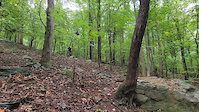
Photos of Shannondale Mountain Bike
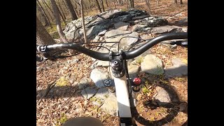
Videos of Shannondale Mountain Bike
trail: On the Rocks
0:08 |
56 |
Jun 14, 2023
trail: Mach Turkey
11:45 |
194 |
Jul 21, 2022 , Shannondale

trail: Mach Turkey
2:03 |
437 |
May 6, 2020 , Shannondale

trail: Have a Double
0:28 |
705 |
Mar 18, 2020 , Shannondale

trail: On the Rocks
737 |
Mar 18, 2020 , Shannondale
Recent Trail Reports
| status | trail | date | condition | info | user |
|---|---|---|---|---|---|
| Moonshine Lane | Nov 23, 2022 @ 9:52am Nov 23, 2022 | Unknown | bill32 |
Activity Feed
| username | action | type | title | date |
|---|---|---|---|---|
| JacobbYnxmS | wishlist | trail | activity #97619622 | Jun 23, 2026 @ 5:30am Jun 23, 2026 |
| CadmonK | wishlist | region | activity #80680800 | Sep 19, 2025 @ 12:17pm Sep 19, 2025 |
| rfjohnson | wishlist | region | activity #74287925 | Jun 21, 2025 @ 4:13pm Jun 21, 2025 |
| Conor67eAbu | wishlist | region | activity #69585266 | Apr 13, 2025 @ 2:03pm Apr 13, 2025 |
| dullesdeals | wishlist | trail | activity #69092874 | Apr 5, 2025 @ 11:17pm Apr 5, 2025 |
Recent Comments
| username | type | title | comment | date |
|---|---|---|---|---|
| trail | ;) | Jun 19, 2023 @ 11:50pm Jun 19, 2023 | ||
| report | ;) | Jun 19, 2023 @ 11:48pm Jun 19, 2023 | ||
| trail | They've been closed by locals for awhile :( | Jun 18, 2023 @ 7:05pm Jun 18, 2023 | ||
| trail | What's the story with these trails? Are they... | Feb 28, 2023 @ 6:01am Feb 28, 2023 | ||
| report | Entire trail has been deliberately trashed. ... | Jun 3, 2022 @ 9:06am Jun 3, 2022 |
Local Badges
-

Epic Ride Descent 2k0 awarded -

Descent 10k Badge0 awarded -

Descent 100k Badge0 awarded
Activity Type Stats
| activitytype | trails | distance | descent | descent distance | total vertical | rating | global rank | state rank | photos | reports | routes | ridelogs |
|---|---|---|---|---|---|---|---|---|---|---|---|---|
| Mountain Bike | 9 | 4 miles | 643 ft | 2 miles | 925 ft | #6,892 | #2,310 | 25 | 21 | 360 | ||
| Hike | 12 | 4 miles | 860 ft | 2 miles | 1,083 ft | #11,383 | #4,065 | 18 | 62 | |||
| Trail Running | 12 | 4 miles | 860 ft | 2 miles | 1,083 ft | #12,051 | #4,208 | 18 | 4 |
Frequently Asked Questions About Shannondale
▼
What are the best places to ride in Shannondale?
Shannondale has 1 areas to explore for mountain biking. The top rated areas are:
▼
What are the highest rated mountain biking trails in Shannondale?
The highest rated mountain biking trails in Shannondale are:
- On the Rocks (4.2/5)
- Mach Turkey (4.2/5)
- Have a Double (4.1/5)
- Bootleggers Run (4/5)
- Hangover (3.9/5)
▼
What is the best time of the year to ride in Shannondale?
Based on ride log data, the most popular months to ride in Shannondale are:
- July (7 activities)
- June (5 activities)
- August (5 activities)
▼
Where can I park to ride in Shannondale?
There are 1 parking locations listed in Shannondale. The most popular parking spots are:
Activities
Trails
Points of Interest
- By brad-af & contributors
- Admins: THUMB, SHARC
- #36184 - 1,965 views
- shannondale activity log | embed map of Shannondale mountain bike trails | shannondale mountain biking points of interest
Downloading of trail gps tracks in kml & gpx formats is enabled for Shannondale.
You must login to download files.