close
-
Layers w
- Weather Layers
- Pro
- Pro
- Pro
- Pro
- Pro
- Pro
- More Layers
- Pro
- Pro
- Pro
- Pro
-
Upgrade to

3D
Trail Conditions
- Unknown
- Snow Groomed
- Snow Packed
- Snow Covered
- Snow Cover Partial
- Freeze/thaw Cycle
- Icy
- Prevalent Mud
- Wet
- Variable
- Ideal
- Dry
- Very Dry
Trail Flow (Ridden Direction)
Trailforks scans users ridelogs to determine the most popular direction each trail is ridden. A good flowing trail network will have most trails flowing in a single direction according to their intension.
The colour categories are based on what percentage of riders are riding a trail in its intended direction.
The colour categories are based on what percentage of riders are riding a trail in its intended direction.
- > 96%
- > 90%
- > 80%
- > 70%
- > 50%
- < 50%
- bi-directional trail
- no data
Trail Last Ridden
Trailforks scans ridelogs to determine the last time a trail was ridden.
- < 2 days
- < 1 week
- < 2 weeks
- < 1 month
- < 6 months
- > 6 months
Trail Ridden Direction
The intended direction a trail should be ridden.
- Downhill Only
- Downhill Primary
- Both Directions
- Uphill Primary
- Uphill Only
- One Direction
Contribute Details
Colors indicate trail is missing specified detail.
- Description
- Photos
- Description & Photos
- Videos
Trail Popularity ?
Trailforks scans ridelogs to determine which trails are ridden the most in the last 9 months.
Trails are compared with nearby trails in the same city region with a possible 25 colour shades.
Think of this as a heatmap, more rides = more kinetic energy = warmer colors.
- most popular
- popular
- less popular
- not popular
ATV/ORV/OHV Filter
Max Vehicle Width
inches
US Cell Coverage
Legend

Radar Time
Activity Recordings
Trailforks uses anonymized public activity data.
?
Activity Recordings
Trailforks uses anonymized public activity data.
?
Personal Heatmap
▶
Activity Types
all
/
none
▶
Options
2
Date range
month
–
Winter Trails
Warning
A routing network for winter maps does not exist. Selecting trails using the winter trails layer has been disabled.
Missing Trails
Most Popular
Least Popular
Trails are colored based on popularity. The more popular a trail is, the more red. Less popular trails trend towards green.
Jump Magnitude Heatmap
Heatmap of where riders jump on trails. Zoom in to see individual jumps, click circles to view jump details.
BC Backroad Status
![map legend]()
Service Road Atlas is a free to use, community-driven service for viewing and creating reports on the numerous back-country service roads around B.C. and Alberta.

Slope Aspect
Direction the slope faces
Trails Deemphasized
Trails are shown in grey.
Only show trails with no bike usage.
Suggested Layers
Based on selected activity type
Save the current map location and zoom level as your default home location whenever this page is loaded.
SavePopular Trail Networks
view all areas »
No description for Shasta Cascade has been added yet!
Login or register to submit one.
Stats
- Avg Trail Rating
- Trails (view details)
- 1,528
- Trails Mountain Bike
- 811
- Trails E-Bike
- 237
- Trails Gravel Bike
- 97
- Trails Adaptive Bike
- 1
- Trails Winter Fat Bike
- 1
- Trails Horse
- 579
- Trails Hike
- 1,406
- Trails Trail Running
- 1,359
- Trails Dirtbike/Moto
- 45
- Trails ATV/ORV/OHV
- 32
- Trails Snowshoe
- 15
- Trails Downhill Ski
- 46
- Trails Backcountry Ski
- 2
- Trails Nordic Ski
- 25
- Total Distance
- 3,444 miles
- Total Descent
- 575,856 ft
- Total Vertical
- 13,980 ft
- Highest Trailhead
- 14,153 ft
- Reports
- 6,046
- Photos
- 1,976
- Ridden Counter
- 95,437
Articles

The Best Road Trips to Take This Summer Across the U.S.
Jul 3, 2025 from outsideonline.com
An expert roadtripper's guide to the best American road trips based on their proximity to adventure—from fly fishing holes to flowy singletrack...
Wanna Hike in California? These Are the 13 Most Stunning Trails.
Jul 18, 2024 from outsideonline.com
A longtime Golden State hiker reveals her dream list of the most beautiful, must-see routes in California

This 71-Year-Old Hiker Just Completed the Pacific Crest Trail
Oct 13, 2022 from backpacker.com
Jon Anderson overcame temporary snowblindness to complete the 2,650-mile journey from Mexico to Canada

Redding: Alphabet Lakes
Sep 20, 2013 from backpacker.com
Basecamp in a rarely visited basin and take daytrips to several alpine lakes with stunning views on this 17.2-mile, long-weekend backpacking trip.
Sub Regions
- Butte County (208)
- Butte Meadows (6)
- Chico (117)
- Lower Bidwell Park (8)
- Upper Bidwell Park (75)
- De Sabla (11)
- Forest Ranch (1)
- Jonesville (21)
- Magalia (48)
- Oroville (11)
- Lake Oroville (11)
- Paradise (2)
- Philbrook (25)
- Butte Meadows (6)
- Lassen County (94)
- Janesville (3)
- Susanville (91)
- Bald Mountain (18)
- Susan River Canyon (7)
- Susanville Ranch Park (67)
- Westwood (1)
- Janesville (3)
- Modoc County (3)
- Alturas (0)
- Cedarville (2)
- New Pine Creek (1)
- Shasta County (230)
- Anderson (2)
- Burney (2)
- Castella (4)
- Old Station (0)
- Redding (217)
- BLM Chappie - Shasta OHV (12)
- Churn Creek Greenway (8)
- Coverdale Trails (8)
- Keswick (24)
- Lema Ranch (0)
- Mule Ridge and Swasey Recreation Area (44)
- Sacramento River Trails (25)
- Shasta Lake (9)
- Westside/Mary Lake (33)
- Whiskeytown (36)
- Shasta Lake City (5)
- Siskiyou County (174)
- Etna (5)
- Fort Jones (1)
- Happy Camp (8)
- McCloud (6)
- Mount Shasta (93)
- Yreka (56)
- Greenhorn Park (25)
- Humbug OHV Area (1)
- Humbug Road (21)
- Yreka Creek Greenway (7)
- Tehama County (28)
- Paskenta (1)
- Paynes Creek (4)
- Red Bluff (15)
- Vina (1)
- Paskenta (1)
- Trinity County (67)
- Hayfork (8)
- Ruth (6)
- Weaverville (47)
- Weaver Basin (47)
- Trinity Alps Wilderness (0)
Popular Shasta Cascade Mountain Biking Trails
• 95 ★ 4.4 • 2 miles • 21 ft • 1,558 •
is arguably the most popular trail in Redding. Originally built circa 2014 by BLM, the has iteratively improved this trail over the years with a couple realignments and the addition of berms, rollers, and jumps. The trail can be...
• 70 ★ 3.5 • 2 miles • 65 ft • 1,251 •
The CC Ditch trail is an easy ditch trail that navigates the lower Swasey area south of Delano drive. Good trail to ride back to the lower parking lot after an adventure up on Mule Mountain. Also, the CC Ditch trail is a good one for...
• 100 ★ 4.4 • 4 miles • 877 ft • 1,078 •
Great climbing trail. Aptly named, is not steep or technical, it is a friendly for most riders with a moderate degree ot fitness. It's a perfect fitness benchmark. It also takes you to all the best trails in Swasey ( , , ) and the...
• 95 ★ 2.5 • 1,286 ft • 0 ft • 1,039 •
Short connector trail that is quite fun to ride down but also pedal-able uphill.
• 85 ★ 4.6 • 4,121 ft • 0 ft • 893 •
This jump trail was created in the Spring of 2017 by Redding Trail Alliance. It is a mile long jump trail featuring berms, jumps and drops. It is like something you would see at a bike park!
• 90 ★ 4.3 • 2 miles • 338 ft • 814 •
The newest trail in the Swasey Recreation area. This is a return trail for the trail, it takes you from the bottom of back to the top and links in to the Wintu trail just west of the . All hand cut singletrack that makes for a nice...
• 90 ★ 3.7 • 2,999 ft • 0 ft • 778 •
Popular blue difficulty singletrack. This mountain bike primary trail can be used downhill only. On average it takes 3 minutes to complete this trail.
• 90 ★ 3.7 • 3 miles • 13 ft • 739 •
Northern section of the which provides access from the main trailhead parking area.
Shasta Cascade Mountain Bike Routes
★ 5.0 • 6 miles • 583 ft • 2 • Loop •
this route has been designed for the Bigfoot Adventure Challenge (bigfootadventurechallenge.com) but is...
★ 4.0 • 20 miles • 2,781 ft • 11 • Loop •
This is an old one but a good one that gets you some classic trails including the infamous La Grange Ditch...
★ 4.0 • 10 miles • 876 ft • 1 • Loop •
The route has been designed for the Bigfoot Adventure Challenge ( bigfootadventurechallenge.com) but is...
★ 3.5 • 11 miles • 1,289 ft • 4 • Loop •
The route has been designed for the Bigfoot Adventure Challenge ( bigfootadventurechallenge.com) but is...
★ 3.0 • 11 miles • 1,527 ft • 7 • Loop •
This Bigfoot Adventure Challenge route is a Bigfoot classic in the BLM managed Swasey Recreation Area near...
★ 3.5 • 8 miles • 1,018 ft • 2 • Loop •
The route has been designed for the Bigfoot Adventure Challenge ( bigfootadventurechallenge.com) but is...
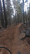
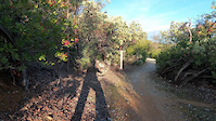
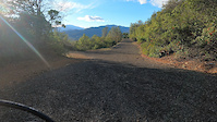
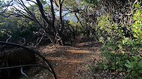
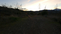
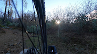
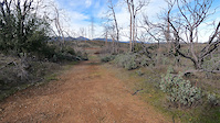
Photos of Shasta Cascade Mountain Bike
Videos of Shasta Cascade Mountain Bike
0:31 |
193 |
Nov 15, 2025
trail: Hornbeck (South Cutoff)
3:44 |
9 |
Jan 7, 2024
trail: Icognito
4:43 |
61 |
Jan 7, 2024
trail: Icognito
0:32 |
4 |
Jan 7, 2024
trail: FB (Lower)
6:05 |
13 |
Jan 7, 2024
trail: Icebox
4:02 |
34 |
Jan 6, 2024
trail: Nutter Butter Downhill
0:40 |
52 |
Jan 4, 2024
trail: Lower Salt Creek
7:32 |
31 |
Jan 2, 2024
Recent Trail Reports
Activity Feed
| username | action | type | title | date |
|---|---|---|---|---|
| sicE4t | wishlist | trail | activity #97292528 | Jun 18, 2026 @ 7:49pm 7 hours |
| AlbertgzsHLF | checkin | trail | activity #97287191 | Jun 18, 2026 @ 5:59pm 9 hours |
| AlbertgzsHLF | ridden | trail | activity #97287177 | Jun 18, 2026 @ 5:59pm 9 hours |
| Chicomecha | comment | route | activity #97276729 | Jun 18, 2026 @ 2:37pm 12 hours |
| Chicomecha | add | report | activity #97276615 | Jun 18, 2026 @ 2:35pm 12 hours |
Recent Comments
| username | type | title | comment | date |
|---|---|---|---|---|
| trail | needs some drainage, could be rad | Jun 15, 2026 @ 12:44pm Jun 15, 2026 | ||
| trail | Amazing Forrest and flowing creek. | Jun 7, 2026 @ 9:23pm Jun 7, 2026 | ||
| trail | The section from 40D1 down to Dozed Animal is... | Jun 5, 2026 @ 3:09pm Jun 5, 2026 | ||
| trail | t | May 31, 2026 @ 5:16pm May 31, 2026 | ||
| trail | This rail trail was not one of the best. The... | May 30, 2026 @ 2:40pm May 30, 2026 |
Local Badges
-

10 Green Trails70 awarded -

10 Blue Trails3 awarded -
10 Green Trails2 awarded -

Completionist0 awarded -

Top 10 Trails0 awarded -
Completionist0 awarded
Bike & Skill Parks
| name | type | city | rating |
|---|---|---|---|
| Mount Shasta Ski Park | bike park | Mount Shasta | |
| Caldwell Junior Bike Park | skill park | Redding | |
| Shastice Bike Park | skill park | ||
| Wildwood Pump Park | skill park | Chico | |
| Anderson Pump Track | skill park | Anderson |
Upcoming Local Events
Local Trail Supporters
- Weaver Basin Trail Committee
![]()
![Great Shasta Rail Trail]()
![]()
- Mount Shasta Trail Association
![BLM]()
![]()
![]()
![Shimano]()
![Nat. Rec. Trail]()
Local Trail Supporters
- Weaver Basin Trail Committee
![]()
![Great Shasta Rail Trail]()
![]()
- Mount Shasta Trail Association
![BLM]()
![]()
![]()
![Shimano]()
![Nat. Rec. Trail]()
Activity Type Stats
| activitytype | trails | distance | descent | descent distance | total vertical | rating | global rank | state rank | photos | reports | routes | ridelogs |
|---|---|---|---|---|---|---|---|---|---|---|---|---|
| Mountain Bike | 811 | 1,207 miles | 187,156 ft | 515 miles | 7,844 ft | 1,811 | 6,005 | 250 | 137,234 | |||
| E-Bike | 237 | 373 miles | 60,935 ft | 160 miles | 7,749 ft | 4 | 3,276 | 102 | 5,665 | |||
| Gravel Bike | 97 | 193 miles | 17,487 ft | 81 miles | 6,434 ft | 791 | 70 | 1,269 | ||||
| Adaptive Bike | 1 | 98 | 9 | |||||||||
| Winter Fat Bike | 1 | 109 | 5 | 2 | ||||||||
| Horse | 579 | 1,995 miles | 312,500 ft | 748 miles | 9,190 ft | 1,483 | 47 | 72 | ||||
| Hike | 1,406 | 3,313 miles | 530,925 ft | 1,270 miles | 13,980 ft | 128 | 5,917 | 379 | 12,944 | |||
| Trail Running | 1,359 | 3,248 miles | 524,967 ft | 1,258 miles | 13,980 ft | 25 | 5,917 | 210 | 11,083 | |||
| Dirtbike/Moto | 45 | 133 miles | 19,636 ft | 48 miles | 7,356 ft | 6 | 1,171 | 5 | 133 | |||
| ATV/ORV/OHV | 32 | 81 miles | 14,790 ft | 30 miles | 7,329 ft | 1,174 | 6 | 26 | ||||
| Snowshoe | 15 | 21 miles | 584 ft | 2 miles | 9,826 ft | 3 | 2 | 2 | 223 | |||
| Downhill Ski | 46 | 21 miles | 19,094 ft | 19 miles | 2,221 ft | 5 | 1 | 1,376 | ||||
| Backcountry Ski | 2 | 5 miles | 75 ft | 3,701 ft | 1 | 1 | 1 | 1,896 | ||||
| Nordic Ski | 25 | 18 miles | 889 ft | 5 miles | 1,424 ft | 18 | 2 | 414 |
Activities
- Shasta Cascade Mountain Biking Trails
- Shasta Cascade E-Biking Trails
- Shasta Cascade Gravel Biking Trails
- Shasta Cascade Horseback Trails
- Shasta Cascade Hiking Trails
- Shasta Cascade Trail Running Trails
- Shasta Cascade Dirtbiking Trails
- Shasta Cascade ATVing/Offroading Trails
- Shasta Cascade Snowshoeing Trails
- Shasta Cascade Skiing Trails
- Shasta Cascade Nordic Skiing Trails
Trails
Points of Interest
- By brenthillier
 NSMBA TRAILFORKS & contributors
 - Admins: jpmcghee, sanfret, brianpetry
- #7887 - 6,700 views
- shasta cascade activity log | embed map of Shasta Cascade mountain bike trails | shasta cascade mountain biking points of interest polygons
Downloading of trail gps tracks in kml & gpx formats is enabled for Shasta Cascade.
You must login to download files.