close
-
Layers w
- Weather Layers
- Pro
- Pro
- Pro
- Pro
- Pro
- Pro
- More Layers
- Pro
- Pro
- Pro
- Pro
-
Upgrade to

3D
Trail Conditions
- Unknown
- Snow Groomed
- Snow Packed
- Snow Covered
- Snow Cover Partial
- Freeze/thaw Cycle
- Icy
- Prevalent Mud
- Wet
- Variable
- Ideal
- Dry
- Very Dry
Trail Flow (Ridden Direction)
Trailforks scans users ridelogs to determine the most popular direction each trail is ridden. A good flowing trail network will have most trails flowing in a single direction according to their intension.
The colour categories are based on what percentage of riders are riding a trail in its intended direction.
The colour categories are based on what percentage of riders are riding a trail in its intended direction.
- > 96%
- > 90%
- > 80%
- > 70%
- > 50%
- < 50%
- bi-directional trail
- no data
Trail Last Ridden
Trailforks scans ridelogs to determine the last time a trail was ridden.
- < 2 days
- < 1 week
- < 2 weeks
- < 1 month
- < 6 months
- > 6 months
Trail Ridden Direction
The intended direction a trail should be ridden.
- Downhill Only
- Downhill Primary
- Both Directions
- Uphill Primary
- Uphill Only
- One Direction
Contribute Details
Colors indicate trail is missing specified detail.
- Description
- Photos
- Description & Photos
- Videos
Trail Popularity ?
Trailforks scans ridelogs to determine which trails are ridden the most in the last 9 months.
Trails are compared with nearby trails in the same city region with a possible 25 colour shades.
Think of this as a heatmap, more rides = more kinetic energy = warmer colors.
- most popular
- popular
- less popular
- not popular
ATV/ORV/OHV Filter
Max Vehicle Width
inches
US Cell Coverage
Legend

Radar Time
Activity Recordings
Trailforks uses anonymized public activity data.
?
Activity Recordings
Trailforks uses anonymized public activity data.
?
Personal Heatmap
▶
Activity Types
all
/
none
▶
Options
2
Date range
month
–
Winter Trails
Warning
A routing network for winter maps does not exist. Selecting trails using the winter trails layer has been disabled.
Missing Trails
Most Popular
Least Popular
Trails are colored based on popularity. The more popular a trail is, the more red. Less popular trails trend towards green.
Jump Magnitude Heatmap
Heatmap of where riders jump on trails. Zoom in to see individual jumps, click circles to view jump details.
BC Backroad Status
![map legend]()
Service Road Atlas is a free to use, community-driven service for viewing and creating reports on the numerous back-country service roads around B.C. and Alberta.

Slope Aspect
Direction the slope faces
Trails Deemphasized
Trails are shown in grey.
Only show trails with no bike usage.
Suggested Layers
Based on selected activity type
Save the current map location and zoom level as your default home location whenever this page is loaded.
Save
No description for Sheffield has been added yet!
Login or register to submit one.
This region uses the Uk/Euro style trail grading system.
Activities Click to view
- Mountain Bike
260 trails
- E-Bike
194 trails
- Gravel Bike
0 trails
- Adaptive Bike
0 trails
- Winter Fat Bike
0 trails
- Horse
2 trails
- Hike
185 trails
- Trail Running
185 trails
- Dirtbike/Moto
0 trails
- Observed Trials
0 trails
- ATV/ORV/OHV
0 trails
Region Details
- 65
- 14
- 32
- 47
- 25
Region Status
Caution as of Jun 19, 2026Local Trail Association
Stats
- Avg Trail Rating
- Trails (view details)
- 184
- Trails Mountain Bike
- 262
- Trails E-Bike
- 194
- Trails Horse
- 2
- Trails Hike
- 185
- Trails Trail Running
- 185
- Trails Snowmobile
- 2
- Total Distance
- 102 miles
- Total Descent
- 18,275 ft
- Total Vertical
- 1,579 ft
- Highest Trailhead
- 1,716 ft
- Reports
- 3,147
- Photos
- 1,092
- Ridden Counter
- 53,393
Articles
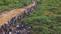
Event Recap: Bolehills BMX Opening Jam 2025
May 28, 2025 from pinkbike.com
BMXers and MTBs alike took to the freshly rebuilt jumps for some fun.
Sheffield's Steel City Downhill Track has Been Vandalised
Apr 20, 2020 from pinkbike.com
Steve Peat has revealed on Instagram that the Steel City Downhill track has been partly destroyed by vandals over the past weekend.
Video: The New Calibre Triple B Tackles Sheffield's Finest Riding Spots
Oct 14, 2019 from pinkbike.com
The updated Triple B proves it's a do-it-all bike in this clean edit.
Sub Regions
-
Beeley Wood
- 2
- 3
- 2
-
Greno Woods
- 2
- 1
-
Lady Cannings Plantation
- 1
- 1
-
Parkwood Springs
- 1
- 5
- 4
-
Rother Valley Country Park
- 4
- 1
-
Wharncliffe Woods
- 1
- 1
- 18
- 19
Popular Sheffield Mountain Biking Trails
• 75 ★ 3.8 • 1 mile • 532 ft • 924 • • hike
From Ladybower Reservoir follow the road across the dam on tarmac; and becomes a dirt track, look for a gate on the left hand side for a path made of slabs - take this. Try to ride all the way to the barn! Continue up the spectacular...
• 95 ★ 4.1 • 2,513 ft • 0 ft • 889 •
The Steel City DH race track was created in 2012 specifically for Peatys Steel City DH race. With permission from the Wildlife Trust a new trail was constructed by BikeTrack.org and paid for completely by funds raised from the first...
• 95 ★ 3.8 • 3,665 ft • 15 ft • 874 •
Popular red difficulty singletrack. This mountain bike primary trail can be used downhill only. It features berm and jump. On average it takes 4 minutes to complete this trail.
• 75 ★ 3.5 • 4,436 ft • 217 ft • 780 •
Popular blue difficulty singletrack. This mountain bike primary trail can be used both directions. On average it takes 14 minutes to complete this trail.
• 60 ★ 4.2 • 1 mile • 0 ft • 755 • • hike
Wide dirt descent from or take the left fork before the bridge to get to the Ladybower Inn. This has been upgraded in the last year to be weatherproof in the lower sections. The higher sections have been maintained by Peak District MTB:...
• 85 ★ 0.0 • 1 mile • 299 ft • 728 • • hike
Popular red difficulty singletrack. This hike primary trail can be used both directions. On average it takes 21 minutes to complete this trail.
• 85 ★ 3.9 • 4,895 ft • 6 ft • 726 •
A lot of fun, longer and more features than
• 65 ★ 3.8 • 1 mile • 148 ft • 704 • • hike
A section that starts off mellow ad fairly flat before tipping into a boulder strewn rock garden descent. Make sure your saddle is down!
Sheffield Mountain Bike Routes
Best of Wharncliffe & Greno (Short) Featured
9 miles • 1,557 ft • 15 • Loop •
Taking in Steel City Downhill, and some of Wharncliffe's best trails.
★ 3.8 • 18 miles • 1,867 ft • 0 • Loop •
Take in some of the sights Ladybower has to offer. From gruelling technical climbs to electric descents....
★ 5.0 • 9 miles • 996 ft • 3 • Loop •
Loop taking in Lady Cannings and Piper House Gate
9 miles • 1,150 ft • 5 • Loop •
Loop starting from the Bottom of Greno Woods the Loop goes up to the Car park and down into Wharncliffe,...
19 miles • 1,095 ft • 3 •
A route that I have found on the Web and now transfered this over to this website in the hope that it will...
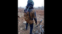
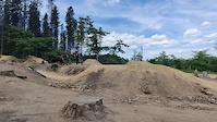
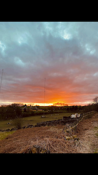
Photos of Sheffield Mountain Bike
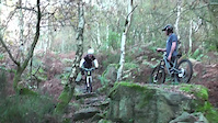
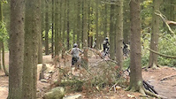
Videos of Sheffield Mountain Bike
trail: Fast Track Wharncliffe
2:27 |
112 |
Mar 14, 2025
trail: Wharncouver
0:13 |
128 |
Dec 16, 2024
trail: Crags
0:13 |
59 |
Oct 27, 2024
trail: Steel City DH Track
0:09 |
119 |
Oct 13, 2024
trail: Peaty's
2:16 |
174 |
Sep 26, 2023
trail: Steel City DH Track
0:40 |
|
Mar 10, 2023
trail: Steel City DH Track
0:06 |
261 |
Jun 25, 2022
trail: Steel City DH Track
0:23 |
77 |
Mar 23, 2022
Recent Trail Reports
| status | trail | date | condition | info | user |
|---|---|---|---|---|---|
| Fergs Varsity | Jun 11, 2026 @ 1:58pm (Europe/London) Jun 11, 2026 | Wet | Strong-mtb | ||
| Ladybower Inn to Cut-throat bridge | Jun 5, 2026 @ 9:25am (Europe/London) Jun 5, 2026 | Ideal | ThexMiniman | ||
| Death by Digpit | Jun 5, 2026 @ 4:35pm (Europe/Isle_of_Man) Jun 5, 2026 | Dry | weridemtbskillscoaching | ||
| Rake and Bake | Jun 5, 2026 @ 4:35pm (Europe/Isle_of_Man) Jun 5, 2026 | Dry | weridemtbskillscoaching | ||
| Bridleway | Jun 5, 2026 @ 4:35pm (Europe/Isle_of_Man) Jun 5, 2026 | Dry | weridemtbskillscoaching | ||
| Steel City DH Track | Jun 3, 2026 @ 9:21am (Europe/Isle_of_Man) Jun 3, 2026 | Dry | weridemtbskillscoaching | ||
| DH3 | Jun 3, 2026 @ 9:21am (Europe/Isle_of_Man) Jun 3, 2026 | Dry | weridemtbskillscoaching | ||
| Pub Run | Jun 3, 2026 @ 9:21am (Europe/Isle_of_Man) Jun 3, 2026 | Dry | weridemtbskillscoaching | ||
| Cutgate to Fairholmes | May 18, 2026 @ 9:02am (Europe/Isle_of_Man) May 18, 2026 | Wet | willmidds123 | ||
| Sandygate Climb | May 5, 2026 @ 9:19pm (Europe/London) May 5, 2026 | Ideal | JWSkierMTBHike |
Activity Feed
| username | action | type | title | date |
|---|---|---|---|---|
| Mookarts | wishlist | route | activity #97426990 | Jun 20, 2026 @ 1:15pm 2 days |
| steelcitydh | add | photo | activity #97116963 | Jun 16, 2026 @ 9:32am Jun 16, 2026 |
| sigibbo | ridden | trail | activity #96858335 | Jun 13, 2026 @ 3:15am Jun 13, 2026 |
| navhussain | wishlist | trail | activity #96839309 | Jun 12, 2026 @ 5:43pm Jun 12, 2026 |
| Strong-mtb | add | report | activity #96731720 | Jun 11, 2026 @ 5:58am Jun 11, 2026 |
Recent Comments
| username | type | title | comment | date |
|---|---|---|---|---|
| trail | Yes | Nov 9, 2025 @ 10:49am Nov 9, 2025 | ||
| trail | Not a bridleway | Jul 31, 2025 @ 12:23pm Jul 31, 2025 | ||
| trail | Not a bridleway | Jul 31, 2025 @ 12:23pm Jul 31, 2025 | ||
| trail | Not a bridleway | Jul 31, 2025 @ 12:23pm Jul 31, 2025 | ||
| trail | The loose rocks seem to be increasing every... | Jun 19, 2025 @ 3:39am Jun 19, 2025 |
Local Badges
-

Epic Ride Climb 2k156 awarded -

Climbing 10k Badge226 awarded -

Climbing 100k Badge16 awarded -

Epic Ride Descent 2k164 awarded -

Descent 10k Badge226 awarded -

Descent 100k Badge16 awarded
Bike & Skill Parks
| name | type | city | rating |
|---|---|---|---|
| Charnock Pumptrack & Dirt Jumps | skill park | Sheffield | |
| Bolehills BMX Track | skill park | Sheffield | |
| Kimberworth BMX Track | skill park | Sheffield | |
| Totley Hall Pumptrack | skill park | Sheffield | |
| Wincobank Pumptrack | skill park | Sheffield |
Activity Type Stats
| activitytype | trails | distance | descent | descent distance | total vertical | rating | global rank | state rank | photos | reports | routes | ridelogs |
|---|---|---|---|---|---|---|---|---|---|---|---|---|
| Mountain Bike | 260 | 102 miles | 18,274 ft | 51 miles | 1,578 ft | #368 | #15 | 1,080 | 3,142 | 13 | 43,265 | |
| E-Bike | 194 | 89 miles | 14,662 ft | 44 miles | 1,578 ft | #139 | #15 | 12 | 2,947 | 5 | 6,258 | |
| Horse | 2 | 371 ft | 20 ft | 338 ft | 20 ft | #270 | #16 | 869 | ||||
| Hike | 185 | 94 miles | 15,030 ft | 45 miles | 1,578 ft | #976 | #27 | 2,981 | 1 | 1,247 | ||
| Trail Running | 185 | 94 miles | 15,030 ft | 45 miles | 1,578 ft | #707 | #25 | 2,982 | 1 | 1,387 | ||
| Snowmobile | 2 | 1,220 ft | 167 ft | 1,047 ft | 171 ft |
Frequently Asked Questions About Sheffield
▼
What are the best places to ride in Sheffield?
Sheffield has 7 areas to explore for mountain biking. The top rated areas are:
▼
What are the highest rated mountain biking trails in Sheffield?
The highest rated mountain biking trails in Sheffield are:
- Devils Elbow (4.5/5)
- Vajazzle (4.3/5)
- Fort Elbow (4.3/5)
- Snake (4.2/5)
- Drifthill's Downhill (4.2/5)
▼
What is the best time of the year to ride in Sheffield?
Based on ride log data, the most popular months to ride in Sheffield are:
- July (135 activities)
- May (72 activities)
- August (64 activities)
▼
Where can I park to ride in Sheffield?
There are 14 parking locations listed in Sheffield. The most popular parking spots are: View all parking and trailhead locations on the map to plan your visit.
Activities
Trails
Points of Interest
- By bennybanzai RS & contributors
- Admins: wisey, MathieuC, cemoorelife, RS, bigbluebike
- #4238 - 20,841 views
- sheffield activity log | embed map of Sheffield mountain bike trails | sheffield mountain biking points of interest polygons
Downloading of trail gps tracks in kml & gpx formats is enabled for Sheffield.
You must login to download files.