close
-
Layers w
- Weather Layers
- Pro
- Pro
- Pro
- Pro
- Pro
- Pro
- More Layers
- Pro
- Pro
- Pro
- Pro
-
Upgrade to

3D
Trail Conditions
- Unknown
- Snow Groomed
- Snow Packed
- Snow Covered
- Snow Cover Partial
- Freeze/thaw Cycle
- Icy
- Prevalent Mud
- Wet
- Variable
- Ideal
- Dry
- Very Dry
Trail Flow (Ridden Direction)
Trailforks scans users ridelogs to determine the most popular direction each trail is ridden. A good flowing trail network will have most trails flowing in a single direction according to their intension.
The colour categories are based on what percentage of riders are riding a trail in its intended direction.
The colour categories are based on what percentage of riders are riding a trail in its intended direction.
- > 96%
- > 90%
- > 80%
- > 70%
- > 50%
- < 50%
- bi-directional trail
- no data
Trail Last Ridden
Trailforks scans ridelogs to determine the last time a trail was ridden.
- < 2 days
- < 1 week
- < 2 weeks
- < 1 month
- < 6 months
- > 6 months
Trail Ridden Direction
The intended direction a trail should be ridden.
- Downhill Only
- Downhill Primary
- Both Directions
- Uphill Primary
- Uphill Only
- One Direction
Contribute Details
Colors indicate trail is missing specified detail.
- Description
- Photos
- Description & Photos
- Videos
Trail Popularity ?
Trailforks scans ridelogs to determine which trails are ridden the most in the last 9 months.
Trails are compared with nearby trails in the same city region with a possible 25 colour shades.
Think of this as a heatmap, more rides = more kinetic energy = warmer colors.
- most popular
- popular
- less popular
- not popular
ATV/ORV/OHV Filter
Max Vehicle Width
inches
US Cell Coverage
Legend

Radar Time
Activity Recordings
Trailforks uses anonymized public activity data.
?
Activity Recordings
Trailforks uses anonymized public activity data.
?
Personal Heatmap
▶
Activity Types
all
/
none
▶
Options
2
Date range
month
–
Winter Trails
Warning
A routing network for winter maps does not exist. Selecting trails using the winter trails layer has been disabled.
Missing Trails
Most Popular
Least Popular
Trails are colored based on popularity. The more popular a trail is, the more red. Less popular trails trend towards green.
Jump Magnitude Heatmap
Heatmap of where riders jump on trails. Zoom in to see individual jumps, click circles to view jump details.
BC Backroad Status
![map legend]()
Service Road Atlas is a free to use, community-driven service for viewing and creating reports on the numerous back-country service roads around B.C. and Alberta.

Slope Aspect
Direction the slope faces
Trails Deemphasized
Trails are shown in grey.
Only show trails with no bike usage.
Suggested Layers
Based on selected activity type
Save the current map location and zoom level as your default home location whenever this page is loaded.
SaveThe Town of Sherborn is host to an extensive network of multi-use trails spanning a number of conservation spaces and private properties. The Sherborn Forest and Trail Association is responsible for curating the trail networks in the town. (see links)
Note: Alterations to existing trails, or creation of any new trails, on any public-use land in Sherborn, including Sherborn conservation land and town forest land, is not allowed without explicit permission.
Please contact [email protected] if you are interested in building and/or maintaining trails. Thank you.
Links
Activities Click to view
- Mountain Bike
250 trails
- Winter Fat Bike
0 trails
- Horse
238 trails
- Hike
253 trails
- Trail Running
253 trails
- Snowshoe
3 trails
- Nordic Ski
2 trails
Region Details
- 33
- 66
- 143
- 3
Region Status
Caution as of Jun 13, 2026Stats
- Avg Trail Rating
- Trails (view details)
- 248
- Trails Mountain Bike
- 250
- Trails Horse
- 238
- Trails Hike
- 253
- Trails Trail Running
- 253
- Trails Snowshoe
- 3
- Trails Nordic Ski
- 2
- Total Distance
- 61 miles
- Total Descent
- 5,498 ft
- Total Vertical
- 283 ft
- Highest Trailhead
- 394 ft
- Reports
- 1,927
- Photos
- 1,814
- Ridden Counter
- 15,172
Articles
The 5 Best New Thru-Hikes to Start Planning Now
Jan 4, 2022 from backpacker.com
Start planning to hike these in-progress U.S. trails in 2022.
Sub Regions
-
Bailey
- 10
-
Barber Reservation
- 17
- 3
-
Bogastow
-
Course Brook
- 6
-
Farm Pond
- 5
-
Hidden Meadow
- 3
- 3
-
Hildreth Schoolhouse
- 1
- 7
-
Laurel Farm
-
Leland Mill Pond Reservation
-
McGregor Quarry
- 6
-
Nason Hill Woods
- 7
-
Pine Hill Cemetery and Ward Parks Pond
- 1
- 4
- 1
-
Price Woodlands
-
Rockwell Woods
- 3
- 1
-
Rocky Narrows
- 1
- 36
-
Sewall Brook
- 5
- 3
-
Sherborn Town Forest - Central
- 14
- 18
-
Sherborn Town Forest - North
- 2
- 16
-
Sherborn Town Forest - South
- 8
- 16
-
Stongate Field
Popular Sherborn Mountain Biking Trails
• 100 ★ 0.0 • 1,322 ft • 57 ft • 212 •
Popular green difficulty family friendly singletrack. This multi-use trail can be used both directions and has a easy overall physical rating with a 57 ft green climb. Trail visibility is always easy to follow. On average it takes 2 minutes to complete this trail.
• 90 ★ 0.0 • 505 ft • 6 ft • 198 •
Popular blue difficulty singletrack. This multi-use trail can be used both directions and has a moderate overall physical rating with a 6 ft blue climb. Trail visibility is sometimes hard to follow. On average it takes minutes to complete this trail.
• 100 ★ 4.0 • 3,563 ft • 60 ft • 193 •
Popular black diamond difficulty singletrack. This mountain bike primary trail can be used both directions. It features drop, jump, rock face and skinny. On average it takes 8 minutes to complete this trail.
• 100 ★ 4.0 • 2,303 ft • 31 ft • 187 •
Popular blue difficulty singletrack. This mountain bike primary trail can be used both directions. On average it takes 5 minutes to complete this trail.
• 90 ★ 0.0 • 918 ft • 14 ft • 179 •
Popular blue difficulty singletrack. This multi-use trail can be used both directions and has a moderate overall physical rating with a 14 ft blue climb. Trail visibility is always easy to follow. On average it takes 3 minutes to complete this trail.
• 100 ★ 0.0 • 666 ft • 9 ft • 172 •
Popular blue difficulty family friendly singletrack. This multi-use trail can be used both directions and has a moderate overall physical rating with a 9 ft green climb. Trail visibility is always easy to follow. On average it takes 1 minutes to complete this trail.
• 100 ★ 0.0 • 1,066 ft • 28 ft • 172 •
Popular blue difficulty family friendly singletrack. This multi-use trail can be used both directions and has a easy overall physical rating with a 28 ft green climb. Trail visibility is always easy to follow. On average it takes 2 minutes to complete this trail.
Sherborn Mountain Bike Routes
Bay Circuit Trail - Sherborn Section Featured
★ 4.0 • 11 miles • 859 ft • 46 • Point to Point •
The Bay Circuit Trail is a route that circles Boston between Rout 128 and Route 495. The Trail starts at...
Tour De Sherborn Mountain Bike Route Featured
15 miles • 1,096 ft • 1 • Loop •
This is Steve The Bike Guy's Tour de Sherborn map, starting and ending on the Charles River Rail Trail and...
22 miles • 1,208 ft • 46 • Point to Point •
This route is the BCT Bike Route from Medfield to Sharon, which mostly follows the main hiking BCT. It is...
5 miles • 449 ft • 13 • Loop • Race •
This is the route for the SherbDuro (sherborn enduro) to help raise funds for Dover-Sherborn High School's...
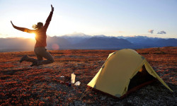
Photos of Sherborn Mountain Bike
Current Trail Warnings
| status | trail | date | condition | user | info |
|---|---|---|---|---|---|
| B4 Bailey West | Jun 7, 2026 @ 9:03am (America/New_York) Jun 7, 2026 | Unknown | rleeman SFTA | ||
| B1 Bailey East | Jun 7, 2026 @ 8:55am (America/New_York) Jun 7, 2026 | Unknown | rleeman SFTA | ||
| SB6 Cart Path | Jun 3, 2026 @ 5:35pm (America/New_York) Jun 3, 2026 | Unknown | Kfrankel |
Recent Trail Reports
| status | trail | date | condition | info | user |
|---|---|---|---|---|---|
| NHW2 Main | Jun 13, 2026 @ 8:56am (America/New_York) Jun 13, 2026 | Unknown | rthomson19 | ||
| B2 Cross Bailey | Jun 12, 2026 @ 10:39am (America/New_York) Jun 12, 2026 | Unknown | rleeman SFTA | ||
| RN25 | May 22, 2026 @ 2:59pm (America/New_York) May 22, 2026 | Unknown | Kfrankel | ||
| RN2 Orange | May 20, 2026 @ 7:00pm (America/New_York) May 20, 2026 | Unknown | Kfrankel | ||
| Farm Tech | May 20, 2026 @ 5:36pm (America/New_York) May 20, 2026 | Unknown | Kfrankel | ||
| BR 21 Power Line Access Road (Whitney Rd North) | May 18, 2026 @ 5:50pm (America/New_York) May 18, 2026 | Unknown | Kfrankel | ||
| STF S5 | May 16, 2026 @ 5:34pm (America/New_York) May 16, 2026 | Dry | Donhov | ||
| RN15 King Phillip's Overlook | May 1, 2026 @ 12:24pm (America/New_York) May 1, 2026 | Dry | robertwolff2 | ||
| RN6 | May 1, 2026 @ 12:23pm (America/New_York) May 1, 2026 | Dry | robertwolff2 | ||
| RN5 | May 1, 2026 @ 12:19pm (America/New_York) May 1, 2026 | Dry | robertwolff2 |
Activity Feed
| username | action | type | title | date |
|---|---|---|---|---|
| sethm375 | update | region | activity #97054603 | Jun 15, 2026 @ 11:18am 3 days |
| SeanQXkKEk | wishlist | region | activity #97043058 | Jun 15, 2026 @ 8:26am 3 days |
| rthomson19 | add | report | activity #96867445 | Jun 13, 2026 @ 5:56am Jun 13, 2026 |
| rleeman | add | report | activity #96803182 | Jun 12, 2026 @ 7:39am Jun 12, 2026 |
| rleeman | add | photo | activity #96802526 and 1 more | Jun 12, 2026 @ 7:28am Jun 12, 2026 |
Recent Comments
| username | type | title | comment | date |
|---|---|---|---|---|
| report | Multiple logs in trail a foot plus in diameter | Jan 24, 2026 @ 9:34am Jan 24, 2026 | ||
| report | This one is clear | Dec 25, 2025 @ 10:28am Dec 25, 2025 | ||
| report | Tried loading a picture but it will not take it. | Nov 2, 2025 @ 12:49pm Nov 2, 2025 | ||
| report | Big tree blocking path | Sep 11, 2025 @ 12:54pm Sep 11, 2025 | ||
| trail | If cleaned up a bit, the upper part of this... | Jul 5, 2025 @ 6:33pm Jul 5, 2025 |
Local Badges
-
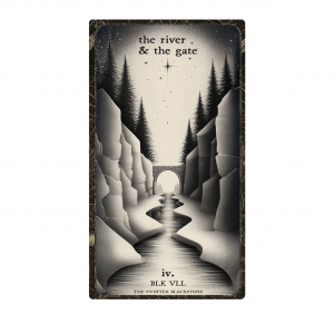
The VVinter Blackstone '25 - The River & The Gate5 awarded -

Descent 100k Badge1 awarded -

Descent 10k Badge40 awarded -

Big Ride 30k1,738 awarded -

Epic Ride 50k677 awarded -

Completionist0 awarded
Activity Type Stats
| activitytype | trails | distance | descent | descent distance | total vertical | rating | global rank | state rank | photos | reports | routes | ridelogs |
|---|---|---|---|---|---|---|---|---|---|---|---|---|
| Mountain Bike | 250 | 60 miles | 5,440 ft | 23 miles | 282 ft | #1,473 | #555 | 1,637 | 1,933 | 7 | 8,015 | |
| Horse | 238 | 57 miles | 5,075 ft | 21 miles | 282 ft | #549 | #515 | 1,613 | 1 | |||
| Hike | 253 | 61 miles | 5,499 ft | 23 miles | 282 ft | #1,504 | #678 | 155 | 1,933 | 4 | 430 | |
| Trail Running | 253 | 61 miles | 5,499 ft | 23 miles | 282 ft | #1,088 | #398 | 33 | 1,933 | 1 | 838 | |
| Snowshoe | 3 | 4,902 ft | 190 ft | 3,796 ft | 125 ft | #1,495 | #839 | 288 | 26 | |||
| Nordic Ski | 2 | 1,171 ft | 72 ft | 1,171 ft | 72 ft | #1,827 | #958 | 273 | 194 |
Frequently Asked Questions About Sherborn
▼
What are the best places to ride in Sherborn?
Sherborn has 21 areas to explore for mountain biking. The top rated areas are:
▼
What are the highest rated mountain biking trails in Sherborn?
The highest rated mountain biking trails in Sherborn are:
- Misery Loves Company (4.2/5)
- RN23 (4.1/5)
- STF S17 (4.1/5)
- Pine Thrill (4/5)
- Extended Day (4/5)
▼
What is the best time of the year to ride in Sherborn?
Based on ride log data, the most popular months to ride in Sherborn are:
- August (78 activities)
- July (70 activities)
- September (57 activities)
▼
Where can I park to ride in Sherborn?
There are 22 parking locations listed in Sherborn. The most popular parking spots are:
- Rocky Narrows Parking Area
- Sewell Brook Trail Parking
- Barber Reservation Parking
- N Main Str Parking
- Farm Pond Parking
Activities
Trails
- By WillieJacobsz
 Trailforks SBP SWW & contributors
 - Admins: SFTA, BVNEMBA Region, BVNEMBA Admins
- #14144 - 7,787 views
- sherborn activity log | embed map of Sherborn mountain bike trails | sherborn mountain biking points of interest
Downloading of trail gps tracks in kml & gpx formats is enabled for Sherborn.
You must login to download files.