close
-
Layers w
- Weather Layers
- Pro
- Pro
- Pro
- Pro
- Pro
- Pro
- More Layers
- Pro
- Pro
- Pro
- Pro
-
Upgrade to

3D
Trail Conditions
- Unknown
- Snow Groomed
- Snow Packed
- Snow Covered
- Snow Cover Partial
- Freeze/thaw Cycle
- Icy
- Prevalent Mud
- Wet
- Variable
- Ideal
- Dry
- Very Dry
Trail Flow (Ridden Direction)
Trailforks scans users ridelogs to determine the most popular direction each trail is ridden. A good flowing trail network will have most trails flowing in a single direction according to their intension.
The colour categories are based on what percentage of riders are riding a trail in its intended direction.
The colour categories are based on what percentage of riders are riding a trail in its intended direction.
- > 96%
- > 90%
- > 80%
- > 70%
- > 50%
- < 50%
- bi-directional trail
- no data
Trail Last Ridden
Trailforks scans ridelogs to determine the last time a trail was ridden.
- < 2 days
- < 1 week
- < 2 weeks
- < 1 month
- < 6 months
- > 6 months
Trail Ridden Direction
The intended direction a trail should be ridden.
- Downhill Only
- Downhill Primary
- Both Directions
- Uphill Primary
- Uphill Only
- One Direction
Contribute Details
Colors indicate trail is missing specified detail.
- Description
- Photos
- Description & Photos
- Videos
Trail Popularity ?
Trailforks scans ridelogs to determine which trails are ridden the most in the last 9 months.
Trails are compared with nearby trails in the same city region with a possible 25 colour shades.
Think of this as a heatmap, more rides = more kinetic energy = warmer colors.
- most popular
- popular
- less popular
- not popular
ATV/ORV/OHV Filter
Max Vehicle Width
inches
US Cell Coverage
Legend

Radar Time
Activity Recordings
Trailforks uses anonymized public activity data.
?
Activity Recordings
Trailforks uses anonymized public activity data.
?
Personal Heatmap
▶
Activity Types
all
/
none
▶
Options
2
Date range
month
–
Winter Trails
Warning
A routing network for winter maps does not exist. Selecting trails using the winter trails layer has been disabled.
Missing Trails
Most Popular
Least Popular
Trails are colored based on popularity. The more popular a trail is, the more red. Less popular trails trend towards green.
Jump Magnitude Heatmap
Heatmap of where riders jump on trails. Zoom in to see individual jumps, click circles to view jump details.
BC Backroad Status
![map legend]()
Service Road Atlas is a free to use, community-driven service for viewing and creating reports on the numerous back-country service roads around B.C. and Alberta.

Slope Aspect
Direction the slope faces
Trails Deemphasized
Trails are shown in grey.
Only show trails with no bike usage.
Suggested Layers
Based on selected activity type
Save the current map location and zoom level as your default home location whenever this page is loaded.
Save
No description for Sherbrooke has been added yet!
Login or register to submit one.
Activities Click to view
- Mountain Bike
75 trails
- E-Bike
20 trails
- Adaptive Bike
0 trails
- Winter Fat Bike
0 trails
- Horse
0 trails
- Hike
81 trails
- Trail Running
81 trails
- Dirtbike/Moto
0 trails
- ATV/ORV/OHV
0 trails
- Snowmobile
1 trails
- Snowshoe
20 trails
- Downhill Ski
0 trails
- Backcountry Ski
4 trails
- Nordic Ski
14 trails
Region Details
- 7
- 23
- 24
- 11
- 2
- 1
Region Status
Open as of Jun 3, 2026Local Trail Association
Stats
- Avg Trail Rating
- Trails (view details)
- 78
- Trails Mountain Bike
- 75
- Trails E-Bike
- 20
- Trails Hike
- 81
- Trails Trail Running
- 81
- Trails Snowmobile
- 1
- Trails Snowshoe
- 20
- Trails Backcountry Ski
- 4
- Trails Nordic Ski
- 14
- Total Distance
- 31 miles
- Total Descent
- 4,689 ft
- Total Vertical
- 721 ft
- Highest Trailhead
- 1,237 ft
- Reports
- 628
- Photos
- 60
- Ridden Counter
- 21,246
Sub Regions
-
Base de plein Air André Nadeau
- 6
- 1
- 1
-
Bois Beckett
- 1
-
Parc du Mont-Bellevue
- 6
- 15
- 19
- 8
- 2
- 1
-
SF Park
-
Zone Nature Dudswell
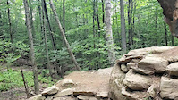
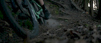
Popular Sherbrooke Mountain Biking Trails
• 95 ★ 4.2 • 2,011 ft • 84 ft • 772 •
Highly rated popular blue difficulty singletrack. This mountain bike primary trail can be used both directions. On average it takes 5 minutes to complete this trail.
• 100 ★ 4.2 • 1,037 ft • 4 ft • 768 •
Highly rated popular blue difficulty singletrack. This mountain bike primary trail can be used both directions. On average it takes 1 minutes to complete this trail.
• 100 ★ 2.7 • 591 ft • 0 ft • 755 •
Popular green difficulty singletrack. This mountain bike primary trail can be used downhill only. On average it takes minutes to complete this trail.
• 100 ★ 4.0 • 512 ft • 0 ft • 729 •
Popular black diamond difficulty singletrack. This mountain bike primary trail can be used downhill only. It features drop and jump. On average it takes 1 minutes to complete this trail.
• 95 ★ 3.5 • 463 ft • 0 ft • 719 •
Popular green difficulty singletrack. This mountain bike primary trail can be used downhill only. It features berm. On average it takes minutes to complete this trail.
• 95 ★ 0.0 • 689 ft • 48 ft • 717 •
Popular green difficulty singletrack. This mountain bike primary trail can be used both directions. On average it takes 1 minutes to complete this trail.
• 85 ★ 4.0 • 755 ft • 0 ft • 672 •
Popular blue difficulty singletrack. This mountain bike primary trail can be used downhill only. It features berm, drop and jump. On average it takes 1 minutes to complete this trail.
• 90 ★ 5.0 • 684 ft • 0 ft • 662 •
Popular blue difficulty singletrack. This mountain bike primary trail can be used downhill primary. On average it takes 1 minutes to complete this trail.
Sherbrooke Mountain Bike Routes
★ 5.0 • 5 miles • 834 ft • 13 • Loop •
Boucle classique du Mont Bellevue. Passe par la Kamikaze, Léandre, Zigzag (flow) et la (Naturelle)
★ 3.5 • 4 miles • 310 ft • 0 • Loop •
Single track dans le coin de l'antenne à Fleurimont. Roulable été comme hiver.
4 miles • 627 ft • 14 • Loop • Race •
COUPE QUÉBEC #2 ET #3 EN VÉLO DE MONTAGNE Quand : 25 et 26 juin 2016 Où : Mont Bellevue, Sherbrooke...
2 miles • 208 ft • 8 • Loop • Race •
COUPE QUÉBEC #2 ET #3 EN VÉLO DE MONTAGNE Quand : 25 et 26 juin 2016 Où : Mont Bellevue, Sherbrooke...
1 mile • 157 ft • 7 • Loop • Race •
COUPE QUÉBEC #2 ET #3 EN VÉLO DE MONTAGNE Quand : 25 et 26 juin 2016 Où : Mont Bellevue, Sherbrooke...
• 3 miles • 543 ft • 3 •
Photos of Sherbrooke Mountain Bike
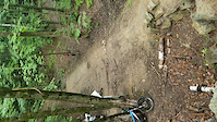
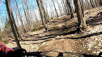
Videos of Sherbrooke Mountain Bike
trail: Kamikaze
0:16 |
288 |
Mar 21, 2021
trail: Kamikaze
2:38 |
177 |
Aug 3, 2020
trail: Kamikaze
0:20 |
285 |
Jul 12, 2020
trail: Phénomène Bacon
0:25 |
322 |
May 14, 2020

trail: Ravito
3:38 |
526 |
Apr 26, 2011
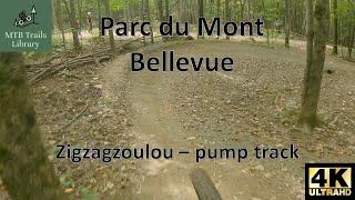
trail: Zigzagzoulou
0:01 |
276 |
Sep 25, 2023 , Sherbrooke

trail: Chicane
4:25 |
423 |
Sep 2, 2010

trail: Kick Ass
17:46 |
386 |
Aug 20, 2010
Recent Trail Reports
| status | trail | date | condition | info | user |
|---|---|---|---|---|---|
| Ligne de sauts | May 29, 2026 @ 11:18am (America/Toronto) May 29, 2026 | Ideal | Gingrama | ||
| Balasi | May 29, 2026 @ 11:18am (America/Toronto) May 29, 2026 | Ideal | Gingrama | ||
| Ravito | May 29, 2026 @ 11:18am (America/Toronto) May 29, 2026 | Ideal | Gingrama | ||
| Ceinture Multiusage Est | May 28, 2026 @ 4:21pm (America/Toronto) May 28, 2026 | Very Dry | Gingrama | ||
| Ceinture Multiusage Ouest | May 28, 2026 @ 4:21pm (America/Toronto) May 28, 2026 | Very Dry | Gingrama | ||
| CaO | Oct 15, 2025 @ 3:21pm (America/Toronto) Oct 15, 2025 | Variable | NicolasRMTB | ||
| La Chaux d'hier | Oct 15, 2025 @ 3:21pm (America/Toronto) Oct 15, 2025 | Variable | NicolasRMTB | ||
| 3 Berms | Jul 12, 2025 @ 10:03am Jul 12, 2025 | Ideal | nouveaumarc | ||
| Passe-Montagne | Jul 12, 2025 @ 10:03am Jul 12, 2025 | Ideal | nouveaumarc | ||
| The Rock intermédiaire | Jul 12, 2025 @ 10:03am Jul 12, 2025 | Variable | nouveaumarc |
Activity Feed
| username | action | type | title | date |
|---|---|---|---|---|
| Adderley75 | wishlist | region | activity #96977022 | Jun 14, 2026 @ 9:19am Jun 14, 2026 |
| marcpaquetteliveca | ridden | trail | activity #96630837 | Jun 9, 2026 @ 2:49pm Jun 9, 2026 |
| johnnywake | wishlist | trail | activity #96498768 | Jun 7, 2026 @ 2:41pm Jun 7, 2026 |
| ValerierjirOH | add | report | activity #96187737 | Jun 3, 2026 @ 4:19pm Jun 3, 2026 |
| Gingrama | add | report | activity #95794320 and 2 more | May 29, 2026 @ 12:11pm May 29, 2026 |
Recent Comments
| username | type | title | comment | date |
|---|---|---|---|---|
| trail | Some puddles yesterday | Jul 12, 2024 @ 6:37am Jul 12, 2024 | ||
| trail | Ça prend quelques occasions pour s'y... | Aug 13, 2020 @ 8:47pm Aug 13, 2020 | ||
| trail | Great circuit with lots of challenging... | Jun 22, 2020 @ 4:08pm Jun 22, 2020 | ||
| trail | Wicked! | Jun 22, 2020 @ 9:56am Jun 22, 2020 | ||
| trail | Tons of fun. | Jun 22, 2020 @ 9:56am Jun 22, 2020 |
Local Badges
-

10 Green Trails276 awarded -

10 Blue Trails295 awarded -

Epic Ride Climb 2k11 awarded -

Climbing 10k Badge88 awarded -

Climbing 100k Badge7 awarded -

Epic Ride Descent 2k10 awarded
Bike & Skill Parks
| name | type | city | rating |
|---|---|---|---|
| BMX Sherbrooke | skill park | Sherbrooke |
Activity Type Stats
| activitytype | trails | distance | descent | descent distance | total vertical | rating | global rank | state rank | photos | reports | routes | ridelogs |
|---|---|---|---|---|---|---|---|---|---|---|---|---|
| Mountain Bike | 75 | 25 miles | 3,930 ft | 11 miles | 722 ft | #631 | #9 | 58 | 628 | 5 | 26,408 | |
| E-Bike | 20 | 3 miles | 325 ft | 1 mile | 243 ft | #5,829 | #62 | 608 | 1 | 365 | ||
| Hike | 81 | 25 miles | 3,530 ft | 11 miles | 722 ft | #4,393 | #26 | 2 | 627 | 611 | ||
| Trail Running | 81 | 25 miles | 3,530 ft | 11 miles | 722 ft | #4,019 | #22 | 627 | 2,171 | |||
| Snowmobile | 1 | #305 | #2 | 3 | ||||||||
| Snowshoe | 20 | 5 miles | 561 ft | 2 miles | 377 ft | #903 | #36 | 59 | ||||
| Backcountry Ski | 4 | 2 miles | 289 ft | 5,072 ft | 233 ft | #531 | #19 | 68 | ||||
| Nordic Ski | 14 | 4 miles | 499 ft | 2 miles | 302 ft | #881 | #40 | 257 |
Frequently Asked Questions About Sherbrooke
▼
What are the best places to ride in Sherbrooke?
Sherbrooke has 6 areas to explore for mountain biking. The top rated areas are:
▼
What are the highest rated mountain biking trails in Sherbrooke?
The highest rated mountain biking trails in Sherbrooke are:
- Kamikaze (4.6/5)
- L'Épingle (4.3/5)
- L'express (4.2/5)
- Huit cents mètres (4.2/5)
- Brute (4.2/5)
▼
What is the best time of the year to ride in Sherbrooke?
Based on ride log data, the most popular months to ride in Sherbrooke are:
- August (313 activities)
- June (294 activities)
- July (266 activities)
▼
Where can I park to ride in Sherbrooke?
There are 6 parking locations listed in Sherbrooke. The most popular parking spots are:
- Stationnement - Entrée secondaire Dunant (Parking)
- Stationnement - Entrée principale (Parking)
- P2 - Stationnement / Parking
- P3 - Stationnement / Parking
- P1 - Stationnement / Parking
Activities
Trails
- By philbike04 & contributors
- Admins: VQ, bigjay, StephaneMarceau, Canadmos, Sherbrooke
- #5503 - 13,746 views
- sherbrooke activity log | embed map of Sherbrooke mountain bike trails | sherbrooke mountain biking points of interest polygons
Downloading of trail gps tracks in kml & gpx formats is enabled for Sherbrooke.
You must login to download files.