close
-
Layers w
- Weather Layers
- Pro
- Pro
- Pro
- Pro
- Pro
- Pro
- More Layers
- Pro
- Pro
- Pro
- Pro
-
Upgrade to

3D
Trail Conditions
- Unknown
- Snow Groomed
- Snow Packed
- Snow Covered
- Snow Cover Partial
- Freeze/thaw Cycle
- Icy
- Prevalent Mud
- Wet
- Variable
- Ideal
- Dry
- Very Dry
Trail Flow (Ridden Direction)
Trailforks scans users ridelogs to determine the most popular direction each trail is ridden. A good flowing trail network will have most trails flowing in a single direction according to their intension.
The colour categories are based on what percentage of riders are riding a trail in its intended direction.
The colour categories are based on what percentage of riders are riding a trail in its intended direction.
- > 96%
- > 90%
- > 80%
- > 70%
- > 50%
- < 50%
- bi-directional trail
- no data
Trail Last Ridden
Trailforks scans ridelogs to determine the last time a trail was ridden.
- < 2 days
- < 1 week
- < 2 weeks
- < 1 month
- < 6 months
- > 6 months
Trail Ridden Direction
The intended direction a trail should be ridden.
- Downhill Only
- Downhill Primary
- Both Directions
- Uphill Primary
- Uphill Only
- One Direction
Contribute Details
Colors indicate trail is missing specified detail.
- Description
- Photos
- Description & Photos
- Videos
Trail Popularity ?
Trailforks scans ridelogs to determine which trails are ridden the most in the last 9 months.
Trails are compared with nearby trails in the same city region with a possible 25 colour shades.
Think of this as a heatmap, more rides = more kinetic energy = warmer colors.
- most popular
- popular
- less popular
- not popular
ATV/ORV/OHV Filter
Max Vehicle Width
inches
US Cell Coverage
Legend

Radar Time
Activity Recordings
Trailforks uses anonymized public activity data.
?
Activity Recordings
Trailforks uses anonymized public activity data.
?
Personal Heatmap
▶
Activity Types
all
/
none
▶
Options
2
Date range
month
–
Winter Trails
Warning
A routing network for winter maps does not exist. Selecting trails using the winter trails layer has been disabled.
Missing Trails
Most Popular
Least Popular
Trails are colored based on popularity. The more popular a trail is, the more red. Less popular trails trend towards green.
Jump Magnitude Heatmap
Heatmap of where riders jump on trails. Zoom in to see individual jumps, click circles to view jump details.
BC Backroad Status
![map legend]()
Service Road Atlas is a free to use, community-driven service for viewing and creating reports on the numerous back-country service roads around B.C. and Alberta.

Slope Aspect
Direction the slope faces
Trails Deemphasized
Trails are shown in grey.
Only show trails with no bike usage.
Suggested Layers
Based on selected activity type
Save the current map location and zoom level as your default home location whenever this page is loaded.
SaveShrewsbury is the largest town in the Shropshire Council area and is the County Town of the historic county of Shropshire. Telford is nearby and has grown in recent years to be bigger than Shrewsbury and has its own Unitary Authority and is not part of Shropshire any more.
eBikes Allowed:
Yes
AKA: Salop
This region uses the Uk/Euro style trail grading system.
Activities Click to view
- Mountain Bike
361 trails
- E-Bike
353 trails
- Gravel Bike
0 trails
- Adaptive Bike
0 trails
- Winter Fat Bike
0 trails
- Horse
104 trails
- Hike
313 trails
- Trail Running
314 trails
Region Details
- 33
- 99
- 116
- 84
- 26
- 1
Region Status
Open as of Jun 24, 2026Stats
- Avg Trail Rating
- Trails (view details)
- 360
- Trails Mountain Bike
- 361
- Trails E-Bike
- 353
- Trails Horse
- 104
- Trails Hike
- 313
- Trails Trail Running
- 314
- Total Distance
- 232 miles
- Total Descent
- 47,665 ft
- Total Vertical
- 1,515 ft
- Highest Trailhead
- 1,680 ft
- Reports
- 4,663
- Photos
- 334
- Ridden Counter
- 36,164
Sub Regions
-
Eastridge Woods
- 13
- 9
- 27
- 3
-
Grinshill
-
Haughmond Hill
- 16
- 35
- 27
- 8
- 1
-
Long Mynd
- 42
- 56
- 21
- 10
-
Nesscliffe
-
Shelve
- 3
- 1
- 5
- 2
-
Shrewsbury Urban
- 2
-
Stiperstones
- 14
- 12
- 4
-
Weston
- 9
- 3
- 3
Popular Shrewsbury Mountain Biking Trails
• 100 ★ 4.0 • 1,926 ft • 66 ft • 554 •
Popular green difficulty doubletrack. This mountain bike primary trail can be used both directions. On average it takes 3 minutes to complete this trail.
• 100 ★ 4.0 • 1,198 ft • 0 ft • 493 •
Popular red difficulty singletrack. This mountain bike primary trail can be used downhill primary. On average it takes 1 minutes to complete this trail.
• 100 ★ 4.0 • 2,182 ft • 136 ft • 489 •
Popular green difficulty dirt/gravel road. This mountain bike primary trail can be used both directions. On average it takes 5 minutes to complete this trail.
• 100 ★ 4.0 • 1,873 ft • 8 ft • 478 •
Popular red difficulty singletrack. This mountain bike primary trail can be used downhill only. On average it takes 2 minutes to complete this trail.
• 85 ★ 4.0 • 2 miles • 22 ft • 460 •
Fast, technical singletrack, often wet in the track.
• 95 ★ 3.0 • 1,558 ft • 0 ft • 436 •
Popular green difficulty singletrack. This mountain bike primary trail can be used both directions and has a easy overall physical rating. On average it takes 3 minutes to complete this trail.
• 100 ★ 5.0 • 1,691 ft • 135 ft • 426 •
Popular blue difficulty singletrack. This mountain bike primary trail can be used downhill primary and has a moderate overall physical rating with a 135 ft blue climb. On average it takes 6 minutes to complete this trail.
• 100 ★ 2.5 • 880 ft • 85 ft • 416 •
Popular blue difficulty singletrack. This mountain bike primary trail can be used downhill primary and has a hard overall physical rating with a 85 ft blue climb. On average it takes 5 minutes to complete this trail.
Shrewsbury Mountain Bike Routes
★ 4.0 • 2 miles • 186 ft • 4 • Loop •
a gentle warm up loop , which is better ridden anti-clockwise , also the access route for many of the...
★ 5.0 • 30 miles • 2,701 ft • 15 • Loop •
30 miles of mixed terrain and trail types. About 42 miles or so if started and finished in Shrewsbury....
★ 4.5 • 5 miles • 956 ft • 25 • Loop •
A short but hard route which will test many riders skills and fitness levels
★ 4.0 • 10 miles • 1,302 ft • 5 • Loop •
With the restrictions getting a little stricter, and the news constantly being full of pandemic, the...
14 miles • 1,668 ft • 3 • Loop •
With the restrictions getting a little stricter, and the news constantly being full of pandemic, the...
20 miles • 2,814 ft • 8 • Loop •
The Long Mynd is an Area of Outstanding Natural Beauty and is a series of hills with steep gullies locally...
Photos of Shrewsbury Mountain Bike
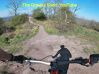
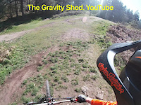
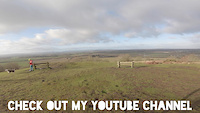
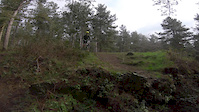
Videos of Shrewsbury Mountain Bike
trail: Wizard
0:48 |
395 |
Apr 21, 2021
trail: Ski Jump
0:07 |
213 |
Apr 21, 2021

trail: Boing
0:54 |
88 |
Apr 21, 2021
trail: Rocky Racoon
0:00 |
129 |
Mar 23, 2020

trail: Armadillo
0:49 |
211 |
Mar 23, 2020

trail: Boing
0:00 |
104 |
Mar 23, 2020
trail: Armadillo
0:12 |
246 |
Mar 23, 2020

trail: Mini Llangollen
3:31 |
478 |
Sep 4, 2019
Recent Trail Reports
| status | trail | date | condition | info | user |
|---|---|---|---|---|---|
| Slade Byway | Jun 24, 2026 @ 9:13am (Europe/Isle_of_Man) Jun 24, 2026 | Very Dry | scblurlt | ||
| Weston Bottom Access Restricted Byway | Jun 15, 2026 @ 1:06pm (Europe/Isle_of_Man) Jun 15, 2026 | Dry | scblurlt | ||
| Bumblebee | Jun 15, 2026 @ 1:06pm (Europe/Isle_of_Man) Jun 15, 2026 | Dry | scblurlt | ||
| Honey Traverse | Jun 15, 2026 @ 1:06pm (Europe/Isle_of_Man) Jun 15, 2026 | Dry | scblurlt | ||
| Hoist | Jun 15, 2026 @ 1:06pm (Europe/Isle_of_Man) Jun 15, 2026 | Dry | scblurlt | ||
| Lee Brockhurst Bridleway | May 16, 2026 @ 12:58pm (Europe/Isle_of_Man) May 16, 2026 | Ideal | scblurlt | ||
| Rest Awhile Descent | Apr 9, 2026 @ 9:18pm (Europe/London) Apr 9, 2026 | Dry | Scotty-Man | ||
| Rock View Traverse | Apr 9, 2026 @ 9:17pm (Europe/London) Apr 9, 2026 | Dry | Scotty-Man | ||
| Boing | Apr 9, 2026 @ 9:16pm (Europe/London) Apr 9, 2026 | Dry | Scotty-Man | ||
| Armadillo | Apr 9, 2026 @ 9:15pm (Europe/London) Apr 9, 2026 | Dry | Scotty-Man |
Activity Feed
| username | action | type | title | date |
|---|---|---|---|---|
| Griffo6215 | wishlist | trail | activity #97581671 | Jun 22, 2026 @ 1:16pm Jun 22, 2026 |
| Griffo6215 | wishlist | route | activity #97579191 | Jun 22, 2026 @ 12:35pm Jun 22, 2026 |
| Griffo6215 | wishlist | route | activity #97579082 and 1 more | Jun 22, 2026 @ 12:34pm Jun 22, 2026 |
| Bernard23 | comment | route | activity #97552042 | Jun 22, 2026 @ 3:58am Jun 22, 2026 |
| JohnoKupl97 | wishlist | route | activity #97237653 | Jun 18, 2026 @ 1:11am Jun 18, 2026 |
Recent Comments
| username | type | title | comment | date |
|---|---|---|---|---|
| trail | Still impassable with fallen trees | Apr 14, 2026 @ 8:48am Apr 14, 2026 | ||
| trail | Unrideable between Upton Magna fire road and... | Aug 24, 2025 @ 6:31am Aug 24, 2025 | ||
| trail | The climb isn't made any easier by the... | Aug 21, 2025 @ 1:58pm Aug 21, 2025 | ||
| trail | Completely overgrown and impassable. | Apr 23, 2025 @ 3:51am Apr 23, 2025 | ||
| report | It was a crap route anyway | Jan 29, 2025 @ 10:19am Jan 29, 2025 |
Local Badges
-

Epic Ride Climb 2k73 awarded -

Climbing 10k Badge98 awarded -

Climbing 100k Badge11 awarded -

Epic Ride Descent 2k71 awarded -

Descent 10k Badge98 awarded -

Descent 100k Badge11 awarded
Bike & Skill Parks
| name | type | city | rating |
|---|---|---|---|
| Bayston Hill BMX Track | skill park | Shrewsbury | |
| Church Stretton BMX Track | skill park | Shrewsbury | |
| Pontesbury Pumptrack | skill park | Shrewsbury | |
| Copthorne Pumptrack | skill park | Shrewsbury | |
| Harlescott Play Track | skill park | Shrewsbury |
Activity Type Stats
| activitytype | trails | distance | descent | descent distance | total vertical | rating | global rank | state rank | photos | reports | routes | ridelogs |
|---|---|---|---|---|---|---|---|---|---|---|---|---|
| Mountain Bike | 361 | 231 miles | 47,644 ft | 117 miles | 1,516 ft | #287 | #10 | 329 | 4,635 | 21 | 20,400 | |
| E-Bike | 353 | 231 miles | 47,333 ft | 117 miles | 1,516 ft | #204 | #21 | 5 | 4,488 | 12 | 3,472 | |
| Horse | 104 | 122 miles | 19,685 ft | 60 miles | 1,516 ft | #119 | #7 | 1,260 | ||||
| Hike | 313 | 224 miles | 43,002 ft | 111 miles | 1,516 ft | #548 | #18 | 4,493 | 7 | 1,445 | ||
| Trail Running | 314 | 224 miles | 43,130 ft | 112 miles | 1,516 ft | #374 | #15 | 4,493 | 7 | 1,732 |
Frequently Asked Questions About Shrewsbury
▼
What are the best places to ride in Shrewsbury?
Shrewsbury has 9 areas to explore for mountain biking. The top rated areas are:
▼
What are the highest rated mountain biking trails in Shrewsbury?
The highest rated mountain biking trails in Shrewsbury are:
- Callow to Small Batch (4.3/5)
- Boing (4.3/5)
- Biltong (4.2/5)
- 93 DH (4.2/5)
- 93 DH Bottom (4.2/5)
▼
What is the best time of the year to ride in Shrewsbury?
Based on ride log data, the most popular months to ride in Shrewsbury are:
- July (138 activities)
- June (134 activities)
- August (128 activities)
▼
Where can I park to ride in Shrewsbury?
There are 18 parking locations listed in Shrewsbury. The most popular parking spots are:
- Shooting Box Car Park - Free
- Pole Cottage Car Park
- Robin Hoods Butts Car Park - Free
- The Bog Free Parking
- Parking
Activities
Trails
Points of Interest
- Jinlye Rock Drop TTF
- First Holly Tree On Right Other
- First Holly Tree On Right Other
- Cow Ridge Viewpoint
- Pole Bank Summit Viewpoint
- Unrideable Ditch TTF
- Huge upturned tree bole Sight
- Minton Batch Boardwalk TTF
- Green Hill Viewpoint
- [tunnel] Telford Way Tunnel Other
- Stiperstones (524 m)
- Pole Bank (513 m)
- Corndon Hill (505 m)
- By brenthillier
 NSMBA TRAILFORKS & contributors
 - Admins: wisey, MathieuC, cemoorelife, Cyclingclaire, ETP, Cyclingclaire
- #13339 - 12,523 views
- shrewsbury activity log | embed map of Shrewsbury mountain bike trails | shrewsbury mountain biking points of interest
Downloading of trail gps tracks in kml & gpx formats is enabled for Shrewsbury.
You must login to download files.