close
-
Layers w
- Weather Layers
- Pro
- Pro
- Pro
- Pro
- Pro
- Pro
- More Layers
- Pro
- Pro
- Pro
- Pro
-
Upgrade to

3D
Trail Conditions
- Unknown
- Snow Groomed
- Snow Packed
- Snow Covered
- Snow Cover Partial
- Freeze/thaw Cycle
- Icy
- Prevalent Mud
- Wet
- Variable
- Ideal
- Dry
- Very Dry
Trail Flow (Ridden Direction)
Trailforks scans users ridelogs to determine the most popular direction each trail is ridden. A good flowing trail network will have most trails flowing in a single direction according to their intension.
The colour categories are based on what percentage of riders are riding a trail in its intended direction.
The colour categories are based on what percentage of riders are riding a trail in its intended direction.
- > 96%
- > 90%
- > 80%
- > 70%
- > 50%
- < 50%
- bi-directional trail
- no data
Trail Last Ridden
Trailforks scans ridelogs to determine the last time a trail was ridden.
- < 2 days
- < 1 week
- < 2 weeks
- < 1 month
- < 6 months
- > 6 months
Trail Ridden Direction
The intended direction a trail should be ridden.
- Downhill Only
- Downhill Primary
- Both Directions
- Uphill Primary
- Uphill Only
- One Direction
Contribute Details
Colors indicate trail is missing specified detail.
- Description
- Photos
- Description & Photos
- Videos
Trail Popularity ?
Trailforks scans ridelogs to determine which trails are ridden the most in the last 9 months.
Trails are compared with nearby trails in the same city region with a possible 25 colour shades.
Think of this as a heatmap, more rides = more kinetic energy = warmer colors.
- most popular
- popular
- less popular
- not popular
ATV/ORV/OHV Filter
Max Vehicle Width
inches
US Cell Coverage
Legend

Radar Time
Activity Recordings
Trailforks uses anonymized public activity data.
?
Activity Recordings
Trailforks uses anonymized public activity data.
?
Personal Heatmap
▶
Activity Types
all
/
none
▶
Options
2
Date range
month
–
Winter Trails
Warning
A routing network for winter maps does not exist. Selecting trails using the winter trails layer has been disabled.
Missing Trails
Most Popular
Least Popular
Trails are colored based on popularity. The more popular a trail is, the more red. Less popular trails trend towards green.
Jump Magnitude Heatmap
Heatmap of where riders jump on trails. Zoom in to see individual jumps, click circles to view jump details.
BC Backroad Status
![map legend]()
Service Road Atlas is a free to use, community-driven service for viewing and creating reports on the numerous back-country service roads around B.C. and Alberta.

Slope Aspect
Direction the slope faces
Trails Deemphasized
Trails are shown in grey.
Only show trails with no bike usage.
Suggested Layers
Based on selected activity type
Save the current map location and zoom level as your default home location whenever this page is loaded.
SavePopular Trail Networks
view all areas »
No description for Shropshire has been added yet!
Login or register to submit one.
This region uses the Uk/Euro style trail grading system.
Activities Click to view
- Mountain Bike
496 trails
- E-Bike
489 trails
- Horse
113 trails
- Hike
409 trails
- Trail Running
410 trails
- Observed Trials
0 trails
Region Details
- 41
- 128
- 173
- 115
- 34
- 1
Stats
- Avg Trail Rating
- Trails (view details)
- 493
- Trails Mountain Bike
- 497
- Trails E-Bike
- 489
- Trails Horse
- 113
- Trails Hike
- 409
- Trails Trail Running
- 410
- Total Distance
- 307 miles
- Total Descent
- 68,901 ft
- Total Vertical
- 1,734 ft
- Highest Trailhead
- 1,878 ft
- Reports
- 5,399
- Photos
- 475
- Ridden Counter
- 52,039
Articles
Video: Summertime Shredding in Shropshire
Sep 19, 2019 from pinkbike.com
Is there a more British sounding place on earth?
Sub Regions
- Bridgnorth (1)
- Comer Woods (1)
- Ludlow (45)
- Oswestry (0)
- Oswestry (0)
- Shrewsbury (361)
- Eastridge Woods (55)
- Grinshill (0)
- Haughmond Hill (93)
- Long Mynd (148)
- Nesscliffe (0)
- Shelve (11)
- Shrewsbury Urban (3)
- Stiperstones (33)
- Weston (18)
- Shropshire (11)
- Telford (80)
- Ercall Park (26)
- Oakengates (8)
- The Wrekin (46)
Popular Shropshire Mountain Biking Trails
• 100 ★ 4.0 • 1,926 ft • 66 ft • 551 •
Popular green difficulty doubletrack. This mountain bike primary trail can be used both directions. On average it takes 3 minutes to complete this trail.
• 100 ★ 4.0 • 1,198 ft • 0 ft • 489 •
Popular red difficulty singletrack. This mountain bike primary trail can be used downhill primary. On average it takes 1 minutes to complete this trail.
• 100 ★ 4.0 • 2,182 ft • 136 ft • 489 •
Popular green difficulty dirt/gravel road. This mountain bike primary trail can be used both directions. On average it takes 5 minutes to complete this trail.
• 100 ★ 4.0 • 1,873 ft • 8 ft • 478 •
Popular red difficulty singletrack. This mountain bike primary trail can be used downhill only. On average it takes 2 minutes to complete this trail.
• 85 ★ 4.0 • 2 miles • 22 ft • 457 •
Fast, technical singletrack, often wet in the track.
• 100 ★ 4.6 • 3,389 ft • 3 ft • 452 •
Highly rated popular red difficulty singletrack. This mountain bike primary trail can be used downhill only. On average it takes 6 minutes to complete this trail.
• 95 ★ 3.0 • 1,558 ft • 0 ft • 434 •
Popular green difficulty singletrack. This mountain bike primary trail can be used both directions and has a easy overall physical rating. On average it takes 3 minutes to complete this trail.
• 100 ★ 5.0 • 1,691 ft • 135 ft • 426 •
Popular blue difficulty singletrack. This mountain bike primary trail can be used downhill primary and has a moderate overall physical rating with a 135 ft blue climb. On average it takes 6 minutes to complete this trail.
Shropshire Mountain Bike Routes
★ 4.0 • 2 miles • 186 ft • 4 • Loop •
a gentle warm up loop , which is better ridden anti-clockwise , also the access route for many of the...
★ 5.0 • 30 miles • 2,701 ft • 15 • Loop •
30 miles of mixed terrain and trail types. About 42 miles or so if started and finished in Shrewsbury....
★ 4.5 • 5 miles • 956 ft • 25 • Loop •
A short but hard route which will test many riders skills and fitness levels
★ 5.0 • 24 miles • 2,209 ft • 4 • Loop •
Loop WWW Lockdown Challenge
★ 4.0 • 10 miles • 1,302 ft • 5 • Loop •
With the restrictions getting a little stricter, and the news constantly being full of pandemic, the...
14 miles • 1,668 ft • 3 • Loop •
With the restrictions getting a little stricter, and the news constantly being full of pandemic, the...
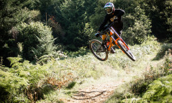
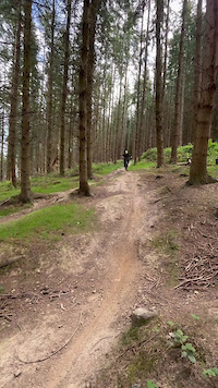
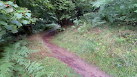
Photos of Shropshire Mountain Bike
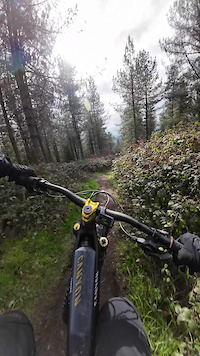
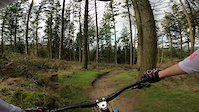
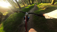
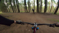
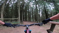
Videos of Shropshire Mountain Bike
trail: Bringewood Full DH
0:36 |
52 |
May 6, 2025

trail: Daves Start
2:51 |
|
Jul 15, 2024
trail: Little Brown
3:17 |
70 |
Mar 12, 2024
trail: Bringewood Full DH
0:18 |
102 |
Apr 21, 2023
trail: Bringewood Full DH
0:09 |
111 |
Oct 26, 2022
trail: Bringewood Full DH
0:14 |
59 |
Oct 26, 2022
trail: Bringewood Full DH
0:06 |
82 |
Oct 26, 2022
trail: Bringewood Full DH
0:14 |
52 |
Aug 17, 2022
Recent Trail Reports
Activity Feed
| username | action | type | title | date |
|---|---|---|---|---|
| itsmrjc | ridden | poi | activity #97066842 | Jun 15, 2026 @ 2:50pm 2 days |
| scblurlt | add | report | activity #97042536 and 21 more | Jun 15, 2026 @ 8:16am 3 days |
| wombatdonkey280 | ridden | trail | activity #96994972 and 1 more | Jun 14, 2026 @ 12:23pm Jun 14, 2026 |
| yman98 | wishlist | trail | activity #96983621 | Jun 14, 2026 @ 10:25am Jun 14, 2026 |
| saSe | wishlist | route | activity #96912789 | Jun 13, 2026 @ 1:43pm Jun 13, 2026 |
Recent Comments
| username | type | title | comment | date |
|---|---|---|---|---|
| trail | Sadly no longer due to felling... | May 15, 2026 @ 4:28pm May 15, 2026 | ||
| trail | Still impassable with fallen trees | Apr 14, 2026 @ 8:48am Apr 14, 2026 | ||
| trail | Unrideable between Upton Magna fire road and... | Aug 24, 2025 @ 6:31am Aug 24, 2025 | ||
| trail | The climb isn't made any easier by the... | Aug 21, 2025 @ 1:58pm Aug 21, 2025 | ||
| trail | It’s just a jump and someone was hiding in... | Jul 29, 2025 @ 7:26am Jul 29, 2025 |
Local Badges
-

Climbing 100k Badge5 awarded -

Completionist0 awarded -

Epic Ride Climb 2k7 awarded -

Climbing 10k Badge56 awarded -
Completionist0 awarded -
Completionist0 awarded
Bike & Skill Parks
| name | type | city | rating |
|---|---|---|---|
| Bayston Hill BMX Track | skill park | Shrewsbury | |
| Church Stretton BMX Track | skill park | Shrewsbury | |
| Pontesbury Pumptrack | skill park | Shrewsbury | |
| Craven Arms Pumptrack | skill park | Shropshire | |
| Copthorne Pumptrack | skill park | Shrewsbury |
Upcoming Local Events
Activity Type Stats
| activitytype | trails | distance | descent | descent distance | total vertical | rating | global rank | state rank | photos | reports | routes | ridelogs |
|---|---|---|---|---|---|---|---|---|---|---|---|---|
| Mountain Bike | 496 | 307 miles | 68,878 ft | 159 miles | 1,736 ft | 470 | 5,371 | 33 | 42,265 | |||
| E-Bike | 489 | 306 miles | 67,959 ft | 158 miles | 1,736 ft | 5 | 5,170 | 18 | 7,672 | |||
| Horse | 113 | 138 miles | 20,577 ft | 67 miles | 1,516 ft | 1,330 | 1 | |||||
| Hike | 409 | 285 miles | 55,558 ft | 143 miles | 1,736 ft | 5,197 | 11 | 2,397 | ||||
| Trail Running | 410 | 285 miles | 55,686 ft | 143 miles | 1,736 ft | 5,197 | 11 | 2,760 |
Frequently Asked Questions About Shropshire
▼
What are the best places to ride in Shropshire?
Shropshire has 17 areas to explore for mountain biking. The top rated areas are:
▼
What are the highest rated mountain biking trails in Shropshire?
The highest rated mountain biking trails in Shropshire are:
- Hopton DH 5 (4.4/5)
- Callow to Small Batch (4.3/5)
- Boing (4.3/5)
- Daves Start (4.3/5)
- Biltong (4.2/5)
▼
What is the best time of the year to ride in Shropshire?
Based on ride log data, the most popular months to ride in Shropshire are:
- July (297 activities)
- August (191 activities)
- June (189 activities)
▼
What is the longest trail in Shropshire?
The longest trail in Shropshire is Corndon and Mitchells Fold at 4.3 miles. View all trails sorted by distance.
Activities
Trails
Points of Interest
- [tunnel] Telford Way Tunnel Other
- Cow Ridge Viewpoint
- Pole Bank Summit Viewpoint
- Unrideable Ditch TTF
- Huge upturned tree bole Sight
- Minton Batch Boardwalk TTF
- Jinlye Rock Drop TTF
- Steep Narrow Gully TTF
- [road crossing] Telford Way Toucan Crossing Other
- First Holly Tree On Right Other
- Rhos Fawr (2,156 ft)
- Black Mixen (2,133 ft)
- Great Creigiau (2,096 ft)
- By plushhill & contributors
- Admins: UKTP, 20twenty-p, wisey, MathieuC, cemoorelife, Cyclingclaire
- #6228 - 24,418 views
- shropshire activity log | embed map of Shropshire mountain bike trails | shropshire mountain biking points of interest
Downloading of trail gps tracks in kml & gpx formats is enabled for Shropshire.
You must login to download files.