close
-
Layers w
- Weather Layers
- Pro
- Pro
- Pro
- Pro
- Pro
- Pro
- More Layers
- Pro
- Pro
- Pro
- Pro
-
Upgrade to

3D
Trail Conditions
- Unknown
- Snow Groomed
- Snow Packed
- Snow Covered
- Snow Cover Partial
- Freeze/thaw Cycle
- Icy
- Prevalent Mud
- Wet
- Variable
- Ideal
- Dry
- Very Dry
Trail Flow (Ridden Direction)
Trailforks scans users ridelogs to determine the most popular direction each trail is ridden. A good flowing trail network will have most trails flowing in a single direction according to their intension.
The colour categories are based on what percentage of riders are riding a trail in its intended direction.
The colour categories are based on what percentage of riders are riding a trail in its intended direction.
- > 96%
- > 90%
- > 80%
- > 70%
- > 50%
- < 50%
- bi-directional trail
- no data
Trail Last Ridden
Trailforks scans ridelogs to determine the last time a trail was ridden.
- < 2 days
- < 1 week
- < 2 weeks
- < 1 month
- < 6 months
- > 6 months
Trail Ridden Direction
The intended direction a trail should be ridden.
- Downhill Only
- Downhill Primary
- Both Directions
- Uphill Primary
- Uphill Only
- One Direction
Contribute Details
Colors indicate trail is missing specified detail.
- Description
- Photos
- Description & Photos
- Videos
Trail Popularity ?
Trailforks scans ridelogs to determine which trails are ridden the most in the last 9 months.
Trails are compared with nearby trails in the same city region with a possible 25 colour shades.
Think of this as a heatmap, more rides = more kinetic energy = warmer colors.
- most popular
- popular
- less popular
- not popular
ATV/ORV/OHV Filter
Max Vehicle Width
inches
US Cell Coverage
Legend

Radar Time
Activity Recordings
Trailforks uses anonymized public activity data.
?
Activity Recordings
Trailforks uses anonymized public activity data.
?
Personal Heatmap
▶
Activity Types
all
/
none
▶
Options
2
Date range
month
–
Winter Trails
Warning
A routing network for winter maps does not exist. Selecting trails using the winter trails layer has been disabled.
Missing Trails
Most Popular
Least Popular
Trails are colored based on popularity. The more popular a trail is, the more red. Less popular trails trend towards green.
Jump Magnitude Heatmap
Heatmap of where riders jump on trails. Zoom in to see individual jumps, click circles to view jump details.
BC Backroad Status
![map legend]()
Service Road Atlas is a free to use, community-driven service for viewing and creating reports on the numerous back-country service roads around B.C. and Alberta.

Slope Aspect
Direction the slope faces
Trails Deemphasized
Trails are shown in grey.
Only show trails with no bike usage.
Suggested Layers
Based on selected activity type
Save the current map location and zoom level as your default home location whenever this page is loaded.
Save
No description for Sidmouth has been added yet!
Login or register to submit one.
This region uses the Uk/Euro style trail grading system.
Activities Click to view
- Mountain Bike
6 trails
- E-Bike
6 trails
- Horse
5 trails
- Hike
7 trails
- Trail Running
7 trails
- Dirtbike/Moto
4 trails
- Observed Trials
4 trails
- ATV/ORV/OHV
4 trails
- Snowshoe
4 trails
- Downhill Ski
4 trails
- Backcountry Ski
4 trails
- Nordic Ski
4 trails
Region Details
- 3
- 1
- 1
- 2
Region Status
Open as of Jan 13, 2026Stats
- Avg Trail Rating
- Trails (view details)
- 6
- Trails Mountain Bike
- 7
- Trails E-Bike
- 6
- Trails Horse
- 5
- Trails Hike
- 7
- Trails Trail Running
- 7
- Trails Dirtbike/Moto
- 4
- Trails Observed Trials
- 4
- Trails ATV/ORV/OHV
- 4
- Trails Snowshoe
- 4
- Trails Downhill Ski
- 4
- Trails Backcountry Ski
- 4
- Trails Nordic Ski
- 4
- Total Distance
- 3,396 ft
- Total Descent Distance
- 1,654 ft
- Total Descent
- 231 ft
- Total Vertical
- 247 ft
- Highest Trailhead
- 418 ft
- Reports
- 31
- Photos
- 3
- Ridden Counter
- 25
Sub Regions
-
Harpford Woods
- 2
Popular Sidmouth Mountain Biking Trails
• 100 ★ 4.7 • 1,654 ft • 0 ft • 13 •
González starts the same as the but carries straight on down the hill. Its fast (hence the name) It has a couple of smaller jumps and some nice pumpy flowy stuff.
• 5 ★ 4.5 • 0 ft • 0 ft • 1 •
Fast and flowy with many jumps and berms. There are currently 2 road gaps 20-25ft long.
• 90 ★ 0.0 • 2 miles • 138 ft • 1 •
Can be ridden in both directions but probably best in descent. Lots of gates to open and close.
Videos of Sidmouth Mountain Bike
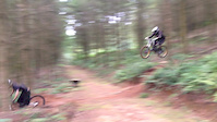
trail: Road Gap Line
0:15 |
379 |
Sep 2, 2015
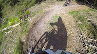
trail: Road Gap Line
0:40 |
277 |
May 5, 2014
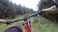
trail: Road Gap Line
0:54 |
409 |
Sep 29, 2013
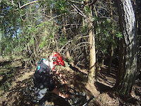
trail: Road Gap Line
0:31 |
219 |
Apr 30, 2011

trail: Road Gap Line
674 |
Sep 6, 2015 , Sidmouth
Recent Trail Reports
| status | trail | date | condition | info | user |
|---|---|---|---|---|---|
| González | Jan 11, 2025 @ 6:09am Jan 11, 2025 | Wet | AndyHops |
Activity Feed
| username | action | type | title | date |
|---|---|---|---|---|
| tom-m82 | add | trail | activity #79615620 and 3 more | Sep 4, 2025 @ 6:03am Sep 4, 2025 |
| AndyHops | add | report | activity #64405447 | Jan 11, 2025 @ 6:09am Jan 11, 2025 |
| AndyHops | vote | trail | activity #64393205 | Jan 11, 2025 @ 12:35am Jan 11, 2025 |
| wackster | ridden | trail | activity #55788392 | Jul 17, 2024 @ 12:28pm Jul 17, 2024 |
| trailforks | add | video | activity #49295571 | Feb 18, 2024 @ 1:00pm Feb 18, 2024 |
Activity Type Stats
| activitytype | trails | distance | descent | descent distance | total vertical | rating | global rank | state rank | photos | reports | routes | ridelogs |
|---|---|---|---|---|---|---|---|---|---|---|---|---|
| Mountain Bike | 6 | 3,396 ft | 233 ft | 1,654 ft | 246 ft | #8,432 | #319 | 3 | 31 | 1,947 | ||
| E-Bike | 6 | 3,396 ft | 233 ft | 1,654 ft | 246 ft | #7,681 | #343 | 30 | 39 | |||
| Horse | 5 | 1,742 ft | 148 ft | #2,303 | #116 | 7 | ||||||
| Hike | 7 | 3,396 ft | 233 ft | 1,654 ft | 246 ft | #12,076 | #440 | 31 | 65 | |||
| Trail Running | 7 | 3,396 ft | 233 ft | 1,654 ft | 246 ft | #11,614 | #433 | 31 | 8 | |||
| Dirtbike/Moto | 4 | #498 | #10 | 7 | ||||||||
| Observed Trials | 4 | #163 | #2 | 1 | ||||||||
| ATV/ORV/OHV | 4 | #342 | #5 | 7 | ||||||||
| Snowshoe | 4 | #292 | #1 | |||||||||
| Downhill Ski | 4 | #411 | #2 | |||||||||
| Backcountry Ski | 4 | #296 | #1 | |||||||||
| Nordic Ski | 4 | #353 | #3 |
Frequently Asked Questions About Sidmouth
▼
What are the best places to ride in Sidmouth?
Sidmouth has 1 areas to explore for mountain biking. The top rated areas are:
▼
What are the highest rated mountain biking trails in Sidmouth?
The highest rated mountain biking trails in Sidmouth are:
- González (4.2/5)
- Road Gap Line (4.1/5)
- Buckton Hill (0/5)
- Broad Down (0/5)
▼
What is the best time of the year to ride in Sidmouth?
Based on ride log data, the most popular months to ride in Sidmouth are:
- August (10 activities)
- July (1 activities)
- February (1 activities)
▼
Where can I park to ride in Sidmouth?
Check the Sidmouth trail map for trailhead and parking information. Community members regularly update access and parking details for trails in the area.
- By brenthillier
 NSMBA TRAILFORKS & contributors
 - Admins: wisey, MathieuC, cemoorelife
- #9940 - 3,645 views
- sidmouth activity log | embed map of Sidmouth mountain bike trails | sidmouth mountain biking points of interest
Downloading of trail gps tracks in kml & gpx formats is enabled for Sidmouth.
You must login to download files.