close
-
Layers w
- Weather Layers
- Pro
- Pro
- Pro
- Pro
- Pro
- Pro
- More Layers
- Pro
- Pro
- Pro
- Pro
-
Upgrade to

3D
Trail Conditions
- Unknown
- Snow Groomed
- Snow Packed
- Snow Covered
- Snow Cover Partial
- Freeze/thaw Cycle
- Icy
- Prevalent Mud
- Wet
- Variable
- Ideal
- Dry
- Very Dry
Trail Flow (Ridden Direction)
Trailforks scans users ridelogs to determine the most popular direction each trail is ridden. A good flowing trail network will have most trails flowing in a single direction according to their intension.
The colour categories are based on what percentage of riders are riding a trail in its intended direction.
The colour categories are based on what percentage of riders are riding a trail in its intended direction.
- > 96%
- > 90%
- > 80%
- > 70%
- > 50%
- < 50%
- bi-directional trail
- no data
Trail Last Ridden
Trailforks scans ridelogs to determine the last time a trail was ridden.
- < 2 days
- < 1 week
- < 2 weeks
- < 1 month
- < 6 months
- > 6 months
Trail Ridden Direction
The intended direction a trail should be ridden.
- Downhill Only
- Downhill Primary
- Both Directions
- Uphill Primary
- Uphill Only
- One Direction
Contribute Details
Colors indicate trail is missing specified detail.
- Description
- Photos
- Description & Photos
- Videos
Trail Popularity ?
Trailforks scans ridelogs to determine which trails are ridden the most in the last 9 months.
Trails are compared with nearby trails in the same city region with a possible 25 colour shades.
Think of this as a heatmap, more rides = more kinetic energy = warmer colors.
- most popular
- popular
- less popular
- not popular
ATV/ORV/OHV Filter
Max Vehicle Width
inches
US Cell Coverage
Legend

Radar Time
Activity Recordings
Trailforks uses anonymized public activity data.
?
Activity Recordings
Trailforks uses anonymized public activity data.
?
Personal Heatmap
▶
Activity Types
all
/
none
▶
Options
2
Date range
month
–
Winter Trails
Warning
A routing network for winter maps does not exist. Selecting trails using the winter trails layer has been disabled.
Missing Trails
Most Popular
Least Popular
Trails are colored based on popularity. The more popular a trail is, the more red. Less popular trails trend towards green.
Jump Magnitude Heatmap
Heatmap of where riders jump on trails. Zoom in to see individual jumps, click circles to view jump details.
BC Backroad Status
![map legend]()
Service Road Atlas is a free to use, community-driven service for viewing and creating reports on the numerous back-country service roads around B.C. and Alberta.

Slope Aspect
Direction the slope faces
Trails Deemphasized
Trails are shown in grey.
Only show trails with no bike usage.
Suggested Layers
Based on selected activity type
Save the current map location and zoom level as your default home location whenever this page is loaded.
Save
No description for Silkeborg has been added yet!
Login or register to submit one.
This region uses the Uk/Euro style trail grading system.
Activities Click to view
- Mountain Bike
104 trails
- E-Bike
99 trails
- Adaptive Bike
7 trails
- Winter Fat Bike
4 trails
- Horse
18 trails
- Hike
29 trails
- Trail Running
29 trails
- Backcountry Ski
12 trails
Stats
- Avg Trail Rating
- Trails (view details)
- 109
- Trails Mountain Bike
- 104
- Trails E-Bike
- 99
- Trails Gravel Bike
- 1
- Trails Adaptive Bike
- 7
- Trails Winter Fat Bike
- 4
- Trails Horse
- 18
- Trails Hike
- 29
- Trails Trail Running
- 29
- Trails Snowshoe
- 1
- Trails Downhill Ski
- 2
- Trails Backcountry Ski
- 12
- Total Distance
- 67 miles
- Total Descent Distance
- 26 miles
- Total Descent
- 6,931 ft
- Total Vertical
- 373 ft
- Highest Trailhead
- 436 ft
- Reports
- 3,917
- Photos
- 586
- Ridden Counter
- 18,295
Sub Regions
-
Gjessø skov, Rustrup Skov, Thorsø og Bødskovgård
- 1
- 1
-
Nordskoven
- 15
- 16
- 9
-
Silkeborg Bikepark
- 1
- 3
- 6
- 1
-
Søhøjlandet
- 4
- 3
-
Vesterskoven
- 21
- 2
- 1
-
Østerskov
- 2
Popular Silkeborg Mountain Biking Trails
• 100 ★ 3.0 • 1 mile • 77 ft • 303 •
Popular blue difficulty singletrack. This multi-use trail can be used one direction. It features berm and jump. Trail visibility is always easy to follow. On average it takes 5 minutes to complete this trail.
• 100 ★ 2.5 • 2,087 ft • 50 ft • 298 •
Popular blue difficulty singletrack. This multi-use trail can be used one direction and has a easy overall physical rating with a 50 ft green climb. It features berm and jump. Trail visibility is always easy to follow. On average it takes 1 minutes to complete this trail.
• 100 ★ 3.0 • 3,635 ft • 123 ft • 297 •
Popular blue difficulty singletrack. This multi-use trail can be used one direction and has a easy overall physical rating with a 123 ft blue climb. It features berm and bridge. Trail visibility is always easy to follow. On average it takes 5 minutes to complete this trail.
• 95 ★ 4.0 • 4,377 ft • 112 ft • 292 •
Popular blue difficulty singletrack. This multi-use trail can be used one direction and has a easy overall physical rating with a 112 ft green climb. It features berm. Trail visibility is always easy to follow. On average it takes 5 minutes to complete this trail.
• 100 ★ 2.5 • 1,965 ft • 73 ft • 289 •
Popular blue difficulty singletrack. This multi-use trail can be used one direction and has a easy overall physical rating with a 73 ft green climb. It features berm. Trail visibility is always easy to follow. On average it takes 5 minutes to complete this trail.
• 95 ★ 3.0 • 3,681 ft • 49 ft • 288 •
Popular blue difficulty singletrack. This multi-use trail can be used one direction and has a easy overall physical rating with a 49 ft green climb. It features berm. Trail visibility is always easy to follow. On average it takes 3 minutes to complete this trail.
• 95 ★ 2.0 • 2,208 ft • 39 ft • 288 •
Popular blue difficulty singletrack. This multi-use trail can be used one direction and has a easy overall physical rating with a 39 ft green climb. It features berm. Trail visibility is always easy to follow. On average it takes 2 minutes to complete this trail.
• 90 ★ 2.0 • 2,484 ft • 140 ft • 286 •
Popular blue difficulty singletrack. This multi-use trail can be used one direction and has a easy overall physical rating with a 140 ft green climb. It features berm. Trail visibility is always easy to follow. On average it takes 6 minutes to complete this trail.
Silkeborg Mountain Bike Routes
Nordskoven Blå Spor Featured
★ 5.0 • 6 miles • 667 ft • 16 • Loop •
Dette er primært det blå spor. Ud fra dette kan man tage røde og sorte afstikkere
Vesterskoven Blå Spor Featured
★ 5.0 • 11 miles • 1,279 ft • 21 •
Vesterskovens blå spor hele vejen rundt.
Vesterskoven Rød Spor Featured
11 miles • 1,330 ft • 19 • Out & Back •
Rød route I versterskoven, består mest af blå spor
Nordskoven Sort Spor Featured
8 miles • 1,121 ft • 29 • Out & Back •
Nordskoven Sort Spor er en udfordrende rute for dem som gerne vil afprøve deres evner
Nordskoven Rød Spor Featured
7 miles • 855 ft • 26 • Out & Back •
Tur rundt i Nordskoven med de røde linier
31 miles • 2,501 ft • 0 •
Fin tur far Silkeborg, rundt om Julsø og tilbage igen.
Photos of Silkeborg Mountain Bike
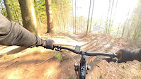
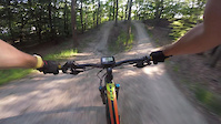
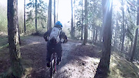
Videos of Silkeborg Mountain Bike
trail: Hugorms Hale
0:07 |
5 |
Jun 6, 2026

0:07 |
4 |
Apr 28, 2026
0:10 |
5 |
Oct 19, 2025
0:40 |
6 |
Aug 24, 2025
trail: Madam Blå
0:30 |
17 |
Jun 27, 2025
trail: Motorvejssløjfen Rød
2:55 |
47 |
Aug 29, 2024
trail: Sort hop linje
0:29 |
87 |
Jul 3, 2021
trail: Kæberasleren
4:06 |
118 |
Apr 29, 2016
Current Trail Warnings
| status | trail | date | condition | user | info |
|---|---|---|---|---|---|
| Hugormen | Jun 21, 2026 @ 2:18pm (Europe/Copenhagen) 1 day | Unknown | NiccoNordborg GR-TB-NSKOV | Nyt drop på mellemstykket, samt nyt burm... |
Recent Trail Reports
| status | trail | date | condition | info | user |
|---|---|---|---|---|---|
| Gyngen | Jun 17, 2026 @ 12:59pm (Europe/Copenhagen) Jun 17, 2026 | Unknown | HansYFr4dY SSSL | ||
| Rød kæberasler loop | Jun 13, 2026 @ 8:55am (Europe/Copenhagen) Jun 12, 2026 | Ideal | trail-niels | ||
| Kæberasleren | Jun 13, 2026 @ 8:55am (Europe/Copenhagen) Jun 12, 2026 | Ideal | trail-niels | ||
| Sidste knold | Jun 13, 2026 @ 8:55am (Europe/Copenhagen) Jun 12, 2026 | Ideal | trail-niels | ||
| Over Ulvehoved - Sokær | Jun 13, 2026 @ 8:55am (Europe/Copenhagen) Jun 12, 2026 | Ideal | trail-niels | ||
| HQ svinget | Jun 13, 2026 @ 8:55am (Europe/Copenhagen) Jun 12, 2026 | Ideal | trail-niels | ||
| Over Ulvehoved blå | Jun 13, 2026 @ 8:55am (Europe/Copenhagen) Jun 12, 2026 | Ideal | trail-niels | ||
| De forelskede træer rød 2 | Jun 13, 2026 @ 8:55am (Europe/Copenhagen) Jun 12, 2026 | Ideal | trail-niels | ||
| De forelskede træer rød 1 | Jun 13, 2026 @ 8:55am (Europe/Copenhagen) Jun 12, 2026 | Ideal | trail-niels | ||
| De forelskede træer | Jun 13, 2026 @ 8:55am (Europe/Copenhagen) Jun 12, 2026 | Ideal | trail-niels |
Activity Feed
| username | action | type | title | date |
|---|---|---|---|---|
| NiccoNordborg | add | report | activity #97474150 | Jun 21, 2026 @ 5:18am 1 day |
| martinhoegh | like | report | activity #97172895 | Jun 17, 2026 @ 4:09am Jun 17, 2026 |
| HansYFr4dY | add | report | activity #97172510 | Jun 17, 2026 @ 3:59am Jun 17, 2026 |
| martinhoegh | update | poi | activity #97029339 | Jun 15, 2026 @ 2:38am Jun 15, 2026 |
| benjaminhoegh | update | trail | activity #96996952 and 1 more | Jun 14, 2026 @ 12:44pm Jun 14, 2026 |
Recent Comments
| username | type | title | comment | date |
|---|---|---|---|---|
| report | Spordag Dato 25/10 | Apr 28, 2026 @ 11:26am Apr 28, 2026 | ||
| report | Træet er fjernet | Oct 11, 2025 @ 6:44am Oct 11, 2025 | ||
| report | Hej Niels. Skal vi mødes uden på det sted... | Oct 10, 2025 @ 11:08am Oct 10, 2025 | ||
| report | Thorbjørn Nørgård Lovende... | Oct 6, 2025 @ 1:28pm Oct 6, 2025 | ||
| report | 4 x grus ! | Oct 6, 2025 @ 2:08am Oct 6, 2025 |
Local Badges
-

Epic Ride Climb 2k2 awarded -

Climbing 10k Badge49 awarded -

Climbing 100k Badge4 awarded -

Epic Ride Descent 2k2 awarded -

Descent 10k Badge50 awarded -

Descent 100k Badge4 awarded
Bike & Skill Parks
| name | type | city | rating |
|---|---|---|---|
| Silkeborg Bikepark | bike park | Silkeborg | |
| Silkeborg Bikepark | skill park | Silkeborg | |
| Silkeborg MX | skill park | Silkeborg |
Upcoming Local Events
Local Trail Supporters
- Silkeborg Sti- og Sporbyggerlaug
Local Trail Supporters
- Silkeborg Sti- og Sporbyggerlaug
Activity Type Stats
| activitytype | trails | distance | descent | descent distance | total vertical | rating | global rank | state rank | photos | reports | routes | ridelogs |
|---|---|---|---|---|---|---|---|---|---|---|---|---|
| Mountain Bike | 104 | 65 miles | 6,677 ft | 25 miles | 374 ft | #766 | #1 | 582 | 3,917 | 6 | 10,785 | |
| E-Bike | 99 | 63 miles | 6,368 ft | 24 miles | 374 ft | #545 | #13 | 2 | 3,902 | 5 | 1,596 | |
| Gravel Bike | 1 | 7 miles | 354 ft | 3 miles | 141 ft | #901 | #2 | 15 | 229 | |||
| Adaptive Bike | 7 | 13 miles | 922 ft | 5 miles | 315 ft | #81 | #10 | 116 | ||||
| Winter Fat Bike | 4 | 4,150 ft | 39 ft | 1,050 ft | 144 ft | #89 | #8 | 291 | ||||
| Horse | 18 | 22 miles | 1,621 ft | 9 miles | 374 ft | #285 | #1 | 247 | ||||
| Hike | 29 | 37 miles | 3,264 ft | 17 miles | 374 ft | #1,664 | #9 | 1 | 3,613 | 281 | ||
| Trail Running | 29 | 37 miles | 3,264 ft | 17 miles | 374 ft | #1,243 | #9 | 3,616 | 369 | |||
| Snowshoe | 1 | 3,940 ft | 161 ft | 2,618 ft | 157 ft | 1 | ||||||
| Downhill Ski | 2 | 4,829 ft | 174 ft | 3,077 ft | 210 ft | 1 | ||||||
| Backcountry Ski | 12 | 12 miles | 1,017 ft | 6 miles | 253 ft | #216 | #1 | 2 | 5 |
Frequently Asked Questions About Silkeborg
▼
What are the best places to ride in Silkeborg?
Silkeborg has 6 areas to explore for mountain biking. The top rated areas are:
▼
What are the highest rated mountain biking trails in Silkeborg?
The highest rated mountain biking trails in Silkeborg are:
- Kanel kage (4.2/5)
- Muldvarpen (4.2/5)
- XC Rød (4.1/5)
- Hugormen (4.1/5)
- Siriusvej pump track (4.1/5)
▼
What is the best time of the year to ride in Silkeborg?
Based on ride log data, the most popular months to ride in Silkeborg are:
- September (39 activities)
- May (28 activities)
- October (27 activities)
▼
Where can I park to ride in Silkeborg?
There are 20 parking locations listed in Silkeborg. The most popular parking spots are: View all parking and trailhead locations on the map to plan your visit.
Activities
Trails
- By brenthillier
 NSMBA TRAILFORKS & contributors
 - Admins: SSSL
- #14434 - 10,441 views
- silkeborg activity log | embed map of Silkeborg mountain bike trails | silkeborg mountain biking points of interest polygons
Downloading of trail gps tracks in kml & gpx formats is enabled for Silkeborg.
You must login to download files.