close
-
Layers w
- Weather Layers
- Pro
- Pro
- Pro
- Pro
- Pro
- Pro
- More Layers
- Pro
- Pro
- Pro
- Pro
-
Upgrade to

3D
Trail Conditions
- Unknown
- Snow Groomed
- Snow Packed
- Snow Covered
- Snow Cover Partial
- Freeze/thaw Cycle
- Icy
- Prevalent Mud
- Wet
- Variable
- Ideal
- Dry
- Very Dry
Trail Flow (Ridden Direction)
Trailforks scans users ridelogs to determine the most popular direction each trail is ridden. A good flowing trail network will have most trails flowing in a single direction according to their intension.
The colour categories are based on what percentage of riders are riding a trail in its intended direction.
The colour categories are based on what percentage of riders are riding a trail in its intended direction.
- > 96%
- > 90%
- > 80%
- > 70%
- > 50%
- < 50%
- bi-directional trail
- no data
Trail Last Ridden
Trailforks scans ridelogs to determine the last time a trail was ridden.
- < 2 days
- < 1 week
- < 2 weeks
- < 1 month
- < 6 months
- > 6 months
Trail Ridden Direction
The intended direction a trail should be ridden.
- Downhill Only
- Downhill Primary
- Both Directions
- Uphill Primary
- Uphill Only
- One Direction
Contribute Details
Colors indicate trail is missing specified detail.
- Description
- Photos
- Description & Photos
- Videos
Trail Popularity ?
Trailforks scans ridelogs to determine which trails are ridden the most in the last 9 months.
Trails are compared with nearby trails in the same city region with a possible 25 colour shades.
Think of this as a heatmap, more rides = more kinetic energy = warmer colors.
- most popular
- popular
- less popular
- not popular
ATV/ORV/OHV Filter
Max Vehicle Width
inches
US Cell Coverage
Legend

Radar Time
Activity Recordings
Trailforks uses anonymized public activity data.
?
Activity Recordings
Trailforks uses anonymized public activity data.
?
Personal Heatmap
▶
Activity Types
all
/
none
▶
Options
2
Date range
month
–
Winter Trails
Warning
A routing network for winter maps does not exist. Selecting trails using the winter trails layer has been disabled.
Missing Trails
Most Popular
Least Popular
Trails are colored based on popularity. The more popular a trail is, the more red. Less popular trails trend towards green.
Jump Magnitude Heatmap
Heatmap of where riders jump on trails. Zoom in to see individual jumps, click circles to view jump details.
BC Backroad Status
![map legend]()
Service Road Atlas is a free to use, community-driven service for viewing and creating reports on the numerous back-country service roads around B.C. and Alberta.

Slope Aspect
Direction the slope faces
Trails Deemphasized
Trails are shown in grey.
Only show trails with no bike usage.
Suggested Layers
Based on selected activity type
Save the current map location and zoom level as your default home location whenever this page is loaded.
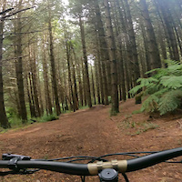
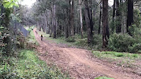
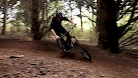
SaveThe steep terrain and tall canopy of the Silvan area of Dandenong Ranges National Park makes for an exciting mountain bike destination, hosting a combination of single trail and management vehicle tracks with opportunities for beginner and intermediate skill level.
The area has 13km of dedicated mountain bike trails and a significant management vehicle track network suitable for riding. The trails can be enjoyed individually, with friends or you can join a local riders club.
The mountain bike trails are managed by Parks Victoria with the support of the local club - Yarra Ranges Mountain Bikers (YRMTB). If you’re interested in being involved in building new trail features or helping maintain trails, get in touch with Parks Victoria or YRMTB to volunteer.
Primary Trail Type: All-Mountain & Downhill
eBikes Allowed:
Yes
Land Status: National Park
Land Manager: Parks Victoria
 google parking directions
 Disclaimer:
Please stick to legal trails Only. No unauthorised trail construction.
Activities Click to view
- Mountain Bike
45 trails
- E-Bike
45 trails
- Hike
24 trails
- Trail Running
24 trails
Region Details
- 9
- 22
- 14
Region Status
Open as of Jun 19, 2026Stats
- Avg Trail Rating
- Trails (view details)
- 51
- Trails Mountain Bike
- 45
- Trails E-Bike
- 45
- Trails Hike
- 24
- Trails Trail Running
- 24
- Total Distance
- 23 miles
- Total Descent Distance
- 12 miles
- Total Descent
- 6,682 ft
- Total Vertical
- 1,182 ft
- Highest Trailhead
- 1,692 ft
- Reports
- 923
- Photos
- 165
- Ridden Counter
- 23,555
Popular Silvan Mountain Bike Trails Trails
• 95 ★ 3.5 • 919 ft • 12 ft • 954 •
10.9 is a blue traversal trail that stretches 300m, providing a smooth and relaxed ride. It's a great option for bikers looking for a more leisurely biking experience with beautiful scenery to enjoy along the way.
• 95 ★ 4.5 • 5,131 ft • 215 ft • 944 •
This trail starts at the bottom of Melba Track in temperate rainforest and climbs up with 13 switchbacks (thus the name), to the junction with Track 12. Slightly further up you can choose to go right, which takes you back down the loop,...
• 95 ★ 4.4 • 3,802 ft • 251 ft • 898 •
After climbing , the trail continues as a moderately steep climb, with yet more switchbacks, to come out on Track 13 next to where Downhill begins. The climb has some great technical challenges including angled logs (one with tyre...
• 95 ★ 3.8 • 1 mile • 22 ft • 822 •
Given its name, has a mixture of speed, berms, ruts, steep corners, and some short climbs so that you can repeat the fun. This is great on a XC or a GE bike.
• 100 ★ 4.5 • 3,284 ft • 0 ft • 796 •
This is a fun, fast, flowy trail that descends all the way to Track. It has some small jumps, ruts, steeper lines and some big logs to get over. This is not a true ‘downhill’ track in that there are no big gap jumps, but it’s just...
• 85 ★ 3.7 • 4,131 ft • 68 ft • 573 •
This is a cross country trail with some pinchy climbs, a few logs and roots to grind over. Plus some fun flowy sections. The trail runs between Track 24 and Track 12, or vice versa, in a north‐ south direction. and meet it from the...
• 100 ★ 4.6 • 1,693 ft • 0 ft • 559 •
Highly rated popular black diamond difficulty singletrack. This mountain bike primary trail and has a hard overall physical rating with a 0 ft green climb. It features berm, drop, jump and rock garden. Exposure: Normal Injury Risk. Trail visibility is always easy to follow. On average it takes 1 minutes to complete this trail.
• 100 ★ 4.8 • 1,657 ft • 0 ft • 528 •
is a thrilling black trail featuring jumps to flat surfaces, perfect for riders seeking an adrenaline rush. As a continuation of , this trail along the ridge offers an exciting and technical ride with challenging features to test your...
Mountain Bike Routes
★ 5.0 • 10 miles • 1,832 ft • 11 •
mostly blue trails,great loop.lots of fun lil bit of climbing to do though,shorten if nesssary
7 miles • 1,285 ft • 9 • Loop •
Loop 1: Stringybark. This route needs capabilities of riding black diamond trails. Running through hard...
6 miles • 473 ft • 3 • Point to Point •
Leave your car near Farndons Hall and then ride down. Get someone to pick you up at the bottom of on...
8 miles • 1,688 ft • 11 • Loop •
Nice little loop including uphills and downhills with not many unsanctioned trail and mostly singletrack.
7 miles • 1,007 ft • 6 • Loop •
Easy 10Km loop with some fun downhill and climbs that are not going to kill you with some cross country...
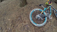
Photos of Silvan Mountain Bike Trails Mountain Bike
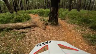
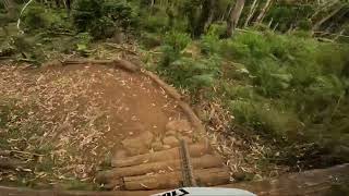
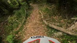
Videos of Silvan Mountain Bike Trails Mountain Bike
trail: Hud's Track
0:17 |
326 |
Feb 6, 2021
trail: Hud's Track
0:14 |
635 |
Nov 1, 2020
trail: Hud's Track
0:32 |
829 |
May 23, 2017
trail: Hud's Track
0:32 |
382 |
May 21, 2017
trail: Hud's Track
2:02 |
691 |
Sep 5, 2016
youtuber
![Broken Bottles Silvan]()
trail: Broken Bottles
2:32 |
42 |
Jan 28, 2023 , Mount Dandenong
Recent Trail Reports
| status | trail | date | condition | info | user |
|---|---|---|---|---|---|
| Yarbung | Jun 19, 2026 @ 8:30pm (Australia/Melbourne) Jun 19, 2026 | Ideal | TallandAwkward | ||
| Second Wave | Jun 8, 2026 @ 1:37pm (Australia/Melbourne) Jun 7, 2026 | Wet | JfwM | ||
| Link | May 22, 2026 @ 5:22pm (Australia/Melbourne) May 22, 2026 | Ideal | skipatrol01 | ||
| Rib Track | May 22, 2026 @ 5:22pm (Australia/Melbourne) May 22, 2026 | Ideal | skipatrol01 | ||
| Yabby Hill Climb | May 1, 2026 @ 9:23pm (Australia/Melbourne) May 1, 2026 | Unknown | skipatrol01 | ||
| JJ’s to Yabby Hill Link | May 1, 2026 @ 9:23pm (Australia/Melbourne) May 1, 2026 | Unknown | skipatrol01 | ||
| JJ's | May 1, 2026 @ 9:23pm (Australia/Melbourne) May 1, 2026 | Unknown | skipatrol01 | ||
| Broken Hoe | May 1, 2026 @ 9:23pm (Australia/Melbourne) May 1, 2026 | Unknown | skipatrol01 | ||
| Twisted Sister | May 1, 2026 @ 9:22pm (Australia/Melbourne) May 1, 2026 | Ideal | skipatrol01 | ||
| Magpie - Yarbung Link | May 1, 2026 @ 9:22pm (Australia/Melbourne) May 1, 2026 | Ideal | skipatrol01 |
Activity Feed
| username | action | type | title | date |
|---|---|---|---|---|
| TallandAwkward | add | report | activity #97305733 | Jun 19, 2026 @ 3:30am Jun 19, 2026 |
| TallandAwkward | comment | trail | activity #97305521 | Jun 19, 2026 @ 3:22am Jun 19, 2026 |
| JfwM | add | report | activity #96520297 | Jun 7, 2026 @ 9:42pm Jun 7, 2026 |
| skipatrol01 | add | report | activity #95226487 and 1 more | May 22, 2026 @ 12:22am May 22, 2026 |
| ridermtb02 | vote | trail | activity #95090828 | May 19, 2026 @ 11:52pm May 19, 2026 |
Recent Comments
| username | type | title | comment | date |
|---|---|---|---|---|
| trail | Trail clear , be wary of intersection of... | Jun 19, 2026 @ 3:22am Jun 19, 2026 | ||
| trail | Overgrown, dont bother. | Apr 2, 2026 @ 3:32am Apr 2, 2026 | ||
| trail | Fantastic track but hard to find. | Apr 2, 2026 @ 3:31am Apr 2, 2026 | ||
| trail | Great variation of styles. My favourite track... | Apr 2, 2026 @ 3:29am Apr 2, 2026 | ||
| trail | Not rideable- really overgrown with big holes... | Mar 26, 2026 @ 1:41am Mar 26, 2026 |
Nearby Areas
| name | distance | ||||
|---|---|---|---|---|---|
| Dandenong Ranges National Park | 15 | 5 | 3.3 km | ||
| Doongalla Forest | 2 | 4 km | |||
| Lillydale Lake | 1 | 1 | 4.9 km | ||
| Birdsland Reserve | 7.7 km | ||||
| Lysterfield Park | 2 | 14 | 3 | 1 | 10.4 km |
Local Badges
-

Completionist0 awarded
Bike & Skill Parks
| name | type | city | rating |
|---|---|---|---|
| Olinda Pines | skill park | Mount Dandenong |
Activity Type Stats
| activitytype | trails | distance | descent | descent distance | total vertical | rating | global rank | state rank | photos | reports | routes | ridelogs |
|---|---|---|---|---|---|---|---|---|---|---|---|---|
| Mountain Bike | 45 | 22 miles | 6,647 ft | 12 miles | 1,181 ft | #680 | #49 | 165 | 923 | 9 | 6,960 | |
| E-Bike | 45 | 22 miles | 6,647 ft | 12 miles | 1,181 ft | #812 | #64 | 853 | 7 | 1,282 | ||
| Hike | 24 | 12 miles | 1,325 ft | 4 miles | 741 ft | #3,468 | #77 | 582 | 167 | |||
| Trail Running | 24 | 12 miles | 1,325 ft | 4 miles | 741 ft | #2,833 | #64 | 582 | 323 |
Frequently Asked Questions About Silvan Mountain Bike Trails
▼
What are the highest rated mountain biking trails in Silvan Mountain Bike Trails?
The highest rated mountain biking trails in Silvan Mountain Bike Trails are:
- Huck 2 Flat (4.4/5)
- Downhill Track (4.3/5)
- To The Valley Below (4.3/5)
- True Grit (4.3/5)
- Rib Track (4.3/5)
▼
What is the best time of the year to ride in Silvan Mountain Bike Trails?
Based on ride log data, the most popular months to ride in Silvan Mountain Bike Trails are:
- December (83 activities)
- October (79 activities)
- February (76 activities)
▼
Where can I park to ride in Silvan Mountain Bike Trails?
There are 8 parking locations listed in Silvan Mountain Bike Trails. The most popular parking spots are: View all parking and trailhead locations on the map to plan your visit.
▼
What is the longest trail in Silvan Mountain Bike Trails?
The longest trail in Silvan Mountain Bike Trails is Tchans at 2.6 km. View all trails sorted by distance.
Activities
Trails
- Hard trails in Silvan Mountain Bike Trails
- Easy trails in Silvan Mountain Bike Trails
- Favorite trails in Silvan Mountain Bike Trails
- Most ridden trails in Silvan Mountain Bike Trails
- Singletrack in Silvan Mountain Bike Trails
- Viewpoint trails in Silvan Mountain Bike Trails
- Trails with technical features in Silvan Mountain Bike Trails
- Race routes in Silvan Mountain Bike Trails
Points of Interest
- By kevpoll1972
 & contributors
 - Admins: YRMTB, PV-DRNP
- #22094 - 79,696 views
- silvan mountain bike trails activity log | embed map of Silvan Mountain Bike Trails mountain bike trails | silvan mountain bike trails mountain biking points of interest polygons
Downloading of trail gps tracks in kml & gpx formats is enabled for Silvan Mountain Bike Trails.
You must login to download files.