close
-
Layers w
- Weather Layers
- Pro
- Pro
- Pro
- Pro
- Pro
- Pro
- More Layers
- Pro
- Pro
- Pro
- Pro
-
Upgrade to

3D
Trail Conditions
- Unknown
- Snow Groomed
- Snow Packed
- Snow Covered
- Snow Cover Partial
- Freeze/thaw Cycle
- Icy
- Prevalent Mud
- Wet
- Variable
- Ideal
- Dry
- Very Dry
Trail Flow (Ridden Direction)
Trailforks scans users ridelogs to determine the most popular direction each trail is ridden. A good flowing trail network will have most trails flowing in a single direction according to their intension.
The colour categories are based on what percentage of riders are riding a trail in its intended direction.
The colour categories are based on what percentage of riders are riding a trail in its intended direction.
- > 96%
- > 90%
- > 80%
- > 70%
- > 50%
- < 50%
- bi-directional trail
- no data
Trail Last Ridden
Trailforks scans ridelogs to determine the last time a trail was ridden.
- < 2 days
- < 1 week
- < 2 weeks
- < 1 month
- < 6 months
- > 6 months
Trail Ridden Direction
The intended direction a trail should be ridden.
- Downhill Only
- Downhill Primary
- Both Directions
- Uphill Primary
- Uphill Only
- One Direction
Contribute Details
Colors indicate trail is missing specified detail.
- Description
- Photos
- Description & Photos
- Videos
Trail Popularity ?
Trailforks scans ridelogs to determine which trails are ridden the most in the last 9 months.
Trails are compared with nearby trails in the same city region with a possible 25 colour shades.
Think of this as a heatmap, more rides = more kinetic energy = warmer colors.
- most popular
- popular
- less popular
- not popular
ATV/ORV/OHV Filter
Max Vehicle Width
inches
US Cell Coverage
Legend

Radar Time
Activity Recordings
Trailforks uses anonymized public activity data.
?
Activity Recordings
Trailforks uses anonymized public activity data.
?
Personal Heatmap
▶
Activity Types
all
/
none
▶
Options
2
Date range
month
–
Winter Trails
Warning
A routing network for winter maps does not exist. Selecting trails using the winter trails layer has been disabled.
Missing Trails
Most Popular
Least Popular
Trails are colored based on popularity. The more popular a trail is, the more red. Less popular trails trend towards green.
Jump Magnitude Heatmap
Heatmap of where riders jump on trails. Zoom in to see individual jumps, click circles to view jump details.
BC Backroad Status
![map legend]()
Service Road Atlas is a free to use, community-driven service for viewing and creating reports on the numerous back-country service roads around B.C. and Alberta.

Slope Aspect
Direction the slope faces
Trails Deemphasized
Trails are shown in grey.
Only show trails with no bike usage.
Suggested Layers
Based on selected activity type
Save the current map location and zoom level as your default home location whenever this page is loaded.
Save
No description for Silverdale has been added yet!
Login or register to submit one.
Activities Click to view
- Mountain Bike
40 trails
- E-Bike
5 trails
- Gravel Bike
3 trails
- Adaptive Bike
0 trails
- Horse
6 trails
- Hike
50 trails
- Trail Running
50 trails
Region Details
- 10
- 1
- 19
- 10
Region Status
Open as of Jun 8, 2026Local Trail Association
Stats
- Avg Trail Rating
- Trails (view details)
- 43
- Trails Mountain Bike
- 42
- Trails E-Bike
- 5
- Trails Gravel Bike
- 3
- Trails Horse
- 6
- Trails Hike
- 50
- Trails Trail Running
- 50
- Total Distance
- 20 miles
- Total Descent
- 1,441 ft
- Total Vertical
- 507 ft
- Highest Trailhead
- 543 ft
- Reports
- 145
- Photos
- 44
- Ridden Counter
- 2,165
Sub Regions
-
Clear Creek Trail
-
Newberry Hill Heritage Park
- 11
- 10
-
Trident Lakes - Naval Base Kitsap-Bangor
- 8
Popular Silverdale Mountain Biking Trails
• 85 ★ 0.0 • 1,893 ft • 4 ft • 106 •
Short trail connects Wildlife trail to the Old Loop Road.
• 80 ★ 3.0 • 4,069 ft • 51 ft • 101 •
Fast, mostly straight trail. Singletrack turns into more of a road at the end.
• 90 ★ 4.4 • 1 mile • 19 ft • 98 •
Twisty loop that can be ridden both directions. There's a shortcut available to cut off the eastern most portion of the loop.
• 75 ★ 0.0 • 1,191 ft • 0 ft • 80 •
Bobcat Run Fire Trail is a twisty flat single-track trail that connects in North Newberry Hill Heritage Park with the Fire Road in South NHHP. This trail, along with are the only two trails that connect the North and South NHHP trail...
• 75 ★ 2.7 • 2,392 ft • 42 ft • 73 •
Popular green difficulty singletrack. This mountain bike primary trail can be used both directions and has a easy overall physical rating with a 42 ft green climb. On average it takes 3 minutes to complete this trail.
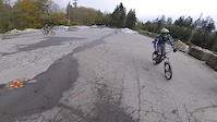
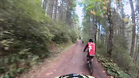
Photos of Silverdale Mountain Bike
Videos of Silverdale Mountain Bike
trail: Gear Jammer
0:36 |
113 |
Oct 22, 2016
trail: OHIO
10:22 |
17421 |
Mar 29, 2015
trail: Wildlife
0:29 |
528 |
Oct 16, 2014

trail: NEVADA
2:07 |
41306 |
Aug 22, 2014

trail: NEVADA
0:52 |
208 |
Nov 14, 2011
trail: NEVADA
0:14 |
28588 |
May 16, 2011

trail: Gear Jammer
3:53 |
282 |
Jan 17, 2011

trail: Wildlife
0:54 |
982 |
Dec 19, 2010
Current Trail Warnings
| status | trail | date | condition | user | info |
|---|---|---|---|---|---|
| Wolf Ridge | Jun 8, 2026 @ 10:23am (America/Los_Angeles) Jun 8, 2026 | Ideal | izzmo | Large tree down across trail, blocking trail |
Recent Trail Reports
Activity Feed
| username | action | type | title | date |
|---|---|---|---|---|
| izzmo | add | report | activity #96545214 and 8 more | Jun 8, 2026 @ 9:31am Jun 8, 2026 |
| friarsky | add | trail | activity #96401662 and 2 more | Jun 6, 2026 @ 1:21pm Jun 6, 2026 |
| friarsky | add | trail | activity #96227631 | Jun 4, 2026 @ 7:55am Jun 4, 2026 |
| friarsky | add | trail | activity #96081390 | Jun 2, 2026 @ 7:05am Jun 2, 2026 |
| fstshrk | add | report | activity #95534785 | May 25, 2026 @ 5:26pm May 25, 2026 |
Recent Comments
| username | type | title | comment | date |
|---|---|---|---|---|
| trail | Numerous trees down across the trail.... | Mar 2, 2025 @ 4:16pm Mar 2, 2025 | ||
| trail | Nice trail. | Aug 8, 2024 @ 1:43am Aug 8, 2024 | ||
| trail | Nice warm-up trail after coming back from CA.... | Aug 8, 2024 @ 1:42am Aug 8, 2024 | ||
| trail | Good condition. | Aug 8, 2024 @ 1:39am Aug 8, 2024 | ||
| trail | Really easy to get lost. Best advice: always... | Jul 23, 2023 @ 12:02pm Jul 23, 2023 |
Local Badges
-

Epic Ride Climb 2k12 awarded -

Climbing 10k Badge8 awarded -

Climbing 100k Badge0 awarded -

Epic Ride Descent 2k12 awarded -

Descent 10k Badge8 awarded -

Descent 100k Badge0 awarded
Activity Type Stats
| activitytype | trails | distance | descent | descent distance | total vertical | rating | global rank | state rank | photos | reports | routes | ridelogs |
|---|---|---|---|---|---|---|---|---|---|---|---|---|
| Mountain Bike | 40 | 20 miles | 1,385 ft | 7 miles | 505 ft | #5,981 | #2,026 | 44 | 149 | 2,838 | ||
| E-Bike | 5 | 4 miles | 190 ft | 2 miles | 453 ft | #8,647 | #2,636 | 105 | 218 | |||
| Gravel Bike | 3 | #702 | #1,211 | 22 | ||||||||
| Horse | 6 | 5 miles | 413 ft | 2 miles | 157 ft | #3,072 | #1,745 | 7 | ||||
| Hike | 50 | 20 miles | 1,440 ft | 7 miles | 505 ft | #6,455 | #2,271 | 149 | 259 | |||
| Trail Running | 50 | 20 miles | 1,440 ft | 7 miles | 505 ft | #6,314 | #2,043 | 145 | 498 |
Frequently Asked Questions About Silverdale
▼
What are the best places to ride in Silverdale?
Silverdale has 3 areas to explore for mountain biking. The top rated areas are:
▼
What are the highest rated mountain biking trails in Silverdale?
The highest rated mountain biking trails in Silverdale are:
- KSS Trail (4.1/5)
- Strange Days (4.1/5)
- Deer Loop (4/5)
- Rhodie Hill (4/5)
- Gear Jammer (3.9/5)
▼
What is the best time of the year to ride in Silverdale?
Based on ride log data, the most popular months to ride in Silverdale are:
- July (47 activities)
- June (34 activities)
- August (31 activities)
▼
Where can I park to ride in Silverdale?
There are 7 parking locations listed in Silverdale. The most popular parking spots are:
- Newberry Hill Heritage Park
- Newberry Hill Heritage Park Access
- Clear Creek Trail Parking - Rotary Gateway Park
- Newberry Hill Heritage Park (Klahowya Secondary School)
- Clear Creek Trail Parking - Silverdale Way
Activities
Trails
Points of Interest
- By Inglekc & contributors
- Admins: EMBA-WS
- #18592 - 4,941 views
- silverdale activity log | embed map of Silverdale mountain bike trails | silverdale mountain biking points of interest
Downloading of trail gps tracks in kml & gpx formats is enabled for Silverdale.
You must login to download files.