close
-
Layers w
- Weather Layers
- Pro
- Pro
- Pro
- Pro
- Pro
- Pro
- More Layers
- Pro
- Pro
- Pro
- Pro
-
Upgrade to

3D
Trail Conditions
- Unknown
- Snow Groomed
- Snow Packed
- Snow Covered
- Snow Cover Partial
- Freeze/thaw Cycle
- Icy
- Prevalent Mud
- Wet
- Variable
- Ideal
- Dry
- Very Dry
Trail Flow (Ridden Direction)
Trailforks scans users ridelogs to determine the most popular direction each trail is ridden. A good flowing trail network will have most trails flowing in a single direction according to their intension.
The colour categories are based on what percentage of riders are riding a trail in its intended direction.
The colour categories are based on what percentage of riders are riding a trail in its intended direction.
- > 96%
- > 90%
- > 80%
- > 70%
- > 50%
- < 50%
- bi-directional trail
- no data
Trail Last Ridden
Trailforks scans ridelogs to determine the last time a trail was ridden.
- < 2 days
- < 1 week
- < 2 weeks
- < 1 month
- < 6 months
- > 6 months
Trail Ridden Direction
The intended direction a trail should be ridden.
- Downhill Only
- Downhill Primary
- Both Directions
- Uphill Primary
- Uphill Only
- One Direction
Contribute Details
Colors indicate trail is missing specified detail.
- Description
- Photos
- Description & Photos
- Videos
Trail Popularity ?
Trailforks scans ridelogs to determine which trails are ridden the most in the last 9 months.
Trails are compared with nearby trails in the same city region with a possible 25 colour shades.
Think of this as a heatmap, more rides = more kinetic energy = warmer colors.
- most popular
- popular
- less popular
- not popular
ATV/ORV/OHV Filter
Max Vehicle Width
inches
US Cell Coverage
Legend

Radar Time
Activity Recordings
Trailforks uses anonymized public activity data.
?
Activity Recordings
Trailforks uses anonymized public activity data.
?
Personal Heatmap
▶
Activity Types
all
/
none
▶
Options
2
Date range
month
–
Winter Trails
Warning
A routing network for winter maps does not exist. Selecting trails using the winter trails layer has been disabled.
Missing Trails
Most Popular
Least Popular
Trails are colored based on popularity. The more popular a trail is, the more red. Less popular trails trend towards green.
Jump Magnitude Heatmap
Heatmap of where riders jump on trails. Zoom in to see individual jumps, click circles to view jump details.
BC Backroad Status
![map legend]()
Service Road Atlas is a free to use, community-driven service for viewing and creating reports on the numerous back-country service roads around B.C. and Alberta.

Slope Aspect
Direction the slope faces
Trails Deemphasized
Trails are shown in grey.
Only show trails with no bike usage.
Suggested Layers
Based on selected activity type
Save the current map location and zoom level as your default home location whenever this page is loaded.
Save
No description for Silverton has been added yet!
Login or register to submit one.
Region Supporters & Maintainers
trail builderSponsor
Activities Click to view
- Mountain Bike
38 trails
- E-Bike
14 trails
- Gravel Bike
0 trails
- Adaptive Bike
0 trails
- Horse
30 trails
- Hike
76 trails
- Trail Running
74 trails
- Dirtbike/Moto
11 trails
- Observed Trials
0 trails
- ATV/ORV/OHV
6 trails
- Snowshoe
4 trails
- Downhill Ski
64 trails
- Backcountry Ski
56 trails
- Nordic Ski
9 trails
Region Details
- 5
- 2
- 8
- 17
- 4
Region Status
Caution as of 10 hoursStats
- Avg Trail Rating
- Trails (view details)
- 123
- Trails Mountain Bike
- 39
- Trails E-Bike
- 14
- Trails Horse
- 30
- Trails Hike
- 76
- Trails Trail Running
- 74
- Trails Dirtbike/Moto
- 11
- Trails ATV/ORV/OHV
- 6
- Trails Snowshoe
- 4
- Trails Downhill Ski
- 64
- Trails Backcountry Ski
- 56
- Trails Nordic Ski
- 9
- Total Distance
- 247 miles
- Total Descent
- 99,323 ft
- Total Vertical
- 5,825 ft
- Highest Trailhead
- 14,049 ft
- Reports
- 279
- Photos
- 142
- Ridden Counter
- 9,656
Articles
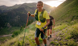
Courtney Dauwalter, Ludovic Pommeret Win Hardrock 100 in Course-Record Times
Jul 19, 2024 from outsideonline.com
It's Dauwalter’s third straight course-record win, while almost 49-year-old Pommeret nailed the grueling 100-mile event on the first try to take...
Sub Regions
-
Baker's Park
- 1
- 1
-
Carson Peak
- 2
- 12
- 2
Popular Silverton Mountain Biking Trails
• 90 ★ 3.5 • 1 mile • 322 ft • 167 •
Popular black diamond difficulty singletrack. This multi-use trail can be used both directions. On average it takes 27 minutes to complete this trail.
• 90 ★ 3.4 • 1 mile • 157 ft • 160 •
Popular black diamond difficulty singletrack. This multi-use trail can be used both directions. On average it takes 18 minutes to complete this trail.
• 65 ★ 3.8 • 8 miles • 1,801 ft • 147 •
Rugged alpine single track, mostly above treeline. Watch out for lightning!
• 75 ★ 3.0 • 16 miles • 3,666 ft • 138 •
A high alpine trail that hits the highest point along the entire CT, it has everything from scree field hike-a-bikes to tasteful alpine descending. This is typically done from spring creek pass as a shuttle ride (or bikepacking) ending...
• 70 ★ 3.0 • 4 miles • 998 ft • 136 •
Popular black diamond difficulty singletrack. This multi-use trail can be used both directions. On average it takes 1 hour34 minutes to complete this trail.
• 100 ★ 5.0 • 2 miles • 23 ft • 133 •
The down segment of Phase 1 of the Bakers Park trail system. Flowy park-style downhill with lots of berms, rock jumps and small drops.
• 100 ★ 0.0 • 3 miles • 1,051 ft • 116 •
Climbing trail for the lower loop for Phase 1 of the Bakers Park trail system. Beautiful climb through aspens and meadows with amazing views of Silverton and the San Juan.
• 80 ★ 4.0 • 5 miles • 132 ft • 115 •
It is highly recommended to start from the Colorado Trail and ride down to Mineral Creek. The top part is pretty overgrown with alpine willow. A bit of traversing and climbing takes you to a hunting camp in the beautiful Putnam Basin....
Silverton Mountain Bike Routes
★ 3.7 • 8 miles • 1,051 ft • 2 •
A short 30-45 minute climb up gets you a great long 20+ minute descent down trail. People can either pedal...
★ 5.0 • 25 miles • 3,600 ft • 5 • Shuttled •
Nice technical high country ride in the Durango Area. Usually ready from late July through September. High...
14 miles • 3,110 ft • 3 •
14 miles • 3,166 ft • 2 •
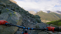
Photos of Silverton Mountain Bike
Videos of Silverton Mountain Bike
trail: Boulder Gulch
0:36 |
|
Jun 8, 2021
trail: Rainbow Trail
3:06 |
335 |
Oct 8, 2013
trail: CT - Molas Creek
6:24 |
153 |
Sep 5, 2021 , Silverton
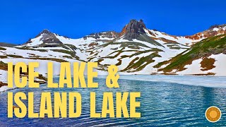
trail: Ice Lake
17:28 |
186 |
Dec 31, 2025 , Silverton
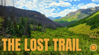
trail: Lost Trail
12:47 |
20 |
Dec 31, 2025 , Silverton
Recent Trail Reports
| status | trail | date | condition | info | user |
|---|---|---|---|---|---|
| CDT CT - East Fork Middle Pole | Jun 17, 2026 @ 2:05pm (America/Denver) 10 hours | Variable | machoprincess | ||
| Maggie Gulch Road | Jun 17, 2026 @ 2:02pm (America/Denver) 10 hours | Ideal | machoprincess | ||
| Bear Creek Silverton | Jun 15, 2026 @ 7:41am (America/Denver) 3 days | Dry | jasbushey Durango | ||
| Phase 1 Descent (Name TBD) | May 25, 2026 @ 10:34am (America/Denver) May 25, 2026 | Ideal | BradChipman FAST | ||
| Phase 1 Climb (Name TBD) | May 25, 2026 @ 10:34am (America/Denver) May 25, 2026 | Ideal | BradChipman FAST | ||
| Pole Creek Trail | Sep 7, 2025 @ 7:23am Sep 7, 2025 | Ideal | markegge | ||
| Pole Creek | Sep 7, 2025 @ 7:23am Sep 7, 2025 | Ideal | markegge | ||
| CDT CT - La Garita Stock Driveway | Sep 7, 2025 @ 7:23am Sep 7, 2025 | Ideal | markegge | ||
| CDT CT - North Clear Creek | Sep 7, 2025 @ 7:23am Sep 7, 2025 | Ideal | markegge | ||
| CDT CT - Carson Saddle | Sep 7, 2025 @ 7:23am Sep 7, 2025 | Ideal | markegge |
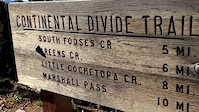
National Scenic Trails & Official Routes
-
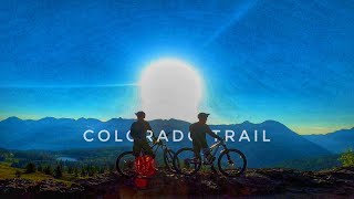
Colorado Trail (Bike)
- Mountain Bike
-
Continental Divide Trail
- Mountain Bike
- Hike
- Trail Running

Activity Feed
| username | action | type | title | date |
|---|---|---|---|---|
| machoprincess | add | report | activity #97205116 and 1 more | Jun 17, 2026 @ 1:02pm 10 hours |
| jasbushey | add | report | activity #97037500 | Jun 15, 2026 @ 6:41am 3 days |
| InfamousBandAid | wishlist | trail | activity #96740471 | Jun 11, 2026 @ 8:44am Jun 11, 2026 |
| JohnDetweiler | add | photo | activity #96383013 | Jun 6, 2026 @ 10:02am Jun 6, 2026 |
| Eidson21 | ridden | trail | activity #96253987 and 1 more | Jun 4, 2026 @ 2:59pm Jun 4, 2026 |
Recent Comments
| username | type | title | comment | date |
|---|---|---|---|---|
| trail | Great downhill very fun | Jun 30, 2025 @ 8:02pm Jun 30, 2025 | ||
| trail | Amazing new trail, go ride this!!! | Jun 28, 2025 @ 6:28am Jun 28, 2025 | ||
| trail | Oh, and there is a parking lot right at the... | Jun 20, 2025 @ 8:00am Jun 20, 2025 | ||
| trail | Nice trail, loose shale rock in the a few... | Jun 20, 2025 @ 7:57am Jun 20, 2025 | ||
| trail | The first eight or so switchbacks are steep... | Nov 5, 2024 @ 2:40pm Nov 5, 2024 |
Local Badges
-

10 Black Trails106 awarded -

Epic Ride Climb 2k224 awarded -

Climbing 10k Badge67 awarded -

Climbing 100k Badge1 awarded -

Epic Ride Descent 2k272 awarded -

Descent 10k Badge89 awarded
Activity Type Stats
| activitytype | trails | distance | descent | descent distance | total vertical | rating | global rank | state rank | photos | reports | routes | ridelogs |
|---|---|---|---|---|---|---|---|---|---|---|---|---|
| Mountain Bike | 38 | 131 miles | 32,352 ft | 68 miles | 3,960 ft | #2,445 | #870 | 135 | 274 | 8 | 4,270 | |
| E-Bike | 14 | 57 miles | 15,167 ft | 31 miles | 3,717 ft | #2,991 | #1,111 | 211 | 126 | |||
| Horse | 30 | 108 miles | 31,516 ft | 59 miles | 4,951 ft | #483 | #497 | 153 | 1 | |||
| Hike | 76 | 228 miles | 63,894 ft | 119 miles | 5,823 ft | #824 | #377 | 2 | 268 | 18 | 2,579 | |
| Trail Running | 74 | 226 miles | 63,894 ft | 119 miles | 5,823 ft | #702 | #260 | 268 | 18 | 394 | ||
| Dirtbike/Moto | 11 | 51 miles | 14,140 ft | 29 miles | 3,717 ft | #661 | #228 | 5 | 153 | 5 | ||
| ATV/ORV/OHV | 6 | 33 miles | 7,959 ft | 18 miles | 3,451 ft | #563 | #209 | 151 | 23 | |||
| Snowshoe | 4 | 5 miles | 522 ft | 1 mile | 4,665 ft | #624 | #249 | 137 | 5 | 156 | ||
| Downhill Ski | 64 | 19 miles | 35,420 ft | 19 miles | 2,746 ft | #375 | #150 | 353 | ||||
| Backcountry Ski | 56 | 2 miles | 1,394 ft | #381 | #79 | 1 | 1,464 | |||||
| Nordic Ski | 9 | 5 miles | 531 ft | 1 mile | 4,678 ft | #674 | #238 | 137 | 1 | 610 |
Frequently Asked Questions About Silverton
▼
What are the best places to ride in Silverton?
Silverton has 5 areas to explore for mountain biking. The top rated areas are:
▼
What are the highest rated mountain biking trails in Silverton?
The highest rated mountain biking trails in Silverton are:
- Phase 1 Descent (Name TBD) (4.2/5)
- Boulder Gulch (4.2/5)
- Ice Lake (4.1/5)
- Rainbow Trail (4.1/5)
- Bear Creek Silverton (4/5)
▼
What is the best time of the year to ride in Silverton?
Based on ride log data, the most popular months to ride in Silverton are:
- July (101 activities)
- August (80 activities)
- September (77 activities)
▼
Where can I park to ride in Silverton?
There are 18 parking locations listed in Silverton. The most popular parking spots are: View all parking and trailhead locations on the map to plan your visit.
Activities
Trails
- By canadaka
 Trailforks & contributors
 - Admins: jpmcghee, msmcfate, cmcquade, SSS, SJMA
- #4947 - 14,219 views
- silverton activity log | embed map of Silverton mountain bike trails | silverton mountain biking points of interest
Downloading of trail gps tracks in kml & gpx formats is enabled for Silverton.
You must login to download files.