close
-
Layers w
- Weather Layers
- Pro
- Pro
- Pro
- Pro
- Pro
- Pro
- More Layers
- Pro
- Pro
- Pro
- Pro
-
Upgrade to

3D
Trail Conditions
- Unknown
- Snow Groomed
- Snow Packed
- Snow Covered
- Snow Cover Partial
- Freeze/thaw Cycle
- Icy
- Prevalent Mud
- Wet
- Variable
- Ideal
- Dry
- Very Dry
Trail Flow (Ridden Direction)
Trailforks scans users ridelogs to determine the most popular direction each trail is ridden. A good flowing trail network will have most trails flowing in a single direction according to their intension.
The colour categories are based on what percentage of riders are riding a trail in its intended direction.
The colour categories are based on what percentage of riders are riding a trail in its intended direction.
- > 96%
- > 90%
- > 80%
- > 70%
- > 50%
- < 50%
- bi-directional trail
- no data
Trail Last Ridden
Trailforks scans ridelogs to determine the last time a trail was ridden.
- < 2 days
- < 1 week
- < 2 weeks
- < 1 month
- < 6 months
- > 6 months
Trail Ridden Direction
The intended direction a trail should be ridden.
- Downhill Only
- Downhill Primary
- Both Directions
- Uphill Primary
- Uphill Only
- One Direction
Contribute Details
Colors indicate trail is missing specified detail.
- Description
- Photos
- Description & Photos
- Videos
Trail Popularity ?
Trailforks scans ridelogs to determine which trails are ridden the most in the last 9 months.
Trails are compared with nearby trails in the same city region with a possible 25 colour shades.
Think of this as a heatmap, more rides = more kinetic energy = warmer colors.
- most popular
- popular
- less popular
- not popular
ATV/ORV/OHV Filter
Max Vehicle Width
inches
US Cell Coverage
Legend

Radar Time
Activity Recordings
Trailforks uses anonymized public activity data.
?
Activity Recordings
Trailforks uses anonymized public activity data.
?
Personal Heatmap
▶
Activity Types
all
/
none
▶
Options
2
Date range
month
–
Winter Trails
Warning
A routing network for winter maps does not exist. Selecting trails using the winter trails layer has been disabled.
Missing Trails
Most Popular
Least Popular
Trails are colored based on popularity. The more popular a trail is, the more red. Less popular trails trend towards green.
Jump Magnitude Heatmap
Heatmap of where riders jump on trails. Zoom in to see individual jumps, click circles to view jump details.
BC Backroad Status
![map legend]()
Service Road Atlas is a free to use, community-driven service for viewing and creating reports on the numerous back-country service roads around B.C. and Alberta.

Slope Aspect
Direction the slope faces
Trails Deemphasized
Trails are shown in grey.
Only show trails with no bike usage.
Suggested Layers
Based on selected activity type
Save the current map location and zoom level as your default home location whenever this page is loaded.
SaveRegional District Okanagan-Similkameen. Important population centres include the district municipality of Summerland, the towns of Oliver, Osoyoos, and Princeton, and the village of Keremeos.
Activities Click to view
- Mountain Bike
123 trails
- E-Bike
32 trails
- Horse
62 trails
- Hike
237 trails
- Trail Running
228 trails
- Dirtbike/Moto
32 trails
- ATV/ORV/OHV
26 trails
- Snowmobile
9 trails
- Snowshoe
53 trails
- Downhill Ski
42 trails
- Backcountry Ski
81 trails
- Nordic Ski
78 trails
Stats
- Avg Trail Rating
- Trails (view details)
- 267
- Trails Mountain Bike
- 123
- Trails E-Bike
- 32
- Trails Horse
- 62
- Trails Hike
- 237
- Trails Trail Running
- 228
- Trails Dirtbike/Moto
- 33
- Trails ATV/ORV/OHV
- 26
- Trails Snowmobile
- 12
- Trails Snowshoe
- 53
- Trails Downhill Ski
- 42
- Trails Backcountry Ski
- 81
- Trails Nordic Ski
- 78
- Total Distance
- 424 miles
- Total Descent
- 94,073 ft
- Total Vertical
- 7,297 ft
- Highest Trailhead
- 8,601 ft
- Reports
- 191
- Photos
- 302
- Ridden Counter
- 11,349
Popular Trail Networks
view all areas »Sub Regions
- Hedley (1)
- Keremeos (17)
- Princeton (52)
- Bankeir (11)
- China Ridge (30)
- Lodestone Lake Recreation Site (0)
- Wilderness Trails (6)
- Tulameen (15)
- E.C.Manning Provincial Park (14)
- Kane Valley Trails (24)
Popular Similkameen Mountain Biking Trails
• 100 ★ 4.4 • 5 miles • 865 ft • 104 •
is a singletrack XC trail constructed for family enjoyment. The trail is named after William Thompson who’s birth coincided with the commencement of trail construction. The trail was named after in appreciation of the enthusiasm and...
• 95 ★ 4.0 • 3 miles • 66 ft • 90 •
The new mountain bike originates on the China Ridge Trail network and joins with the historic Kettle Valley (KVR). “It has challenges, but has been built to accommodate more than just the extreme cyclists who like to shred through a...
• 90 ★ 3.4 • 4,715 ft • 25 ft • 82 •
The new mountain bike originates on the China Ridge Trail network and joins with the historic Kettle Valley (KVR). “It has challenges, but has been built to accommodate more than just the extreme cyclists who like to shred through a...
• 90 ★ 1.0 • 2 miles • 71 ft • 61 •
A forest service road that connects Lightning Lakes campground to the trailhead. It can also be ridden in a loop with .
• 100 ★ 1.0 • 1 mile • 134 ft • 60 •
Popular blue difficulty doubletrack. This multi-use trail can be used both directions. On average it takes 9 minutes to complete this trail.
• 95 ★ 1.7 • 3 miles • 1,431 ft • 55 •
Climbs up through the ski resort from the Strawberry Flats parking lot. Lots of great views and alpine flowers in the right season.
• 65 ★ 1.0 • 2 miles • 527 ft • 46 •
A forest service road that connects Lightning Lakes campground to the trailhead. It can also be used as a loop when ridden with . Can be ridden either direction.
• 85 ★ 5.0 • 1 mile • 17 ft • 37 • • hike
The is one of the busy trails in the park. The trailhead is located at the bridge crossing the Similkameen River approximately 1 km from Hwy 3 along the Gibson Pass Road. This trail is the connection for the , , and Frosty trails....
Similkameen Mountain Bike Routes
Whipsaw Trail Featured
★ 2.7 • 62 miles • 7,063 ft • 2 • Loop •
The infamous Whipsaw Trail BIgger bikes consider doing this counter clockwise starting from Tulameen side...
★ 5.0 • 26 miles • 2,960 ft • 5 • Loop •
Chugger is an annual memorial ride to commemorate the inspirational work Duncan MacKenzie completed at...
4 miles • 51 ft • 11 • Loop •
follows the KVR Trail and Princeton-Summerland Highway looping around Osprey Lake. Can be traveled in...
★ 1.0 • 3 miles • 76 ft • 4 • Loop •
Loop of Link Lake can be done in either direction. Highest elevation on south side of route. Mix of rail...
3 miles • 48 ft • 0 •
follows the KVR on the south side of Osprey Lake and the Princeton-Summerland Rd on the north. Connecting...
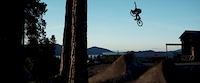
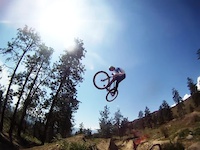
Photos of Similkameen Mountain Bike
Videos of Similkameen Mountain Bike

trail: Parking Lot
0:07 |
36 |
Oct 15, 2018

trail: Parking Lot
0:08 |
15 |
Oct 15, 2018
trail: Shadow
2:25 |
39922 |
Mar 17, 2017
trail: Skyline I/II
0:11 |
167 |
Nov 24, 2015
trail: Skyline I/II
0:10 |
262 |
Sep 3, 2015

trail: Skyline I/II
0:09 |
183 |
Aug 30, 2015
trail: Lower Rail Trail
10:08 |
518 |
Aug 7, 2015
trail: Upper Rail Trail
3:57 |
220 |
Aug 7, 2015
Recent Trail Reports
Activity Feed
| username | action | type | title | date |
|---|---|---|---|---|
| darklord | add | report | activity #96926923 | Jun 13, 2026 @ 4:59pm Jun 13, 2026 |
| gregorys | add | report | activity #96065218 | Jun 1, 2026 @ 11:50pm Jun 1, 2026 |
| dvdan | wishlist | trail | activity #95760308 | May 29, 2026 @ 12:15am May 29, 2026 |
| cdh585 | wishlist | trail | activity #95225082 | May 21, 2026 @ 11:23pm May 21, 2026 |
| Jennyoakey | add | photo | activity #95007397 and 1 more | May 18, 2026 @ 4:20pm May 18, 2026 |
Recent Comments
| username | type | title | comment | date |
|---|---|---|---|---|
| report | C'mon....an old Cove guy like you should have... | Sep 23, 2025 @ 3:10pm Sep 23, 2025 | ||
| trail | Great little ride. Really enjoyed the trail... | May 7, 2025 @ 10:45am May 7, 2025 | ||
| trail | Lots of trees down on east end of trail. At... | Dec 24, 2024 @ 10:36am Dec 24, 2024 | ||
| trail | Loved this trail. A great ride especially with... | Aug 11, 2024 @ 8:19pm Aug 11, 2024 | ||
| trail | Cattle are a big issue here especially if you... | Jun 8, 2024 @ 5:00pm Jun 8, 2024 |
Local Badges
-

Completionist0 awarded -

Epic Mountain Bike Climb 2k0 awarded -
Completionist0 awarded -

10 Blue Trails1 awarded -

Top 10 Trails0 awarded -

Epic Ride 50k69 awarded
Bike & Skill Parks
| name | type | city | rating |
|---|---|---|---|
| Princeton Bike Park | skill park | Princeton | |
| Hampton Campground Bike Park | skill park |
Local Trail Supporters
- Similkameen Trails Society
Local Trail Association
Activity Type Stats
| activitytype | trails | distance | descent | descent distance | total vertical | rating | global rank | state rank | photos | reports | routes | ridelogs |
|---|---|---|---|---|---|---|---|---|---|---|---|---|
| Mountain Bike | 123 | 204 miles | 33,304 ft | 91 miles | 5,948 ft | 258 | 178 | 6 | 2,208 | |||
| E-Bike | 32 | 50 miles | 7,963 ft | 22 miles | 3,973 ft | 3 | 124 | 3 | 176 | |||
| Horse | 62 | 97 miles | 12,917 ft | 46 miles | 4,357 ft | 2 | 54 | 2 | 6 | |||
| Hike | 237 | 380 miles | 75,981 ft | 168 miles | 7,297 ft | 32 | 188 | 4 | 2,746 | |||
| Trail Running | 228 | 364 miles | 71,391 ft | 160 miles | 7,297 ft | 186 | 6 | 929 | ||||
| Dirtbike/Moto | 32 | 28 miles | 4,757 ft | 12 miles | 2,182 ft | 41 | 4 | 260 | ||||
| ATV/ORV/OHV | 26 | 22 miles | 2,890 ft | 9 miles | 2,152 ft | 5 | 38 | 4 | 70 | |||
| Snowmobile | 9 | 15 miles | 2,018 ft | 7 miles | 1,161 ft | 5 | 4 | 68 | ||||
| Snowshoe | 53 | 56 miles | 9,416 ft | 21 miles | 4,216 ft | 17 | 235 | |||||
| Downhill Ski | 42 | 11 miles | 13,583 ft | 10 miles | 1,814 ft | 3 | 924 | |||||
| Backcountry Ski | 81 | 98 miles | 28,392 ft | 38 miles | 6,112 ft | 2 | 14 | 892 | ||||
| Nordic Ski | 78 | 110 miles | 14,357 ft | 54 miles | 3,629 ft | 17 | 720 |
Frequently Asked Questions About Similkameen
▼
What are the best places to ride in Similkameen?
Similkameen has 9 areas to explore for mountain biking. The top rated areas are:
▼
What are the highest rated mountain biking trails in Similkameen?
The highest rated mountain biking trails in Similkameen are:
- Parker Trail (4.2/5)
- West Similkameen Trail (4.1/5)
- Fireman (4.1/5)
- Barry's Trail (4.1/5)
- Menzies Trail (4.1/5)
▼
What is the best time of the year to ride in Similkameen?
Based on ride log data, the most popular months to ride in Similkameen are:
- July (57 activities)
- August (51 activities)
- September (44 activities)
▼
What is the longest trail in Similkameen?
The longest trail in Similkameen is Monument 83 at 9.5 miles. View all trails sorted by distance.
Activities
- Similkameen Mountain Biking Trails
- Similkameen E-Biking Trails
- Similkameen Horseback Trails
- Similkameen Hiking Trails
- Similkameen Trail Running Trails
- Similkameen Dirtbiking Trails
- Similkameen ATVing/Offroading Trails
- Similkameen Snowmobiling Trails
- Similkameen Snowshoeing Trails
- Similkameen Skiing Trails
- Similkameen Backcountry Skiing Trails
- Similkameen Nordic Skiing Trails
Trails
Points of Interest
- Buckhorn Campground Camping
- Strike Lake Campground Camping
- Bare Tree Cabin
- Sunrise Blind Cabin
- Noon Blind Cabin
- Chain Lake West Camping
- Link Lake Recreation Camp site Camping
- Hampton Campground Camping
- Blackwell Peak Summit
- Shelter Cabin
- Grimface Mountain (8,629 ft)
- Lakeview Mountain (8,586 ft)
- Stone City (8,540 ft)
- By canadaka
 Trailforks & contributors
 - Admins: BCBR, TrailsBC, BCORMA, DSBC, wheelmaniac3, bcpunk, canadianenduro, 1partatatime
- #3024 - 4,965 views
- similkameen activity log | embed map of Similkameen mountain bike trails | similkameen mountain biking points of interest
Downloading of trail gps tracks in kml & gpx formats is enabled for Similkameen.
You must login to download files.