close
-
Layers w
- Weather Layers
- Pro
- Pro
- Pro
- Pro
- Pro
- Pro
- More Layers
- Pro
- Pro
- Pro
- Pro
-
Upgrade to

3D
Trail Conditions
- Unknown
- Snow Groomed
- Snow Packed
- Snow Covered
- Snow Cover Partial
- Freeze/thaw Cycle
- Icy
- Prevalent Mud
- Wet
- Variable
- Ideal
- Dry
- Very Dry
Trail Flow (Ridden Direction)
Trailforks scans users ridelogs to determine the most popular direction each trail is ridden. A good flowing trail network will have most trails flowing in a single direction according to their intension.
The colour categories are based on what percentage of riders are riding a trail in its intended direction.
The colour categories are based on what percentage of riders are riding a trail in its intended direction.
- > 96%
- > 90%
- > 80%
- > 70%
- > 50%
- < 50%
- bi-directional trail
- no data
Trail Last Ridden
Trailforks scans ridelogs to determine the last time a trail was ridden.
- < 2 days
- < 1 week
- < 2 weeks
- < 1 month
- < 6 months
- > 6 months
Trail Ridden Direction
The intended direction a trail should be ridden.
- Downhill Only
- Downhill Primary
- Both Directions
- Uphill Primary
- Uphill Only
- One Direction
Contribute Details
Colors indicate trail is missing specified detail.
- Description
- Photos
- Description & Photos
- Videos
Trail Popularity ?
Trailforks scans ridelogs to determine which trails are ridden the most in the last 9 months.
Trails are compared with nearby trails in the same city region with a possible 25 colour shades.
Think of this as a heatmap, more rides = more kinetic energy = warmer colors.
- most popular
- popular
- less popular
- not popular
ATV/ORV/OHV Filter
Max Vehicle Width
inches
US Cell Coverage
Legend

Radar Time
Activity Recordings
Trailforks uses anonymized public activity data.
?
Activity Recordings
Trailforks uses anonymized public activity data.
?
Personal Heatmap
▶
Activity Types
all
/
none
▶
Options
2
Date range
month
–
Winter Trails
Warning
A routing network for winter maps does not exist. Selecting trails using the winter trails layer has been disabled.
Missing Trails
Most Popular
Least Popular
Trails are colored based on popularity. The more popular a trail is, the more red. Less popular trails trend towards green.
Jump Magnitude Heatmap
Heatmap of where riders jump on trails. Zoom in to see individual jumps, click circles to view jump details.
BC Backroad Status
![map legend]()
Service Road Atlas is a free to use, community-driven service for viewing and creating reports on the numerous back-country service roads around B.C. and Alberta.

Slope Aspect
Direction the slope faces
Trails Deemphasized
Trails are shown in grey.
Only show trails with no bike usage.
Suggested Layers
Based on selected activity type
Save the current map location and zoom level as your default home location whenever this page is loaded.
Save
No description for Singapore has been added yet!
Login or register to submit one.
Stats
- Avg Trail Rating
- Trails (view details)
- 956
- Trails Mountain Bike
- 958
- Trails E-Bike
- 345
- Trails Hike
- 1,699
- Trails Trail Running
- 1,696
- Total Distance
- 24 miles
- Total Descent
- 2,167 ft
- Total Vertical
- 242 ft
- Highest Trailhead
- 248 ft
- Reports
- 329
- Photos
- 109
- Ridden Counter
- 8,709
Sub Regions
- Tampines Quarry (223)
- Bukit Timah (2)
- Pasir Panjang (17)
- Pulau Ubin (4)
- Singaopre (342)
- Chestnuts (341)
- Singapore (4)
- Tampines (116)
- Lower Selatar Reservoir (1)
- Rifle Range Nature Park (0)
- Sungei Bulah Wetland Reserve (0)
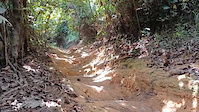
Popular Singapore Mountain Biking Trails
• 100 ★ 4.0 • 4 miles • 369 ft • 293 •
Highly rated popular green difficulty singletrack. This mountain bike primary trail and has a moderate overall physical rating with a 369 ft black diamond climb. On average it takes 41 minutes to complete this trail.
• 100 ★ 4.4 • 3 miles • 190 ft • 220 •
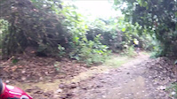
Track 15 runs between Mandai Road in the north and runs into the Chestnut North loop of the Chestnut Nature Park MTB trails. It is a beginner-friendly route with wide turns, some fun downhill sections, a few intense but short climbs,...
• 100 ★ 4.5 • 2 miles • 386 ft • 125 •
Jungle single track in one direction (clockwise) around an old reservoir on Pulau Ubin. Trail offers lots of flow with technical A / B line features throughout.
• 100 ★ 2.7 • 1,250 ft • 2 ft • 91 •
Very short downhill course located within Kentridge park. Trail is downhill only and offers some rock garden, drops, berms, jumps
• 70 ★ 3.0 • 1 mile • 197 ft • 89 •
Easy intermediate trail, a few short climbs and 3 big drops that make it more difficult
• 50 ★ 3.0 • 1 mile • 126 ft • 60 •
Adding here for someone who wants to use for trailforks.
• ★ 0.0 • 5,105 ft • 27 ft • 39 • • hike
Green difficulty singletrack. This hike primary trail can be used both directions and has a easy overall physical rating. Trail visibility is always easy to follow.
Singapore Mountain Bike Routes
12 miles • 1,159 ft • 6 • Out & Back •
Race route for the Singapore Open Enduro 2026 - Kid-duro and Enduro events.
5 miles • 542 ft • 1 • Point to Point • Race •
Race route for the Singapore Open Enduro 2026 - Kid-duro event. This comprises of 3 race stages, as well...
5 miles • 636 ft • 1 • Point to Point • Race •
Singapore Open Enduro 2026 (11 July) race route for Kid-duro categories.
5 miles • 636 ft • 1 • Point to Point • Race •
Race route for the Singapore Open Enduro 2026 - Kid-duro event.
12 miles • 1,159 ft • 6 • Loop • Race •
Singapore Open enduro is the island city-state's original enduro format MTB community event Established...
12 miles • 1,159 ft • 6 • Loop • Race •
Singapore Open enduro is the island city-state's original enduro format MTB community event Established...
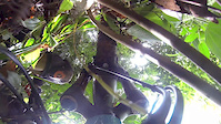
Photos of Singapore Mountain Bike
Videos of Singapore Mountain Bike
0:21 |
66 |
Jun 1, 2022

0:39 |
|
Jun 10, 2021

trail: Kent Ridge XC
2:37 |
63 |
Mar 22, 2021

4:56 |
220 |
Sep 25, 2018
trail: Ketam MTB Trail
0:33 |
317 |
Feb 12, 2017

trail: Ketam MTB Trail
25:34 |
298 |
Nov 13, 2016

trail: Ketam MTB Trail
5:23 |
125 |
May 2, 2016
trail: Scorpion
3:27 |
260 |
Oct 30, 2014
Recent Comments
| username | type | title | comment | date |
|---|---|---|---|---|
| report | The tree has meanwhile been removed | Apr 14, 2026 @ 7:18am Apr 14, 2026 | ||
| trail | This trail is closed for redevelopment. Big shame. | Sep 16, 2024 @ 1:01am Sep 16, 2024 | ||
| trail | NOT a green/blue trail. Some intermediate... | Feb 20, 2024 @ 4:49am Feb 20, 2024 | ||
| trail | Did this today with a rented hardtail from... | Jan 17, 2024 @ 11:36pm Jan 17, 2024 | ||
| trail | Andreas. Call a bike transporter, see Carousell. | Mar 18, 2023 @ 10:14pm Mar 18, 2023 |
Activity Type Stats
| activitytype | trails | distance | descent | descent distance | total vertical | rating | global rank | state rank | photos | reports | routes | ridelogs |
|---|---|---|---|---|---|---|---|---|---|---|---|---|
| Mountain Bike | 958 | 24 miles | 2,169 ft | 9 miles | 243 ft | #68 | 106 | 329 | 19 | 54,231 | ||
| E-Bike | 345 | #73 | 304 | 751 | ||||||||
| Hike | 1,693 | 9 miles | 1,050 ft | 4 miles | 180 ft | #36 | 313 | 1,685 | ||||
| Trail Running | 1,696 | 9 miles | 1,050 ft | 4 miles | 180 ft | #54 | 313 | 1,133 |
Activities
Trails
Points of Interest
- By canadaka
 Trailforks & contributors
 - Admins: apply
- #3238 - 21,271 views
- singapore activity log | embed map of Singapore mountain bike trails | singapore mountain biking points of interest
Downloading of trail gps tracks in kml & gpx formats is enabled for Singapore.
You must login to download files.