close
-
Layers w
- Weather Layers
- Pro
- Pro
- Pro
- Pro
- Pro
- Pro
- More Layers
- Pro
- Pro
- Pro
- Pro
-
Upgrade to

3D
Trail Conditions
- Unknown
- Snow Groomed
- Snow Packed
- Snow Covered
- Snow Cover Partial
- Freeze/thaw Cycle
- Icy
- Prevalent Mud
- Wet
- Variable
- Ideal
- Dry
- Very Dry
Trail Flow (Ridden Direction)
Trailforks scans users ridelogs to determine the most popular direction each trail is ridden. A good flowing trail network will have most trails flowing in a single direction according to their intension.
The colour categories are based on what percentage of riders are riding a trail in its intended direction.
The colour categories are based on what percentage of riders are riding a trail in its intended direction.
- > 96%
- > 90%
- > 80%
- > 70%
- > 50%
- < 50%
- bi-directional trail
- no data
Trail Last Ridden
Trailforks scans ridelogs to determine the last time a trail was ridden.
- < 2 days
- < 1 week
- < 2 weeks
- < 1 month
- < 6 months
- > 6 months
Trail Ridden Direction
The intended direction a trail should be ridden.
- Downhill Only
- Downhill Primary
- Both Directions
- Uphill Primary
- Uphill Only
- One Direction
Contribute Details
Colors indicate trail is missing specified detail.
- Description
- Photos
- Description & Photos
- Videos
Trail Popularity ?
Trailforks scans ridelogs to determine which trails are ridden the most in the last 9 months.
Trails are compared with nearby trails in the same city region with a possible 25 colour shades.
Think of this as a heatmap, more rides = more kinetic energy = warmer colors.
- most popular
- popular
- less popular
- not popular
ATV/ORV/OHV Filter
Max Vehicle Width
inches
US Cell Coverage
Legend

Radar Time
Activity Recordings
Trailforks uses anonymized public activity data.
?
Activity Recordings
Trailforks uses anonymized public activity data.
?
Personal Heatmap
▶
Activity Types
all
/
none
▶
Options
2
Date range
month
–
Winter Trails
Warning
A routing network for winter maps does not exist. Selecting trails using the winter trails layer has been disabled.
Missing Trails
Most Popular
Least Popular
Trails are colored based on popularity. The more popular a trail is, the more red. Less popular trails trend towards green.
Jump Magnitude Heatmap
Heatmap of where riders jump on trails. Zoom in to see individual jumps, click circles to view jump details.
BC Backroad Status
![map legend]()
Service Road Atlas is a free to use, community-driven service for viewing and creating reports on the numerous back-country service roads around B.C. and Alberta.

Slope Aspect
Direction the slope faces
Trails Deemphasized
Trails are shown in grey.
Only show trails with no bike usage.
Suggested Layers
Based on selected activity type
Save the current map location and zoom level as your default home location whenever this page is loaded.
Save
No description for Singen has been added yet!
Login or register to submit one.
This region uses the Uk/Euro style trail grading system.
Activities Click to view
- Mountain Bike
12 trails
- E-Bike
11 trails
- Adaptive Bike
0 trails
- Hike
0 trails
- Trail Running
0 trails
Region Details
- 1
- 3
- 4
- 3
- 1
Region Status
Open as of Aug 30, 2025Stats
- Avg Trail Rating
- Trails (view details)
- 12
- Trails Mountain Bike
- 12
- Trails E-Bike
- 11
- Total Distance
- 2 miles
- Total Descent
- 1,436 ft
- Total Vertical
- 732 ft
- Highest Trailhead
- 2,303 ft
- Reports
- 59
- Photos
- 9
- Ridden Counter
- 977
Sub Regions
-
Bikepark Schinerberg
- 2
- 4
- 3
- 1
Popular Singen Mountain Biking Trails
• 50 ★ 4.5 • 2,792 ft • 6 ft • 165 •
Highly rated moderately popular blue difficulty singletrack. This mountain bike primary trail can be used downhill primary and has a easy overall physical rating. It features berm, drop and jump. On average it takes 10 minutes to complete this trail.
• 65 ★ 0.0 • 1,486 ft • 0 ft • 77 •
Moderately popular red difficulty singletrack. This mountain bike primary trail can be used downhill only and has a hard overall physical rating. Adaptive MTB rating: amtb blue.
• 70 ★ 5.0 • 2,208 ft • 0 ft • 68 •
Popular red difficulty singletrack. This mountain bike primary trail can be used downhill only and has a hard overall physical rating. Adaptive MTB rating: amtb blue.
• 95 ★ 5.0 • 1,732 ft • 3 ft • 68 •
Popular black difficulty singletrack. This mountain bike primary trail can be used downhill only. Adaptive MTB rating: amtb black.
• 100 ★ 0.0 • 627 ft • 12 ft • 66 •
Popular black difficulty singletrack. This mountain bike primary trail can be used downhill only. Adaptive MTB rating: amtb black.
• 85 ★ 0.0 • 1,949 ft • 12 ft • 66 •
Popular blue difficulty singletrack. This mountain bike primary trail can be used downhill primary and has a easy overall physical rating. It features berm, drop and jump.
• 80 ★ 0.0 • 1,801 ft • 3 ft • 65 •
Popular red difficulty singletrack. This mountain bike primary trail can be used downhill only. Adaptive MTB rating: amtb blue.
• 5 ★ 3.7 • 4,677 ft • 0 ft • 45 •
Less popular blue difficulty singletrack. This mountain bike primary trail can be used downhill only. On average it takes 7 minutes to complete this trail.
Videos of Singen Mountain Bike
youtuber
![I took a bit of a digger at Schienerberg]()
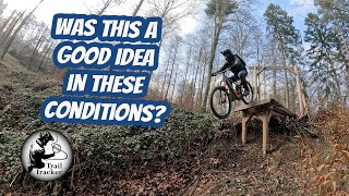
trail: MTB Black Upper
11:01 |
198 |
Feb 26, 2025 , Singen
Recent Trail Reports
| status | trail | date | condition | info | user |
|---|---|---|---|---|---|
| MTB Blue Lower | Aug 30, 2025 @ 8:24am Aug 30, 2025 | Ideal | karls-drowning | ||
| MTB Blue Upper | Aug 30, 2025 @ 8:23am Aug 30, 2025 | Ideal | karls-drowning | ||
| Steinhaldentrail | Aug 30, 2025 @ 8:23am Aug 30, 2025 | Ideal | karls-drowning | ||
| MTB Black Upper | Apr 21, 2025 @ 10:21am Apr 21, 2025 | Ideal | glaborie | ||
| MTB Black Lower | Apr 21, 2025 @ 10:21am Apr 21, 2025 | Ideal | glaborie | ||
| MTB Red Lower | Apr 21, 2025 @ 10:21am Apr 21, 2025 | Ideal | glaborie | ||
| MTB Red | Apr 21, 2025 @ 10:21am Apr 21, 2025 | Ideal | glaborie | ||
| MTB Red Upper | Apr 21, 2025 @ 10:21am Apr 21, 2025 | Ideal | glaborie | ||
| MTB Black/Red | Apr 21, 2025 @ 10:21am Apr 21, 2025 | Ideal | glaborie | ||
| Bikepark Schienerberg Uphill | Apr 21, 2025 @ 10:21am Apr 21, 2025 | Ideal | glaborie |
Activity Feed
| username | action | type | title | date |
|---|---|---|---|---|
| Leaclp | wishlist | region | activity #94739413 | May 15, 2026 @ 3:18am May 15, 2026 |
| tderstroff | wishlist | trail | activity #89788629 | Mar 1, 2026 @ 10:35am Mar 1, 2026 |
| i4KZsI | ridden | trail | activity #85065754 and 1 more | Dec 2, 2025 @ 11:23am Dec 2, 2025 |
| i4KZsI | ridden | trail | activity #85065669 and 7 more | Dec 2, 2025 @ 11:22am Dec 2, 2025 |
| QDorh7 | wishlist | region | activity #79575736 | Sep 3, 2025 @ 1:04pm Sep 3, 2025 |
Recent Comments
| username | type | title | comment | date |
|---|---|---|---|---|
| trail | It was pretty fine. Quite steep for a blue not... | Apr 27, 2025 @ 2:01pm Apr 27, 2025 | ||
| trail | Jahreszeitenbedingt ordentlich Laub im Trail.... | Nov 16, 2024 @ 8:12am Nov 16, 2024 | ||
| trail | Achtung, Holzfällerarbeiten! Abschnittsweise... | Jan 7, 2022 @ 1:58pm Jan 7, 2022 | ||
| trail | Hier sollte bitte der Eintrag nachgebessert... | Sep 5, 2021 @ 8:21am Sep 5, 2021 | ||
| trail | Es gibt nicht einen Trail, sondern drei: Blau... | Nov 29, 2020 @ 12:09am Nov 29, 2020 |
Local Badges
-

Epic Mountain Bike Climb 2k0 awarded -

Climbing 10k Badge1 awarded -

Mountain Biking 100k Badge0 awarded -

Epic Ride Descent 2k0 awarded -

Descent 10k Badge1 awarded -

Descent 100k Badge0 awarded
Activity Type Stats
| activitytype | trails | distance | descent | descent distance | total vertical | rating | global rank | state rank | photos | reports | routes | ridelogs |
|---|---|---|---|---|---|---|---|---|---|---|---|---|
| Mountain Bike | 12 | 2 miles | 1,437 ft | 2 miles | 732 ft | #7,090 | #256 | 9 | 59 | 1,625 | ||
| E-Bike | 11 | 2 miles | 1,437 ft | 2 miles | 732 ft | #6,891 | #304 | 49 | 109 |
Frequently Asked Questions About Singen
▼
What are the best places to ride in Singen?
Singen has 1 areas to explore for mountain biking. The top rated areas are:
▼
What are the highest rated mountain biking trails in Singen?
The highest rated mountain biking trails in Singen are:
- MTB Blue Upper (4.2/5)
- Wilder Mann (4.2/5)
- Steinhaldentrail (3.9/5)
- MTB Black/Red (0/5)
- MTB Black Lower (0/5)
▼
What is the best time of the year to ride in Singen?
Based on ride log data, the most popular months to ride in Singen are:
- October (10 activities)
- July (8 activities)
- April (7 activities)
▼
Where can I park to ride in Singen?
There are 1 parking locations listed in Singen. The most popular parking spots are:
- By canadaka
 Trailforks & contributors
 - Admins: HDRiders, Sasse82, sp00n82, martywis
- #18120 - 2,449 views
- singen activity log | embed map of Singen mountain bike trails | singen mountain biking points of interest
Downloading of trail gps tracks in kml & gpx formats is enabled for Singen.
You must login to download files.