close
-
Layers w
- Weather Layers
- Pro
- Pro
- Pro
- Pro
- Pro
- Pro
- More Layers
- Pro
- Pro
- Pro
- Pro
-
Upgrade to

3D
Trail Conditions
- Unknown
- Snow Groomed
- Snow Packed
- Snow Covered
- Snow Cover Partial
- Freeze/thaw Cycle
- Icy
- Prevalent Mud
- Wet
- Variable
- Ideal
- Dry
- Very Dry
Trail Flow (Ridden Direction)
Trailforks scans users ridelogs to determine the most popular direction each trail is ridden. A good flowing trail network will have most trails flowing in a single direction according to their intension.
The colour categories are based on what percentage of riders are riding a trail in its intended direction.
The colour categories are based on what percentage of riders are riding a trail in its intended direction.
- > 96%
- > 90%
- > 80%
- > 70%
- > 50%
- < 50%
- bi-directional trail
- no data
Trail Last Ridden
Trailforks scans ridelogs to determine the last time a trail was ridden.
- < 2 days
- < 1 week
- < 2 weeks
- < 1 month
- < 6 months
- > 6 months
Trail Ridden Direction
The intended direction a trail should be ridden.
- Downhill Only
- Downhill Primary
- Both Directions
- Uphill Primary
- Uphill Only
- One Direction
Contribute Details
Colors indicate trail is missing specified detail.
- Description
- Photos
- Description & Photos
- Videos
Trail Popularity ?
Trailforks scans ridelogs to determine which trails are ridden the most in the last 9 months.
Trails are compared with nearby trails in the same city region with a possible 25 colour shades.
Think of this as a heatmap, more rides = more kinetic energy = warmer colors.
- most popular
- popular
- less popular
- not popular
ATV/ORV/OHV Filter
Max Vehicle Width
inches
US Cell Coverage
Legend

Radar Time
Activity Recordings
Trailforks uses anonymized public activity data.
?
Activity Recordings
Trailforks uses anonymized public activity data.
?
Personal Heatmap
▶
Activity Types
all
/
none
▶
Options
2
Date range
month
–
Winter Trails
Warning
A routing network for winter maps does not exist. Selecting trails using the winter trails layer has been disabled.
Missing Trails
Most Popular
Least Popular
Trails are colored based on popularity. The more popular a trail is, the more red. Less popular trails trend towards green.
Jump Magnitude Heatmap
Heatmap of where riders jump on trails. Zoom in to see individual jumps, click circles to view jump details.
BC Backroad Status
![map legend]()
Service Road Atlas is a free to use, community-driven service for viewing and creating reports on the numerous back-country service roads around B.C. and Alberta.

Slope Aspect
Direction the slope faces
Trails Deemphasized
Trails are shown in grey.
Only show trails with no bike usage.
Suggested Layers
Based on selected activity type
Save the current map location and zoom level as your default home location whenever this page is loaded.
Save
No description for Sintra has been added yet!
Login or register to submit one.
AKA: Concelho de Sintra
This region uses the Uk/Euro style trail grading system.
Activities Click to view
- Mountain Bike
14 trails
- E-Bike
11 trails
- Gravel Bike
0 trails
- Adaptive Bike
0 trails
- Winter Fat Bike
0 trails
- Horse
0 trails
- Hike
29 trails
- Trail Running
27 trails
Region Details
- 6
- 3
- 3
Region Status
Caution as of 15 hoursLocal Trail Association
Stats
- Avg Trail Rating
- Trails (view details)
- 7
- Trails Mountain Bike
- 16
- Trails E-Bike
- 11
- Trails Hike
- 29
- Trails Trail Running
- 27
- Total Distance
- 2 miles
- Total Descent Distance
- 1 mile
- Total Descent
- 1,073 ft
- Total Vertical
- 923 ft
- Highest Trailhead
- 1,506 ft
- Reports
- 1,048
- Photos
- 154
- Ridden Counter
- 9,442
Articles

Video: Micayla Gatto & Scotty Laughland Ride Sintra's Enchanted Forests - GoPro Track Down S1 EP3
Aug 6, 2019 from pinkbike.com
Scotty Laughland and Micayla Gatto headed to the Portuguese coast to sample as much of this mountain bike paradise as they could.
Sub Regions
-
Belas
- 1
- 7
- 8
- 1
-
Parque Natural de Sintra-Cascais
- 26
- 51
- 26
- 1
Popular Sintra Mountain Biking Trails
• 85 ★ 4.7 • 1 mile • 28 ft • 611 •
Very fast narrow single-track surrounded by short bushes featuring some natural gullies.
• 100 ★ 5.0 • 2,457 ft • 0 ft • 536 •
Highly rated popular green difficulty singletrack. This mountain bike primary trail can be used downhill primary and has a easy overall physical rating with a 0 ft green climb. On average it takes 3 minutes to complete this trail.
• 90 ★ 4.7 • 1 mile • 6 ft • 536 •
Easy flow trail with tight berms in the top section followed by more open/faster berms on the second part. The third section is slightly steeper and more natural. To access the second section you need to do a small climb along the...
• 100 ★ 4.5 • 590 ft • 0 ft • 526 •
Highly rated popular red difficulty singletrack. This mountain bike primary trail can be used downhill only. It features drop, jump and rock face. On average it takes 1 minutes to complete this trail.
• 70 ★ 4.6 • 3,753 ft • 0 ft • 487 •
Highly rated popular blue difficulty singletrack. This multi-use trail can be used downhill primary. It features drop, jump and skinny. On average it takes 8 minutes to complete this trail.
• 100 ★ 5.0 • 695 ft • 2 ft • 460 •
Highly rated popular red difficulty singletrack. This mountain bike primary trail can be used downhill primary. It features drop, jump and rock face. On average it takes minutes to complete this trail.
• 100 ★ 5.0 • 793 ft • 0 ft • 442 •
Highly rated popular red difficulty singletrack. This mountain bike primary trail can be used downhill primary. It features drop, jump and rock face. On average it takes 2 minutes to complete this trail.
Sintra Mountain Bike Routes
★ 4.5 • 23 miles • 3,838 ft • 20 • Loop •
Inicio junto á Penha Longa e subida em direcção ao trilho para chegar ao . No fim do Flow seguimos pelo...
• 23 miles • 5,227 ft • 18 •
• 16 miles • 2,618 ft • 14 •
• 27 miles • 3,760 ft • 1 •
Photos of Sintra Mountain Bike
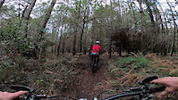
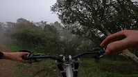
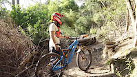
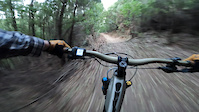
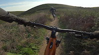
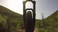
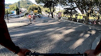
Videos of Sintra Mountain Bike

trail: 4 Seasons - Middle
2:14 |
37 |
Jan 1, 2024
trail: 2022 (top)
2:23 |
50 |
Dec 22, 2023
trail: 4 Seasons - Bottom
0:27 |
13 |
Dec 14, 2023
trail: Impossível
0:00 |
196 |
Sep 13, 2023
trail: Taça do Mundo
0:15 |
281 |
Feb 18, 2022
trail: Abano
0:12 |
149 |
Dec 26, 2021
trail: Abano
0:30 |
46 |
Mar 4, 2021
trail: Pedra Branca
9:50 |
78 |
Sep 30, 2019
Current Trail Warnings
| status | trail | date | condition | user | info |
|---|---|---|---|---|---|
| 2022 (top) | Jun 3, 2026 @ 10:41am (Europe/Lisbon) Jun 3, 2026 | Unknown | rent4trail | Trail section braided (multiple alt lines) | |
| Zero | Jun 3, 2026 @ 10:40am (Europe/Lisbon) Jun 3, 2026 | Ideal | rent4trail | Trail section braided (multiple alt lines) | |
| Malveira Left | Jun 3, 2026 @ 10:40am (Europe/Lisbon) Jun 3, 2026 | Unknown | rent4trail | Major erosion (major ruts or slumping,... |
Recent Trail Reports
| status | trail | date | condition | info | user |
|---|---|---|---|---|---|
| Home | Jun 23, 2026 @ 7:09pm (Europe/Lisbon) 15 hours | Ideal | mattiapic | ||
| Abano | Jun 22, 2026 @ 9:32am (Europe/Lisbon) 2 days | Dry | mattiapic | ||
| Burros Middle | Jun 22, 2026 @ 9:30am (Europe/Lisbon) 2 days | Dry | mattiapic | ||
| Burros Upper | Jun 22, 2026 @ 9:28am (Europe/Lisbon) 2 days | Dry | mattiapic | ||
| Yakuza | Jun 10, 2026 @ 11:31pm (Europe/Lisbon) Jun 10, 2026 | Unknown | Nunofs | ||
| Connector | Jun 4, 2026 @ 10:24am (Europe/Lisbon) Jun 4, 2026 | Ideal | Torrazo CDL-PFM | ||
| Charlie's | Jun 8, 2026 @ 9:47pm (Europe/Lisbon) Jun 8, 2026 | Ideal | zimbora | ||
| Charlie's | Jun 8, 2026 @ 9:46pm (Europe/Lisbon) Jun 8, 2026 | Ideal | zimbora | ||
| Trilho do Avô | May 24, 2026 @ 10:17am (Europe/Lisbon) May 24, 2026 | Ideal | RicardoColaco | ||
| Dimas -1 e 0 | May 24, 2026 @ 10:17am (Europe/Lisbon) May 24, 2026 | Ideal | RicardoColaco |
Activity Feed
| username | action | type | title | date |
|---|---|---|---|---|
| mattiapic | add | report | activity #97639735 | Jun 23, 2026 @ 11:09am 15 hours |
| mattiapic | ridden | trail | activity #97639694 | Jun 23, 2026 @ 11:09am 15 hours |
| mattiapic | add | report | activity #97548587 and 2 more | Jun 22, 2026 @ 1:28am 2 days |
| mattiapic | ridden | trail | activity #97548537 and 1 more | Jun 22, 2026 @ 1:27am 2 days |
| Steven5956 | wishlist | route | activity #97547000 | Jun 22, 2026 @ 12:29am 2 days |
Recent Comments
| username | type | title | comment | date |
|---|---|---|---|---|
| trail | Not red a tall. It is black | Jun 20, 2026 @ 4:33am Jun 20, 2026 | ||
| trail | Trees down before and after the road crossing | Mar 3, 2026 @ 3:46pm Mar 3, 2026 | ||
| trail | Trees down before and after the road crossing | Mar 3, 2026 @ 3:44pm Mar 3, 2026 | ||
| trail | Broken, needs to be maintained for flow | Dec 27, 2025 @ 5:39am Dec 27, 2025 | ||
| trail | All good | Nov 30, 2025 @ 10:10pm Nov 30, 2025 |
Local Badges
-

Epic Mountain Bike Climb 2k11 awarded -

Climbing 10k Badge13 awarded -

Mountain Biking 100k Badge1 awarded -

Big Ride 30k265 awarded -

Epic Ride 50k92 awarded
Local Mountain Biking Directory
-
WERIDE.pt
-
Cycling Rentals
-
Rent4Trail
![Rent4Trail]()
-
2CyclingBike Shop
-
The Bike ShopBike Shop
Local Trail Supporters
- TF and co.
Activity Type Stats
| activitytype | trails | distance | descent | descent distance | total vertical | rating | global rank | state rank | photos | reports | routes | ridelogs |
|---|---|---|---|---|---|---|---|---|---|---|---|---|
| Mountain Bike | 14 | 2 miles | 846 ft | 1 mile | 745 ft | #619 | #2 | 147 | 1,099 | 10,897 | ||
| E-Bike | 11 | 2,680 ft | 407 ft | 1,801 ft | 407 ft | #236 | #3 | 6 | 1,069 | 2,796 | ||
| Hike | 29 | 1 mile | 810 ft | 5,141 ft | 738 ft | #2,227 | #8 | 1,091 | 876 | |||
| Trail Running | 27 | 1 mile | 810 ft | 5,141 ft | 738 ft | #1,607 | #6 | 1,091 | 724 |
Frequently Asked Questions About Sintra
▼
What are the best places to ride in Sintra?
Sintra has 1 areas to explore for mountain biking. The top rated areas are:
▼
What are the highest rated mountain biking trails in Sintra?
The highest rated mountain biking trails in Sintra are:
- Kamikaze 5 (4.6/5)
- Trilho do Avô (4.6/5)
- Kamikaze 2 (4.6/5)
- Kamikaze 3 (4.6/5)
- Pedra Branca (4.6/5)
▼
What is the best time of the year to ride in Sintra?
Based on ride log data, the most popular months to ride in Sintra are:
- July (82 activities)
- October (82 activities)
- February (80 activities)
▼
Where can I park to ride in Sintra?
- By carlosparentee & contributors
- Admins: elyari, AMG, marcossantamaria, CDL-PFM
- #4282 - 33,355 views
- sintra activity log | embed map of Sintra mountain bike trails | sintra mountain biking points of interest
Downloading of trail gps tracks in kml & gpx formats is enabled for Sintra.
You must login to download files.