close
-
Layers w
- Weather Layers
- Pro
- Pro
- Pro
- Pro
- Pro
- Pro
- More Layers
- Pro
- Pro
- Pro
- Pro
-
Upgrade to

3D
Trail Conditions
- Unknown
- Snow Groomed
- Snow Packed
- Snow Covered
- Snow Cover Partial
- Freeze/thaw Cycle
- Icy
- Prevalent Mud
- Wet
- Variable
- Ideal
- Dry
- Very Dry
Trail Flow (Ridden Direction)
Trailforks scans users ridelogs to determine the most popular direction each trail is ridden. A good flowing trail network will have most trails flowing in a single direction according to their intension.
The colour categories are based on what percentage of riders are riding a trail in its intended direction.
The colour categories are based on what percentage of riders are riding a trail in its intended direction.
- > 96%
- > 90%
- > 80%
- > 70%
- > 50%
- < 50%
- bi-directional trail
- no data
Trail Last Ridden
Trailforks scans ridelogs to determine the last time a trail was ridden.
- < 2 days
- < 1 week
- < 2 weeks
- < 1 month
- < 6 months
- > 6 months
Trail Ridden Direction
The intended direction a trail should be ridden.
- Downhill Only
- Downhill Primary
- Both Directions
- Uphill Primary
- Uphill Only
- One Direction
Contribute Details
Colors indicate trail is missing specified detail.
- Description
- Photos
- Description & Photos
- Videos
Trail Popularity ?
Trailforks scans ridelogs to determine which trails are ridden the most in the last 9 months.
Trails are compared with nearby trails in the same city region with a possible 25 colour shades.
Think of this as a heatmap, more rides = more kinetic energy = warmer colors.
- most popular
- popular
- less popular
- not popular
ATV/ORV/OHV Filter
Max Vehicle Width
inches
US Cell Coverage
Legend

Radar Time
Activity Recordings
Trailforks uses anonymized public activity data.
?
Activity Recordings
Trailforks uses anonymized public activity data.
?
Personal Heatmap
▶
Activity Types
all
/
none
▶
Options
2
Date range
month
–
Winter Trails
Warning
A routing network for winter maps does not exist. Selecting trails using the winter trails layer has been disabled.
Missing Trails
Most Popular
Least Popular
Trails are colored based on popularity. The more popular a trail is, the more red. Less popular trails trend towards green.
Jump Magnitude Heatmap
Heatmap of where riders jump on trails. Zoom in to see individual jumps, click circles to view jump details.
BC Backroad Status
![map legend]()
Service Road Atlas is a free to use, community-driven service for viewing and creating reports on the numerous back-country service roads around B.C. and Alberta.

Slope Aspect
Direction the slope faces
Trails Deemphasized
Trails are shown in grey.
Only show trails with no bike usage.
Suggested Layers
Based on selected activity type
Save the current map location and zoom level as your default home location whenever this page is loaded.
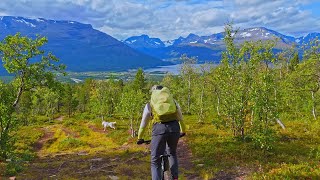
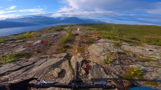
Save1.5h drive from Tromsø. Small town called Skibotn with many trails just behind town, great camping possibilities and a generally very dry climate.
Primary Trail Type: All-Mountain & Downhill
This region uses the Uk/Euro style trail grading system.
Activities Click to view
- Mountain Bike
20 trails
- E-Bike
1 trails
- Adaptive Bike
0 trails
- Winter Fat Bike
0 trails
- Horse
1 trails
- Hike
19 trails
- Trail Running
19 trails
- Dirtbike/Moto
1 trails
- ATV/ORV/OHV
1 trails
Region Details
- 7
- 10
Region Status
Open as of Jul 10, 2025Stats
- Avg Trail Rating
- Trails (view details)
- 22
- Trails Mountain Bike
- 20
- Trails E-Bike
- 1
- Trails Horse
- 1
- Trails Hike
- 19
- Trails Trail Running
- 19
- Trails Dirtbike/Moto
- 1
- Trails ATV/ORV/OHV
- 1
- Trails Backcountry Ski
- 2
- Total Distance
- 29 miles
- Total Descent
- 13,525 ft
- Total Vertical
- 4,962 ft
- Highest Trailhead
- 4,975 ft
- Reports
- 30
- Photos
- 28
- Ridden Counter
- 464
Popular Skibotn Mountain Biking Trails
• 95 ★ 4.2 • 3 miles • 21 ft • 44 •
An absolute gem of a trail. The view at the top is amazing as you have a great vantage point towards Signaldalen, Kitdalen and the Lyngen alps. The trail itself is a blast to ride and offers diverse riding; steeper terrain in the upper...
• 75 ★ 4.0 • 4,188 ft • 3 ft • 39 •
NB!!! Trail needs maintenance, closed until further notice! Sweet singeltrack from the Sledo river. The trail is connected to Hengden. DO NOT BIKE WHEN WET!
• 100 ★ 0.0 • 1,924 ft • 261 ft • 38 •
Popular green difficulty gravel path. This mountain bike primary trail can be used uphill primary. On average it takes 6 minutes to complete this trail.
• 70 ★ 3.5 • 4,044 ft • 0 ft • 36 •
Popular blue difficulty mixed. This mountain bike primary trail can be used downhill primary with a 0 ft blue climb. It features drop and rock garden. On average it takes 6 minutes to complete this trail.
• 5 ★ 3.4 • 2 miles • 261 ft • 24 •
The Bollmannsveien route is an old military road built by Russian, Yugoslavian and Polish prisoners of war at the end of World War II. The road was part of the defence barrier, the Lyngen Line. It’s now an important cultural heritage...
Photos of Skibotn Mountain Bike
Videos of Skibotn Mountain Bike
trail: Skibotn Shopping
9:59 |
34 |
Nov 11, 2025 , Skibotn
trail: Várdovárri
18:49 |
54 |
Oct 27, 2025 , Skibotn
Recent Trail Reports
| status | trail | date | condition | info | user |
|---|---|---|---|---|---|
| Uptrack | Jul 10, 2025 @ 12:22pm Jul 10, 2025 | Ideal | pelcyc | ||
| Mannfjellaksla | Jun 10, 2025 @ 10:31am Jun 10, 2025 | Dry | teunvandenbrink | ||
| Hengen | May 24, 2025 @ 12:14pm May 24, 2025 | Wet | kga | ||
| Hotti | May 24, 2025 @ 10:55am May 24, 2025 | Wet | kga | ||
| Sledo Singeltrack | Aug 4, 2021 @ 6:10am Aug 4, 2021 | Variable | kaarle | ||
| Elva | Aug 11, 2020 @ 3:22am Aug 11, 2020 | Variable | ejo016 | ||
| Shopping Nord | Aug 11, 2020 @ 3:22am Aug 11, 2020 | Ideal | ejo016 | ||
| Bollmannsveien/Blodveien | Jul 31, 2020 @ 5:48am Jul 31, 2020 | Variable | Thomas0 | ||
| Uptrack | Jul 13, 2019 @ 6:33am Jul 13, 2019 | Dry | blueberrybiker | ||
| St-Hanshaugen sør | Aug 19, 2017 @ 5:32pm Aug 19, 2017 | Dry | ErikGustafsson |
Activity Feed
| username | action | type | title | date |
|---|---|---|---|---|
| Heliplausch | add | photo | activity #92748272 and 3 more | Apr 16, 2026 @ 2:33pm Apr 16, 2026 |
| Tomnov | add | video | activity #83952214 | Nov 11, 2025 @ 2:44am Nov 11, 2025 |
| Tomnov | add | video | activity #83105688 | Oct 27, 2025 @ 3:56am Oct 27, 2025 |
| Cykeljohan | update | region | activity #83050438 | Oct 26, 2025 @ 7:01am Oct 26, 2025 |
| Mikk0jii | ridden | trail | activity #80821827 | Sep 21, 2025 @ 7:32am Sep 21, 2025 |
Recent Comments
| username | type | title | comment | date |
|---|---|---|---|---|
| trail | Quite wet track. | Jul 29, 2020 @ 8:10am Jul 29, 2020 |
Local Badges
-

Epic Ride Climb 2k6 awarded -

Climbing 10k Badge0 awarded -

Climbing 100k Badge0 awarded -

Epic Ride Descent 2k6 awarded -

Descent 10k Badge0 awarded -

Descent 100k Badge0 awarded
Activity Type Stats
| activitytype | trails | distance | descent | descent distance | total vertical | rating | global rank | state rank | photos | reports | routes | ridelogs |
|---|---|---|---|---|---|---|---|---|---|---|---|---|
| Mountain Bike | 20 | 23 miles | 13,442 ft | 18 miles | 1,814 ft | #2,103 | #26 | 28 | 30 | 426 | ||
| E-Bike | 1 | 1 mile | 66 ft | 764 ft | 568 ft | #1,961 | #24 | 20 | 29 | |||
| Horse | 1 | 1 mile | 66 ft | 764 ft | 568 ft | #657 | #11 | 16 | ||||
| Hike | 19 | 22 miles | 12,890 ft | 17 miles | 1,814 ft | #2,183 | #32 | 26 | 103 | |||
| Trail Running | 19 | 22 miles | 12,890 ft | 17 miles | 1,814 ft | #1,695 | #32 | 26 | 19 | |||
| Dirtbike/Moto | 1 | 1 mile | 66 ft | 764 ft | 568 ft | #476 | #7 | 16 | ||||
| ATV/ORV/OHV | 1 | 1 mile | 66 ft | 764 ft | 568 ft | #331 | #9 | 16 | ||||
| Backcountry Ski | 2 | 6 miles | 82 ft | 1,949 ft | 4,941 ft | 54 |
Frequently Asked Questions About Skibotn
▼
What are the highest rated mountain biking trails in Skibotn?
The highest rated mountain biking trails in Skibotn are:
- Shopping Nord (4.3/5)
- Skibotn Shopping (4.2/5)
- Mannfjellaksla (4.1/5)
- Hengen (4.1/5)
- Sledo Singeltrack (4/5)
▼
What is the best time of the year to ride in Skibotn?
Based on ride log data, the most popular months to ride in Skibotn are:
- July (27 activities)
- August (9 activities)
- June (7 activities)
▼
Where can I park to ride in Skibotn?
There are 1 parking locations listed in Skibotn. The most popular parking spots are:
▼
What is the longest trail in Skibotn?
The longest trail in Skibotn is Mannfjellaksla at 4.2 km. View all trails sorted by distance.
Trails
Points of Interest
- By sam-swag-g
 TromsøEnduro & contributors
 - Admins: maristam
- #8578 - 11,362 views
- skibotn activity log | embed map of Skibotn mountain bike trails | skibotn mountain biking points of interest
Downloading of trail gps tracks in kml & gpx formats is enabled for Skibotn.
You must login to download files.