close
-
Layers w
- Weather Layers
- Pro
- Pro
- Pro
- Pro
- Pro
- Pro
- More Layers
- Pro
- Pro
- Pro
- Pro
-
Upgrade to

3D
Trail Conditions
- Unknown
- Snow Groomed
- Snow Packed
- Snow Covered
- Snow Cover Partial
- Freeze/thaw Cycle
- Icy
- Prevalent Mud
- Wet
- Variable
- Ideal
- Dry
- Very Dry
Trail Flow (Ridden Direction)
Trailforks scans users ridelogs to determine the most popular direction each trail is ridden. A good flowing trail network will have most trails flowing in a single direction according to their intension.
The colour categories are based on what percentage of riders are riding a trail in its intended direction.
The colour categories are based on what percentage of riders are riding a trail in its intended direction.
- > 96%
- > 90%
- > 80%
- > 70%
- > 50%
- < 50%
- bi-directional trail
- no data
Trail Last Ridden
Trailforks scans ridelogs to determine the last time a trail was ridden.
- < 2 days
- < 1 week
- < 2 weeks
- < 1 month
- < 6 months
- > 6 months
Trail Ridden Direction
The intended direction a trail should be ridden.
- Downhill Only
- Downhill Primary
- Both Directions
- Uphill Primary
- Uphill Only
- One Direction
Contribute Details
Colors indicate trail is missing specified detail.
- Description
- Photos
- Description & Photos
- Videos
Trail Popularity ?
Trailforks scans ridelogs to determine which trails are ridden the most in the last 9 months.
Trails are compared with nearby trails in the same city region with a possible 25 colour shades.
Think of this as a heatmap, more rides = more kinetic energy = warmer colors.
- most popular
- popular
- less popular
- not popular
ATV/ORV/OHV Filter
Max Vehicle Width
inches
US Cell Coverage
Legend

Radar Time
Activity Recordings
Trailforks uses anonymized public activity data.
?
Activity Recordings
Trailforks uses anonymized public activity data.
?
Personal Heatmap
▶
Activity Types
all
/
none
▶
Options
2
Date range
month
–
Winter Trails
Warning
A routing network for winter maps does not exist. Selecting trails using the winter trails layer has been disabled.
Missing Trails
Most Popular
Least Popular
Trails are colored based on popularity. The more popular a trail is, the more red. Less popular trails trend towards green.
Jump Magnitude Heatmap
Heatmap of where riders jump on trails. Zoom in to see individual jumps, click circles to view jump details.
BC Backroad Status
![map legend]()
Service Road Atlas is a free to use, community-driven service for viewing and creating reports on the numerous back-country service roads around B.C. and Alberta.

Slope Aspect
Direction the slope faces
Trails Deemphasized
Trails are shown in grey.
Only show trails with no bike usage.
Suggested Layers
Based on selected activity type
Save the current map location and zoom level as your default home location whenever this page is loaded.
SaveRegion includes the trails of the Slate Valley which stretches from Castleton in the north, through Poultney, to Wells to the south.
Activities Click to view
- Mountain Bike
67 trails
- Hike
66 trails
- Trail Running
66 trails
- Snowmobile
0 trails
- Snowshoe
30 trails
Stats
- Avg Trail Rating
- Trails (view details)
- 69
- Trails Mountain Bike
- 67
- Trails Gravel Bike
- 4
- Trails Adaptive Bike
- 20
- Trails Winter Fat Bike
- 5
- Trails Hike
- 66
- Trails Trail Running
- 66
- Trails Snowshoe
- 30
- Total Distance
- 64 miles
- Total Descent
- 9,735 ft
- Total Vertical
- 1,024 ft
- Highest Trailhead
- 1,406 ft
- Reports
- 2,604
- Photos
- 141
- Ridden Counter
- 24,908
Sub Regions
- Castleton (3)
- Poultney (48)
- Endless Brook Trails (26)
- Fairgrounds Trails (20)
- Wells (0)
- Wells (15)
- Delaney Woods (14)
Popular Slate Valley Mountain Biking Trails
• 100 ★ 4.3 • 4,813 ft • 89 ft • 849 •
Highly rated popular green difficulty singletrack. This mountain bike primary trail and has a easy overall physical rating with a 89 ft green climb. Adaptive MTB rating: amtb green. On average it takes 7 minutes to complete this trail.
• 90 ★ 4.0 • 3,665 ft • 183 ft • 814 •
This twisty singletrack trail is the main access point for all the other trails in the network. Expect technical steep side-hills after the long bridge over a beautiful gorge.
• 80 ★ 4.7 • 1 mile • 250 ft • 813 •
Highly rated popular blue difficulty singletrack. This mountain bike primary trail and has a moderate overall physical rating with a 250 ft blue climb. Trail visibility is always easy to follow. On average it takes 14 minutes to complete this trail.
• 90 ★ 4.8 • 3,068 ft • 13 ft • 791 •
Popular green difficulty singletrack. This mountain bike primary trail and has a easy overall physical rating with a 13 ft green climb. On average it takes 5 minutes to complete this trail.
• 70 ★ 4.3 • 2 miles • 79 ft • 776 •
Highly rated popular blue difficulty singletrack. This mountain bike primary trail and has a moderate overall physical rating with a 79 ft blue climb. Trail visibility is always easy to follow. On average it takes 16 minutes to complete this trail.
• 75 ★ 4.3 • 2 miles • 450 ft • 735 •
Highly rated popular blue difficulty singletrack. This mountain bike primary trail and has a hard overall physical rating with a 450 ft blue climb. On average it takes 34 minutes to complete this trail.
• 100 ★ 3.0 • 715 ft • 31 ft • 728 •
Popular green difficulty singletrack. This mountain bike primary trail and has a easy overall physical rating with a 31 ft green climb. On average it takes minutes to complete this trail.
• 75 ★ 4.7 • 4,741 ft • 173 ft • 717 •
Highly rated popular blue difficulty singletrack. This mountain bike primary trail can be used both directions. On average it takes 12 minutes to complete this trail.
Slate Valley Mountain Bike Routes
★ 5.0 • 11 miles • 2,001 ft • 8 •
A counter clockwise loop so that you can ride as a downhill track. is included but you could ride a...
4 miles • 333 ft • 5 • Loop •
This route starts and finishes at the Fairgrounds Trailhead. It consists of 2 Green loops that can be...
19 miles • 2,494 ft • 14 • Loop •
This route is based out of the Fairgrounds parking lot and features the highlights from the northern part...
8 miles • 1,283 ft • 5 •
A counter clockwise loop so that you can ride as a downhill track. is not included but you could add it as...
6 miles • 988 ft • 4 • Loop •
Clockwise loop heading up Hardy's hill and then back down after taking in the view at the summit. Links to...
7 miles • 537 ft • 12 • Loop •
This loop starts at the Fairgrounds trailhead and features the green trails accessed from that lot. These...
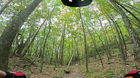
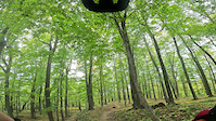
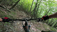
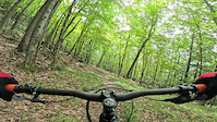
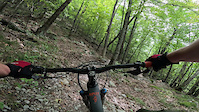
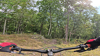
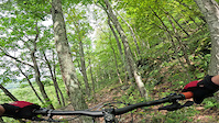
Photos of Slate Valley Mountain Bike
Videos of Slate Valley Mountain Bike
trail: Hunker Down
3:13 |
162 |
Oct 9, 2023
trail: Hunker Down
2:38 |
103 |
Oct 9, 2023
trail: Lightning
3:04 |
121 |
Oct 9, 2023
trail: Lightning
3:39 |
|
Sep 23, 2023
trail: Lightning
3:04 |
|
Sep 18, 2023

trail: Lightning
0:31 |
119 |
Sep 18, 2023
trail: Lower Birdie
2:53 |
189 |
Sep 18, 2023
trail: Lightning
0:31 |
|
Sep 18, 2023
Recent Trail Reports
Activity Feed
| username | action | type | title | date |
|---|---|---|---|---|
| BrokenHandlebar | add | report | activity #97431460 | Jun 20, 2026 @ 2:04pm 21 hours |
| Cielo | wishlist | route | activity #97394233 | Jun 20, 2026 @ 7:43am 1 day |
| CPSEMASS | wishlist | route | activity #97393210 | Jun 20, 2026 @ 7:32am 1 day |
| pabsa | wishlist | route | activity #97385782 | Jun 20, 2026 @ 5:51am 1 day |
| melanievE3wEi | wishlist | route | activity #97317271 | Jun 19, 2026 @ 7:50am 2 days |
Recent Comments
| username | type | title | comment | date |
|---|---|---|---|---|
| trail | Fun, fast decent, two thumbs up. | Apr 25, 2026 @ 1:22pm Apr 25, 2026 | ||
| trail | Amazing mix of rock rolls, jumps, and... | Apr 12, 2026 @ 2:51pm Apr 12, 2026 | ||
| trail | Amigos fans will dig this trail ;) | Oct 17, 2025 @ 5:42pm Oct 17, 2025 | ||
| trail | Adios lovers will dig this trail 😉 | Aug 4, 2025 @ 12:56pm Aug 4, 2025 | ||
| trail | Pretty loop but the double track it spits you... | Jul 8, 2025 @ 7:56pm Jul 8, 2025 |
Local Badges
-

Epic Ride Descent 2k0 awarded -

10 Blue Trails169 awarded -

Epic Mountain Bike Climb 2k0 awarded -

Climbing 10k Badge0 awarded -

Mountain Biking 100k Badge0 awarded -

Descent 100k Badge0 awarded
Bike & Skill Parks
| name | type | city | rating |
|---|---|---|---|
| Paradox MX/Hickory Hill MX | skill park | Wells |
Upcoming Local Events
Activity Type Stats
| activitytype | trails | distance | descent | descent distance | total vertical | rating | global rank | state rank | photos | reports | routes | ridelogs |
|---|---|---|---|---|---|---|---|---|---|---|---|---|
| Mountain Bike | 67 | 61 miles | 8,796 ft | 24 miles | 1,024 ft | 138 | 2,593 | 18 | 12,016 | |||
| Gravel Bike | 4 | 2 miles | 138 ft | 3,497 ft | 804 ft | 206 | 1 | 108 | ||||
| Adaptive Bike | 20 | 20 miles | 1,503 ft | 7 miles | 935 ft | 867 | 1 | |||||
| Winter Fat Bike | 5 | 8 miles | 217 ft | 4 miles | 256 ft | 37 | 2 | |||||
| Hike | 66 | 59 miles | 7,762 ft | 23 miles | 1,024 ft | 2 | 2,576 | 408 | ||||
| Trail Running | 66 | 59 miles | 7,762 ft | 23 miles | 1,024 ft | 2,576 | 227 | |||||
| Snowshoe | 30 | 30 miles | 4,711 ft | 10 miles | 906 ft | 666 | 20 |
Frequently Asked Questions About Slate Valley
▼
What are the best places to ride in Slate Valley?
Slate Valley has 5 areas to explore for mountain biking. The top rated areas are:
▼
What are the highest rated mountain biking trails in Slate Valley?
The highest rated mountain biking trails in Slate Valley are:
- Hunker Down (4.6/5)
- Lower Birdie (4.5/5)
- Lower Ledges (4.4/5)
- Upper Birdie (4.3/5)
- Clown Shoes (4.3/5)
▼
What is the best time of the year to ride in Slate Valley?
Based on ride log data, the most popular months to ride in Slate Valley are:
- July (291 activities)
- August (217 activities)
- September (214 activities)
▼
What is the longest trail in Slate Valley?
The longest trail in Slate Valley is Carnie at 2.6 miles. View all trails sorted by distance.
Activities
Trails
- By ridevtsjc & contributors
- Admins: VMBA, Velomont, Jwduston, SVT
- #25321 - 20,308 views
- slate valley activity log | embed map of Slate Valley mountain bike trails | slate valley mountain biking points of interest
Downloading of trail gps tracks in kml & gpx formats is enabled for Slate Valley.
You must login to download files.