close
-
Layers w
- Weather Layers
- Pro
- Pro
- Pro
- Pro
- Pro
- Pro
- More Layers
- Pro
- Pro
- Pro
- Pro
-
Upgrade to

3D
Trail Conditions
- Unknown
- Snow Groomed
- Snow Packed
- Snow Covered
- Snow Cover Partial
- Freeze/thaw Cycle
- Icy
- Prevalent Mud
- Wet
- Variable
- Ideal
- Dry
- Very Dry
Trail Flow (Ridden Direction)
Trailforks scans users ridelogs to determine the most popular direction each trail is ridden. A good flowing trail network will have most trails flowing in a single direction according to their intension.
The colour categories are based on what percentage of riders are riding a trail in its intended direction.
The colour categories are based on what percentage of riders are riding a trail in its intended direction.
- > 96%
- > 90%
- > 80%
- > 70%
- > 50%
- < 50%
- bi-directional trail
- no data
Trail Last Ridden
Trailforks scans ridelogs to determine the last time a trail was ridden.
- < 2 days
- < 1 week
- < 2 weeks
- < 1 month
- < 6 months
- > 6 months
Trail Ridden Direction
The intended direction a trail should be ridden.
- Downhill Only
- Downhill Primary
- Both Directions
- Uphill Primary
- Uphill Only
- One Direction
Contribute Details
Colors indicate trail is missing specified detail.
- Description
- Photos
- Description & Photos
- Videos
Trail Popularity ?
Trailforks scans ridelogs to determine which trails are ridden the most in the last 9 months.
Trails are compared with nearby trails in the same city region with a possible 25 colour shades.
Think of this as a heatmap, more rides = more kinetic energy = warmer colors.
- most popular
- popular
- less popular
- not popular
ATV/ORV/OHV Filter
Max Vehicle Width
inches
US Cell Coverage
Legend

Radar Time
Activity Recordings
Trailforks uses anonymized public activity data.
?
Activity Recordings
Trailforks uses anonymized public activity data.
?
Personal Heatmap
▶
Activity Types
all
/
none
▶
Options
2
Date range
month
–
Winter Trails
Warning
A routing network for winter maps does not exist. Selecting trails using the winter trails layer has been disabled.
Missing Trails
Most Popular
Least Popular
Trails are colored based on popularity. The more popular a trail is, the more red. Less popular trails trend towards green.
Jump Magnitude Heatmap
Heatmap of where riders jump on trails. Zoom in to see individual jumps, click circles to view jump details.
BC Backroad Status
![map legend]()
Service Road Atlas is a free to use, community-driven service for viewing and creating reports on the numerous back-country service roads around B.C. and Alberta.

Slope Aspect
Direction the slope faces
Trails Deemphasized
Trails are shown in grey.
Only show trails with no bike usage.
Suggested Layers
Based on selected activity type
Save the current map location and zoom level as your default home location whenever this page is loaded.
Save
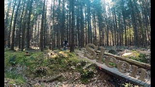
No description for Sleen has been added yet!
Login or register to submit one.
Activities Click to view
- Mountain Bike
8 trails
Region Details
- 2
- 6
Region Status
Open as of Nov 23, 2024Stats
- Avg Trail Rating
- Global Ranking
- #9,706
- State Ranking
- #68
- Trails (view details)
- 8
- Trails Mountain Bike
- 8
- Trails E-Bike
- 3
- Trails Hike
- 3
- Trails Trail Running
- 3
- Total Distance
- 5 miles
- Total Descent Distance
- 1 mile
- Total Descent
- 121 ft
- Total Vertical
- 43 ft
- Highest Trailhead
- 110 ft
- Reports
- 10
- Ridden Counter
- 820
Popular Sleen Mountain Biking Trails
• 100 ★ 3.0 • 1 mile • 49 ft • 195 •
Popular green difficulty family friendly singletrack. This mountain bike primary trail can be used one direction and has a easy overall physical rating with a 49 ft green climb. It features berm and jump. Trail visibility is always easy to follow. On average it takes 8 minutes to complete this trail.
• 75 ★ 3.0 • 1 mile • 40 ft • 191 •
Popular green difficulty family friendly singletrack. This mountain bike primary trail can be used one direction and has a easy overall physical rating with a 40 ft green climb. Trail visibility is always easy to follow. On average it takes 4 minutes to complete this trail.
• 90 ★ 0.0 • 1,732 ft • 7 ft • 173 •
Popular green difficulty family friendly dirt/gravel road. This mountain bike primary trail can be used both directions and has a easy overall physical rating with a 7 ft green climb. Trail visibility is always easy to follow. On average it takes 1 minutes to complete this trail.
• 65 ★ 0.0 • 1 mile • 45 ft • 139 •
Moderately popular green difficulty family friendly singletrack. This mountain bike primary trail can be used one direction and has a easy overall physical rating with a 45 ft green climb. It features berm and jump. Trail visibility is always easy to follow. On average it takes 6 minutes to complete this trail.
• 40 ★ 0.0 • 118 ft • 0 ft • 9 •
Moderately popular green difficulty family friendly singletrack. This mountain bike primary trail can be used one direction and has a easy overall physical rating with a 0 ft green climb. On average it takes 5 minutes to complete this trail.
• 5 ★ 0.0 • 141 ft • 0 ft • 2 •
Less popular green difficulty family friendly singletrack. This mountain bike primary trail can be used one direction and has a easy overall physical rating with a 0 ft green climb. On average it takes minutes to complete this trail.
Sleen Mountain Bike Routes
★ 4.0 • 20 miles • 323 ft • 0 •
Recent Trail Reports
| status | trail | date | condition | info | user |
|---|---|---|---|---|---|
| Tot het fietspad | Nov 23, 2024 @ 10:30am Nov 23, 2024 | Very Dry | SjeambecK | ||
| Naar de grote weg | Nov 23, 2024 @ 10:30am Nov 23, 2024 | Ideal | SjeambecK | ||
| Het bos weer in | May 7, 2024 @ 11:27am May 7, 2024 | Ideal | mt-kuipers | ||
| Even rust | Jun 17, 2023 @ 1:13am Jun 17, 2023 | Very Dry | Pierewaaier |
Activity Feed
| username | action | type | title | date |
|---|---|---|---|---|
| SjeambecK | vote | trail | activity #62355475 and 1 more | Nov 27, 2024 @ 6:05am Nov 27, 2024 |
| SjeambecK | add | report | activity #62184357 and 1 more | Nov 23, 2024 @ 9:29am Nov 23, 2024 |
| mt-kuipers | add | report | activity #52232926 and 1 more | May 7, 2024 @ 1:31pm May 7, 2024 |
| mtb-challenge | add | video | activity #48359700 | Jan 19, 2024 @ 3:30am Jan 19, 2024 |
| Batsie | ridden | route | activity #44663398 | Sep 29, 2023 @ 5:52am Sep 29, 2023 |
Activity Type Stats
| activitytype | trails | distance | descent | descent distance | total vertical | rating | global rank | state rank | photos | reports | routes | ridelogs |
|---|---|---|---|---|---|---|---|---|---|---|---|---|
| Mountain Bike | 8 | 5 miles | 121 ft | 1 mile | 43 ft | #9,706 | #68 | 10 | 2 | 4,005 | ||
| E-Bike | 3 | 3,743 ft | 151 ft | 10 ft | 10 | 83 | ||||||
| Hike | 3 | 3,743 ft | 151 ft | 10 ft | 10 | 110 | ||||||
| Trail Running | 3 | 3,743 ft | 151 ft | 10 ft | 10 | 3 |
Frequently Asked Questions About Sleen
▼
What are the highest rated mountain biking trails in Sleen?
The highest rated mountain biking trails in Sleen are:
- Naar de grote weg (3.8/5)
- Tot het fietspad (3.8/5)
- Even rust (0/5)
- Het bos weer in (0/5)
- Terug (0/5)
▼
What is the best time of the year to ride in Sleen?
Based on ride log data, the most popular months to ride in Sleen are:
- May (22 activities)
- August (20 activities)
- April (18 activities)
▼
Where can I park to ride in Sleen?
Check the Sleen trail map for trailhead and parking information. Community members regularly update access and parking details for trails in the area.
▼
What is the longest trail in Sleen?
The longest trail in Sleen is Naar de grote weg at 1.3 miles. View all trails sorted by distance.
- By bam-85-bam & contributors
- Admins: apply
- #29313 - 1,244 views
- sleen activity log | embed map of Sleen mountain bike trails |
Downloading of trail gps tracks in kml & gpx formats is enabled for Sleen.
You must login to download files.