close
-
Layers w
- Weather Layers
- Pro
- Pro
- Pro
- Pro
- Pro
- Pro
- More Layers
- Pro
- Pro
- Pro
- Pro
-
Upgrade to

3D
Trail Conditions
- Unknown
- Snow Groomed
- Snow Packed
- Snow Covered
- Snow Cover Partial
- Freeze/thaw Cycle
- Icy
- Prevalent Mud
- Wet
- Variable
- Ideal
- Dry
- Very Dry
Trail Flow (Ridden Direction)
Trailforks scans users ridelogs to determine the most popular direction each trail is ridden. A good flowing trail network will have most trails flowing in a single direction according to their intension.
The colour categories are based on what percentage of riders are riding a trail in its intended direction.
The colour categories are based on what percentage of riders are riding a trail in its intended direction.
- > 96%
- > 90%
- > 80%
- > 70%
- > 50%
- < 50%
- bi-directional trail
- no data
Trail Last Ridden
Trailforks scans ridelogs to determine the last time a trail was ridden.
- < 2 days
- < 1 week
- < 2 weeks
- < 1 month
- < 6 months
- > 6 months
Trail Ridden Direction
The intended direction a trail should be ridden.
- Downhill Only
- Downhill Primary
- Both Directions
- Uphill Primary
- Uphill Only
- One Direction
Contribute Details
Colors indicate trail is missing specified detail.
- Description
- Photos
- Description & Photos
- Videos
Trail Popularity ?
Trailforks scans ridelogs to determine which trails are ridden the most in the last 9 months.
Trails are compared with nearby trails in the same city region with a possible 25 colour shades.
Think of this as a heatmap, more rides = more kinetic energy = warmer colors.
- most popular
- popular
- less popular
- not popular
ATV/ORV/OHV Filter
Max Vehicle Width
inches
US Cell Coverage
Legend

Radar Time
Activity Recordings
Trailforks uses anonymized public activity data.
?
Activity Recordings
Trailforks uses anonymized public activity data.
?
Personal Heatmap
▶
Activity Types
all
/
none
▶
Options
2
Date range
month
–
Winter Trails
Warning
A routing network for winter maps does not exist. Selecting trails using the winter trails layer has been disabled.
Missing Trails
Most Popular
Least Popular
Trails are colored based on popularity. The more popular a trail is, the more red. Less popular trails trend towards green.
Jump Magnitude Heatmap
Heatmap of where riders jump on trails. Zoom in to see individual jumps, click circles to view jump details.
BC Backroad Status
![map legend]()
Service Road Atlas is a free to use, community-driven service for viewing and creating reports on the numerous back-country service roads around B.C. and Alberta.

Slope Aspect
Direction the slope faces
Trails Deemphasized
Trails are shown in grey.
Only show trails with no bike usage.
Suggested Layers
Based on selected activity type
Save the current map location and zoom level as your default home location whenever this page is loaded.
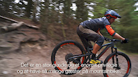
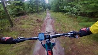
SaveAs one of the prime riding areas in Northern Europe, Slettestrand is the place to ride and live your life with your bike. The area is covering several hundred kilometers of cross country styled very flowy singletrack trails which will make you smile just as much on an trail bike as a hardtail xc bike.
Activities Click to view
- Mountain Bike
5 trails
- E-Bike
5 trails
- Adaptive Bike
0 trails
- Horse
0 trails
- Hike
1 trails
- Trail Running
1 trails
Region Details
- 2
- 1
- 1
Region Status
Caution as of Jun 8, 2026Stats
- Avg Trail Rating
- Trails (view details)
- 5
- Trails Mountain Bike
- 5
- Trails E-Bike
- 5
- Trails Hike
- 1
- Trails Trail Running
- 1
- Total Distance
- 17 miles
- Total Descent Distance
- 6 miles
- Total Descent
- 1,539 ft
- Total Vertical
- 232 ft
- Highest Trailhead
- 246 ft
- Reports
- 43
- Photos
- 17
- Ridden Counter
- 395
Sub Regions
-
Kollerup Plantage
-
Svinkløv Plantage
- 1
-
The Old Smithy
Popular Slettestrand Mountain Biking Trails
• 40 ★ 4.0 • 4,616 ft • 87 ft • 120 •
A short trail technical in places with some gnarly and tight drops, off the main Svinkløv Hvid trail.
• 80 ★ 4.0 • 10 miles • 977 ft • 100 •
Popular blue difficulty singletrack. This mountain bike primary trail can be used one direction and has a moderate overall physical rating with a 977 ft blue climb. On average it takes 1 hour24 minutes to complete this trail.
Photos of Slettestrand Mountain Bike
Videos of Slettestrand Mountain Bike
trail: Svinkløv hvid
2:48 |
193 |
Oct 22, 2017
trail: Svinkløv hvid
0:36 |
552 |
May 16, 2019 , Slettestrand
Recent Trail Reports
| status | trail | date | condition | info | user |
|---|---|---|---|---|---|
| Svinkløv hvid | May 6, 2026 @ 10:31pm (Europe/Copenhagen) May 6, 2026 | Ideal | XCDigger | ||
| Kollerup Plantage | May 4, 2024 @ 7:21am May 4, 2024 | Ideal | MichaelHoffmMdyEO | ||
| Svinkløv Sort | Mar 30, 2024 @ 1:50am Mar 30, 2024 | Ideal | Flintegaarden | ||
| Maries Drop Retur | Jul 11, 2022 @ 5:25am Jul 11, 2022 | Very Dry | topgundk | ||
| Maries drop & Olavs Kilde | Oct 24, 2020 @ 1:06am Oct 24, 2020 | Variable | Flintegaarden |
Activity Feed
| username | action | type | title | date |
|---|---|---|---|---|
| Simbosu | ridden | trail | activity #95759836 | May 28, 2026 @ 11:57pm May 28, 2026 |
| Ginger_Gravelgirl | ridden | trail | activity #94732740 | May 14, 2026 @ 10:11pm May 14, 2026 |
| XCDigger | add | report | activity #94175244 | May 6, 2026 @ 1:31pm May 6, 2026 |
| bikie77 | vote | trail | activity #92310163 | Apr 10, 2026 @ 3:58am Apr 10, 2026 |
| bikie77 | ridden | trail | activity #92310139 | Apr 10, 2026 @ 3:57am Apr 10, 2026 |
Recent Comments
| username | type | title | comment | date |
|---|---|---|---|---|
| trail | Very nice trail, not too twisted, like many... | Jul 11, 2025 @ 3:54am Jul 11, 2025 | ||
| trail | It looks more like a route. Some parts might... | Jun 19, 2025 @ 3:55am Jun 19, 2025 | ||
| trail | Mainly XC with some very rooty and technical... | Jun 17, 2025 @ 7:04am Jun 17, 2025 | ||
| trail | Very gnarly, enough room and different lines... | Jun 17, 2025 @ 7:02am Jun 17, 2025 | ||
| trail | Nice trail that kind of has it all. | Jun 16, 2025 @ 2:05pm Jun 16, 2025 |
Bike & Skill Parks
| name | type | city | rating |
|---|---|---|---|
| Den Gamle Smedje | skill park | Slettestrand |
Activity Type Stats
| activitytype | trails | distance | descent | descent distance | total vertical | rating | global rank | state rank | photos | reports | routes | ridelogs |
|---|---|---|---|---|---|---|---|---|---|---|---|---|
| Mountain Bike | 5 | 17 miles | 1,539 ft | 6 miles | 233 ft | #2,675 | #9 | 17 | 43 | 1,229 | ||
| E-Bike | 5 | 17 miles | 1,539 ft | 6 miles | 233 ft | #1,451 | #20 | 43 | 203 | |||
| Hike | 1 | 4,616 ft | 92 ft | 1,522 ft | 43 ft | #2,903 | #22 | 38 | 65 | |||
| Trail Running | 1 | 4,616 ft | 92 ft | 1,522 ft | 43 ft | #2,401 | #22 | 38 | 3 |
- By kristianskjodt & contributors
- Admins: trail-niels
- #7482 - 4,536 views
- slettestrand activity log | embed map of Slettestrand mountain bike trails |
Downloading of trail gps tracks in kml & gpx formats is enabled for Slettestrand.
You must login to download files.