close
-
Layers w
- Weather Layers
- Pro
- Pro
- Pro
- Pro
- Pro
- Pro
- More Layers
- Pro
- Pro
- Pro
- Pro
-
Upgrade to

3D
Trail Conditions
- Unknown
- Snow Groomed
- Snow Packed
- Snow Covered
- Snow Cover Partial
- Freeze/thaw Cycle
- Icy
- Prevalent Mud
- Wet
- Variable
- Ideal
- Dry
- Very Dry
Trail Flow (Ridden Direction)
Trailforks scans users ridelogs to determine the most popular direction each trail is ridden. A good flowing trail network will have most trails flowing in a single direction according to their intension.
The colour categories are based on what percentage of riders are riding a trail in its intended direction.
The colour categories are based on what percentage of riders are riding a trail in its intended direction.
- > 96%
- > 90%
- > 80%
- > 70%
- > 50%
- < 50%
- bi-directional trail
- no data
Trail Last Ridden
Trailforks scans ridelogs to determine the last time a trail was ridden.
- < 2 days
- < 1 week
- < 2 weeks
- < 1 month
- < 6 months
- > 6 months
Trail Ridden Direction
The intended direction a trail should be ridden.
- Downhill Only
- Downhill Primary
- Both Directions
- Uphill Primary
- Uphill Only
- One Direction
Contribute Details
Colors indicate trail is missing specified detail.
- Description
- Photos
- Description & Photos
- Videos
Trail Popularity ?
Trailforks scans ridelogs to determine which trails are ridden the most in the last 9 months.
Trails are compared with nearby trails in the same city region with a possible 25 colour shades.
Think of this as a heatmap, more rides = more kinetic energy = warmer colors.
- most popular
- popular
- less popular
- not popular
ATV/ORV/OHV Filter
Max Vehicle Width
inches
US Cell Coverage
Legend

Radar Time
Activity Recordings
Trailforks uses anonymized public activity data.
?
Activity Recordings
Trailforks uses anonymized public activity data.
?
Personal Heatmap
▶
Activity Types
all
/
none
▶
Options
2
Date range
month
–
Winter Trails
Warning
A routing network for winter maps does not exist. Selecting trails using the winter trails layer has been disabled.
Missing Trails
Most Popular
Least Popular
Trails are colored based on popularity. The more popular a trail is, the more red. Less popular trails trend towards green.
Jump Magnitude Heatmap
Heatmap of where riders jump on trails. Zoom in to see individual jumps, click circles to view jump details.
BC Backroad Status
![map legend]()
Service Road Atlas is a free to use, community-driven service for viewing and creating reports on the numerous back-country service roads around B.C. and Alberta.

Slope Aspect
Direction the slope faces
Trails Deemphasized
Trails are shown in grey.
Only show trails with no bike usage.
Suggested Layers
Based on selected activity type
Save the current map location and zoom level as your default home location whenever this page is loaded.
SaveSlovakia lies between latitudes 47° and 50° N, and longitudes 16° and 23° E.
The Slovak landscape is noted primarily for its mountainous nature, with the Carpathian Mountains extending across most of the northern half of the country. Among these mountain ranges are the high peaks of the Fatra-Tatra Area (including Tatra Mountains, Greater Fatra and Lesser Fatra), Slovak Ore Mountains, Slovak Central Mountains or Beskids. The largest lowland is the fertile Danubian Lowland in the southwest, followed by the Eastern Slovak Lowland in the southeast. Forests cover 41% of Slovak land surface.
The Slovak climate lies between the temperate and continental climate zones with relatively warm summers and cold, cloudy and humid winters. Temperature extremes are between −41 to 40.3 °C (−41.8 to 104.5 °F) although temperatures below −30 °C (−22 °F) are rare. The weather differs from the mountainous north to the plains in the south.
The warmest region is Bratislava and Southern Slovakia where the temperatures may reach 30 °C (86 °F) in summer, occasionally to 39 °C (102 °F) in Hurbanovo. During night, the temperatures drop to 20 °C (68 °F). The daily temperatures in winter average in the range of −5 °C (23 °F) to 10 °C (50 °F). During night it may be freezing, but usually not below −10 °C (14 °F).
In Slovakia, there are four seasons, each season (Spring, Summer, Autumn and Winter) lasts three months. The dry continental air brings in the summer heat and winter frosts. In contrast, oceanic air brings rainfalls and reduces summer temperatures. In the lowlands and valleys fog is often, especially in winter.
source: Slovakia
Stats
- Avg Trail Rating
- Trails (view details)
- 2,769
- Trails Mountain Bike
- 2,543
- Trails E-Bike
- 1,225
- Trails Gravel Bike
- 9
- Trails Adaptive Bike
- 8
- Trails Winter Fat Bike
- 7
- Trails Horse
- 66
- Trails Hike
- 2,188
- Trails Trail Running
- 2,192
- Trails Dirtbike/Moto
- 24
- Trails Observed Trials
- 4
- Trails ATV/ORV/OHV
- 20
- Trails Snowmobile
- 2
- Trails Snowshoe
- 86
- Trails Downhill Ski
- 36
- Trails Backcountry Ski
- 220
- Trails Nordic Ski
- 61
- Total Distance
- 3,317 miles
- Total Descent
- 1,042,585 ft
- Total Vertical
- 8,076 ft
- Highest Trailhead
- 8,444 ft
- Reports
- 35,098
- Photos
- 6,439
- Ridden Counter
- 163,717
Articles
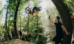
Video: Freeride at Its Finest at the 2025 Dusty Days from Bikepark Kálnica
Jun 14, 2025 from pinkbike.com
Freeride is alive and well in Slovakia.
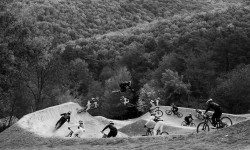
Video: William Robert & Talus Turk Blend Their Riding Styles in Kalnica
May 29, 2025 from pinkbike.com
Ion have fired up the moody and artistic vibes in this one. Cue the dramatic music.
Popular Trail Networks
view all areas »Sub Regions
- Banskobystrický kraj (344)
- Javorie (6)
- Kremnicke vrchy (66)
- Handlová (15)
- Krupinská planina (1)
- Muránska Planina (1)
- Poľana (75)
- Zvolen (11)
- Starohorské Vrchy (38)
- Štiavnické Vrchy (34)
- Banska Stiavnica (34)
- Stolické Vrchy (22)
- Revuca (21)
- Veporské Vrchy (37)
- Detva (21)
- Banská Bystrica (180)
- Brezno (25)
- Nová Baňa (8)
- Rimavská Sobota (1)
- Veľký Krtíš (1)
- Žiar nad Hronom (26)
- Javorie (6)
- Bratislavský kraj (144)
- Malé Karpaty (232)
- Záhorie (1)
- Bratislava (77)
- Košický kraj (181)
- Slovenský Kras (1)
- Slovenský Raj (22)
- Spišská Nová Ves (19)
- Volovské Vrchy a Čierna Hora (154)
- Košice (70)
- Roznava (72)
- Slovenský Kras (1)
- Nitriansky kraj (76)
- Pohronský Inovec (50)
- Tribeč (48)
- Nitra (4)
- Sala (1)
- Sturovo (3)
- Topoľčany (21)
- Zlate Moravce (49)
- Pohronský Inovec (50)
- Prešovský kraj (339)
- Branisko (36)
- Bukovské Vrchy (2)
- Čergov (10)
- Kozie Chrbty (69)
- Ľubovnianska Vrchovina (12)
- Stará Lubovna (23)
- Nízke Beskydy (66)
- Pieniny (4)
- Šariš (33)
- Sabinov (7)
- Slanské Vrchy (52)
- Spišská Magura (15)
- Kežmarok (20)
- Vihorlatské Vrchy (44)
- Michalovce (26)
- Vysoké Tatry (23)
- Humenné (47)
- Poprad (55)
- Prešov (118)
- Snina (11)
- Svit (3)
- Branisko (36)
- Trenčiansky kraj (550)
- Biele Karpaty (85)
- Považský Inovec (76)
- Hlohovec (14)
- Strážovské Vrchy (195)
- Bánovce nad Bebravou (26)
- Vtáčnik (54)
- Prievidza (72)
- Žiar (9)
- Ilava (47)
- Myjava (13)
- Nove Mesto nad Vahom (61)
- Partizánske (36)
- Považská Bystrica (43)
- Púchov (67)
- Trenčín (181)
- Biele Karpaty (85)
- Trnavský kraj (122)
- Žilinský kraj (822)
- Chočské Vrchy (5)
- Javorníky (64)
- Kysucká Vrchovina (47)
- Kysucké Nové Mesto (14)
- Kysucké Beskydy (20)
- Cadca (24)
- Malá Fatra (280)
- Nizke Tatry (40)
- Oravská Magura (34)
- Oravská Vrchovina (2)
- Oravské Beskydy (24)
- Skorušinské vrchy (4)
- Súľovské Vrchy (146)
- Veľká Fatra (61)
- Západné Beskydy (2)
- Západné Tatry (15)
- Trstená (2)
- Bytča (28)
- Dolný Kubín (16)
- Liptovský Mikuláš (88)
- Martin (117)
- Namestovo (46)
- Ružomberok (63)
- Turčianske Teplice (13)
- Tvrdosin (4)
- Žilina (398)
- Chočské Vrchy (5)
Popular Slovakia Mountain Biking Trails
• 100 ★ 4.6 • 2 miles • 31 ft • 557 •
Highly rated popular blue difficulty singletrack. This mountain bike primary trail can be used downhill only. It features drop and rock face. On average it takes 7 minutes to complete this trail.
• 100 ★ 4.6 • 2,720 ft • 0 ft • 528 •
Trail is initial, and the highest elevated part of the TrailBK. It starts under Biely Kríž. This part leads throught undemanding terrain with one light climb and is therefore also suitable for beginners and as a warm-up trail. It has...
• 100 ★ 5.0 • 2,117 ft • 5 ft • 500 •
Highly rated popular green difficulty singletrack. This mountain bike primary trail can be used downhill only and has a easy overall physical rating. On average it takes 2 minutes to complete this trail.
• 90 ★ 4.7 • 4,226 ft • 4 ft • 493 •
TBK 2 starts at the top of Piesky (447m). It is a fast, medium-difficulty trail that is almost exclusively downhill. Trail consist of smaller and bigger jumps and gap-jumps, which can be bypassed if needed, and a lot of berms. This part...
• 100 ★ 4.4 • 2 miles • 77 ft • 482 •
Simple trail even for beginners. But nice alternative to parallel tarmac road. Perfectly ride-able in both directions. Just two wooden bridges and few built steps.One or two curves little bit narrow in the steeper hillside, just be...
• 95 ★ 4.5 • 1,306 ft • 0 ft • 479 •
Highly rated popular blue difficulty doubletrack. This mountain bike primary trail can be used downhill only and has a moderate overall physical rating. It features berm and jump. On average it takes 1 minutes to complete this trail.
• 100 ★ 4.3 • 4,659 ft • 25 ft • 463 •
Highly rated popular blue difficulty machine groomed. This mountain bike primary trail can be used downhill only and has a moderate overall physical rating. It features a-frame and berm. Trail visibility is always easy to follow. On average it takes 12 minutes to complete this trail.
• 100 ★ 3.3 • 5 miles • 976 ft • 458 •
Popular white difficulty family friendly dirt/gravel road. This mountain bike primary trail can be used both directions and has a easy overall physical rating with a 976 ft green climb. On average it takes 46 minutes to complete this trail.
Slovakia Mountain Bike Routes
★ 5.0 • 24 miles • 4,592 ft • 5 • Loop •
Cyklookruh Hrebenom Velkej Fatry so zakoncenim na trailoch okolo Sidorova.
★ 5.0 • 13 miles • 3,130 ft • 8 • Point to Point •
AM/EN route from Turie to Strecno.
★ 5.0 • 29 miles • 6,185 ft • 15 • Out & Back •
Trasa jesenného nesúťažného výjazdu: Sobota 13.10.2018: - - Carbonkiller (možnosť obísť) -...
★ 5.0 • 25 miles • 6,116 ft • 15 • Out & Back •
Trasa jesenného nesúťažného výjazdu: Nedeľa 14.10.2018: - sedlo Humence - Dúbravský singel (NEW)...
★ 5.0 • 15 miles • 2,086 ft • 5 • Loop •
Technical up and downhill singletrack in Javorniky. Accessible from Horna Marikova, Certov or from Chata...
★ 4.5 • 13 miles • 2,411 ft • 6 • Out & Back •
Short route around mtbiker.sk centrum in Hradok.
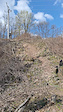
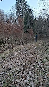
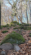
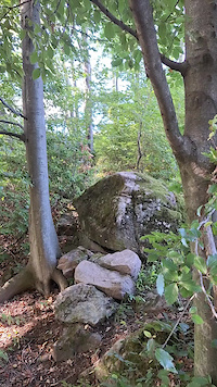
Photos of Slovakia Mountain Bike
Videos of Slovakia Mountain Bike
featured
![KE.CY košické cyklotraily PROMO video 2015]()

4:16 |
5392 |
Sep 26, 2015
trail: Super Natural
3:22 |
8 |
May 13, 2026
trail: Partisan trench
0:05 |
8 |
Apr 23, 2026
trail: Spojár
0:13 |
2 |
Mar 30, 2026
trail: V.V. MTB
0:07 |
15 |
Mar 18, 2026
trail: Partisan trench
0:09 |
12 |
Dec 30, 2025
trail: Partisan trench
0:10 |
24 |
Oct 22, 2025
trail: Partisan trench
0:16 |
17 |
Oct 22, 2025
Recent Comments
| username | type | title | comment | date |
|---|---|---|---|---|
| trail | Dopad na dropoch na konci by si zasluzil... | Jun 15, 2026 @ 2:13am Jun 15, 2026 | ||
| report | Všechno Ok | May 30, 2026 @ 2:58am May 30, 2026 | ||
| trail | Ne prejazdná | May 30, 2026 @ 2:07am May 30, 2026 | ||
| trail | pekny hravy trail, navrat na 911 trail je... | May 19, 2026 @ 11:35pm May 19, 2026 | ||
| trail | Novovybudovaná vrchná čast trailu s názvom... | May 12, 2026 @ 8:16am May 12, 2026 |
Bike & Skill Parks
| name | type | city | rating |
|---|---|---|---|
| ŽILINA OKӨ TRAILS | bike park | Žilina | |
| Bikepark Koliba | bike park | Bratislava | |
| Malinô Brdo | bike park | Ružomberok | |
| Bike Centrum Kálnica | bike park | Nove Mesto nad Vahom | |
| Bike World Jasná | bike park | Liptovský Mikuláš |
Activity Type Stats
| activitytype | trails | distance | descent | descent distance | total vertical | rating | global rank | state rank | photos | reports | routes | ridelogs |
|---|---|---|---|---|---|---|---|---|---|---|---|---|
| Mountain Bike | 2,540 | 2,840 miles | 800,892 ft | 1,381 miles | 6,168 ft | #19 | 6,330 | 35,015 | 131 | 383,160 | ||
| E-Bike | 1,225 | 1,328 miles | 305,318 ft | 592 miles | 6,240 ft | #23 | 61 | 30,892 | 40 | 36,253 | ||
| Gravel Bike | 9 | #20 | 83 | 1 | 2,185 | |||||||
| Adaptive Bike | 8 | #19 | 41 | 2 | ||||||||
| Winter Fat Bike | 7 | #20 | 37 | 1 | 2 | |||||||
| Horse | 66 | 85 miles | 6,037 ft | 23 miles | 3,392 ft | #26 | 2,918 | 2 | 1 | |||
| Hike | 2,188 | 2,885 miles | 840,682 ft | 1,365 miles | 7,700 ft | #19 | 42 | 32,880 | 13 | 42,664 | ||
| Trail Running | 2,192 | 2,882 miles | 824,190 ft | 1,354 miles | 7,700 ft | #20 | 32,898 | 14 | 15,308 | |||
| Dirtbike/Moto | 24 | 16 miles | 1,798 ft | 4 miles | 2,451 ft | #22 | 2,900 | 67 | ||||
| Observed Trials | 4 | 2 miles | 13 ft | 489 ft | 187 ft | #19 | 1 | 64 | 1 | |||
| ATV/ORV/OHV | 20 | 17 miles | 2,070 ft | 4 miles | 2,579 ft | #20 | 2,875 | 14 | ||||
| Snowmobile | 2 | 3 miles | 2,339 ft | #16 | 56 | |||||||
| Snowshoe | 86 | 110 miles | 38,363 ft | 47 miles | 7,201 ft | #13 | 144 | 2 | 70 | |||
| Downhill Ski | 36 | 20 miles | 23,287 ft | 19 miles | 5,223 ft | #15 | 65 | 8,015 | ||||
| Backcountry Ski | 220 | 237 miles | 116,660 ft | 119 miles | 7,762 ft | #13 | 2 | 195 | 2 | 9,995 | ||
| Nordic Ski | 61 | 109 miles | 16,056 ft | 41 miles | 4,757 ft | #13 | 148 | 1 | 5,461 |
Activities
- Slovakia Mountain Biking Trails
- Slovakia E-Biking Trails
- Slovakia Gravel Biking Trails
- Slovakia Adaptive Biking Trails
- Slovakia Winter Fat Biking Trails
- Slovakia Horseback Trails
- Slovakia Hiking Trails
- Slovakia Trail Running Trails
- Slovakia Dirtbiking Trails
- Slovakia ATVing/Offroading Trails
- Slovakia Snowshoeing Trails
- Slovakia Skiing Trails
- Slovakia Backcountry Skiing Trails
- Slovakia Nordic Skiing Trails
Trails
Points of Interest
- By canadaka
 Trailforks & contributors
 - Admins: jxxw
- #3237 - 126,897 views
- slovakia activity log | embed map of Slovakia mountain bike trails | slovakia mountain biking points of interest polygons
Downloading of trail gps tracks in kml & gpx formats is enabled for Slovakia.
You must login to download files.