close
-
Layers w
- Weather Layers
- Pro
- Pro
- Pro
- Pro
- Pro
- Pro
- More Layers
- Pro
- Pro
- Pro
- Pro
-
Upgrade to

3D
Trail Conditions
- Unknown
- Snow Groomed
- Snow Packed
- Snow Covered
- Snow Cover Partial
- Freeze/thaw Cycle
- Icy
- Prevalent Mud
- Wet
- Variable
- Ideal
- Dry
- Very Dry
Trail Flow (Ridden Direction)
Trailforks scans users ridelogs to determine the most popular direction each trail is ridden. A good flowing trail network will have most trails flowing in a single direction according to their intension.
The colour categories are based on what percentage of riders are riding a trail in its intended direction.
The colour categories are based on what percentage of riders are riding a trail in its intended direction.
- > 96%
- > 90%
- > 80%
- > 70%
- > 50%
- < 50%
- bi-directional trail
- no data
Trail Last Ridden
Trailforks scans ridelogs to determine the last time a trail was ridden.
- < 2 days
- < 1 week
- < 2 weeks
- < 1 month
- < 6 months
- > 6 months
Trail Ridden Direction
The intended direction a trail should be ridden.
- Downhill Only
- Downhill Primary
- Both Directions
- Uphill Primary
- Uphill Only
- One Direction
Contribute Details
Colors indicate trail is missing specified detail.
- Description
- Photos
- Description & Photos
- Videos
Trail Popularity ?
Trailforks scans ridelogs to determine which trails are ridden the most in the last 9 months.
Trails are compared with nearby trails in the same city region with a possible 25 colour shades.
Think of this as a heatmap, more rides = more kinetic energy = warmer colors.
- most popular
- popular
- less popular
- not popular
ATV/ORV/OHV Filter
Max Vehicle Width
inches
US Cell Coverage
Legend

Radar Time
Activity Recordings
Trailforks uses anonymized public activity data.
?
Activity Recordings
Trailforks uses anonymized public activity data.
?
Personal Heatmap
▶
Activity Types
all
/
none
▶
Options
2
Date range
month
–
Winter Trails
Warning
A routing network for winter maps does not exist. Selecting trails using the winter trails layer has been disabled.
Missing Trails
Most Popular
Least Popular
Trails are colored based on popularity. The more popular a trail is, the more red. Less popular trails trend towards green.
Jump Magnitude Heatmap
Heatmap of where riders jump on trails. Zoom in to see individual jumps, click circles to view jump details.
BC Backroad Status
![map legend]()
Service Road Atlas is a free to use, community-driven service for viewing and creating reports on the numerous back-country service roads around B.C. and Alberta.

Slope Aspect
Direction the slope faces
Trails Deemphasized
Trails are shown in grey.
Only show trails with no bike usage.
Suggested Layers
Based on selected activity type
Save the current map location and zoom level as your default home location whenever this page is loaded.
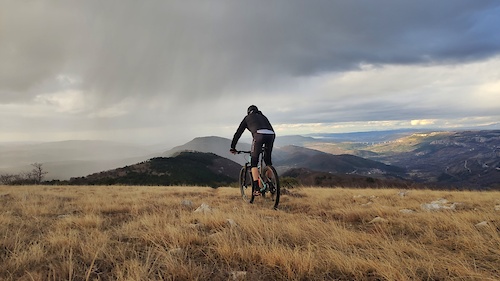
SaveSlovenia is situated in Central and Southeastern Europe touching the Alps and bordering the Mediterranean.
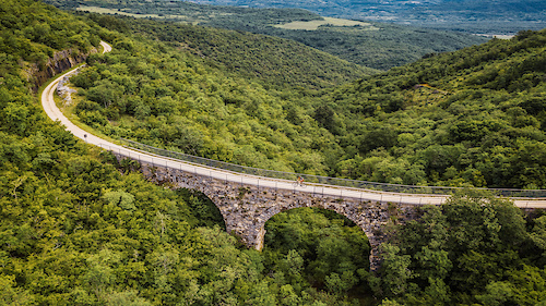
Four major European geographic regions meet in Slovenia: the Alps, the Dinarides, the Pannonian Plain, and the Mediterranean. Although on the shore of the Adriatic Sea near the Mediterranean Sea, most of Slovenia is in the Black Sea drainage basin. The Alps—including the Julian Alps, the Kamnik-Savinja Alps and the Karavanke chain, as well as the Pohorje massif—dominate Northern Slovenia along its long border with Austria.
Slovenia's Adriatic coastline stretches approximately 47 kilometres (29 mi) from Italy to Croatia.
The term "Karst topography" refers to that of southwestern Slovenia's Karst Plateau, a limestone region of underground rivers, gorges, and caves, between Ljubljana and the Mediterranean. On the Pannonian plain to the East and Northeast, toward the Croatian and Hungarian borders, the landscape is essentially flat. However, the majority of Slovenian terrain is hilly or mountainous, with around 90% of the surface 200 m (656 ft) or more above sea level.
Over half of the country is covered by forests. This makes Slovenia the third most forested country in Europe, after Finland and Sweden. The areas are covered mostly by beech, fir-beech and beech-oak forests and have a relatively high production capacity.
source: Wiki
This region uses the Uk/Euro style trail grading system.
Region Details
- 415
- 12
- 209
- 329
- 159
- 85
- 7
Stats
- Avg Trail Rating
- Trails (view details)
- 1,361
- Trails Mountain Bike
- 1,317
- Trails E-Bike
- 673
- Trails Gravel Bike
- 9
- Trails Adaptive Bike
- 9
- Trails Winter Fat Bike
- 8
- Trails Horse
- 76
- Trails Hike
- 868
- Trails Trail Running
- 856
- Trails Dirtbike/Moto
- 37
- Trails Observed Trials
- 2
- Trails ATV/ORV/OHV
- 31
- Trails Snowmobile
- 4
- Trails Snowshoe
- 8
- Trails Downhill Ski
- 54
- Trails Backcountry Ski
- 5
- Trails Nordic Ski
- 8
- Total Distance
- 1,456 miles
- Total Descent
- 489,774 ft
- Total Vertical
- 8,209 ft
- Highest Trailhead
- 8,212 ft
- Reports
- 17,087
- Photos
- 12,216
- Ridden Counter
- 94,194
Articles
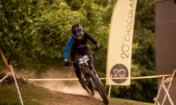
Details Announced for the 20chocolate Downhill Cup Series 2026
Mar 4, 2026 from pinkbike.com
Four familiar locations are returning, and the series will conclude on a new track with new organizers.
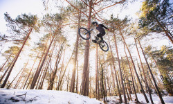
Video: Getting Rad on a Fresh Slovenian Snowfall in Blueberry White
Jan 13, 2026 from pinkbike.com
This one’s for all the snow-covered readers out there.
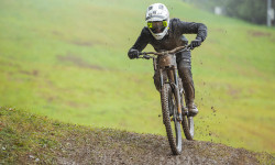
Video & Race Report: DH Sljeme, Final Round of 20chocolate Downhill Cup
Oct 10, 2025 from pinkbike.com
Riders only managed one run in the all-day rain, which counted as the final.
Highlights: Race Mashup - iXS EDC #6 Kranjska Gora, Slovenia
Sep 30, 2025 from pinkbike.com
A legendary track, a field of international top riders, unpredictable weather, and emotions running high.
Popular Trail Networks
view all areas »Sub Regions
- Bela Krajina (5)
- Črnomelj (1)
- Črnomelj (1)
- Dolenjska (36)
- Novo mesto (24)
- Vrhovo (4)
- Novo mesto (24)
- Gorenjska (129)
- Kališe (7)
- Triglav National Park (1)
- Bohinj (1)
- Begunje na Gorenjskem (2)
- Gorje (1)
- Jesenice (1)
- Kamnik (11)
- Kranj (14)
- Kranjska Gora (39)
- Železniki (30)
- Žiri (26)
- Žirovnica (6)
- Kališe (7)
- Koroška (94)
- Kope (14)
- Slovenj Gradec (2)
- Črna na Koroškem (13)
- Dravograd (1)
- Mežica (7)
- Prevalje (58)
- Ravne Na Koroškem (6)
- Kope (14)
- Osrednje Slovenska Regija (372)
- Litija-Šmartno pri Litiji (1)
- Borovnica (26)
- Cerknica (7)
- Domžale (10)
- Grosuplje (57)
- Ig (7)
- Jezero (1)
- Kočevje (17)
- Ljubljana (128)
- Logatec (11)
- Medvode (6)
- Škofja Loka (45)
- Stari Trg Pri Ložu (4)
- Trbovlje (25)
- Vrhnika (3)
- Zagorje ob Savi (17)
- Litija-Šmartno pri Litiji (1)
- Pomurje (40)
- Goričko (23)
- Dolenci (1)
- Lendava (15)
- Murska Sobota (1)
- Goričko (23)
- Posočje (213)
- Ajdovščina (60)
- Avče (3)
- Bovec (30)
- Cerkno (19)
- Idrija (22)
- Kanal Ob Soči (1)
- Kobarid (18)
- Ložice (9)
- Miren (10)
- Nova Gorica (41)
- Robidišče (11)
- Tolmin (2)
- Ajdovščina (60)
- Primorska (300)
- Štajerska (181)
- Pohorje (60)
- Bresternica (17)
- Brežice (1)
- Celje (15)
- Dobrna (12)
- Dramlje (18)
- Maribor (38)
- Ptuj (7)
- Radlje (2)
- Rogaška Slatina (2)
- Šentjur (1)
- Sevnica (3)
- Slovenska Bistrica (5)
- Slovenske Konjice (15)
- Velenje (16)
- Vitanje (3)
- Žalec (4)
- Litija (1)
- Miklavž na Dravskem Polju (1)
Popular Slovenia Mountain Biking Trails
• 100 ★ 4.1 • 4 miles • 3 ft • 682 •
The is a fun blue trail that starts at the upper station of the Pohorje Cable Car. It stretches for approximately 5.5 kilometers and provides an exciting descent of over 712 vertical meters, leading cyclists all the way down to the...
• 100 ★ 4.9 • 3,199 ft • 0 ft • 655 •
Golovec trails most flowy trail made from riders for riders. Endless turns and easy jumps. Trail managed by ŠD Golovec trails
• 100 ★ 5.0 • 2,995 ft • 24 ft • 504 •
Golovec trails second flow trail. Features berms, rollers, jumps, tables and fast sections. Its a real heavenly trail.
• 75 ★ 3.6 • 1 mile • 0 ft • 490 •
The downhill track is the one that put Maribor on the global map of mountain biking. This iconic black trail, with fast and root-filled sections, the famous rocky “Rocks and Roll,” and breathtaking jumps, will undoubtedly leave you...
• 95 ★ 4.8 • 2,333 ft • 0 ft • 482 •
Golovec trails enduro jewel. Roots and fast technical sections. Trail managed by ŠD Golovec trails
• 95 ★ 3.9 • 1,276 ft • 51 ft • 429 •
Popular red difficulty singletrack. This mountain bike primary trail can be used downhill only. On average it takes 3 minutes to complete this trail.
Slovenia Mountain Bike Routes
★ 4.5 • 15 miles • 2,552 ft • 4 • Loop •
Very fun ride,first some xc and then when you get onto the top come some fast downhill... great enduro loop
★ 5.0 • 14 miles • 3,021 ft • 7 • Loop •
Route with three beautiful natural trails from the same trail head on Na lanišču hill. Two uphills...
★ 5.0 • 17 miles • 2,762 ft • 4 • Loop •
Route with two and a half trails from Molnik hill. Start and finish at Grosuplje. First trail Molniške...
★ 5.0 • 18 miles • 3,333 ft • 13 • Loop •
Route with some finest and beautiful trails in Trailandija that will take you to three hill tops - , and ....
★ 4.5 • 13 miles • 1,752 ft • 3 • Loop •
Route with three nice downhill trails, , , and . All of them MTB only and all of them built by local MTB...
★ 5.0 • 13 miles • 1,901 ft • 4 • Loop •
First dual purpose path for hikers and mountain bikers in Slovenia, opened avgust 25, 2013. Riding...
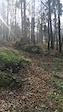
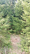
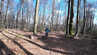
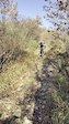
Photos of Slovenia Mountain Bike
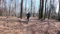
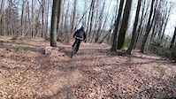
Videos of Slovenia Mountain Bike
trail: Banzai
0:08 |
35 |
Apr 27, 2026
trail: Buldožer
0:08 |
21 |
Apr 27, 2026
trail: Cirkus Jumpline
0:51 |
23 |
Apr 14, 2026
trail: Cirkus Jumpline
0:51 |
7 |
Apr 14, 2026
trail: Cirkus Jumpline
0:51 |
8 |
Apr 14, 2026
0:10 |
1 |
Jan 9, 2026
0:06 |
1 |
Jan 9, 2026
0:40 |
1 |
Jan 9, 2026
National Scenic Trails & Official Routes
-
Movraška turnokolesarska pot
- Mountain Bike
- Hike
-
Parenzana
- Mountain Bike
- E-Bike
Recent Comments
| username | type | title | comment | date |
|---|---|---|---|---|
| trail | Fast singletrail going straight down. | Jun 20, 2026 @ 7:14am 2 hours | ||
| trail | Ok | Jun 20, 2026 @ 6:44am 3 hours | ||
| trail | good trail , very rocky. | Jun 15, 2026 @ 11:49am Jun 15, 2026 | ||
| trail | Nie trail. Can be slippery after a full day of... | Jun 8, 2026 @ 3:55am Jun 8, 2026 | ||
| report | Very nice trail | Jun 7, 2026 @ 3:12am Jun 7, 2026 |
Bike & Skill Parks
| name | type | city | rating |
|---|---|---|---|
| Bike Park Pohorje Maribor | bike park | Maribor | |
| Krvavec | bike park | Kranj | |
| Bike Park Kranjska Gora | bike park | Kranjska Gora | |
| Bike Park Rogla | bike park | Rogla | |
| Vogel | bike park | Bohinj |
Upcoming Local Events
Activity Type Stats
| activitytype | trails | distance | descent | descent distance | total vertical | rating | global rank | state rank | photos | reports | routes | ridelogs |
|---|---|---|---|---|---|---|---|---|---|---|---|---|
| Mountain Bike | 1,305 | 1,348 miles | 437,044 ft | 657 miles | 7,415 ft | #29 | 12,086 | 17,159 | 177 | 215,823 | ||
| E-Bike | 673 | 777 miles | 200,341 ft | 337 miles | 6,260 ft | #29 | 37 | 13,428 | 83 | 26,022 | ||
| Gravel Bike | 9 | #23 | 24 | 63 | 10 | 1,940 | ||||||
| Adaptive Bike | 9 | #21 | 4 | 2 | ||||||||
| Winter Fat Bike | 8 | #23 | 21 | 1 | ||||||||
| Horse | 76 | 120 miles | 10,558 ft | 38 miles | 6,217 ft | #29 | 915 | |||||
| Hike | 868 | 1,122 miles | 303,097 ft | 477 miles | 8,209 ft | #29 | 32 | 12,053 | 11 | 44,405 | ||
| Trail Running | 856 | 1,112 miles | 303,888 ft | 476 miles | 8,209 ft | #31 | 11 | 12,015 | 5 | 4,793 | ||
| Dirtbike/Moto | 37 | 92 miles | 5,282 ft | 21 miles | 4,938 ft | #27 | 908 | 3 | ||||
| Observed Trials | 2 | 6 miles | 564 ft | 3 miles | 4,324 ft | #25 | 38 | 7 | ||||
| ATV/ORV/OHV | 31 | 83 miles | 4,856 ft | 19 miles | 4,747 ft | #24 | 886 | 15 | ||||
| Snowmobile | 4 | 5 miles | 154 ft | 3,478 ft | 3,278 ft | #20 | 11 | 1 | ||||
| Snowshoe | 8 | 10 miles | 650 ft | 2 miles | 5,194 ft | #20 | 26 | 79 | ||||
| Downhill Ski | 54 | 24 miles | 21,732 ft | 20 miles | 5,912 ft | #19 | 25 | 2,908 | ||||
| Backcountry Ski | 5 | 6 miles | 46 ft | 1,119 ft | 2,165 ft | #20 | 25 | 3,679 | ||||
| Nordic Ski | 8 | 6 miles | 354 ft | 4,551 ft | 5,912 ft | #20 | 26 | 3,288 |
Activities
- Slovenia Mountain Biking Trails
- Slovenia E-Biking Trails
- Slovenia Gravel Biking Trails
- Slovenia Adaptive Biking Trails
- Slovenia Winter Fat Biking Trails
- Slovenia Horseback Trails
- Slovenia Hiking Trails
- Slovenia Trail Running Trails
- Slovenia Dirtbiking Trails
- Slovenia ATVing/Offroading Trails
- Slovenia Snowshoeing Trails
- Slovenia Skiing Trails
- Slovenia Backcountry Skiing Trails
- Slovenia Nordic Skiing Trails
Trails
- By canadaka
 Trailforks & contributors
 - Admins: VjekoslavKrsanac, zocknroll
- #3200 - 114,853 views
- slovenia activity log | embed map of Slovenia mountain bike trails | slovenia mountain biking points of interest polygons
Downloading of trail gps tracks in kml & gpx formats is enabled for Slovenia.
You must login to download files.