close
-
Layers w
- Weather Layers
- Pro
- Pro
- Pro
- Pro
- Pro
- Pro
- More Layers
- Pro
- Pro
- Pro
- Pro
-
Upgrade to

3D
Trail Conditions
- Unknown
- Snow Groomed
- Snow Packed
- Snow Covered
- Snow Cover Partial
- Freeze/thaw Cycle
- Icy
- Prevalent Mud
- Wet
- Variable
- Ideal
- Dry
- Very Dry
Trail Flow (Ridden Direction)
Trailforks scans users ridelogs to determine the most popular direction each trail is ridden. A good flowing trail network will have most trails flowing in a single direction according to their intension.
The colour categories are based on what percentage of riders are riding a trail in its intended direction.
The colour categories are based on what percentage of riders are riding a trail in its intended direction.
- > 96%
- > 90%
- > 80%
- > 70%
- > 50%
- < 50%
- bi-directional trail
- no data
Trail Last Ridden
Trailforks scans ridelogs to determine the last time a trail was ridden.
- < 2 days
- < 1 week
- < 2 weeks
- < 1 month
- < 6 months
- > 6 months
Trail Ridden Direction
The intended direction a trail should be ridden.
- Downhill Only
- Downhill Primary
- Both Directions
- Uphill Primary
- Uphill Only
- One Direction
Contribute Details
Colors indicate trail is missing specified detail.
- Description
- Photos
- Description & Photos
- Videos
Trail Popularity ?
Trailforks scans ridelogs to determine which trails are ridden the most in the last 9 months.
Trails are compared with nearby trails in the same city region with a possible 25 colour shades.
Think of this as a heatmap, more rides = more kinetic energy = warmer colors.
- most popular
- popular
- less popular
- not popular
ATV/ORV/OHV Filter
Max Vehicle Width
inches
US Cell Coverage
Legend

Radar Time
Activity Recordings
Trailforks uses anonymized public activity data.
?
Activity Recordings
Trailforks uses anonymized public activity data.
?
Personal Heatmap
▶
Activity Types
all
/
none
▶
Options
2
Date range
month
–
Winter Trails
Warning
A routing network for winter maps does not exist. Selecting trails using the winter trails layer has been disabled.
Missing Trails
Most Popular
Least Popular
Trails are colored based on popularity. The more popular a trail is, the more red. Less popular trails trend towards green.
Jump Magnitude Heatmap
Heatmap of where riders jump on trails. Zoom in to see individual jumps, click circles to view jump details.
BC Backroad Status
![map legend]()
Service Road Atlas is a free to use, community-driven service for viewing and creating reports on the numerous back-country service roads around B.C. and Alberta.

Slope Aspect
Direction the slope faces
Trails Deemphasized
Trails are shown in grey.
Only show trails with no bike usage.
Suggested Layers
Based on selected activity type
Save the current map location and zoom level as your default home location whenever this page is loaded.
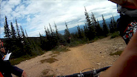
SaveSmithers riding is unique, offering a full range of experiences. From high alpine singletrack to trails winding through the northern forest landscape, Smithers hosts a blend of rugged, steep technical terrain combined with new school all-mountain flow. The Smithers Mountain Bike Association manages three trail networks in partnership with the Province:
Typically, the Bluff opens in early May, followed by the Ptarmigan network. The Piper and Backdoor areas typically open by mid-June. The riding season usually ends in early November.
Typically, the Bluff opens in early May, followed by the Ptarmigan network. The Piper and Backdoor areas typically open by mid-June. The riding season usually ends in early November.
Activities Click to view
- Mountain Bike
67 trails
- E-Bike
53 trails
- Gravel Bike
0 trails
- Adaptive Bike
0 trails
- Winter Fat Bike
0 trails
- Hike
89 trails
- Trail Running
87 trails
- Dirtbike/Moto
5 trails
- Snowmobile
0 trails
- Snowshoe
32 trails
- Downhill Ski
33 trails
- Backcountry Ski
49 trails
- Nordic Ski
47 trails
Region Details
- 12
- 11
- 26
- 10
- 1
Region Status
Caution as of 5 hoursStats
- Avg Trail Rating
- Trails (view details)
- 183
- Trails Mountain Bike
- 71
- Trails E-Bike
- 53
- Trails Hike
- 89
- Trails Trail Running
- 87
- Trails Dirtbike/Moto
- 5
- Trails Snowshoe
- 32
- Trails Downhill Ski
- 33
- Trails Backcountry Ski
- 49
- Trails Nordic Ski
- 47
- Total Distance
- 190 miles
- Total Descent Distance
- 100 miles
- Total Descent
- 69,776 ft
- Total Vertical
- 5,271 ft
- Highest Trailhead
- 6,907 ft
- Reports
- 3,088
- Photos
- 535
- Ridden Counter
- 17,870
Articles
Exploring Northern British Columbia By Bike & Train
Aug 5, 2020 from pinkbike.com
A dream trip to some of British Columbia's lesser-known, but still world-class, ride locations.
Sub Regions
-
Babine Mountains Provincial Park
- 1
- 2
-
Piper Recreation Area
- 5
- 2
-
Ptarmigan Recreation Trails
- 1
- 1
-
The Bluff Recreation Area
- 4
- 20
- 5
- 1
Popular Smithers Mountain Biking Trails
• 100 ★ 3.0 • 2,910 ft • 54 ft • 683 •
(Duthie Access Trail) is the aptly-named access to the Bluff. What once was hundreds of meters of is now a double wide trail to access the Bluff. Some modifications were done in 2025, when riding in from the parking lot, when you see...
• 100 ★ 4.0 • 1 mile • 740 ft • 531 •
is a 3 km long trail offers riders a pedal-able route to the top of the Bluff. The lower section of was entirely redesigned in 2023 making a smooth ride to the top of the bluffs. Access is from the just above the exit of . The trail...
• 95 ★ 4.5 • 1,083 ft • 10 ft • 432 •
Machine built jump line for the kids. Doubles, step-ups and hips which all can be rolled if you'd like!
• 95 ★ 4.4 • 1 mile • 615 ft • 413 •
Alternate climb to the top. Fun climb with several bridges, lots of switchbacks, and flatter sections to give the ol' legs a small rest while climbing. Easier physically than and more technically challenging/interesting. Primarily a...
• 100 ★ 5.0 • 620 ft • 6 ft • 410 •
Rebuilt in 2025 by Out There Contracting. This trail consists of some flowy goodness, with some jumps and berms to put a smile on your face as you exit the Bluff. Accessible for everyone and advanced riders can ride this without...
• 90 ★ 3.7 • 3,770 ft • 0 ft • 406 •
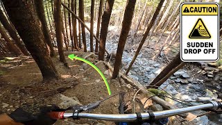
Smithers' flowing singletrack mixed with some machine built sections at the bottom. This trail has just about everything, it is steep and technical switchbacks at the top and flowy/fast in the middle to bottom. Along the way there are...
• 90 ★ 4.6 • 1 mile • 0 ft • 399 •
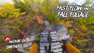
Huckin Eh' is a fast, flowy trail and very popular. Some nice views and stunning forest along the way. There are optional routes for advanced riders, a large cliff drop and big rock ramp to steep roll. This trail is super fun and can be...
• 95 ★ 4.5 • 1,191 ft • 0 ft • 370 •
Machine built berms and rollers. Fast and smooth, great way to end a run on or upper Flo. There is also a shortcut trail from , great for quick access.
Smithers Mountain Bike Routes
3 miles • 532 ft • 4 •
This is the route that we'll be using for the Sprockids B.I.K.E. ride at the round up BBQ. It's rider and...
★ 4.0 • 9 miles • 1,679 ft • 29 • Loop •
This is a perimeter loop of the entire Bluff trail system, come for a challenge. Climb up Meanstreak and...
★ 5.0 • 23 miles • 6,337 ft • 32 • Loop •
Looking for an epic ride? Try this gigantic route which samples nearly every bluff trail in one ride.
2 miles • 352 ft • 6 • Out & Back •
This is the easier of the two Sprockids routes for the B.I.K.E. ride. It's a great way to introduce riders...
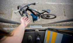
Photos of Smithers Mountain Bike
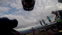
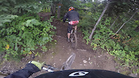
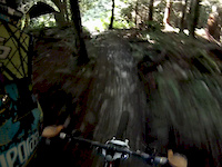
Videos of Smithers Mountain Bike

trail: Pump Daddy
2:44 |
2259 |
Aug 19, 2019
trail: Backdoor
7:13 |
162 |
Aug 16, 2019

trail: Backdoor
8:08 |
181 |
Aug 18, 2018
trail: Huckin' Eh
5:32 |
677 |
Sep 16, 2016
trail: Shining
0:14 |
323 |
Dec 17, 2013
trail: Piper Down - Lower
9:11 |
369 |
Aug 14, 2012
youtuber
![DON'T RIDE HERE...]()
trail: Huckin' Eh
42:51 |
64 |
Dec 10, 2025 , Smithers
trail: Huckin' Eh
7:04 |
131 |
Mar 18, 2025 , Smithers
Current Trail Warnings
| status | trail | date | condition | user | info |
|---|---|---|---|---|---|
| Shining | Jun 7, 2026 @ 4:50pm (America/Vancouver) Jun 7, 2026 | Dry | richied | Large tree across trail |
Recent Trail Reports
| status | trail | date | condition | info | user |
|---|---|---|---|---|---|
| Piper Cross | Jun 26, 2026 @ 10:00am (America/Vancouver) 5 hours | Unknown | gfortin SMBA | ||
| Piper Down - Upper | Jun 26, 2026 @ 10:00am (America/Vancouver) 5 hours | Unknown | gfortin SMBA | ||
| Access to Piper Down | Jun 26, 2026 @ 10:00am (America/Vancouver) 5 hours | Unknown | gfortin SMBA | ||
| Piper Down - Lower | Jun 25, 2026 @ 10:01am (America/Vancouver) 1 day | Unknown | skierbrain | ||
| New Shiny Penny | Jun 20, 2026 @ 2:52pm (America/Vancouver) Jun 20, 2026 | Dry | richied | ||
| Nervous Shakedown | Jun 11, 2026 @ 5:01pm (America/Vancouver) Jun 11, 2026 | Unknown | skierbrain | ||
| Upper Apocalypse | Jun 5, 2026 @ 5:55pm (America/Vancouver) Jun 5, 2026 | Ideal | TheSpangler WLCC | ||
| Silver King Basin | Jun 4, 2026 @ 12:37pm (America/Vancouver) Jun 4, 2026 | Variable | abeauche | ||
| Lower Auntie Flo | Jun 1, 2026 @ 4:19pm (America/Metlakatla) Jun 1, 2026 | Ideal | gfortin SMBA | ||
| Uptrack | Jun 1, 2026 @ 4:19pm (America/Metlakatla) Jun 1, 2026 | Ideal | gfortin SMBA |
Activity Feed
| username | action | type | title | date |
|---|---|---|---|---|
| gfortin | add | report | activity #97841729 and 2 more | Jun 26, 2026 @ 10:00am 5 hours |
| skierbrain | add | report | activity #97776188 | Jun 25, 2026 @ 10:01am 1 day |
| Novedevon | wishlist | trail | activity #97673411 and 1 more | Jun 23, 2026 @ 8:55pm 3 days |
| chubby5000 | comment | trail | activity #97625035 and 1 more | Jun 23, 2026 @ 7:18am Jun 23, 2026 |
| chubby5000 | vote | trail | activity #97624804 and 4 more | Jun 23, 2026 @ 7:14am Jun 23, 2026 |
Recent Comments
| username | type | title | comment | date |
|---|---|---|---|---|
| trail | Pretty climbing trail. | Jun 23, 2026 @ 7:18am Jun 23, 2026 | ||
| trail | Excellent climbing trail. Well built and... | Jun 23, 2026 @ 7:18am Jun 23, 2026 | ||
| trail | Fast and awesome warmup track to get the blood... | Jan 13, 2026 @ 1:15pm Jan 13, 2026 | ||
| trail | Epic for sure \m/ | Jul 19, 2025 @ 8:13am Jul 19, 2025 | ||
| report | Just came here to say, “screw you man”😂... | Jul 16, 2025 @ 3:31pm Jul 16, 2025 |
Local Badges
-

10 Blue Trails137 awarded -

Epic Ride Climb 2k22 awarded -

Climbing 10k Badge46 awarded -

Climbing 100k Badge1 awarded -

Epic Ride Descent 2k36 awarded -

Descent 10k Badge50 awarded
Bike & Skill Parks
| name | type | city | rating |
|---|---|---|---|
| SMBA & Town of Smithers Skills Park | skill park | Smithers |
Local Trail Supporters
- Carl Lutz
- Dave Bobb
- Jeff McKaY
![]()
Activity Type Stats
| activitytype | trails | distance | descent | descent distance | total vertical | rating | global rank | state rank | photos | reports | routes | ridelogs |
|---|---|---|---|---|---|---|---|---|---|---|---|---|
| Mountain Bike | 67 | 63 miles | 20,932 ft | 37 miles | 4,350 ft | #1,198 | #54 | 544 | 2,753 | 16 | 14,010 | |
| E-Bike | 53 | 41 miles | 16,512 ft | 24 miles | 3,553 ft | #2,365 | #60 | 1,389 | 2 | 433 | ||
| Hike | 89 | 94 miles | 16,230 ft | 35 miles | 5,272 ft | #729 | #44 | 8 | 2,673 | 4 | 1,675 | |
| Trail Running | 87 | 91 miles | 14,859 ft | 32 miles | 5,272 ft | #1,423 | #53 | 5 | 2,646 | 3 | 2,330 | |
| Dirtbike/Moto | 5 | 7 miles | 167 ft | 2 miles | 148 ft | #732 | #53 | 3 | 809 | 11 | ||
| Snowshoe | 32 | 6 miles | 2,175 ft | 5 miles | 2,910 ft | #456 | #35 | 380 | 79 | |||
| Downhill Ski | 33 | 20 miles | 20,961 ft | 20 miles | 1,736 ft | #318 | #19 | 16 | 905 | |||
| Backcountry Ski | 49 | 30 miles | 18,114 ft | 18 miles | 2,995 ft | #51 | #5 | 406 | 1,298 | |||
| Nordic Ski | 47 | 31 miles | 2,966 ft | 14 miles | 604 ft | #130 | #16 | 1 | 686 | 4,587 |
Frequently Asked Questions About Smithers
▼
What are the best places to ride in Smithers?
Smithers has 8 areas to explore for mountain biking. The top rated areas are:
▼
What are the highest rated mountain biking trails in Smithers?
The highest rated mountain biking trails in Smithers are:
- Backdoor (4.4/5)
- Piper Cross (4.4/5)
- Huckin' Eh (4.4/5)
- Piper Down - Upper (4.3/5)
- Nervous Shakedown (4.1/5)
▼
What is the best time of the year to ride in Smithers?
Based on ride log data, the most popular months to ride in Smithers are:
- July (219 activities)
- August (188 activities)
- June (153 activities)
▼
Where can I park to ride in Smithers?
There are 28 parking locations listed in Smithers. The most popular parking spots are: View all parking and trailhead locations on the map to plan your visit.
Activities
Trails
- By brenthillier
 NSMBA TRAILFORKS & contributors
 - Admins: BCBR, TrailsBC, BCORMA, DSBC, wheelmaniac3, bcpunk, SMBA, BVCC, BBSS, NBC
- #3357 - 38,486 views
- smithers activity log | embed map of Smithers mountain bike trails | smithers mountain biking points of interest polygons
Downloading of trail gps tracks in kml & gpx formats is enabled for Smithers.
You must login to download files.