close
-
Layers w
- Weather Layers
- Pro
- Pro
- Pro
- Pro
- Pro
- Pro
- More Layers
- Pro
- Pro
- Pro
- Pro
-
Upgrade to

3D
Trail Conditions
- Unknown
- Snow Groomed
- Snow Packed
- Snow Covered
- Snow Cover Partial
- Freeze/thaw Cycle
- Icy
- Prevalent Mud
- Wet
- Variable
- Ideal
- Dry
- Very Dry
Trail Flow (Ridden Direction)
Trailforks scans users ridelogs to determine the most popular direction each trail is ridden. A good flowing trail network will have most trails flowing in a single direction according to their intension.
The colour categories are based on what percentage of riders are riding a trail in its intended direction.
The colour categories are based on what percentage of riders are riding a trail in its intended direction.
- > 96%
- > 90%
- > 80%
- > 70%
- > 50%
- < 50%
- bi-directional trail
- no data
Trail Last Ridden
Trailforks scans ridelogs to determine the last time a trail was ridden.
- < 2 days
- < 1 week
- < 2 weeks
- < 1 month
- < 6 months
- > 6 months
Trail Ridden Direction
The intended direction a trail should be ridden.
- Downhill Only
- Downhill Primary
- Both Directions
- Uphill Primary
- Uphill Only
- One Direction
Contribute Details
Colors indicate trail is missing specified detail.
- Description
- Photos
- Description & Photos
- Videos
Trail Popularity ?
Trailforks scans ridelogs to determine which trails are ridden the most in the last 9 months.
Trails are compared with nearby trails in the same city region with a possible 25 colour shades.
Think of this as a heatmap, more rides = more kinetic energy = warmer colors.
- most popular
- popular
- less popular
- not popular
ATV/ORV/OHV Filter
Max Vehicle Width
inches
US Cell Coverage
Legend

Radar Time
Activity Recordings
Trailforks uses anonymized public activity data.
?
Activity Recordings
Trailforks uses anonymized public activity data.
?
Personal Heatmap
▶
Activity Types
all
/
none
▶
Options
2
Date range
month
–
Winter Trails
Warning
A routing network for winter maps does not exist. Selecting trails using the winter trails layer has been disabled.
Missing Trails
Most Popular
Least Popular
Trails are colored based on popularity. The more popular a trail is, the more red. Less popular trails trend towards green.
Jump Magnitude Heatmap
Heatmap of where riders jump on trails. Zoom in to see individual jumps, click circles to view jump details.
BC Backroad Status
![map legend]()
Service Road Atlas is a free to use, community-driven service for viewing and creating reports on the numerous back-country service roads around B.C. and Alberta.

Slope Aspect
Direction the slope faces
Trails Deemphasized
Trails are shown in grey.
Only show trails with no bike usage.
Suggested Layers
Based on selected activity type
Save the current map location and zoom level as your default home location whenever this page is loaded.
SaveSnowbird has an developed trail system with some good riding to be found.
The lower mountain has a circuit of trails (Chaunier, Mid Level, Dean's and Baby Thunder that are interconnected with some fire road/cat tracks. Baby Thunder is a good "up" trail leading to Mid Level and fire roads/cat tracks that access the upper mountain. Mid Level is closed to up hill traffic where it crosses Dick Bass Highway after 11:00 a.m.
Mid mountain trails are mostly fire roads/cat tracks that lead to tram and Peruvian Lift. The Big Mountain trail is the exception, a downhill trail that goes from the tram top to the tram base when linked with the lower part of Mid Level. This trail combo gives one 7 to 7.5 miles of downhill punctuated by more berms, rock gardens and pump jumps than you can count.
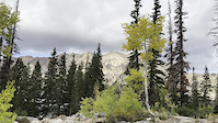
The trails on top are again mostly fire roads/cat tracks except for the aforementioned Big Mountain trail. From the top you can drop into Mineral Basin and access Alta or American Fork.
The lower mountain has a circuit of trails (Chaunier, Mid Level, Dean's and Baby Thunder that are interconnected with some fire road/cat tracks. Baby Thunder is a good "up" trail leading to Mid Level and fire roads/cat tracks that access the upper mountain. Mid Level is closed to up hill traffic where it crosses Dick Bass Highway after 11:00 a.m.
Mid mountain trails are mostly fire roads/cat tracks that lead to tram and Peruvian Lift. The Big Mountain trail is the exception, a downhill trail that goes from the tram top to the tram base when linked with the lower part of Mid Level. This trail combo gives one 7 to 7.5 miles of downhill punctuated by more berms, rock gardens and pump jumps than you can count.
The trails on top are again mostly fire roads/cat tracks except for the aforementioned Big Mountain trail. From the top you can drop into Mineral Basin and access Alta or American Fork.
Primary Trail Type: Cross-Country
Land Status: National Forest
Land Manager: uinta-wasatch-cache national forest
 google parking directions
 Access Info:
Usual meeting point is at the base of the Gad Lift.
Activities Click to view
- Mountain Bike
27 trails
- E-Bike
5 trails
- Gravel Bike
7 trails
- Hike
44 trails
- Trail Running
44 trails
- Snowshoe
0 trails
- Downhill Ski
175 trails
- Nordic Ski
0 trails
Region Details
- 13
- 1
- 10
- 2
Region Status
Open as of Jun 15, 2026Stats
- Avg Trail Rating
- Trails (view details)
- 216
- Trails Mountain Bike
- 27
- Trails E-Bike
- 5
- Trails Gravel Bike
- 7
- Trails Hike
- 44
- Trails Trail Running
- 44
- Trails Dirtbike/Moto
- 1
- Trails ATV/ORV/OHV
- 1
- Trails Downhill Ski
- 175
- Total Distance
- 89 miles
- Total Descent
- 79,379 ft
- Total Vertical
- 3,668 ft
- Highest Trailhead
- 11,402 ft
- Reports
- 723
- Photos
- 99
- Ridden Counter
- 47,326
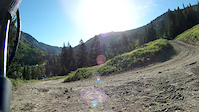
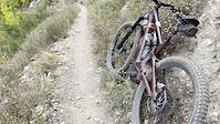
Popular Snowbird Mountain Resort Mountain Biking Trails
• 100 ★ 4.2 • 6 miles • 24 ft • 1,103 •
Snowbird has not taken bikes up the tram since 2019 and according to comment from Snowbird the trail is no longer closed to uphill traffic after 11am. However the posted signage still says it is DH only after 11. Thus, you can treat it...
• 100 ★ 3.8 • 1 mile • 3 ft • 1,015 •
A little of everything, some rocks, roots, and pine needles. Excellent trail!
• 95 ★ 3.7 • 4,452 ft • 274 ft • 961 •
This is a great singletrack trail that is pretty easy but still has some embedded rocks and provides a gradual elevation gain. There is one sweeping turn that opens up to a beautiful view of the valley. This is also a fast and fun...
• 75 ★ 3.7 • 3,386 ft • 164 ft • 641 •
Another great trail here, not steep at all, and really fun and flows well going west
• 95 ★ 2.8 • 643 ft • 0 ft • 530 •
Starts out smooth, then drops you through some fun a rooty sections with little bridge crossings.
• 80 ★ 3.2 • 3,179 ft • 133 ft • 414 •
A bit overgrown at times. It starts of pretty easy with a re-route from the construction of the Mountain Coaster as you climb up. The section from the top to the connection with Dick Bass Highway has some rocky and rooty section that is...
Snowbird Mountain Resort Mountain Bike Routes
★ 5.0 • 2 miles • 550 ft • 2 •
4 miles • 630 ft • 4 • Loop •
2022 SLC Corporate Games Intermediate/Pro Course 1x Lap for Intermediate 2x Laps for Pro
5 miles • 1,183 ft • 4 •
8 miles • 2,824 ft • 2 •
9 miles • 2,636 ft • 3 •
Photos of Snowbird Mountain Resort Mountain Bike
Videos of Snowbird Mountain Resort Mountain Bike

trail: Big Mountain
3:22 |
311 |
Mar 23, 2021
trail: Deans Delight
4:03 |
193 |
Mar 15, 2015
trail: Big Mountain
428 |
Aug 10, 2020 , Alta

trail: Big Mountain
28:30 |
1521 |
Aug 17, 2019 , Alta

trail: Baby Thunder
6:47 |
1513 |
May 13, 2018 , Alta
0:42 |
3 |
Sep 22, 2025
0:41 |
4 |
Sep 22, 2025
Current Trail Warnings
| status | trail | date | condition | user | info |
|---|---|---|---|---|---|
| Big Mountain | Jun 15, 2026 @ 12:32pm (America/Denver) Jun 15, 2026 | Wet | turdol | Wet in some places, snow packed on most... |
Recent Trail Reports
Activity Feed
| username | action | type | title | date |
|---|---|---|---|---|
| iceberg77 | wishlist | trail | activity #97650628 | Jun 23, 2026 @ 1:54pm 42 mins |
| turdol | add | report | activity #97055503 | Jun 15, 2026 @ 11:32am Jun 15, 2026 |
| cam-lo | add | report | activity #96700662 and 10 more | Jun 10, 2026 @ 3:56pm Jun 10, 2026 |
| cam-lo | add | report | activity #95817404 | May 29, 2026 @ 6:49pm May 29, 2026 |
| cam-lo | add | report | activity #95749305 | May 28, 2026 @ 6:43pm May 28, 2026 |
Recent Comments
| username | type | title | comment | date |
|---|---|---|---|---|
| trail | the site is still saying no bikes on the tram.... | Sep 16, 2025 @ 8:09am Sep 16, 2025 | ||
| trail | Apparently Snowbird is allowing tram access... | Sep 13, 2025 @ 5:23am Sep 13, 2025 | ||
| trail | Really enjoyable descent with fun variety. Big... | Sep 12, 2025 @ 7:44pm Sep 12, 2025 | ||
| trail | Brutal climb (many tight steep rocky switch... | Jul 30, 2025 @ 4:30pm Jul 30, 2025 | ||
| report | it's not overgrown, it's supposed to be... | Jul 25, 2025 @ 8:02pm Jul 25, 2025 |
Nearby Areas
| name | distance | ||||
|---|---|---|---|---|---|
| Alta Ski Resort | 1 | 1 | 1.8 km | ||
| Solitude Bike Park | 2 | 5 | 2 | 1 | 4 km |
| Little Cottonwood Canyon | 1 | 5 | 2 | 3 | 4.4 km |
| Brighton Ski Resort | 2 | 1 | 2 | 4.5 km | |
| Big Cottonwood Canyon | 1 | 3 | 5 | 1 | 4.5 km |
Local Products
Activity Type Stats
| activitytype | trails | distance | descent | descent distance | total vertical | rating | global rank | state rank | photos | reports | routes | ridelogs |
|---|---|---|---|---|---|---|---|---|---|---|---|---|
| Mountain Bike | 27 | 23 miles | 8,166 ft | 16 miles | 3,196 ft | #4,386 | #1,545 | 84 | 722 | 13 | 3,134 | |
| E-Bike | 5 | 4 miles | 1,969 ft | 3 miles | 2,871 ft | #6,326 | #1,799 | 8 | 516 | 1 | 401 | |
| Gravel Bike | 7 | 8 miles | 3,366 ft | 5 miles | 3,196 ft | #86 | #40 | 110 | 4 | |||
| Hike | 44 | 34 miles | 12,251 ft | 21 miles | 3,655 ft | #877 | #452 | 7 | 699 | 12 | 1,027 | |
| Trail Running | 44 | 34 miles | 12,251 ft | 21 miles | 3,655 ft | #3,113 | #824 | 700 | 14 | 835 | ||
| Dirtbike/Moto | 1 | 1 mile | 7 ft | 394 ft | 482 ft | 206 | 1 | 3 | ||||
| ATV/ORV/OHV | 1 | 1 mile | 7 ft | 394 ft | 482 ft | 206 | 2 | 1 | ||||
| Downhill Ski | 175 | 56 miles | 67,178 ft | 51 miles | 3,376 ft | #37 | #21 | 17 | 8,683 |
Frequently Asked Questions About Snowbird Mountain Resort
▼
What are the highest rated mountain biking trails in Snowbird Mountain Resort?
The highest rated mountain biking trails in Snowbird Mountain Resort are:
- Big Mountain (4.2/5)
- Whale Rock (4/5)
- Whirley Bird (3.9/5)
- Mid-Way (3.8/5)
- Deans Delight (3.8/5)
▼
What is the best time of the year to ride in Snowbird Mountain Resort?
Based on ride log data, the most popular months to ride in Snowbird Mountain Resort are:
- July (69 activities)
- August (50 activities)
- September (33 activities)
▼
Where can I park to ride in Snowbird Mountain Resort?
There are 2 parking locations listed in Snowbird Mountain Resort. The most popular parking spots are:
▼
What is the longest trail in Snowbird Mountain Resort?
The longest trail in Snowbird Mountain Resort is Big Mountain at 6.3 miles. View all trails sorted by distance.
Activities
Trails
- Hard trails in Snowbird Mountain Resort
- Easy trails in Snowbird Mountain Resort
- Favorite trails in Snowbird Mountain Resort
- Most ridden trails in Snowbird Mountain Resort
- Singletrack in Snowbird Mountain Resort
- Viewpoint trails in Snowbird Mountain Resort
- Trails with technical features in Snowbird Mountain Resort
- Race routes in Snowbird Mountain Resort
- By frizbee-luke
 & contributors
 - Admins: apply
- #14917 - 14,125 views
- snowbird mountain resort activity log | embed map of Snowbird Mountain Resort mountain bike trails | snowbird mountain resort mountain biking points of interest
Downloading of trail gps tracks in kml & gpx formats is enabled for Snowbird Mountain Resort.
You must login to download files.