close
-
Layers w
- Weather Layers
- Pro
- Pro
- Pro
- Pro
- Pro
- Pro
- More Layers
- Pro
- Pro
- Pro
- Pro
-
Upgrade to

3D
Trail Conditions
- Unknown
- Snow Groomed
- Snow Packed
- Snow Covered
- Snow Cover Partial
- Freeze/thaw Cycle
- Icy
- Prevalent Mud
- Wet
- Variable
- Ideal
- Dry
- Very Dry
Trail Flow (Ridden Direction)
Trailforks scans users ridelogs to determine the most popular direction each trail is ridden. A good flowing trail network will have most trails flowing in a single direction according to their intension.
The colour categories are based on what percentage of riders are riding a trail in its intended direction.
The colour categories are based on what percentage of riders are riding a trail in its intended direction.
- > 96%
- > 90%
- > 80%
- > 70%
- > 50%
- < 50%
- bi-directional trail
- no data
Trail Last Ridden
Trailforks scans ridelogs to determine the last time a trail was ridden.
- < 2 days
- < 1 week
- < 2 weeks
- < 1 month
- < 6 months
- > 6 months
Trail Ridden Direction
The intended direction a trail should be ridden.
- Downhill Only
- Downhill Primary
- Both Directions
- Uphill Primary
- Uphill Only
- One Direction
Contribute Details
Colors indicate trail is missing specified detail.
- Description
- Photos
- Description & Photos
- Videos
Trail Popularity ?
Trailforks scans ridelogs to determine which trails are ridden the most in the last 9 months.
Trails are compared with nearby trails in the same city region with a possible 25 colour shades.
Think of this as a heatmap, more rides = more kinetic energy = warmer colors.
- most popular
- popular
- less popular
- not popular
ATV/ORV/OHV Filter
Max Vehicle Width
inches
US Cell Coverage
Legend

Radar Time
Activity Recordings
Trailforks uses anonymized public activity data.
?
Activity Recordings
Trailforks uses anonymized public activity data.
?
Personal Heatmap
▶
Activity Types
all
/
none
▶
Options
2
Date range
month
–
Winter Trails
Warning
A routing network for winter maps does not exist. Selecting trails using the winter trails layer has been disabled.
Missing Trails
Most Popular
Least Popular
Trails are colored based on popularity. The more popular a trail is, the more red. Less popular trails trend towards green.
Jump Magnitude Heatmap
Heatmap of where riders jump on trails. Zoom in to see individual jumps, click circles to view jump details.
BC Backroad Status
![map legend]()
Service Road Atlas is a free to use, community-driven service for viewing and creating reports on the numerous back-country service roads around B.C. and Alberta.

Slope Aspect
Direction the slope faces
Trails Deemphasized
Trails are shown in grey.
Only show trails with no bike usage.
Suggested Layers
Based on selected activity type
Save the current map location and zoom level as your default home location whenever this page is loaded.
Save
No description for Sobótka has been added yet!
Login or register to submit one.
This region uses the Uk/Euro style trail grading system.
Activities Click to view
- Mountain Bike
125 trails
- E-Bike
125 trails
- Gravel Bike
16 trails
- Adaptive Bike
12 trails
- Winter Fat Bike
5 trails
- Hike
88 trails
- Trail Running
88 trails
Region Details
- 56
- 13
- 28
- 20
- 8
Region Status
Caution as of Jun 18, 2026Stats
- Avg Trail Rating
- Trails (view details)
- 129
- Trails Mountain Bike
- 125
- Trails E-Bike
- 125
- Trails Gravel Bike
- 16
- Trails Adaptive Bike
- 12
- Trails Winter Fat Bike
- 5
- Trails Hike
- 88
- Trails Trail Running
- 88
- Total Distance
- 100 miles
- Total Descent
- 29,198 ft
- Total Vertical
- 1,615 ft
- Highest Trailhead
- 2,300 ft
- Reports
- 2,989
- Photos
- 1,624
- Ridden Counter
- 9,872
Sub Regions
-
Masyw Ślęży
- 11
- 26
- 20
- 8
-
Suliwoods
- 1
- 1
-
Trasy MTB Sobótka - Janosik
Popular Sobótka Mountain Biking Trails
• 75 ★ 4.8 • 1,955 ft • 3 ft • 408 •
Highly rated popular red difficulty singletrack. This mountain bike primary trail can be used downhill only. It features berm, drop, jump and rock garden. On average it takes 4 minutes to complete this trail.
• 100 ★ 5.0 • 958 ft • 0 ft • 345 •
Popular blue difficulty wilderness trail. This mountain bike primary trail can be used both directions and has a moderate overall physical rating with a 0 ft blue climb. Trail visibility is always easy to follow. On average it takes 2 minutes to complete this trail.
• 85 ★ 5.0 • 1 mile • 0 ft • 251 •
Highly rated popular red difficulty singletrack. This mountain bike primary trail can be used downhill primary. On average it takes 10 minutes to complete this trail.
• 60 ★ 4.3 • 2,169 ft • 0 ft • 240 • • hike
Część niebieskiego szlaku turystycznego PTTK.
Sobótka Mountain Bike Routes
★ 5.0 • 11 miles • 2,434 ft • 9 • Loop •
Jedziemy klasykami. , , (z pominięciem części w rezerwacie). Potem parking, żarełko i skok na . Osoby...
19 miles • 1,951 ft • 6 • Loop •
Łatwa technicznie i średnio trudna kondycyjnie trasa okrążająca Ślężę i Radunię. Zahacza o...
9 miles • 1,717 ft • 4 • Loop •
Trasa składająca się z najprostszych segmentów, lecz dających duuuużo frajdy. Idealna dla tych, co...
★ 3.0 • 10 miles • 1,338 ft • 7 • Loop •
Jeden z dwóch oficjalnych, oznakowanych szlaków rowerowych Masywu Ślęży. Oznaczony niebieskim kołem...
17 miles • 4,011 ft • 8 • Loop •
Start na parkingu Tąpadła. Zaczynamy podjazd na Tajemną. Potem zjazd nią i chamski podjazd z końca...
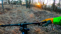
Photos of Sobótka Mountain Bike
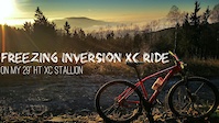
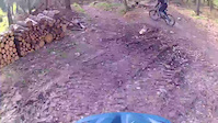
Videos of Sobótka Mountain Bike
trail: Tajemna Hardline
0:50 |
120 |
Nov 1, 2023
trail: Baba Jaga Upper
0:04 |
278 |
Apr 4, 2023

trail: Baba Jaga Upper
0:08 |
89 |
Apr 4, 2023
trail: Suliwoods Singletrack
0:08 |
365 |
Feb 1, 2020
trail: Suliwoods Singletrack
0:12 |
328 |
Jun 16, 2018
trail: Przemiłowskie Sekatory
0:39 |
235 |
Apr 3, 2018
trail: Suliwoods Singletrack
0:54 |
3014 |
Dec 20, 2016
trail: Świerkowa
0:44 |
504 |
Nov 6, 2016
Current Trail Warnings
| status | trail | date | condition | user | info |
|---|---|---|---|---|---|
| Tajemna Hardline | Jun 13, 2026 @ 10:01am (Europe/Warsaw) Jun 13, 2026 | Ideal | ppw | Początku trasy nie ma. Zasypany... | |
| Forest Path | May 24, 2026 @ 11:10pm (Europe/Warsaw) May 24, 2026 | Variable | ya1 WE | E-Bike Trasa bardzo zarośnięta i zakrzaczona.... |
Recent Trail Reports
Activity Feed
| username | action | type | title | date |
|---|---|---|---|---|
| RiFFu | add | report | activity #97314647 | Jun 19, 2026 @ 7:07am Jun 19, 2026 |
| RiFFu | add | report | activity #97314644 and 4 more | Jun 19, 2026 @ 7:07am Jun 19, 2026 |
| Spaff | wishlist | trail | activity #97273297 | Jun 18, 2026 @ 1:29pm Jun 18, 2026 |
| Spaff | add | report | activity #97239704 and 4 more | Jun 18, 2026 @ 2:45am Jun 18, 2026 |
| nieuchron | difficultyvote | trail | activity #97237310 | Jun 18, 2026 @ 12:56am Jun 18, 2026 |
Recent Comments
| username | type | title | comment | date |
|---|---|---|---|---|
| trail | Ja jechałem i potwierdzam | May 11, 2026 @ 1:48am May 11, 2026 | ||
| trail | Aktualnie na końcówce jest gap przez strumień | May 11, 2026 @ 1:33am May 11, 2026 | ||
| trail | Po zmianach trasa jest jeszcze lepsza, dodano... | May 11, 2026 @ 1:31am May 11, 2026 | ||
| trail | Zalecam mieć gaz pieprzowy ze względu na psy. | Apr 12, 2026 @ 2:01am Apr 12, 2026 | ||
| trail | Autor ścieżki twierdzi, że to niebieska... | Dec 29, 2025 @ 4:23am Dec 29, 2025 |
Local Badges
-

Epic Mountain Bike Climb 2k7 awarded -

Climbing 10k Badge22 awarded -

Mountain Biking 100k Badge0 awarded -

Epic Ride Descent 2k7 awarded -

Descent 10k Badge22 awarded -

Descent 100k Badge0 awarded
Bike & Skill Parks
| name | type | city | rating |
|---|---|---|---|
| Trasy MTB Janosik Sobótka | skill park | Sobótka |
Activity Type Stats
| activitytype | trails | distance | descent | descent distance | total vertical | rating | global rank | state rank | photos | reports | routes | ridelogs |
|---|---|---|---|---|---|---|---|---|---|---|---|---|
| Mountain Bike | 125 | 98 miles | 28,632 ft | 53 miles | 1,614 ft | #722 | #10 | 1,616 | 2,961 | 14 | 5,592 | |
| E-Bike | 125 | 98 miles | 28,632 ft | 53 miles | 1,614 ft | #265 | #259 | 3 | 2,253 | 3 | 1,124 | |
| Gravel Bike | 16 | 20 miles | 1,893 ft | 7 miles | 1,204 ft | #103 | #61 | 421 | 1 | 28 | ||
| Adaptive Bike | 12 | 12 miles | 1,086 ft | 4 miles | 1,040 ft | #95 | #88 | 227 | ||||
| Winter Fat Bike | 5 | 4 miles | 1,644 ft | 2 miles | 984 ft | #98 | #57 | 219 | ||||
| Hike | 88 | 77 miles | 14,639 ft | 35 miles | 1,608 ft | #1,488 | #43 | 4 | 1,966 | 1,113 | ||
| Trail Running | 88 | 77 miles | 14,639 ft | 35 miles | 1,608 ft | #1,288 | #31 | 1,966 | 502 |
Frequently Asked Questions About Sobótka
▼
What are the best places to ride in Sobótka?
Sobótka has 3 areas to explore for mountain biking. The top rated areas are:
▼
What are the highest rated mountain biking trails in Sobótka?
The highest rated mountain biking trails in Sobótka are:
- Tajemna (4.8/5)
- Żmija (4.7/5)
- Świerkowa (4.6/5)
- Gangster (4.6/5)
- Dolce Vita (4.5/5)
▼
What is the best time of the year to ride in Sobótka?
Based on ride log data, the most popular months to ride in Sobótka are:
- August (35 activities)
- October (33 activities)
- July (26 activities)
▼
Where can I park to ride in Sobótka?
There are 7 parking locations listed in Sobótka. The most popular parking spots are: View all parking and trailhead locations on the map to plan your visit.
Activities
Trails
- By micolai
 TRAILFORKS Poland & contributors
 - Admins: xaoo
- #15152 - 9,251 views
- sobótka activity log | embed map of Sobótka mountain bike trails | sobótka mountain biking points of interest
Downloading of trail gps tracks in kml & gpx formats is enabled for Sobótka.
You must login to download files.