close
-
Layers w
- Weather Layers
- Pro
- Pro
- Pro
- Pro
- Pro
- Pro
- More Layers
- Pro
- Pro
- Pro
- Pro
-
Upgrade to

3D
Trail Conditions
- Unknown
- Snow Groomed
- Snow Packed
- Snow Covered
- Snow Cover Partial
- Freeze/thaw Cycle
- Icy
- Prevalent Mud
- Wet
- Variable
- Ideal
- Dry
- Very Dry
Trail Flow (Ridden Direction)
Trailforks scans users ridelogs to determine the most popular direction each trail is ridden. A good flowing trail network will have most trails flowing in a single direction according to their intension.
The colour categories are based on what percentage of riders are riding a trail in its intended direction.
The colour categories are based on what percentage of riders are riding a trail in its intended direction.
- > 96%
- > 90%
- > 80%
- > 70%
- > 50%
- < 50%
- bi-directional trail
- no data
Trail Last Ridden
Trailforks scans ridelogs to determine the last time a trail was ridden.
- < 2 days
- < 1 week
- < 2 weeks
- < 1 month
- < 6 months
- > 6 months
Trail Ridden Direction
The intended direction a trail should be ridden.
- Downhill Only
- Downhill Primary
- Both Directions
- Uphill Primary
- Uphill Only
- One Direction
Contribute Details
Colors indicate trail is missing specified detail.
- Description
- Photos
- Description & Photos
- Videos
Trail Popularity ?
Trailforks scans ridelogs to determine which trails are ridden the most in the last 9 months.
Trails are compared with nearby trails in the same city region with a possible 25 colour shades.
Think of this as a heatmap, more rides = more kinetic energy = warmer colors.
- most popular
- popular
- less popular
- not popular
ATV/ORV/OHV Filter
Max Vehicle Width
inches
US Cell Coverage
Legend

Radar Time
Activity Recordings
Trailforks uses anonymized public activity data.
?
Activity Recordings
Trailforks uses anonymized public activity data.
?
Personal Heatmap
▶
Activity Types
all
/
none
▶
Options
2
Date range
month
–
Winter Trails
Warning
A routing network for winter maps does not exist. Selecting trails using the winter trails layer has been disabled.
Missing Trails
Most Popular
Least Popular
Trails are colored based on popularity. The more popular a trail is, the more red. Less popular trails trend towards green.
Jump Magnitude Heatmap
Heatmap of where riders jump on trails. Zoom in to see individual jumps, click circles to view jump details.
BC Backroad Status
![map legend]()
Service Road Atlas is a free to use, community-driven service for viewing and creating reports on the numerous back-country service roads around B.C. and Alberta.

Slope Aspect
Direction the slope faces
Trails Deemphasized
Trails are shown in grey.
Only show trails with no bike usage.
Suggested Layers
Based on selected activity type
Save the current map location and zoom level as your default home location whenever this page is loaded.
Save
No description for Sóller has been added yet!
Login or register to submit one.
This region uses the Uk/Euro style trail grading system.
Activities Click to view
- Mountain Bike
70 trails
- E-Bike
58 trails
- Gravel Bike
0 trails
- Adaptive Bike
0 trails
- Hike
72 trails
- Trail Running
72 trails
Region Details
- 13
- 2
- 31
- 17
- 6
Region Status
Open as of Dec 16, 2025Stats
- Avg Trail Rating
- Trails (view details)
- 70
- Trails Mountain Bike
- 71
- Trails E-Bike
- 58
- Trails Hike
- 72
- Trails Trail Running
- 72
- Total Distance
- 124 miles
- Total Descent
- 36,903 ft
- Total Vertical
- 3,024 ft
- Highest Trailhead
- 3,038 ft
- Reports
- 210
- Photos
- 136
- Ridden Counter
- 2,993
Sub Regions
-
Tramuntana Central
- 2
- 5
- 2
- 2
Popular Sóller Mountain Biking Trails
• 100 ★ 3.0 • 4,245 ft • 10 ft • 60 •
Nice downhill route that flows quite nicely all the way to the bottom
• 80 ★ 3.5 • 4,718 ft • 71 ft • 57 •
Very technical descent with tight switchbacks, steps, small drops and a rock slab half way down. Eases off towards the bottom becoming faster
• 90 ★ 4.1 • 1 mile • 60 ft • 55 •
Highly rated popular red difficulty doubletrack. This multi-use trail can be used both directions and has a moderate overall physical rating with a 60 ft blue climb. Trail visibility is always easy to follow. On average it takes 7 minutes to complete this trail.
• 90 ★ 3.0 • 4,046 ft • 149 ft • 54 •
Popular blue difficulty singletrack. This multi-use trail. On average it takes 5 minutes to complete this trail.
• 90 ★ 4.4 • 4 miles • 884 ft • 51 •
Highly rated popular blue difficulty singletrack. This multi-use trail. On average it takes 40 minutes to complete this trail.
• 95 ★ 4.0 • 1 mile • 430 ft • 41 •
easier route back towards solleric taking the higher track rather than the dh route
• 100 ★ 4.0 • 2 miles • 676 ft • 37 •
Trail starts at the old house of Oli Clar before climbing to the rocky outcrop of Pujol de can Xirgo, which gives fantastic views of the Tramuntana mountains in one direction and the central plane in the other. The trail enters the...
Sóller Mountain Bike Routes
★ 5.0 • 33 miles • 6,605 ft • 7 • Loop •
Ruta espectacular donde las haya, pero dura de cojones también. Las vistas sobre el Mediterráneo...
★ 5.0 • 33 miles • 6,161 ft • 3 • Point to Point •
Part of the TransTramuntana route that traverses all the Tramuntana Serra in Mallorca island. There are...
16 miles • 2,443 ft • 1 • Loop •
Ruta con varios segmentos diferentes. Hay trozos de carretera, de pista y trialera de bicipateo.
• 15 miles • 1,283 ft • 0 •
• 12 miles • 5,169 ft • 0 •
Photos of Sóller Mountain Bike
Videos of Sóller Mountain Bike
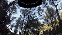
trail: Oli Clar, Font Figuera
4:57 |
139 |
Aug 6, 2014
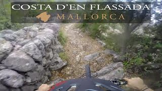
trail: Costa D'en Flassada
3:56 |
167 |
Sep 14, 2023 , Sóller
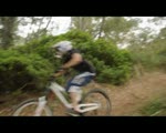
trail: La Torre
0:47 |
155 |
Sep 30, 2010
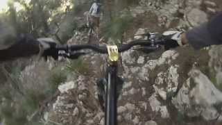
1194 |
Jun 14, 2014 , Sóller
Recent Trail Reports
Activity Feed
| username | action | type | title | date |
|---|---|---|---|---|
| imdoor | wishlist | trail | activity #94996324 | May 18, 2026 @ 1:13pm May 18, 2026 |
| Charlie3yJdZe | wishlist | trail | activity #94626628 and 4 more | May 13, 2026 @ 7:43am May 13, 2026 |
| LCO6ee | comment | trail | activity #92247782 | Apr 9, 2026 @ 6:01am Apr 9, 2026 |
| LCO6ee | ridden | trail | activity #92247681 | Apr 9, 2026 @ 5:58am Apr 9, 2026 |
| Angelreing | update | trail | activity #92206500 and 2 more | Apr 8, 2026 @ 1:09pm Apr 8, 2026 |
Recent Comments
| username | type | title | comment | date |
|---|---|---|---|---|
| trail | Trail was very overgrown and at the end there... | Apr 9, 2026 @ 6:01am Apr 9, 2026 | ||
| trail | Road then farm track. Straightforward.... | Apr 8, 2026 @ 9:09am Apr 8, 2026 | ||
| trail | Rideable hiking path. 1st half on the Soller... | Apr 8, 2026 @ 9:07am Apr 8, 2026 | ||
| trail | Rode this yesterday. Rocky, technical, but no... | Apr 8, 2026 @ 9:04am Apr 8, 2026 | ||
| trail | Se recorta,gracias | Nov 27, 2024 @ 9:14am Nov 27, 2024 |
Local Badges
-

10 Blue Trails20 awarded -

10 Black Trails1 awarded -

Epic Ride Climb 2k1,467 awarded -

Climbing 10k Badge143 awarded -

Climbing 100k Badge1 awarded -

Epic Ride Descent 2k1,471 awarded
Activity Type Stats
| activitytype | trails | distance | descent | descent distance | total vertical | rating | global rank | state rank | photos | reports | routes | ridelogs |
|---|---|---|---|---|---|---|---|---|---|---|---|---|
| Mountain Bike | 70 | 123 miles | 35,948 ft | 51 miles | 3,025 ft | #1,745 | #160 | 136 | 213 | 4 | 5,718 | |
| E-Bike | 58 | 24 miles | 5,115 ft | 10 miles | 2,428 ft | #2,773 | #325 | 187 | 2 | 419 | ||
| Hike | 72 | 124 miles | 36,903 ft | 52 miles | 3,025 ft | #1,613 | #173 | 213 | 1 | 545 | ||
| Trail Running | 72 | 124 miles | 36,903 ft | 52 miles | 3,025 ft | #1,207 | #167 | 212 | 1 | 153 |
Frequently Asked Questions About Sóller
▼
What are the best places to ride in Sóller?
Sóller has 1 areas to explore for mountain biking. The top rated areas are:
▼
What are the highest rated mountain biking trails in Sóller?
The highest rated mountain biking trails in Sóller are:
- Cami Vell Des Port (4.4/5)
- Castello (4.2/5)
- Muleta (4.1/5)
- Far Soller (4.1/5)
- Cami De Sa Costera (4.1/5)
▼
What is the best time of the year to ride in Sóller?
Based on ride log data, the most popular months to ride in Sóller are:
- October (20 activities)
- September (14 activities)
- December (13 activities)
▼
Where can I park to ride in Sóller?
There are 5 parking locations listed in Sóller. The most popular parking spots are:
- Layby parking
- Parking at Es Verger
- Parking Castell de Alaro
- Carrer sa Bastida parking
- Parking Son Tugadores
Activities
Trails
- By brenthillier
 NSMBA TRAILFORKS & contributors
 - Admins: apply
- #15918 - 8,278 views
- sóller activity log | embed map of Sóller mountain bike trails | sóller mountain biking points of interest
Downloading of trail gps tracks in kml & gpx formats is enabled for Sóller.
You must login to download files.