close
-
Layers w
- Weather Layers
- Pro
- Pro
- Pro
- Pro
- Pro
- Pro
- More Layers
- Pro
- Pro
- Pro
- Pro
-
Upgrade to

3D
Trail Conditions
- Unknown
- Snow Groomed
- Snow Packed
- Snow Covered
- Snow Cover Partial
- Freeze/thaw Cycle
- Icy
- Prevalent Mud
- Wet
- Variable
- Ideal
- Dry
- Very Dry
Trail Flow (Ridden Direction)
Trailforks scans users ridelogs to determine the most popular direction each trail is ridden. A good flowing trail network will have most trails flowing in a single direction according to their intension.
The colour categories are based on what percentage of riders are riding a trail in its intended direction.
The colour categories are based on what percentage of riders are riding a trail in its intended direction.
- > 96%
- > 90%
- > 80%
- > 70%
- > 50%
- < 50%
- bi-directional trail
- no data
Trail Last Ridden
Trailforks scans ridelogs to determine the last time a trail was ridden.
- < 2 days
- < 1 week
- < 2 weeks
- < 1 month
- < 6 months
- > 6 months
Trail Ridden Direction
The intended direction a trail should be ridden.
- Downhill Only
- Downhill Primary
- Both Directions
- Uphill Primary
- Uphill Only
- One Direction
Contribute Details
Colors indicate trail is missing specified detail.
- Description
- Photos
- Description & Photos
- Videos
Trail Popularity ?
Trailforks scans ridelogs to determine which trails are ridden the most in the last 9 months.
Trails are compared with nearby trails in the same city region with a possible 25 colour shades.
Think of this as a heatmap, more rides = more kinetic energy = warmer colors.
- most popular
- popular
- less popular
- not popular
ATV/ORV/OHV Filter
Max Vehicle Width
inches
US Cell Coverage
Legend

Radar Time
Activity Recordings
Trailforks uses anonymized public activity data.
?
Activity Recordings
Trailforks uses anonymized public activity data.
?
Personal Heatmap
▶
Activity Types
all
/
none
▶
Options
2
Date range
month
–
Winter Trails
Warning
A routing network for winter maps does not exist. Selecting trails using the winter trails layer has been disabled.
Missing Trails
Most Popular
Least Popular
Trails are colored based on popularity. The more popular a trail is, the more red. Less popular trails trend towards green.
Jump Magnitude Heatmap
Heatmap of where riders jump on trails. Zoom in to see individual jumps, click circles to view jump details.
BC Backroad Status
![map legend]()
Service Road Atlas is a free to use, community-driven service for viewing and creating reports on the numerous back-country service roads around B.C. and Alberta.

Slope Aspect
Direction the slope faces
Trails Deemphasized
Trails are shown in grey.
Only show trails with no bike usage.
Suggested Layers
Based on selected activity type
Save the current map location and zoom level as your default home location whenever this page is loaded.
SaveAs one of B.C's largest growing municipalities, of its own modest size, Sooke is poised to become the outdoor recreation capital of Vancouver Island- with mountain biking as the prominent jewel in its heavily encrusted crown.
The region includes Sooke, East Sooke, Otter Point and most of the Sooke Hills.
The region includes Sooke, East Sooke, Otter Point and most of the Sooke Hills.
Activities Click to view
- Mountain Bike
62 trails
- E-Bike
41 trails
- Gravel Bike
0 trails
- Adaptive Bike
0 trails
- Winter Fat Bike
0 trails
- Horse
18 trails
- Hike
150 trails
- Trail Running
148 trails
Region Details
- 15
- 4
- 18
- 21
- 3
Region Status
Open as of Jun 14, 2026Stats
- Avg Trail Rating
- Trails (view details)
- 160
- Trails Mountain Bike
- 62
- Trails E-Bike
- 41
- Trails Horse
- 18
- Trails Hike
- 150
- Trails Trail Running
- 148
- Total Distance
- 140 miles
- Total Descent
- 25,399 ft
- Total Vertical
- 2,192 ft
- Highest Trailhead
- 2,195 ft
- Reports
- 1,355
- Photos
- 353
- Ridden Counter
- 23,504
Sub Regions
-
Harbourview
- 4
- 11
- 3
-
Sooke Hills Wilderness
- 1
- 10
Popular Sooke Mountain Biking Trails
• 100 ★ 3.9 • 1,371 ft • 0 ft • 1,185 •
Continuation from , finishing trail to the Harbourview trail network. Flowing and steep trail with bermed corners, rolling drops and more. A great way to end the ride! Drops right to the parking lot.
• 95 ★ 4.3 • 3,711 ft • 99 ft • 1,155 •
Finishing trails to the Harbourview network, short climb then a mix of short drops & rock rolls.
• 100 ★ 4.4 • 4,764 ft • 80 ft • 1,015 •
Continuation of the spicy route down the front side of Mt Manuel Quimper. A short climb up from takes you to a scenic overlook of Sooke Basin. The trail continues down several rocky steep sections, through some meadows then back into to...
• 95 ★ 3.8 • 3,645 ft • 11 ft • 933 •
Section of singletrack parallel to Harbourview Road. A mix of flowing and tight technical trail with roots and sharp corners.
• 100 ★ 4.1 • 2,477 ft • 0 ft • 859 •
Named after a family of who's mother used the trail to walk her cubs to school. Here the elevation continues to flatten out as you come closer to the end with XC singletrack and some smaller rock rolls and tight tree sections.
• 90 ★ 2.4 • 4,272 ft • 686 ft • 854 • • hike
Steep and rough trail to the summit of Mt Quimper. Old road grade has become well washed out and loose over time from erosion and motorized traffic. Primarily a hiking trail, but walking/pushing your bike up is permitted. Biking down is...
• 90 ★ 4.3 • 3,537 ft • 0 ft • 819 •
A somewhat spicy route down the front side of Mt Manuel Quimper. Head south from the summit, through rocky meadows then into the trees. A number of challenging rock slabs and step-downs will keep you on your toes. Rideable year round,...
• 80 ★ 3.0 • 1,545 ft • 26 ft • 783 •
Can be ridden in either direction, wet or dry. A single track trail alternative to the road to connect Lower (AKA Kumquat) and Trails.
Sooke Mountain Bike Routes
5 miles • 1,467 ft • 5 •
Join us for a virtual poker ride! Complete the route and come back to Fuca cycles to gain poker cards from...
★ 3.0 • 12 miles • 2,000 ft • 6 •
Nice long ride to a couple of fine swimming lakes culminating in the stunning and its superb views.
12 miles • 2,631 ft • 5 • Loop •
Proposed route for event Big Mountain MTB Challenge - Sooke,
39 miles • 3,397 ft • 10 • Loop •
Harbourview parking lot to Sooke Hills Wilderness (GT1 / Stonecrop 2 included just for fun) - and on to...
13 miles • 2,186 ft • 25 • Point to Point •
A ride that makes you feel that you are far away from the urban sprawl. is the highlight with its many...
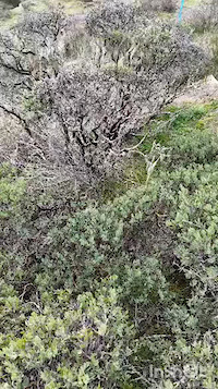
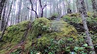
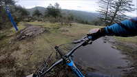
Photos of Sooke Mountain Bike
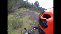
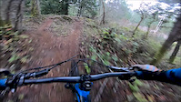
Videos of Sooke Mountain Bike
trail: Airflow (Arbutus)
0:25 |
33 |
Dec 23, 2023

8:16 |
142 |
Aug 2, 2021

trail: GT1 (Stonecrop 2)
4:52 |
131 |
Aug 1, 2021

trail: FM Radio (Juniper)
10:36 |
138 |
Jul 31, 2021
trail: Raven
0:15 |
930 |
Sep 26, 2020
3:45 |
375 |
Feb 5, 2018
trail: GT2 (Stonecrop 3)
0:15 |
346 |
Jan 7, 2018
2:18 |
507 |
Jan 7, 2018
Current Trail Warnings
| status | trail | date | condition | user | info |
|---|---|---|---|---|---|
| Sword Fern | Jun 3, 2026 @ 2:01pm (America/Vancouver) Jun 3, 2026 | Variable | CRD-Parks | Temporary Closure due to bear activity in... |
Recent Trail Reports
| status | trail | date | condition | info | user |
|---|---|---|---|---|---|
| GT2 (Stonecrop 3) | Jun 14, 2026 @ 6:43pm (America/Vancouver) Jun 14, 2026 | Ideal | shmarv | ||
| GT1 (Stonecrop 2) | Jun 14, 2026 @ 6:41pm (America/Vancouver) Jun 14, 2026 | Ideal | shmarv | ||
| 3 Bears (Bracken) | Jun 7, 2026 @ 8:03pm (America/Vancouver) Jun 7, 2026 | Dry | mikewulder | ||
| Ridge Trail | May 22, 2026 @ 3:55pm (America/Vancouver) May 22, 2026 | Dry | Wouteraarts | ||
| Mt Quimper North Trail (Push Up) | May 3, 2026 @ 1:29pm (America/Vancouver) May 3, 2026 | Unknown | JustEatRealFood | ||
| K2 (Manzanita) | Apr 29, 2026 @ 9:56am (America/Vancouver) Apr 29, 2026 | Dry | mtb-ben-victoria | ||
| Hump (Stonecrop 1) | Apr 29, 2026 @ 9:56am (America/Vancouver) Apr 29, 2026 | Dry | mtb-ben-victoria | ||
| Zig Zag (Rocky Mountain Ridge) | Apr 29, 2026 @ 9:56am (America/Vancouver) Apr 29, 2026 | Very Dry | mtb-ben-victoria | ||
| Zig Zag (Push up) | Apr 29, 2026 @ 9:56am (America/Vancouver) Apr 29, 2026 | Dry | mtb-ben-victoria | ||
| FM Radio (Juniper) | Apr 6, 2026 @ 12:08pm (America/Vancouver) Apr 6, 2026 | Variable | Andrewr31DWX |
Activity Feed
| username | action | type | title | date |
|---|---|---|---|---|
| WillyA | wishlist | route | activity #97810614 | Jun 25, 2026 @ 7:26pm 10 hours |
| trailforks | add | video | activity #97716428 | Jun 24, 2026 @ 12:21pm 2 days |
| Matthew4h2rWM | ridden | trail | activity #97439399 and 6 more | Jun 20, 2026 @ 3:54pm Jun 20, 2026 |
| shmarv | add | report | activity #97017919 and 1 more | Jun 14, 2026 @ 6:41pm Jun 14, 2026 |
| K175QMgQ | wishlist | trail | activity #96784810 and 1 more | Jun 11, 2026 @ 10:05pm Jun 11, 2026 |
Recent Comments
| username | type | title | comment | date |
|---|---|---|---|---|
| trail | Fuckijf grind | Dec 30, 2025 @ 10:30pm Dec 30, 2025 | ||
| trail | This trail is closed | Oct 27, 2025 @ 1:19pm Oct 27, 2025 | ||
| trail | Very fun trail for fast access to The Last... | Jul 5, 2025 @ 12:42pm Jul 5, 2025 | ||
| trail | Fun easy trail. Leans toward more a modern... | May 17, 2025 @ 4:23pm May 17, 2025 | ||
| trail | Pretty mellow single track hiking trail. Fun... | May 17, 2025 @ 4:21pm May 17, 2025 |
Local Badges
-

10 Black Trails344 awarded -

Epic Ride Climb 2k62 awarded -

Climbing 10k Badge99 awarded -

Climbing 100k Badge2 awarded -

Epic Ride Descent 2k64 awarded -

Descent 10k Badge100 awarded
Bike & Skill Parks
| name | type | city | rating |
|---|---|---|---|
| Sooke Bike Park | skill park | Sooke |
Activity Type Stats
| activitytype | trails | distance | descent | descent distance | total vertical | rating | global rank | state rank | photos | reports | routes | ridelogs |
|---|---|---|---|---|---|---|---|---|---|---|---|---|
| Mountain Bike | 62 | 51 miles | 10,246 ft | 24 miles | 1,732 ft | #1,374 | #57 | 271 | 1,353 | 8 | 14,531 | |
| E-Bike | 41 | 42 miles | 7,572 ft | 20 miles | 1,732 ft | #2,360 | #59 | 4 | 1,299 | 1,405 | ||
| Horse | 18 | 25 miles | 2,382 ft | 12 miles | 1,414 ft | #1,110 | #41 | 320 | 9 | |||
| Hike | 150 | 134 miles | 21,024 ft | 52 miles | 2,192 ft | #595 | #37 | 35 | 1,202 | 2 | 3,228 | |
| Trail Running | 148 | 133 miles | 20,994 ft | 52 miles | 2,192 ft | #649 | #34 | 43 | 1,200 | 2 | 1,179 |
Frequently Asked Questions About Sooke
▼
What are the best places to ride in Sooke?
Sooke has 7 areas to explore for mountain biking. The top rated areas are:
▼
What are the highest rated mountain biking trails in Sooke?
The highest rated mountain biking trails in Sooke are:
- Zig Zag (Rocky Mountain Ridge) (4.6/5)
- New K2 (4.5/5)
- Raven (4.4/5)
- K2 (Manzanita) (4.3/5)
- GT1 (Stonecrop 2) (4.2/5)
▼
What is the best time of the year to ride in Sooke?
Based on ride log data, the most popular months to ride in Sooke are:
- July (189 activities)
- May (157 activities)
- April (151 activities)
▼
Where can I park to ride in Sooke?
There are 19 parking locations listed in Sooke. The most popular parking spots are: View all parking and trailhead locations on the map to plan your visit.
Activities
Trails
Points of Interest
- By canadaka
 Trailforks & contributors
 - Admins: Dubnyk, CRD-Parks, SBC
- #3037 - 36,762 views
- sooke activity log | embed map of Sooke mountain bike trails | sooke mountain biking points of interest
Downloading of trail gps tracks in kml & gpx formats is enabled for Sooke.
You must login to download files.