close
-
Layers w
- Weather Layers
- Pro
- Pro
- Pro
- Pro
- Pro
- Pro
- More Layers
- Pro
- Pro
- Pro
- Pro
-
Upgrade to

3D
Trail Conditions
- Unknown
- Snow Groomed
- Snow Packed
- Snow Covered
- Snow Cover Partial
- Freeze/thaw Cycle
- Icy
- Prevalent Mud
- Wet
- Variable
- Ideal
- Dry
- Very Dry
Trail Flow (Ridden Direction)
Trailforks scans users ridelogs to determine the most popular direction each trail is ridden. A good flowing trail network will have most trails flowing in a single direction according to their intension.
The colour categories are based on what percentage of riders are riding a trail in its intended direction.
The colour categories are based on what percentage of riders are riding a trail in its intended direction.
- > 96%
- > 90%
- > 80%
- > 70%
- > 50%
- < 50%
- bi-directional trail
- no data
Trail Last Ridden
Trailforks scans ridelogs to determine the last time a trail was ridden.
- < 2 days
- < 1 week
- < 2 weeks
- < 1 month
- < 6 months
- > 6 months
Trail Ridden Direction
The intended direction a trail should be ridden.
- Downhill Only
- Downhill Primary
- Both Directions
- Uphill Primary
- Uphill Only
- One Direction
Contribute Details
Colors indicate trail is missing specified detail.
- Description
- Photos
- Description & Photos
- Videos
Trail Popularity ?
Trailforks scans ridelogs to determine which trails are ridden the most in the last 9 months.
Trails are compared with nearby trails in the same city region with a possible 25 colour shades.
Think of this as a heatmap, more rides = more kinetic energy = warmer colors.
- most popular
- popular
- less popular
- not popular
ATV/ORV/OHV Filter
Max Vehicle Width
inches
US Cell Coverage
Legend

Radar Time
Activity Recordings
Trailforks uses anonymized public activity data.
?
Activity Recordings
Trailforks uses anonymized public activity data.
?
Personal Heatmap
▶
Activity Types
all
/
none
▶
Options
2
Date range
month
–
Winter Trails
Warning
A routing network for winter maps does not exist. Selecting trails using the winter trails layer has been disabled.
Missing Trails
Most Popular
Least Popular
Trails are colored based on popularity. The more popular a trail is, the more red. Less popular trails trend towards green.
Jump Magnitude Heatmap
Heatmap of where riders jump on trails. Zoom in to see individual jumps, click circles to view jump details.
BC Backroad Status
![map legend]()
Service Road Atlas is a free to use, community-driven service for viewing and creating reports on the numerous back-country service roads around B.C. and Alberta.

Slope Aspect
Direction the slope faces
Trails Deemphasized
Trails are shown in grey.
Only show trails with no bike usage.
Suggested Layers
Based on selected activity type
Save the current map location and zoom level as your default home location whenever this page is loaded.
Save
No description for South Fork has been added yet!
Login or register to submit one.
Activities Click to view
- Mountain Bike
41 trails
- Gravel Bike
1 trails
- Adaptive Bike
1 trails
- Horse
7 trails
- Hike
45 trails
- Trail Running
45 trails
- Snowshoe
4 trails
Region Details
- 17
- 8
- 10
- 5
- 1
Region Status
Open as of Jun 6, 2026Stats
- Avg Trail Rating
- Trails (view details)
- 44
- Trails Mountain Bike
- 42
- Trails Gravel Bike
- 1
- Trails Adaptive Bike
- 1
- Trails Horse
- 7
- Trails Hike
- 45
- Trails Trail Running
- 45
- Trails Snowshoe
- 4
- Total Distance
- 70 miles
- Total Descent
- 9,260 ft
- Total Vertical
- 3,957 ft
- Highest Trailhead
- 11,818 ft
- Reports
- 55
- Photos
- 26
- Ridden Counter
- 3,653
Sub Regions
-
Cat Creek
- 3
- 1
- 1
Popular South Fork Mountain Biking Trails
• 100 ★ 2.7 • 2,354 ft • 139 ft • 370 •
Popular green difficulty singletrack. This mountain bike primary trail can be used both directions. On average it takes 5 minutes to complete this trail.
• 100 ★ 3.0 • 1,164 ft • 2 ft • 322 •
Popular blue difficulty singletrack. This mountain bike primary trail can be used both directions. On average it takes 2 minutes to complete this trail.
• 95 ★ 4.0 • 2 miles • 136 ft • 315 •
Highly rated popular black diamond difficulty singletrack. This mountain bike primary trail can be used both directions with a 136 ft black diamond climb. On average it takes 28 minutes to complete this trail.
• 90 ★ 2.5 • 1,560 ft • 0 ft • 177 •
Popular blue difficulty singletrack. This mountain bike primary trail can be used both directions. On average it takes 1 minutes to complete this trail.
• 85 ★ 4.1 • 2 miles • 404 ft • 168 •
This is trail is why mountain bikers go to Penitente Canyon, technical rock fin sections with great single track that you have to stay ready for just about anything, drops, wheelie hops etc. Great Riding!
• 75 ★ 3.7 • 3,906 ft • 16 ft • 159 •
Popular black diamond difficulty singletrack. This mountain bike primary trail can be used downhill primary. On average it takes 8 minutes to complete this trail.
• 75 ★ 2.0 • 1 mile • 137 ft • 136 •
Popular green difficulty singletrack. This mountain bike primary trail can be used both directions. On average it takes 14 minutes to complete this trail.
• 90 ★ 3.0 • 3,214 ft • 68 ft • 134 •
Popular green difficulty singletrack. This mountain bike primary trail can be used both directions. On average it takes 4 minutes to complete this trail.
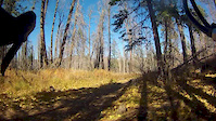
Photos of South Fork Mountain Bike
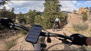
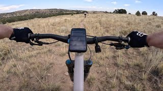
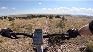
Videos of South Fork Mountain Bike
trail: Access Road
8:14 |
31 |
Oct 24, 2016
trail: Blue Sky Loop
10:40 |
114 |
Oct 22, 2024 , South Fork
trail: Wild Horse Loop
4:47 |
90 |
Oct 11, 2024 , South Fork
trail: Loop B (Capulin North)
0:08 |
63 |
Oct 10, 2024 , South Fork
Recent Trail Reports
| status | trail | date | condition | info | user |
|---|---|---|---|---|---|
| Blue Sky Loop | Jun 6, 2026 @ 4:34pm (America/Denver) Jun 6, 2026 | Ideal | smhogen | ||
| Blue Sky Loop (South) | Jun 6, 2026 @ 4:34pm (America/Denver) Jun 6, 2026 | Ideal | smhogen | ||
| Blue Sky Loop | Jun 6, 2026 @ 4:34pm (America/Denver) Jun 6, 2026 | Ideal | smhogen | ||
| Cat Creek | May 25, 2026 @ 7:28pm (America/Denver) May 25, 2026 | Dry | greaseeater | ||
| Ute Loop | Apr 5, 2026 @ 10:13am (America/Denver) Apr 5, 2026 | Dry | camerdb | ||
| Wild Horse Loop | Apr 5, 2026 @ 10:13am (America/Denver) Apr 5, 2026 | Dry | camerdb | ||
| Penitente Acc | Apr 4, 2026 @ 12:49pm (America/Denver) Apr 4, 2026 | Dry | camerdb | ||
| Los Hermanos | Apr 4, 2026 @ 12:49pm (America/Denver) Apr 4, 2026 | Ideal | camerdb | ||
| Sunshine Kitty | Apr 4, 2026 @ 12:49pm (America/Denver) Apr 4, 2026 | Dry | camerdb | ||
| Loop B | Apr 4, 2026 @ 12:49pm (America/Denver) Apr 4, 2026 | Ideal | camerdb |
National Scenic Trails & Official Routes
-
Continental Divide Trail
- Mountain Bike
- Hike
- Trail Running

Activity Feed
| username | action | type | title | date |
|---|---|---|---|---|
| Nk9nMw2z | ridden | trail | activity #97257484 | Jun 18, 2026 @ 9:26am 20 hours |
| smhogen | add | report | activity #96572973 and 2 more | Jun 8, 2026 @ 4:59pm Jun 8, 2026 |
| Nk9nMw2z | ridden | trail | activity #95903820 and 1 more | May 30, 2026 @ 6:42pm May 30, 2026 |
| greaseeater | add | photo | activity #95537597 | May 25, 2026 @ 6:30pm May 25, 2026 |
| greaseeater | comment | trail | activity #95537572 | May 25, 2026 @ 6:29pm May 25, 2026 |
Recent Comments
| username | type | title | comment | date |
|---|---|---|---|---|
| trail | Fun upper half. Bottom is flat and pedally.... | May 25, 2026 @ 6:29pm May 25, 2026 | ||
| trail | If you’re idea of fun is a mix of... | Mar 13, 2026 @ 12:29pm Mar 13, 2026 | ||
| trail | Rides both directions but better as a climbing... | Mar 9, 2026 @ 9:03am Mar 9, 2026 | ||
| trail | Great section but if you like dh trail don’t... | Mar 9, 2026 @ 9:02am Mar 9, 2026 | ||
| trail | Reclaimed 2 track | Mar 9, 2026 @ 9:00am Mar 9, 2026 |
Local Badges
-

10 Green Trails2 awarded -

10 Blue Trails2 awarded -

Epic Ride Climb 2k29 awarded -

Climbing 10k Badge4 awarded -

Climbing 100k Badge0 awarded -

Epic Ride Descent 2k39 awarded
Activity Type Stats
| activitytype | trails | distance | descent | descent distance | total vertical | rating | global rank | state rank | photos | reports | routes | ridelogs |
|---|---|---|---|---|---|---|---|---|---|---|---|---|
| Mountain Bike | 41 | 57 miles | 8,323 ft | 24 miles | 3,878 ft | #3,961 | #1,332 | 28 | 55 | 828 | ||
| Gravel Bike | 1 | #722 | #1,225 | 3 | ||||||||
| Adaptive Bike | 1 | #678 | #1,941 | |||||||||
| Horse | 7 | 16 miles | 1,050 ft | 4 miles | 2,602 ft | #2,166 | #1,205 | 15 | 1 | |||
| Hike | 45 | 70 miles | 9,259 ft | 27 miles | 3,957 ft | #3,767 | #1,334 | 55 | 2 | 284 | ||
| Trail Running | 45 | 70 miles | 9,259 ft | 27 miles | 3,957 ft | #3,424 | #1,016 | 55 | 2 | 16 | ||
| Snowshoe | 4 | 8 miles | 869 ft | 3 miles | 2,339 ft | #1,304 | #710 | 9 |
Frequently Asked Questions About South Fork
▼
What are the best places to ride in South Fork?
South Fork has 1 areas to explore for mountain biking.
▼
What are the highest rated mountain biking trails in South Fork?
The highest rated mountain biking trails in South Fork are:
- Sunshine Kitty (4.2/5)
- Wild Horse Loop (4.1/5)
- Blue Sky Loop (4.1/5)
- Loop B (Capulin North) (4/5)
- CDT - Wolf Creek Pass (4/5)
▼
What is the best time of the year to ride in South Fork?
Based on ride log data, the most popular months to ride in South Fork are:
- September (20 activities)
- June (17 activities)
- July (16 activities)
▼
Where can I park to ride in South Fork?
There are 16 parking locations listed in South Fork. The most popular parking spots are: View all parking and trailhead locations on the map to plan your visit.
Activities
Trails
- By canadaka
 Trailforks & contributors
 - Admins: jpmcghee, msmcfate, cmcquade
- #4888 - 5,681 views
- south fork activity log | embed map of South Fork mountain bike trails | south fork mountain biking points of interest
Downloading of trail gps tracks in kml & gpx formats is enabled for South Fork.
You must login to download files.